Observations

12/15/20

variable conditions

Zone: Southeast Mountains

Location: RLG

Date of Observation: 12/15/2020

Name: Kye, Marko, Owen, Finn, Ross graduating class of 2020


Subject: variable conditions

Aspect: South, South West

Elevation: 11,000 to the valley floor

Avalanches:

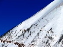
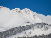
Hard to see the surrounding mountains at times due to weather but some activity was seen in the form of old crowns on steeper terrain in wind blown areas. Looks like some of these released during the last snow. No activity was observed in the RLG zone.


Weather: Cold and windy in the valley bottom. Looked like it was ripping down the valley, 20mph because winds were light at the goal posts.
Overcast and lightly snowing. The solar didn’t seem to be affecting the snow that much. Wind higher on the ridge tops looked to be transporting snow.

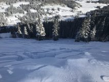
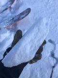
Snowpack: Super variable in the glades. A mixed bag of crusts, facets and new snow on top of ground. Depths ranged from 6-8 inches to 2 feet depending on elevation, aspect and wind loaded zones. Some areas had a supportable crust, while other shaded areas had facets at the ground. Lower in the fields large collapses were felt with shooting cracks observed, no movement seen due to the lack of slope angle. No avalanche activity was observed. The most dangerous part of the day was hitting obstacles. Its a mixed bag in RLG and it will be interesting to see how this pans out as we get more snow load

Read Full Observation
12/15/20

Crazy remote triggering

Zone: Southeast Mountains

Location: East River

Date of Observation: 12/15/2020

Name: Zach Guy


Subject: Crazy remote triggering

Aspect: East

Elevation: 9100 – 9500′

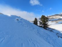
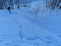
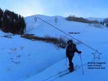
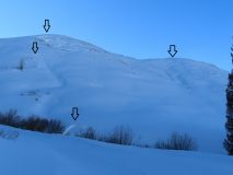
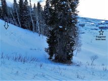
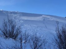
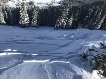
Avalanches: Remotely triggered two small slab avalanches (about a foot thick, 20 feet wide, ran 30 to 50 feet).  One of the slides we triggered from 1200′ away! I watched the cracks connect and the feature slide in pure disbelief.  We also got a number of similar slopes to shatter with cracks and slump, but not move, mostly remotely triggered again.

Weather: Light to moderate northerly wind channeling down valley. Partly cloudy skies

Snowpack: About 10″ or so of settled storm snow over the 12/10 interface, which was decaying surface hoar on facets here. Recent and ongoing northerly winds had redistributed the snow into a patchy network of stiffer slabs (4F). We produced collapses in most areas where there was wind stiffening or loading. They seemed localized, but then we got a few collapses that produced cracking and avalanches from surprisingly long distances away. Surface hoar does some crazy things.  The slabs were small and easy to recognize, but we avoided riding above terrain traps where a small avalanche could push you into trees.

Photos:

Read Full Observation
12/15/20

Cement Creek snow

Zone: Southeast Mountains

Location: Cement creek

Date of Observation: 12/15/2020

Name: Cosmo Langsfeld

Subject: Cement Creek snow

Elevation: 9250

Weather: 3” on the ground from yesterday’s storm.

Read Full Observation
12/15/20

Gothic

Zone: Southeast Mountains

Location: Gothic

Date of Observation: 12/15/2020

Name: billy barr

Subject: Gothic

Weather: Light snow much of Monday but ending at sunset and staying dry overnight with 3″ new and water 0.18″. Snowpack is at 23″. Currently mostly cloudy, calm and cool with the temp. range a high of 24F. low of 5F and the current is 11.

Read Full Observation
12/14/20

Kid triggered slide near town

Zone: Southeast Mountains

Location: Peanut Lake Road

Date of Observation: 12/13/2020

Subject: Kid triggered slide near town

Elevation: BTL

Avalanches:

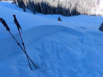
Small child triggered this avalanche while playing in the snow.

Photos:

[/gravityforms]

Read Full Observation
12/13/20

Gothic obs

Zone: Southeast Mountains

Location:

Date of Observation: 12/13/2020

Name: Alex Tiberio


Subject: Gothic obs

Aspect: North, North East, East

Elevation: 10,500

Avalanches:

15 or so naturals ranging from D1 to D2 from 1st bowl to the flanks of Gothic

Weather:

Snowpack: Winds overnight creates some big patches of wind board. More collapsing and cracking on our tour including areas we traveled yesterday that had already collapsed, especially where winds deposited a lot of new snow.

Read Full Observation
12/13/20

I thought it snowed?

Zone: Southeast Mountains

Location: Red Coon Glade

Date of Observation: 12/13/2020

Name: Steve Banks


Subject: I thought it snowed?

Aspect: South

Elevation: 11,600

Avalanches:

Saw a couple mid storm crowns on Axtell and I’m RLB. None looked bigger than D1.5 though they were quite filled in. These were on NE,E and SE facing slopes Above TL.

Weather: So hot in the sun. So cold in the shade. Barely a breath of wind. I thought I saw a cloud but it was just my judgment. I did see some flagging off of Beckwith in the late afternoon which I found a little surprising given the lack of wind where I was.

Snowpack: Thin! Solar slope BTL had little old snow except where shaded by trees. I found a little bit of moist snow and a little bit of a new crust forming, but only in 30+* slopes. In a few lower angle slopes there was old snow which was a confused mess of large faceted grains and up to 2 older crusts. Recent snowfall amounted to about 6-8” depending on elevation. I wouldn’t be surprised if some S-SW slopes got a new surface crust today.

Read Full Observation
12/13/20

Snodgrass slides

Zone: Southeast Mountains

Location: Snodgrass

Date of Observation: 12/13/2020

Name: billy barr


Subject: Snodgrass slides

Aspect: North East

Elevation: BTL

Avalanches:

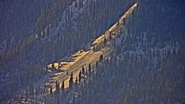
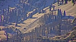
See photos of some slide activity on Snodgrass Mountain.


Weather:

Snowpack:

Photos:

Read Full Observation
12/13/20

Washington Gulch

Zone: Southeast Mountains
Date of Observation: 12/13/2020
Name: Colorado Backcountry Avalanche L1
Aspect: North East, East
Elevation: 9,500-10,500

Avalanches: Many natural avalanches on below treeline slopes facing east to northeast. In general, the south side of Washington gulch has natural avalanche activity down by the reservoir and homes, on up to Coneys and beyond. These avalanches ran on Friday or Saturday. Many of those avalanches were small, a few where large in size. All appearing to release on old weak snowpack.

The above treeline Southwest Flanks of Gothic Mountain had 2 large windslab that ran early this morning.

Easterly and southeasterly terrain above treeline on Mt Baldy had one large persistent slab, and one smaller slab that may have released yesterday.

Weather: Clear, Cold, Calm.

Snowpack: Last night’s wind event was very evident looking around. In the Coney’s area, the winds mostly cross-loaded and blew up the terrain. The resulting wind-boards trashed much of the skiing, unfortunately. The new snow was notably thicker today, compared to yesterday. The persistent slab avalanche problem was less reactive than yesterday, but still making noise with collapses and shooting cracks while traveling on terrain less than 30 degrees.

Read Full Observation
12/13/20

Coneys

Zone: Southeast Mountains

Location: Coneys

Date of Observation: 12/13/2020

Name: Jack Caprio

Aspect: North, North East, East

Elevation: 10,800

Avalanches:

From the ridgeline, skier remotely triggered a R1D1.5 persistent slab on a NE facing aspect near the treeline. The avalanche broke on a 1-inch thick melt-freeze crust about 14 inches down from the surface. Above the MF crust were 1-2 mm faceted grains which developed during our dry spell before Thursday. The slide entrained all the new snow from the most recent storm (about 14 inches) and propagated about 60 feet wide. The slab initiated on a > 30-degree start zone and the momentum quickly diminished as the slope angle decreased. All in all the avalanche ran about 150 vertical feet.

SS-AS-R1D1.5-I

Weather: Sunny and cold. Very subtle to no winds along ridgeline at 2 pm.

Snowpack: Last night’s winds towards the tail end of the storm cross-loaded many slopes. In open areas, the surface snow of breakable windboard ranging from 1-3 inches made for some very unenjoyable turns. Underneath the windboard was about 10-15 inches of F+ storm snow. On N aspects, basal facets made up the bottom foot of the snowpack. As soon as the compass rotated east of north, a melt-freeze crust with near-surface facets above it was found sitting below the new storm snow. This melt-freeze crust was the guilty layer/ bed surface of the skier triggered slab.

Photos:


Read Full Observation
The blog.