Observations

12/29/20

Larger Than Expected Propagations

Date of Observation: 12/29/2020
Name: Drew Kelly


Zone: Southeast Mountains
Location: Red Coon Glades
Aspect: South East
Elevation: 11,100K


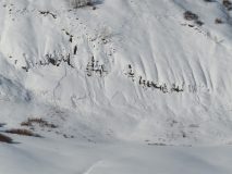
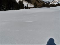
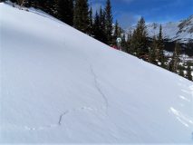
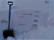
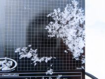
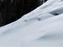
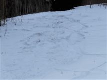
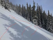
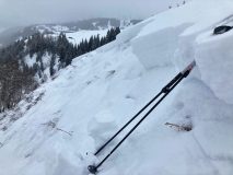
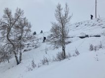
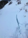
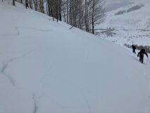
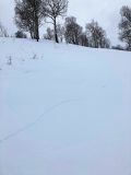
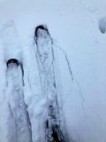
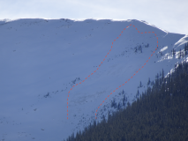
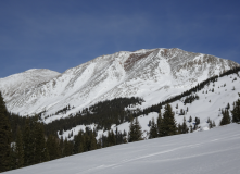
Avalanches: Lots of collapsing, and long shooting cracks. We climbed and “skied” terrain less than about 31 degrees. Nearing the 30 degree angle (+/- a degree or two) nearly everything collapsed and fractured. We sent continuous cracks nearly 200 ft across one slope, a distance that surprised us (see picture). There were numerous other slopes where cracks travelled 50+ft.

All moving snow seemed to break at the interface between the last few days’ storm slab and the older decomposing snow from previous weeks.
Weather: Occasional light breeze mostly near and above treeline, intermittent cloud cover, ~10-20F, light snow.
Snowpack: Snow depths varied between 1-2ft. In some places recent storm snow sat on bare ground; in other places that recent storm snow sat on a melt-freeze crust that was on top of faceting older snow.


Photos:

Read Full Observation
12/29/20

Gothic 7 a.m.

Date of Observation: 12/29/2020
Name: billy barr


Zone: Southeast Mountains
Location: Gothic

Avalanches: No visibility to see if any slide activity.
Weather: There was 10½” new snow with water total of 0.75″ as the snowpack sits at 32½”. Wind is calm now and the snowfall has stopped. Mild with yesterday’s high 24ºF and the current is the morning low of 11º.


Read Full Observation
12/29/20

Large naturals on hidden lake bowl on Whetstone

Date of Observation: 12/29/2020
Name: Turner Petersen


Zone: Southeast Mountains
Location: Hidden lake bowl Whetstone
Aspect: North
Elevation: 12,200

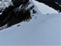
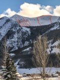
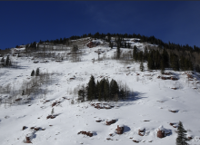
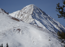
Avalanches: Multiple large natural avalanches spotted from 135.
Weather: Tail end of storm system.


Photos:

Read Full Observation
12/29/20

Cement Creek new snow

Date of Observation: 12/29/2020
Name: Cosmo Langsfeld


Zone: Southeast Mountains
Elevation: 9250

Weather: 5” new snow overnight.


Read Full Observation
12/28/20

Lower Snodgrass

Date of Observation: 12/28/2020
Name: Steve Banks


Zone: Southeast Mountains
Location: Lower Snodgrass
Aspect: North East
Elevation: 9800


Avalanches: None noted
Weather: Light snow throughout the day with even lighter winds. Mild temps felt like low 20’s. New snow accumulation of about 3-4” from overnight and through the day.
Snowpack: Weak AF. There is about a foot and a half of snow where we were. 4” below the surface is a thin buried weak layer (suspect SH/SF) which popped out in CT tests but did now propagate in ECTs. This will be another one to watch with this incoming storm or the next. Midway through the snowpack is the horribly weak weak layer. 2-4mm facets. This was resting on a 2” thick decomposing crust, with weak faceted snow (just becoming DH) on the ground. Multiple Easy to Moderate CT and ECTP test results on this weak layer, all above the crust.


Read Full Observation
12/28/20

A lot of bark and some bite too

Date of Observation: 12/28/2020
Name: Zach Guy, Zach Kinler, Jack Caprio


Zone: Southeast Mountains
Location: Gothic Road
Aspect: East
Elevation: Below treeline


Avalanches: Intentionally triggered a couple of small persistent slabs, about 15″ thick and up to 50 feet wide on small terrain features, failing on fist hard facets near the ground.
Weather: Light snowfall mid-afternoon started picking up in intensity to S2 around 3:30 p.m as we were leaving. Calm winds.
Snowpack: About 3″ of new snow so far. Frequent rumbling collapses and shooting cracks traveling about 30 to 50 feet. Slabs were somewhat discontinuous across terrain due to previous wind loading and scouring effects. It was easy to trigger collapses in the transition from stiffer, supportive snow to unsupportive, softer snow or vice versa. Of the few test slopes we poked at, a couple slid, while most just cracked and slumped.
The 12/22 interface is down about 5″ (mix of near surface facets and surface hoar). It was producing cracking underfoot but not shooting past skis.


Photos:

Read Full Observation
12/27/20

Snowpack still chatty up Bush Creek

Date of Observation: 12/27/2020
Name: Zach Guy


Zone: Southeast Mountains
Location: West Brush Creek
Aspect: North East, East
Elevation: 9,900-11,800′


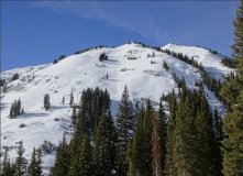
Avalanches: Skier triggered a persistent slab avalanche on an east aspect BTL. The slab didn’t propagate widely (about 20 feet) and was about a foot thick, small in size. In steep, sheltered terrain that has previously avalanched, we triggered several small dry loose avalanches to the ground.
Noted a crisp looking crown above East River (east aspect BTL, D1) that seems as if it could have run last night. It was triggered by a sluff from above.
Noted a handful of older slab avalanches that ran during the wind event a few days ago on leeward aspects near treeline.
Weather: Clouds increased throughout the day. Light ridgetop winds. A few flakes started falling this afternoon. 1″ of snow last night.
Snowpack: Despite the persistent slab structure clearly faceting and losing cohesion, we were impressed by widespread collapses, many of which radiated cracks up to 100 feet away. Most low angle, open slopes that we traveled on collapsed audibly and produced shooting cracks. If there was a pattern to the slopes that produced far-reaching collapses, I would say it was most commonly where there’s a residual crust layered between the basal facets (on slightly sunnier inclines or aspects). The basal facets are evolving into chains of depth hoar here. (3mm, striated, Fist- ) The slab above is about a foot thick, fist hard and faceting. Near ridgelines at treeline, there are lobes of much harder, thicker slabs and areas where the snowpack is wind eroded almost to the ground. Collapsing was less common in the wind hardened areas, but we still got several very loud ones triggered from where the slabs thin.
In spite of what was clearly an unstable snowpack, the instabilities didn’t translate well into the avalanche terrain that we tested with remote collapses or ski cuts (on smaller terrain features). On lower angled avalanche terrain (~30 to 35*), the slopes would crack, perhaps slump a few inches, but not avalanche. On steeper angled avalanche terrain (~37* +) it seemed that almost everything had previously avalanched; the snow depth was roughly 10″ and was facet sluffing to the ground.
The 12/22 interface is a few inches deep and is showing clean hand shears and minor cracking. The interface consists of near surface facets (northern half of compass) or small grained facets below or between crusts turning east or southeast.


Photos:

[/gravityforms]
Read Full Observation
12/27/20

Gothic 7am Weather Update

Date of Observation: 12/27/2020
Name: billy barr

Zone: Southeast Mountains

Weather: Cloudy and windy most of the night with scattered light snow, as it clears and wind stops around 5 a.m.  Total new snow a scant 1″ with 0.06″ of water and snowpack at 21½”.  Temperature range from a high of 35ºF to a low, and the current, of 14.  Now partly cloudy with a light breeze.

The snowpack is awful with a very rotten base and now a sizable surface hoar build-up.  In the meantime the snowpack continues to collapse.  A big snowstorm will make things interesting, and very dangerous.

Read Full Observation
12/25/20

Cement Creek Christmas Snowmo tour

Date of Observation: 12/25/2020
Name: Eric Murrow


Zone: Southeast Mountains
Location: Cement Creek Road
Aspect: North East, East, South East, South, South West, West
Elevation: 9000′ – 11000′


Avalanches: Cement Mountain – large avalanche above treeline in North Bowl, crown drifted over but flanks still visible D2
Hunter Hill – thin slab on SE aspect near treeline D1.5
Italian Mountain – debris visible in southwest gully, D1
Weather: Clear, cold low in drainage with much warmer temps at head of valley, no wind below treeline
Snowpack: Traveled along Cement Creek Rd. to look around at snow depths and get a general impression of conditions from snowmobile by glassing terrain with binos. Checked snow depth and snow water equivalent in two locations: near Deadmans TH (9,600′) HS around 45 -50cm (18″) with 3.6″SWE, near Italian Mountain (11,000′) HS 65cm (26″) with 5″ SWE. Overall the snowpack is very weak in this area. Boot penetration in areas unaffected by the wind was generally full depth. Below treeline snowpack is just faceted fist hard snow, did not travel on any slopes but hard to imagine much Persistent Slab issues except for very isolated features stiffened by the wind. Near treeline terrain coverage looked to be deep enough to have Persistent Slab issues. East and southeast slopes near treeline appeared to be the most common places to find slabs of concern. Many northeast slopes near treeline looked to be worked over by the wind. Some minor collapsing while skinning around flat meadows, but collapses did not extend much past 20 feet, silent no audible noise. Alpine terrain was largely hammered by the wind. I would expect hard slab conditions on many features above treeline, I did not see many slopes above treeline with soft snow surfaces.


Photos:


Read Full Observation
12/25/20

Merry Collapsemas

Date of Observation: 12/25/2020
Name: Zach Guy

Zone: Southeast Mountains
Location: Coneys
Aspect: North East
Elevation: N/BTL

Avalanches: No recent avalanches. Plenty of older ones.
Weather: Beautiful day: few clouds, mild temps, calm winds.
Snowpack: Stepping off the skintrack in a heavily trafficked area, got several audible collapses, but certainly not as reactive as some previous tours where we have been breaking trail. The brief bit of travel I did into untracked areas (NTL) produced a few large collapses. Small grained surface hoar growth overnight on the surface of shady aspects. Quick handpit on south facing slope shows some small faceting below the most recent suncrust (12/22). The crust was about an inch thick on a 25* slope. Feels like the slab is starting to facet away in the shallowest areas.


Read Full Observation
The blog.