Observations

04/06/21

More wet avalanches

Date of Observation: 04/06/2021
Name: Eric Murrow Ben Pritchett


Zone: Northwest Mountains
Location: Slate River corridor to Angel Pass area
Aspect: North, North East, East, South East, South, South West, West, North West
Elevation: 8,900′. – 11.600′
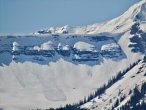
 

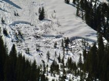
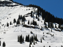
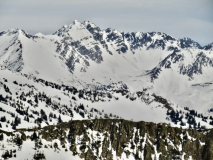
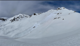
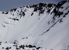
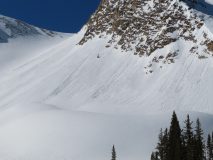
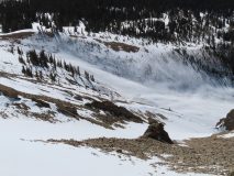
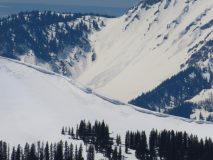
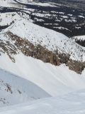
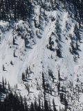
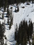
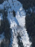
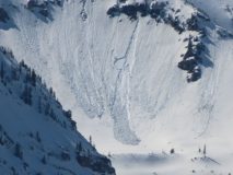
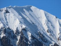
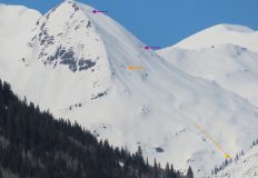
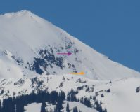
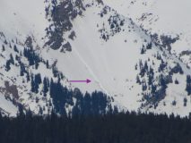
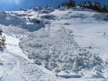
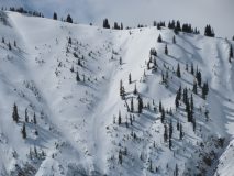
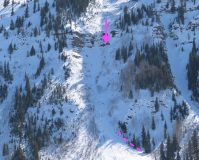
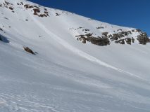
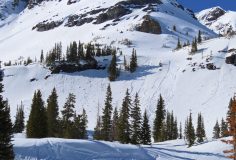
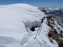
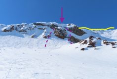
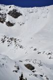
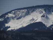
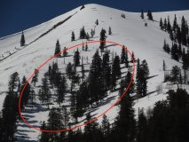
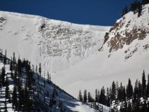
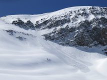
Avalanches: Numerous recent wet avalanches on northeast through east through south through west aspects. Many were small, but some were large, gouging Wet Loose avalanches. A couple of recent Wet Slabs were observed as well. Two fresh avalanches occurred today on northeast slopes of Schuylkill Ridge – a full-depth Wet Slab below treeline and a gouging long-running Wet Loose avalanche.
Weather: Very warm temperatures with thin high clouds passing by through early afternoon. Light winds from southwest below ridgetop.
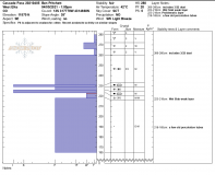
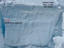
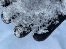
Snowpack: Spring transition is well underway, with no dry snow observed on any snow surfaces. Near treeline on a north facing slope, we found about 2 inches of wet polycrystals on the snow surface, with a moist snowpack below that showed signs of yesterday’s meltwater percolating down around a foot and a half deep. The recent meltwater was frozen into widespread horizontal ice lens, likely around old melt-freeze crust buried in mid March. We dug a profile adjacent to a 48 hour old Wet Slab avalanche. The avalanche and our test profile were located on steep southeast-facing slopes with signs of light wind-loading. We measured a 230-300cm deep snowpack. The top of the crown was around 12,000′ and our profile was at a similar elevation to the middle portion of the slab that released (~11,700′). We found a pooled layer of meltwater 50cm below the snow surface that had spread horizontally through an old layer of large-grained facets below a melt-freeze crust. This layer corresponded to depth of the avalanche’s flanks. The slab broke deeper (up to ~100cm) near the crown, higher on the slope. Snowpack tests were not relevant as too much water had flowed through the snowpack since the avalanche released. Generally, the snowpack was pencil hard, with a few harder layers of frozen melt water. We couldn’t determine the hardness of the wetted weak layer since it was a frozen mixture of previously weak facets, an old crust, and newly frozen horizontal and vertical ice masses.


Photos:

Read Full Observation
04/03/21

Wet activity ramping up

Date of Observation: 04/03/2021
Name: Zach Guy

Zone: Northwest Mountains
Location: Anthracite Range and driving tour
Aspect: North, North East, East, South East, South
Elevation: 9,600 – 12,200

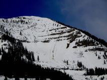
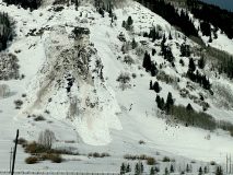
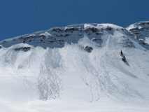
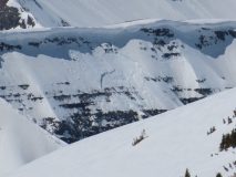
Avalanches: See photos. Large wet avalanche activity on the rise. We noted numerous natural D2 wet loose avalanches on all but due north aspects and at all elevations. Many of these gouged deep into the snowpack. Some ran today, some yesterday. Several large wet slabs, generally D2 in size, ran today. The one off of the east face of Gothic may have been up to D3 given the long runout (which was obscured from view).
Weather: Africa Hot.
Snowpack: We found frozen surfaces this morning and good corn skiing on due south aspects until about noon, at which point ski and boot pen quickly detoriated. On an east aspect below treeline around 1 p.m., we were triggering large pinwheels that gouged 12″ to 18″ deep. The most active aspects for wet activity were east and northeast where we traveled, but we left before westerlies had their fair share of sunshine.


Photos:

Read Full Observation
04/03/21

2:30 PM avy obs

Date of Observation: 04/03/2021
Name: Zach Kinler
Location: NW/SE Mountains
Aspect: East, South East, South

Avalanches: Mineral Point had several small loose wet avalanches ATL on the South face and several large loose wet avalanches ATL on the East face. A couple of these were long-running with one gouging to the ground in spots and running to valley bottom. On Baldy, ESE ATL a wet loose initiating from a rock band triggered a wet slab mid slope. One other long-running and gouging wet loose was spotted on an ESE aspect NTL above Copper Creek.
Weather: Hot AF.


[/gravityforms]

Read Full Observation
04/03/21

Late day wet snow check-in

Date of Observation: 04/02/2021
Name: Ben Pritchett


Zone: Northwest Mountains
Location: Roadside observations around Crested Butte. Late day wet snow check-in. Assess depth of melt-water infiltration in relation to potential Wet Slab avalanche problems.
Aspect: North, North East, East, West, North West
Elevation: 10,000

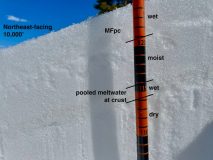
Avalanches: Photo 1: A wet snow surface on a mostly dry snowpack at 10,000′ on a northeast-facing slope. April 2, 2021.
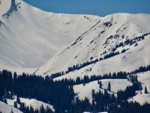
Photo 2: A pattern of small natural avalanches on southeasterly-facing slopes near and above treeline. April 2, 2021
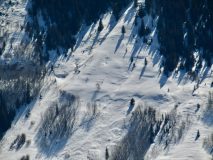
Photo 3: A small natural avalanche on a south-facing slope above treeline. April 2, 2021
Photo 4: An example of an easterly-facing slope that could become dangerous without a freeze at mid-elevations.
Photo 5: A pair of recent slab avalanches that ran on the east to northeast-facing slopes off the Ruby/Owen ridge, and Scarp Ridge.

Estimate* 3/29/21- 1- >TL- E-C-N-R1-D1
Estimate* 3/29/21- 1- >TL -SE-C-N-R1-D1
Weather: Ridgeline Wind Speed: Calm
Wind Loading: None
Temperature: 53 F
Sky Cover: Few
Depth of Total Snow: 120 cm
Weather Description: 53 degrees at 10,000′ at 3pm.
Snowpack: Near 10,000 feet, on northwest through north to northeast-facing slopes, the snowpack was mostly dry, with meltwater draining down only around 10cm so far. Below and near treeline, the shoulder aspects of east and west look the closest to developing a Wet Slab avalanche problem. The steeper southeast through south to southwest-facing slopes are wetted to the ground and melting out quickly. At the Butte snotel at a similar elevation, it did not freeze Thursday night, and it may not again tonight (Friday night). In the worst case rocky terrain features rocky with a shallow snowpack, human-triggered Wet Slab avalanche may become possible by late afternoon Saturday. If there’s another night without a freeze on Saturday, natural Wet Slab avalanches might run Sunday.


Photos:

Read Full Observation
04/02/21

Weekly Snowpack, Weather, and Avalanche Summary 4/2/21

Date: 04/02/2021

Name: Jack Caprio

Zone: Crested Butte Backcountry


Spring has sprung. It’s getting hot out there and liquid water is making its way deep into the snowpack. See what this all means for spring skiing right here.

Read Full Observation
04/02/21

Wet obs

Date of Observation: 04/02/2021
Name: Zach Guy and Zach Kinler


Zone: Northwest/Southeast boundary
Location: Mt. Emmons
Aspect: North East, East, South East, West, North West
Elevation: 9500-12000′

Avalanches: A handful of small wet loose avalanches ran today, generally on northeast and some east aspects at all elevations. Skier triggered a couple of wet loose avalanches this afternoon below treeline on a northeast aspect. The slides gouged through most of the snowpack, large enough bury someone in a gulley (~D1.5). These were in steep, rocky terrain holding a shallow and weak snowpack that is just now becoming saturated.
Weather: Unseasonably warm: Highs reached mid 50’s at 10,000′ and 40 at 12,000′. Partly cloudy skies. Light ridgetop winds.
Snowpack: Several pits on E, SE, and W aspects N/BTL targeting wet slab concerns. Generally, slopes that are getting the most water right now have already seen a fair amount of water already and have moist or wet grains throughout the entire snowpack. Slopes where the snowpack has remained dry until the last few days have water in the upper few inches today. Water was pooling about 40 cm deep on a SE aspect NTL (the rest of the snowpack was moist), and pooling about 5 cm deep on a West aspect NTL (the rest of the pack was dry). At low elevations, the saturated snowpack became unsupportive (bottomless boot pen) by the afternoon on flat terrain. All but high northerly aspects or steep due north aspects at low elevations got wet today. Good, stable corn skiing this morning on southerly aspects until about noon, at which point the snow surface became increasingly mushy and we were able to trigger pinwheels and micro-sluffs. Northeast and northwesterly aspects were most active today for wet loose activity because the snow surface is just now transitioning from dry to moist or wet.


Read Full Observation
04/01/21

Large cornice avalanche

Date of Observation: 04/01/2021
Name: Zach Kinler Evan Ross
Zone: Northwest Mountains
Location: Southern Ruby Range
Aspect: East, South East, South
Elevation: 9,000′-12,600′

Avalanches: Observed several Wet Loose avalanches, both natural and human triggered. Size ranged from D1-D1.5 with activity primarily on steep East, South and Southwest slopes near and above tree line. While traversing the Ruby spine we encountered several large overhanging Cornices which had begun to pull back from the ridge. Two of these were triggered from dry ground on the ridge by simply “pole whacking” the gap.

We got a close look at the previously reported Cornice Avalanche on the SE flanks of Mt Owen. This was a big section of cornice that fell down and resulted in a large D2.5 avalanche. The cornice initially gouged close to the ground in steep rocky terrain, then appeared to run on March interfaces as dust layers can be seen on the bed surface.

Weather: It’s heating up! We skinned in t-shirts most of the day. Temps soared above freezing at all elevations today under abundant sunshine. Westerly winds were light at rideline.

Snowpack: We travelled primarily on sunny aspects from E-S near and above treeline. By 12:00, we observed several small natural Wet Loose avalanches on steep East aspects near tree line. As the day progressed, action moved to South aspects and eventually Southwest slope near and above treeline. While these avalanches were only entraining the upper few inches of wet snow, they were gaining momentum on larger slopes. Skiing off the ridge in the late afternoon, we choose to avoid our intended ski objectives that was south east facing above 12,oooft to due to the fact that we would be triggering loose wet avalanches and didn’t feel we could safely manage the problem on that terrain feature. While briefly hanging out on the bed surface of an old cornice avalanche you could actually hear water cascading somewhere. Sounded like you were standing next to a running water fountain.

Cornices, which have grown large throughout this season on certain leeward aspects, proved to be sensitive where large portions are overhanging ridges and are beginning to pull back from ridgeline. These babies are very unpredictable with some being resistent to cutting while others may be triggered by simply hitting the right spot or right time of day. These beasts were best managed by avoiding traveling on or below slopes where present.

[/gravityforms]

Read Full Observation
04/01/21

Small wet loose

Date of Observation: 04/01/2021
Name: Sam L

Zone: Northwest Mountains
Location: East face of mineral
Aspect: East

Avalanches: Skier triggered small wet loose. Slow and shallow, could have been worse with more exposure. Sorry no pic.

Weather: Clear and strong sun. Snow surface wet at 1030.

Read Full Observation
04/01/21

Carbon Peak

Date of Observation: 03/31/2021
Name: ben Pritchett

Zone: Northwest Mountains
Location: Carbon Peak
Aspect: North, North East, East, South East, South
Elevation: 9-11,000′

Avalanches: The slow trickle of large avalanches continues. In Whetstone Mountain’s Hidden Lake bowl, a broad (~250′ wide) section of very large cornice released around 12,200′ and triggered a Persistent Slab avalanche that broke at the ground on a northeast-facing slope. The avalanche looked fresh.

Weather: Chilly start following a strong freeze, warmed to just above freezing. Calm, and clear.

Snowpack: Near and below treeline south and southwest facing slopes have previously drained water to the ground. Little concern for future Wet Slabs. East to southeast-facing slopes near treeline could still pose a near-term Wet Slab concern. Thin slabs (30-70cm deep) rest on presently moist facets. Recently the meltwater has stopped within the slab, but if the melt rate picks up quickly these aspects would be most concerning first. North of east both near and above treeline I found a dry snowpack. Where the snowpack was deeper, the slab was fairly supportive and strong. Triggering a Persistent Slab avalanche remains unlikely, but consequences remain ugly. On these slopes with a dry snowpack, shallow areas remained spooky. In areas with less than around 3 feet of snow, boot penetration would go to the ground. I didn’t experience any collapsing, but I did two ECT’s and both produced hard propagating results on faceted weak layers, one at the ground, one in a very weak layer of large facets below the March storm snow.


Photos:

Read Full Observation
03/31/21

Normal Caution

Date of Observation: 03/31/2021
Name: Evan Ross, Zach Kinler

Zone: Northwest Mountains
Location: Treasury
Aspect: North, North East, East, South
Elevation: 9,000-13,300

Avalanches: A few small wind slabs that had run over the last couple days. 1 one NE and a few on E to SE. All above treeline.

Weather: Cool northerly winds helped keep the heating in check. Clear Sky.

Snowpack: Normal caution on steep slopes or for small isolated avalanche problems. We considered trying to avoid a few trigger points when we were exposed to high consequence terrain. Thin surface slabs from the previous winds were stubborn, but still something we ended up managing a little in extreme terrain. Plenty of dry snow out there that is waiting to transition during the upcoming heatwave. On the way home there were lots of glossy-looking snow surfaces down at lower elevations.

Read Full Observation
The blog.