Update 11/18/2018

RobStricklandAvi-Off-Season, Fall 2018

Another weak wave of moisture has passed over the Crested Butte area leaving us with a dusting of fresh snow and not much of an increase in our avalanche danger. As a cold front chases this storm out we could see winds whip the new snow into very shallow wind slabs on Northeast through Southeast leeward slopes, though these are likely to be thin and less hazardous. 
Our early season snowpack has been weakening through the faceting process promoted by our warm and sunny days followed by clear and cold nights. This has allowed the current avalanche danger to diminish with signs of instability tapering off. The sun has created some crusts out there, and the temperature swings have created a thin layer of facets on top of this crust. All of this points toward more dangerous avalanche problems once we do receive more snow. 
For now, there are still some lingering areas to be heads up in. North through Northeast slopes, above treeline (where the snow is the deepest and therefore the riding will be the best), are still holding onto strong over weak layering and slab type conditions. These slabs are pretty tired right now and have reached a point where they are unlikely to be triggered, however it is still possible and we should still be prepared. 
Continue to carry and know how to use all appropriate avalanche rescue tools. Bust out your probe to check for snow depths along your journey and feel what the snow layers are like. When you detect strong over weak layering, get out your shovel and do some tests to see how reactive that slab might be. Shadier leeward slopes steeper than 35 degrees where previous snow has drifted in and where the snow transitions from deeper to shallower will be the most suspect area to be aware of. 
Looking ahead, the forecast models are showing another storm headed our way on Thanksgiving and perhaps a more prolonged stormy period after that. If you are out in the backcountry this week, take note of the current snow cover and structure and think what it will be like if/when we do receive another foot of snow or more. 
The CBAC will begin daily forecast operations on Thanksgiving Day. Please continue to send us your backcountry observations!

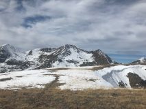
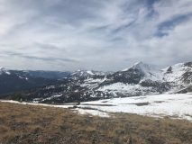
1-2 mm facets found near treeline on a SW aspect

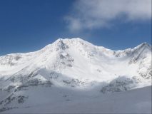
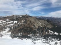
Mount Owen Slab avalanche if you zoom into apron.

Nov 1 Update

RobStrickland2018-19 Observations, Avi-Off-Season, Fall 2018

After our first big storm October 10th, we saw drier and warming weather return that melted most snow below 11,000ft on the southerly aspects, but the warmth wasn’t strong or long enough to melt away all the snow on west, north or east facing slopes.  It cooked it into a dense, slick layer that will be problematic for future avalanches, but at the time, kept those skis above the sharp rocks below.
Snow and precipitation returned around October 24th bringing pretty impressive rainfall below 11,000ft and another slushy few inches above treeline.
Now, most recently, we saw about 6” of “rightside up” snowfall on Halloween, starting wet, windy, and falling at around 30 degrees on the 30th, until overnight temperatures fell into the teens, leaving a fluffy finish and some people took advantage of that snow for some turns in the Kebler Pass area.  However, a decent natural slab avalanche (size 1.5) was observed on the NE bowl of Mount Owen, failing within that new/old snow interface and running mid apron.
As the snow piles up, it will become increasingly likely to see avalanche conditions develop on slopes steeper than 30 degrees, on the northern half of the compass where the snowpack is deepest.  That is the conundrum this time of year, looking for the deepest turns also means poking your nose into the most avalanche prone terrain.
As always, mind those sharky early season hazards and tread lightly!  Don’t put a fork in your season before it begins.  Please pass along any early season observations and remember, the Crested Butte area has seen a healthy dose of near misses and close calls with avalanches this time of year in the past.
Look for another update as conditions continue to develop and regular forecasts firing up later this month.
-Ian Havlick

Fall updates saved

CB Avalanche CenterAvi-Off-Season

Issued 6:30 am, Friday, November 24th, 2017, by Ian Havlick

Despite our string of sunny days and warming weather, triggering an avalanche in isolated terrain features remains possible. Steep, high elevation, northerly facing terrain holds enough snow and poor structure to warrant caution and avoidance.  The dilemma we all currently face is that the areas deep enough to skim above the rocks on skis or board, are the exact places most likely to trigger a lingering persistent slab avalanche.

Weak, sugary, faceted October snow was recently buried by our first significant storm of the year which dropped 10-20 inches of snow across our surrounding backcountry.  We observed dozens of small to large natural and human triggered avalanches last week, with a very close call nearby in Aspen on November 18th.  A bit of wind at higher elevations moved some of that powdery snow into stiffer windslabs in lee and cross loaded gully features, adding to the potential slab resting above that weak faceted snow just above the ground.  Most recently, warm and unseasonable temperatures over Thanksgiving in the Crested Butte area has added some surface crusts to slopes facing east through south through west, with even some melt-freeze crust formation on lower elevation northerlies.

If after that quick early season summary still has you chomping to get out, get some exercise, and slide on some snow….you are braver than I.  It should be business as usual out there. Everyone should have a beacon, shovel and probe.  Inspect that equipment, conduct a beacon check in the parking lot (even if you start walking on dirt), and dust those cobwebs off.  Once on snow, it should be easy to collect valuable snow observations with hand pits and constant probing with a pole.  Look and feel for denser snow resting above weak sugary snow.  That is the classic slab avalanche structure to avoid, strong over weak.  Look and listen for cracking and collapsing as you travel, keeping in mind that if there are previous tracks on the slope, parties before you may have gathered valuable information like collapsing or whumphing, leading you to a false sense of stability.  For each day of blue skies and mild temperatures, the likelihood of triggering an isolated persistent slab avalanche decreases, but poor snow structure demands respect, because if you are wrong, a nasty ride into rocks, stumps, and other early season hazards is likely.

For more information, scroll down and read previous conditions updates.  The Crested Butte Avalanche Center  will post the next conditions update on Sunday, November 26th.  Full Operations and daily avalanche advisories will begin after enough snow accumulates.

Issued 6:45 am, Wednesday, November 20, 2017, by Ben Pritchett

Persistent slab avalanches remain a possibility in steep terrain on the shady side of the compass near and above treeline.  While these slabs are becoming less reactive than they were during our avalanche cycle this past weekend, they remain a serious hazard to people seeking out turns in the Ruby Range, Paradise Divide, and along the spine of the Elk Mountains.  Given the thin snowpack overall, any ride in an avalanche is likely to beat you up bad.  Consider the incredible luck in this recent avalanche accident just on the other side of the Elk Mountains.  Here’s a picture of the avalanche, a great illustration of the kind of terrain feature where our problem lies.

Don’t underestimate the potential for a deep burial despite the paltry look of the snow cover.  Here’s a recent slide, the crown, and 8 foot deep debris above Emerald Lake, near Schofield Pass.


The one additional consideration on top of our Persistent Slab avalanche problem literally lies on top of it.  Tuesday afternoon we picked up several hours of west to northwest winds that drifted snow in alpine terrain on the east half of the compass.  These fresh drifts accumulated several inches deep in the same features that held snow in October, hence the overlap.

Consider these fresh drifts as indicators of the Persistent Slab avalanche problem lurking below.  In terms of where to travel safely and where to expect avalanches, change will be slow to come.  Your safest bet is still to choose slopes on the sunny half of the compass where the most recent snow sits directly on the ground as illustrated in the first image below.  If you venture into the shade, on slopes facing northwest to northeast, stick to low-angled features out of avalanche terrain.

Given that these weak layers will be slow to heal, Evan’s storm recap on Monday still rings true.  I’ll leave his comments and photos below as additional detail for those venturing into the high country.

The Crested Butte Avalanche Center will post the next conditions update on Friday, November 24th. Full operations and daily avalanche advisories will begin after enough snow accumulates.

Issued 7:15 am, Monday, November 18, 2017, by Evan Ross

A large winter storm on November 17th has kicked off our winter season. This storm left the area with a Persistent Slab avalanche problem and numerous skier triggered avalanches over the weekend as seen on the Observation Page. This dangerous avalanche activity was reported from both our area and around the state. Between this avalanche problem and all the recently buried rocks, backcountry travelers need to stay heads up this week.

The November 17th storm deposited over 20” of snow at Schofield Pass in the northwest portion of our forecast area, and 9” of snow at the more centrally located Crested Butte Mountain Resort. These numbers help highlight where the mountains received enough snow to create the current Persistent Slab avalanche problem. There are two ingredients necessary for this avalanche problem: 1) More than 10” of new snow on the 17th, and 2) old buried weak layers from October. These conditions primarily line up in the Paradise Divide and Kebler Pass portions of our forecast area, at near and above treeline elevations, on slopes facing northwest to northeast. West and east facing slopes have appeared less reactive, but could still harbor the Persistent Slab issue on shaded portions of the slope. Moving to aspects further south around the compass rose, there is only the November 17th snow on the ground, thus no current avalanche problem. Ground debris just under the snow surface would be the main hazard.

This video from before the November 17th storm highlights where old weak snow is at the bottom of the snowpack. While this video on November 18th highlights the current avalanche problem and the additional hazards of a small avalanche causing traumatic injuries as it pushes you into uncovered rocks or ground hazards.

Your ideal terrain should have one layer of snow on the ground with a smooth grassy ground surface like this:

Stay away from slopes over 32 degrees in steepness with old weak snow on the ground that look like this:

Welcome Ben Pritchett as the new ED and Lead forecaster for CBAC!

CB Avalanche CenterAvi Blog, Avi-Off-Season

It comes with a heavy heart to announce I’m moving on from the Crested Butte Avalanche Center to take on a new role as the director of the Flathead Avalanche Center.  I’m looking forward to an opportunity for personal and professional growth in Montana. I’m grateful for the strong sense of community here that has made this place my home, both in town and in the backcountry.  Our mountain town is unique in how our backcountry users respect and look out for each other, and this energy is what has helped our little avalanche center thrive and grow to what it is.  Your observations, support, and donations help to make the CBAC one of the best forecast centers in the country.  Thank you for that, Gunnison Valley, and I hope that is something that won’t change here as the backcountry evolves and becomes more crowded.
I’m excited to announce our new executive director and lead forecaster:  Ben Pritchett.  Ben brings a broad skill-set and diverse experience in the avalanche industry to the CBAC.  In the past 12 years, Ben has served as the program coordinator for AIARE and avalanche education coordinator for the CAIC, gaining valuable experience working with backcountry users, educators, and forecasters around the country.  Ben is a former forecaster for the CBAC and leads the forecasting program for the Grand Traverse.  He also owns and runs a backcountry guiding business here in Crested Butte.  Ben’s industry connections and local understanding of our terrain, weather, and snowpack will contribute to the quality of our forecast products.
Ben at the 2017 Grand Traverse
Over the past 5 years, I have poured my heart into making this center the best it could be.  One of the hardest parts about leaving the CBAC was my sense of investment here and the fear of leaving the center high and dry on my way out.  The folks at the Flathead Avalanche Center were patiently willing to negotiate for a delayed start date which helped us conduct a thorough interview and hand-off process, and I’m glad we landed Ben.  Evan and Ian are two of the most dedicated and passionate forecasters I’ve had the pleasure of working with, and they are both planning on returning next year.  We brought on a new development director this past fall, Karen Williams, who has been working with us to improve our fundraising and outreach.  And with Ben joining the team,  I know now that the CBAC is in good hands moving towards a promising future with the goal of educating our community and saving lives from avalanche hazards. 
Sincerely,
Zach Guy 

A letter of protest to surface hoar

CB Avalanche CenterAvi Blog, Avi-Off-Season

Dear Surface Hoar,
First you bedazzled us with your shimmering feathers, glistening under the cloud layers that brought our unusual surface hoar event back in mid-January.  You are fragile and don’t belong in Colorado’s windy and sunny environment.   We thought to ourselves, “You’re a long shot, surely you won’t survive.”  But somehow you did.  Things started to go downhill on January 19th, when you got buried beneath a storm that came without wind, against the odds.
Unusual cloud layers and unusually widespread surface hoar layer in mid January.  Photo courtesy of MSF Films

Then more snow came, and it formed a soft slab above you, and your behavior started getting erratic through the last week of January.  We saw lots of natural avalanches, we saw avalanches breaking in dense aspen groves and on low angle slopes, and we saw slides remotely triggered from flat terrain. 
Video demonstrating the touchy and unusual avalanche behavior in late January.
It has been 2 weeks since the last storm, and we have heard about slides triggered on you almost every single day, either in our zone or our neighboring Aspen zone. There were a number of close calls and partial burials on the Aspen side. 
A slide on Mt. Emmons that caught a skier off guard.
 Things have started to quiet down this past week, and travelers are starting to let their guard down.  But with more snow on the way this week, we can’t trust you and your unruly and dangerous behavior.  It will become more sporadic and less predictable.

Video explaining our current snowpack structure on northerly/easterly aspects
I can’t recall the last time we had someone like you as widespread and troublesome in our snowpack.  Granted, a lot of things have changed in the past few weeks for the better, and we are thankful for that.  A lot of slopes have flushed.  Winds have blasted you and their overlying slabs away in places.  The sun has capped the snowpack with a stout crust on other slopes.  So now you are lurking on fewer slopes, but now the slabs above you will be growing thicker and more dangerous, and you will become more volatile again as more snow and wind prod at you.  We will see skiers and snowmobilers recreate on a lot of slopes with no apparent sign of problems from you, and our focus will be on freshly formed but manageable storm instabilities. But then somewhere you will react harshly as you buckle under increasing pressure, or someone pokes your small feathers on the wrong slope, and it will be bad news for everyone involved.  We know where you are most likely to be bothered, and that happens to be our favorite riding areas, northerly and easterly aspects near and below treeline. But we can’t know for sure where or when you will strike next.  That scares us. 
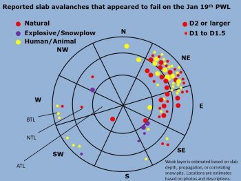
Most of the persistent slab avalanche activity in late January was on surface hoar.
Read this observation for some caveats to this diagram. 
 At the CBAC, we ask that you resign from causing problems in our snowpack, and move back to Canada, where you belong. 

Sincerely,
Zach Guy
Director of CBAC

The New Year storm….already historic and still counting!
CB Avalanche CenterAvi Blog, Avi-Off-Season

The New Year storm….already historic and still counting!

By Zach Guy.  CBAC Director/Lead Forecaster

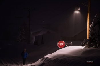
Credit: Xavier Fane
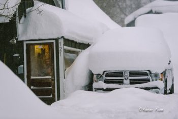
Since January 1st, the Gunnison Valley has been in the bullseye for heavy moisture streaming in from the Pacific.  CBMR recorded 47″ last week and 30″ this week as of Tuesday morning.  Irwin has recorded 87″ out of this storm.  We usually hear from billy barr by 7 a.m. for Gothic reports, but we’re getting radio silence this morning, so I’m assuming that he’s given up on digging and has turned to his stack of movies and chocolate barrs.  But Gothic was at 86″ yesterday.  Holy Cow!

Credit: Chris Miller
The first half of the storm came in pleasantly low density. On January 3rd, CBMR got 14″ of 2% density snow. On the 4th, I came into the office to no snow, and by the time I left a few hours later, 10″ had piled up, the kind that you clean your windshield with by blowing on it. On January 5th, Irwin got 20″ of 5% snow, with steady 2″-3″/hour rates.   
The next major pulse on January 9th was just the opposite: warm and wet.  In a fantastic display of atmospheric absurdity, CBMR got 30″ of dense snow.  Schofield picked 3″ of Snow Water Equivalent (SWE) in a mere 16 hours. (SWE is the water weight of the snow…multiply by about 12 or 15 to calculate how much snow fell for average conditions).  It felt like I had just gotten out of the shower when I got back from the field to investigate a 3 foot slide that ran naturally across Kebler Pass Road.  Trail breaking was miserable, wallowing through thigh deep, upside-down heavy snow. I’m sure countless people pulled out their backs shoveling. The Crested Butte Community School closed for the first time since 1970.  CBMR closed early due to safety concerns.  I counted at least two emails from billy barr that started with “It’s a mess”. With the rain line hovering near town, roof avalanches were ripping out right and left.  Winds have been howling.

Of course, we haven’t had much in the way of visibility since then, and with few people traveling in the backcountry right now, observations have been limited.  Two large slides ran across Kebler Pass Road, piling 8 feet of debris on the road.  I caught just enough clearing to spot a slide that ran to ground near Red Ridge. A lot of the paths near town were still holding as of yesterday afternoon.

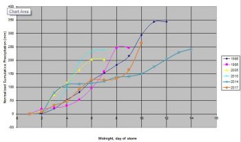
Now to the weather stats. Schofield Pass SNOTEL has been operating since 1985.  As of Tuesday morning, the site has picked up 10.5″ of SWE since New Year’s. This storm has surpassed all but one major storm in the past 32 years.  We have another major pulse arriving Tuesday night into Wednesday and continued stormy weather into the weekend.  This could push us beyond the historical 1986 storm, which reached 13.5″ of SWE.  Yowza!!
We have had avalanche warnings and high avalanche danger for 4 days of this storm.  Tomorrow we trended to extreme danger, something I’ve never done in my 6 years here (We missed a day of extreme danger back in 2014).  Extreme danger calls for a very unusual event: widespread natural avalanche activity D3 in size, with the potential for some natural avalanches D4 or greater in size. Avalanches will break trees and may include areas of mature timber. Avalanches will likely run full path through all elevation bands, thus we paint all elevations black. These types of events happen so rarely that they are incredibly tough for forecasters to predict.  In the 5 storms shown above, all of them saw widespread natural activity, and with the exception of 2010, all of them saw long running avalanches to the valley. 2010 saw most avalanches run before they reached the volume capable of historic paths. This year, we don’t have as pronounced of weak layers as in some years, but we’re seeing an exceptional load that could break the camel’s back: the volume is already there.  We will see what data we have tomorrow and how the next pulse of snow and wind is shaping up. Either way, it is very dangerous in the backcountry right now.
Credit: Xavier Fane
Regardless of whether we are at high or extreme tomorrow or the following days, our travel advice is pretty simple during an avalanche warning. Just stay off of and out from under avalanche terrain: slopes steeper than about 30 degrees or low angle slopes connected to steeper terrain above.  Most backcountry travelers know better than to jump into big alpine faces during this kind of storm, but it can be the sneaky or small avalanche paths that kill you.  We are more worried about a shoveler getting buried in a roof avalanche, or a kid on the sledding hill, or a dog walker on Peanut Lake Road, or a commuter to Irwin during storms like this.   Our snowpack is shaping up to be a deep and strong one this year, so let’s give it its due time to recover from this historical storm, and then let’s enjoy a great winter ahead!  And be sure to thank your local ski patrollers for their tough and dangerous work to reduce the risk of avalanches at CBMR. There have been two patrollers caught and carried in large slides this week. Those guys and gals hang it out there to get terrain open for you.

CB Avalanche CenterAvi Blog, Avi-Off-Season

Back in the flow. Zach Guy, CBAC Director

The Western U.S. is coming out of a long drought and the atmospheric snow guns have finally replaced the artificial ones that were building our ski area’s snow base. With snow comes avalanches. There were two avalanche fatalities in the West over the weekend: a skier in closed terrain in Mt Rose Ski Tahoe on Saturday, and a backcountry skier near Cooke City, MT on Sunday. We send our sincere condolences to all of those affected by these tragedies.  Here in Colorado, there has been a stroke of divine luck, with a number of multi-party burials that resulted in profound learning lessons, rather than fatalities. A trio of skiers in Butler Gulch, near Berthoud Pass, were all caught and buried on Saturday. Two of them were only partially buried and were able to rescue the third. On Sunday, a skier was caught in a slide near Red Mountain Pass and two snowmobilers were fully buried but rescued by their group near Steamboat. On Monday, a snowmobiler was buried near Crested Butte.  Needless to say, avalanche season is upon us.


The search area for the avalanche victim at Mt. Rose Ski Tahoe. Photo courtesy of Washoe County Search and Rescue.

The Elk Mountains have been in a favorable zonal flow pattern since December 6th. CBMR reported 18” of snow in the past week, and some of our backcountry areas have picked up almost twice that. More is on the way this weekend. Anytime we have periods of dry weather, especially early season, our snowpack develops weak layers. Once we start getting back into the storm track, those weak layers get loaded and stressed, creating avalanche concerns. Sometimes these avalanches can act in surprising or unique ways, like being triggered from long distances away or from flat terrain. This video demonstrates the challenging nature of persistent slab avalanche problems, where there is a cohesive slab over a persistent weak layer.

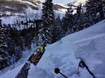
A group of 3 skiers were buried in this slide in Butler Gulch, CO on Saturday. Photo courtesy of CAIC.

It is easy to get caught up in the powder frenzy this time of year. We’ve all been itching to arc those graceful turns down powder filled slopes or throttle through deep pillows and faceshots. But we need to draw a line and stay behind it. One of my mentors up in Montana recently discussed how taking one step back from the line is insufficient. “To ensure a lifetime in the mountains, it is a matter of taking three or four steps back.” The CBAC got an observation yesterday, reporting signs of instability, which concluded with: “Suspect a successful tour could have been had with proper navigation today, but the instabilities spooked us, especially while navigating unfamiliar terrain. We opted to head home.” I applaud that kind of decision making. There isn’t any kind of steep or deep powder run that exceeds the reward of returning home safe at the end of the day.


Snow profile showing unstable results near Crested Butte. 12/11/16

If you are new to the area or visiting, make sure you tune into our avalanche advisories at www.cbavalanchecenter.org. Our forecast team has been in frenzy the last couple weeks to keep tabs on the state of the snowpack. On Sunday, after a big pulse of moisture plowed through the night before, we had all three of our forecast staff up three prominent drainages surrounding our town digging into and documenting the snowpack to help aid in your backcountry decision making. Use our website and observations page as a resource! Give those guys a pat on the back for their often stressful and sleep deprived work during the holiday season. You can just sense the anxiety in Havlick’s voice in this video, and I bet the poor guy hasn’t done his laundry in 2 weeks now. And thank our ski patrollers at CBMR and respect roped off or closed terrain. Those guys and gals are working hard to mitigate avalanche hazards to get terrain open.