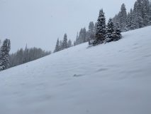
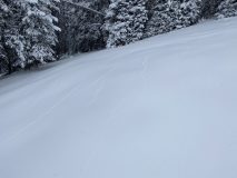
Cement Creek Snow

CB Avalanche Center2020-21 Observations

Zone: Southeast Mountains

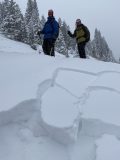
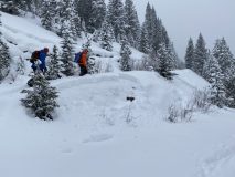
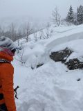
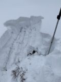
Location: Cement Creek

Date of Observation: 12/13/2020

Name: Cosmo Langsfeld

Subject: Cement Creek Snow

Aspect:

Elevation: 9250

Avalanches:

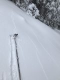
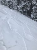
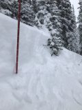
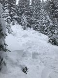
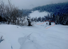
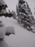
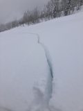
Weather: Snow let up around midmorning Saturday, and though it never really quit snowing all day, only another 1.5″ accumulated, bringing storm totals from Thursday night through Sunday morning to ~4.5″. Thermometer said -12 at 6:30am.


Touchy Conditions Mount Emmons

CB Avalanche Center2020-21 Observations

Zone: Southeast Mountains

Location: Gunsight Road

Date of Observation: 12/12/2020

Name: Ian Havlick

Subject: Touchy Conditions Mount Emmons

Aspect: North, North East, East, South East

Elevation: 9000-11,200

Avalanches:

Numerous remotely triggered D1 avalanches failing off road cuts within old snow on steep rollovers and raod cuts. Junky facets 30cm deep, new snow 30cm deep in terrain travelled. Slabs were fist+ hard above fist- 2-3mm facets. Fracture line profile on one remote trigger, 10,800ft, NE facing revealed ECTPV (1 tap) and CT3 failing 35cm deep within upper 3cm of old facet surface.


Weather: S-1 to S2 most of the day, some partial midday clearing but no vis into the alpine. calm conditions. Temps 5-17ºF

Snowpack: Simple structure, new snow on top of really weak old snow. same same as other parts of zone. appeared the yesterdays snowfall was slightly denser than todays and slightly denser than the old snow it fell on, creating just barely enough cohesion and hardness difference to allow propagation. Seemed the slab had increased reactivity in the afternoon with increased temperatures and a little more time to consolidate than earlier in the morning. Didnt seem like as much an increase of load (though some was occuring) as evolution of the slab character.

Photos:


Ponytail glades

CB Avalanche Center2020-21 Observations

Zone: Northwest Mountains

Location: Ponytail glades

Date of Observation: 12/12/2020

Name: JAFAR TABAIAN

Subject: Ponytail glades

Aspect: East, South East, South

Elevation: 11200

Avalanches:

None.

Weather: Snowing. :)

Snowpack: Extreme cracking on S slopes, ran 15-20 feet. Nothing moved on us but slope angle was max 28 degrees. S slopes had a very crusty ice layer near ground. E slopes had un-consolidated loose snow to ground level and skied better. Pretty thin, hiked out the last pitch down to the mine road.

Photos:


Pittsburg

CB Avalanche Center2020-21 Observations

Zone: Northwest Mountains

Location: Pittsburg

Date of Observation: 12/12/2020

Name: Joey Carpenter

Subject: Pittsburg

Aspect: North East

Elevation: 9250-10.5k

Avalanches:

Remote trigger (skinning), unintentional, R1D1, 10k, NE, 37 degrees, 45cm storm slab, 40′ wide, 50 vert, ran on November facets (35cm to ground, 1.5-2mm). Cracking extended onto 34-35 degree slopes 30′ to either side of the crown. M/f crust here has deteriorated almost entirely.

Remote trigger (skinning), intentional, R1D.5, 9700k, NE, 36 degrees, 45cm storm slab. 25 ft wide, 30 vert, Nov facets. The 60-80ft skiers left of this slide ran naturally sometime yesterday afternoon.

Skier trigger, R1.5D1.5, 10k, 35 degrees, 45cm storm slab (estimate), ran 60-70 vert, intentional, This slide had the most energy of anything we saw today w/ a ski cut at a convex roll.

At least 2-3 naturals BTL that ran yesterday of similar characteristics to slides described above. Small in overall size entraining only snow from the last 36 hours.


Weather: Overcast skies all day, temps started in single digits and rose to the high teens. No wind or transport. S-1 snowfall throughout the day with about 2″ accumlation from 8a-230p.

Snowpack: Snowpack was very sensitive today. Cracking at every step breaking trail through ~45cm of low density storm snow sitting on top of 35cm of 1.5-2mm facets to the ground. You could still dig to the MF crust from before the Turkey week storm but it was mostly rotted out and becoming part of the facet mess. Shooting cracks, slumping and small avalanches were easily triggered on any slope tipping past 32-33 degrees.

Photos:


CBAC2020-21 Observations

Zone: Southeast Mountains

Location: Coneys S Trees

Date of Observation: 12/12/2020

Name: J B

Aspect: North East, East, South East

Elevation: up to 10,800

Avalanches:

A few notable natural slides overnight in terrain up to 35 degrees on ESE up to D2.

Slabs On Junk

CB Avalanche Center2020-21 Observations

Zone: Southeast Mountains
Date of Observation: 12/12/2020
Name: Colorado Backcountry AVY L1
Aspect: North East
Elevation: 10,000

Avalanches: 1 Tree Bomb triggered D1

Weather: Overcast, calm, cold. Mostly light snowfall with about 2″ new snow on the cars when we returned to the trailhead.

Snowpack: About a 35cm soft slab, sitting on exceptionally weak facets. When we tried to isolate columns, with hands or ski poles, the columns failed before they were fully isolated. We never felt any collapses, but traveling in areas with slope angles between about 15 to 30 degrees, often produced shooting cracks and blocks of new snow shifting on the facets below.

Reactive Slabs on Snodgrass

CBAC2020-21 Observations

Zone: Southeast Mountains

Location: Snodgrass

Date of Observation: 12/12/2020

Name: Eric Murrow

Subject: Reactive Slabs on Snodgrass

Aspect: North, North East, East

Elevation: 9,500 – 11,100

Avalanches:

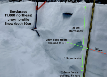
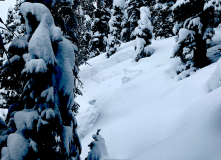
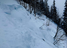
Triggered two avalanches from ridgetop D1’s but enough volume to take you for a ride and pound you into trees and rocks, one on east, one on northeast (see photos).
Observed a natural on a north-facing feature that ran early in the day, as bed surface had just a dusting of new snow, D1.


Weather: Overcast skies, very light winds (trees holding lots of snow), consistent light snow, S-1, between 10am and 230pm accumulated a bit more than an inch.

Snowpack: Storm totals since Friday morning were up to 35cm (13″) at 11,000′, 130pm. Measures SWE was .9″. Snowpack was often ‘trenchy’ with little support on east and north aspects. It was easy to trigger D1 avalanches on slopes greater than 35 degrees that faced north through east. Not enough volume to bury you, but enough to hurt ya from hitting objects. Fractures propagate up to 75 feet. No collapsing or remote triggering experienced. Needed to walk right to the edge of the slope for slabs to break. The weak basal snowpack was quickly entrained as slab ran.


Photos:

Cracking, collapsing, avalanching

CB Avalanche Center2020-21 Observations

Zone: Northwest Mountains

Location: Pittsburg

Date of Observation: 12/12/2020

Name: Sam L

Subject: Cracking, collapsing, avalanching

Aspect: North, North East

Elevation:

Avalanches:

Widespread cracking and collapsing including remote and skier triggered low energy D1s.

Weather: Steady snowfall all day, snowed up to an inch on sleds, seemed more like two at the trail head.

Snowpack: Slides entrained all of storm snow from the past two days and ran on basal facets and seemingly a deteriorated sun crust on more sunny aspects.

Photos:


Red Lady glades pow tour

CB Avalanche Center2020-21 Observations

Zone: Northwest Mountains

Location: Red Lady Glades

Date of Observation: 12/12/2020

Subject: Red Lady glades pow tour

Aspect: North East, East

Elevation: 11200

Avalanches:

Small R1/D1 avalanche path noticed at 11200 feet. Most likely intentional from the skier before me skiing on the SE facing skin track.

Weather: Snowing, low visibility,1 5 degrees

Snowpack: 70 cm depth

Photos:


Gothic Obs

CB Avalanche Center2020-21 Observations

Zone: Northwest Mountains

Date of Observation: 12/12/2020

Name: Alex Tiberio

Subject: Gothic Obs

Aspect: North East, East

Elevation: 10,000

Avalanches:

Weather:

Snowpack: Lots of shooting cracks on our low angle tour, propagating large distances. Entire meadows would all collapse at once.

Photos:

[/gravityforms]