Name: RR
Title: Skiing
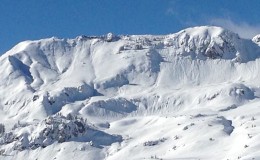
Location: Kebler Pass Area
Title: Skiing
Location: Kebler Pass Area
Date of Observation: 12/18/2014
Aspect: North, North East, North West
Elevation: 11,500
Aspect: North, North East, North West
Elevation: 11,500
Avalanches: None observed, but some predictable pockets of power were popping out in steeper trees where there were rollovers. This big round of new snow seems quite tender. It was unconsolidated, so a little surface sloughing, but when the new layer slabs up, it could be interesting.
Don’t drive your sled into a creek.
Weather: Snowing (s1) with no to very light winds from the north.
Snowpack: 18 – 24″ of unconsolidated pow on top of a supportive crust or on top of more hollow snow.