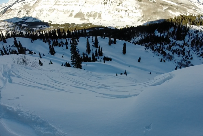
Washington Gulch

CBAC2014-15 Observations

Name: Evan Ross
DATE: 1/09/15
LOCATION: Crested Butte Area
ASPECT: E, NE
Elevation: Valley Bottom, 9,500ft
WEATHER: Sunny and warm. No wind.

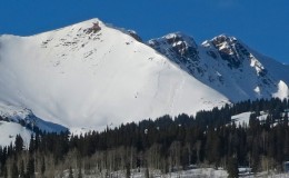
SNOWPACK/AVALANCHE OBS: Low angle near Washington Gulch TH. Plenty of collapsing without any cracks. Variable slab strength with ski pen at 10cm during the good times and ski pen on the ground during the bad times. Boot pen would have been to the ground all the time. The low elevation slab has certainly been faceting out at these low elevations but the question is how much longer will it take for the slabs to become isolated? HS 60-80cm. Lots of large surface hoar in the valley. SS-N-R1-D2-O at 12,300ft on south aspect of Baldy. Likely failed around Jan 4th and originally observed on Jan 5th.

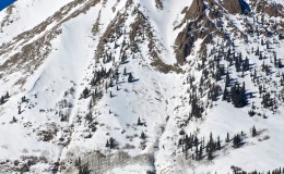
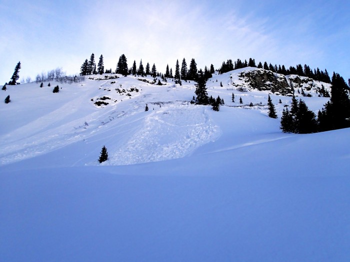
Loose snow avalanche that propagated a shallow slab 100ft wide below Gothic Spoon at 11,300ft, D2. Likely failed Jan 6th and originally observed on the 7th.

Anthracite Surface Hoar

CB Avalanche Center2014-15 Observations

Name: Alan Bernholtz
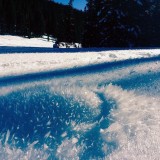
Title: Anthracite Surface Hoar
Location: Kebler Pass Area
Date of Observation: 01/09/2015
Elevation: BTL

Uploads:

Mountain Weather for Friday, January 9th, 2015

CB Avalanche CenterWeather

Date: 01/09/2015

A big arctic airmass will droop into the Midwest today, but terrain will block that cold air from western Colorado, and we will only see slightly cooler temperatures today, with partly cloudy skies once again. Tomorrow night it all gets a little more interesting with an appetizer of snow before another, stronger wave of moisture on Monday.

Washington Gulch

CB Avalanche Center2014-15 Observations

Name: Irwin Guides (CBMG)
Title: Washington Gulch
Location: Crested Butte Area
Date of Observation: 01/08/2015
Aspect: North East, East, South East
Elevation: 9500-11000

WEATHER: Clear skies, hot in the sun, no wind in valley, light winds from NW on ridge top.

Snowpack: SNOWPACK/AVALANCHE OBS: Huge surface hoar growth from valley floor to ridge top. Overall snowpack very weak and unconsolidated. HS average of 60cm valley floor and 120cm at ridge top. Lots of big collapses observed on bottom 1/2 of terrain both on up track and on egress out. These seemed to become widespread and predictable the minute the snowpack structure lacked any cohesive ‘mid-pack’. Upper 1/3 of terrain was characterized by a snowpack structure that was slightly more supportive with ski pen about 20cm. Here quick test profile pits revealed a small (15cm thick) 4F+/1F- hard layer about 40cm below the surface capping the Dec 13th interface and the basal facets. Hand shear tests and compression tests both showed moderate failures on the basal facets directly below this layer The middle 1/3 is the scary tapering thickness persistent slab problem pointed out in CBAC report (0-15cm thick) where skier triggering is likely to occur.

Uploads:

Park Cone Above Taylor Reservior

CB Avalanche Center2014-15 Observations

Name: Ian Havlick
Title: Park Cone near Taylor Reservior
Location: Cement Creek Area
Date of Observation: 01/08/2015
Aspect: North, North East
Elevation: 9400-11600

Avalanches: only avalanches observed were D1.5 WL slides across SE-S-SW facing slopes across Collegiates and off Matchless Mtn. All originated in steep, rocky or krumholtzy terrain.

Weather: Clear, calm, mild.

Snowpack: Snowpack depth varied from ~65cm to 155cm in wind loaded areas near treeline. Constant collapsing as we broke trail all day. Every step would collapse between the TH at 9400 til we broke onto more open, wind effected slopes near treeline. Some collapses were booming, and rolling, many were localized around each ski. Treebombed snow surfaces added support and structure and helped ascent. Many times ski pen would be 10-15cm, then suddenly drop knee deep into the snowpack…example of variable structure and slab.

Uploads:

Wet Loose in Brush Creek

CB Avalanche Center2014-15 Observations

Name: John lewis
Title: Small sluff slide on death pass
Location: Brush Creek Area
Date of Observation: 01/07/2015
Aspect: South East, South
Elevation: 9300

Avalanches: Small sluff slide maybe 5 foot wide and 30 feet long. Slide down to the ground.

Weather: Blue skies

Snowpack: Soft snow, warming snow, surface hoar on some areas

Uploads:

Mountain Weather January 8, 2015

CB Avalanche CenterWeather

Date: 01/08/2015

The high pressure over the Great Basin continues to drive mild weather under northwest flow for the next few days. A colder air mass is dropping along the Great Plains today, which will have minimal effects on us except for slightly cooler temperatures than the record-breaking high temps we saw the past two days. The cooling trend progresses into the weekend as the ridge begins to deform. By Sunday, a more active weather pattern develops, but models are still in disagreement on the details. Look for a return to snowier weather by Monday and Tuesday at the latest.

Snodgrass Snow Study Plot

CB Avalanche Center2014-15 Observations

Title: Snodgrass Snow Study Plot
Location: Crested Butte Area
Date of Observation: 01/07/2015
Aspect: North East
Elevation:

Avalanches:

Weather:

Snowpack: Multiple whumps on tour out, all when ski pen was 10-15 cm on leeward rolls often near buried vegetation. Ski pen up to 45 cm n many places on open/fetch slopes.

Uploads:

Snodgrassplot20150107

Skier triggered avalanche in Wolverine Basin

CBAC2014-15 Observations


OLYMPUS DIGITAL CAMERAwolverine

DATE: 01/07/2015

LOCATION: Wolverine Basin

ELEVATION: 9000′ – 10,200′

ASPECT: N-E

WEATHER: Clear skies and hot in the sun. Temps below freezing in the shade. Calm to light winds.

SNOWPACK/AVALANCHE OBS: Thin crusts on SE-W aspects in the valley bottom. Surface hoar was also noted in the valley bottom. While ascending the gunsight road HS remained consistent around 110cm. Outside of the skintrack no instabilities were noted, and boot pen was essentially to the ground. Hand pits consistently showed an extremely weak snowpack with no layer greater than fist hardness. One human triggered slab avalanche occurred on a NE aspect at ~10,200′. The run was a short path (~300′) between two switchbacks on the Gunsight road visible when you enter Wolverine Basin. Near the start zone HS was approximately 75cm with consistently weak snow to the ground. As I continued down the slope I felt the snow become increasingly more supportive and near the bottom felt a collapse. The slab was triggered from approximately 250ft below the crown, and the crown depth was ~75cm. The crown was approximately 150ft wide and I would classify the slide a R2-D1. Skier 1 was on the road above the path when the avalanche occurred, and skier 2 was clear of the runout by the time the avalanche accelerated.

Windslabs near Pittsburg

CBAC2014-15 Observations

GUIDE(S): Jeff

DATE: 2015/01/05

ACTIVITY: Ski tour

LOCATION: Commando Trees

ELEVATION: 9600′ – 10,400

ASPECT: NW-N-NE

WEATHER: Variable/Overcast, flat light, dry most of the day, Strong to Extreme, mostly N channeled down valley

SNOWPACK/AVALANCHE OBS: sled parking (valley floor along stream) got avalanched by a D1 windslab 30cm thick that formed while we were touring! Fairly recent slab D1.5 under the cliff band of Schuykill peak above pittsburgh rollers. Schuykill looks stripped in many places & very thin, highly variable. No other signs of instability on surrounding alpine peaks

In Old Growth timber: consistent & stable pack of ~120-135cm of well bonded snow.
Bonding Tests:
Location: NW, large living room sized opening in forest @ 10,400. Lots of tree bombs evident in the pit. 25 degree slope, ski pen 10-15cm. boot pen 30cm. Progressive hardness downwards except a 1 hardness change @ 70cm down on rounds/rounding facets interface

DTH on ground (moist, dense (4F) cohesive facets, sticking to leaves, non repeatable)
DTN
CTH @ 70cm down on rounded slab (1F) & rounding facets interface (4F), Q2 (RP)
CTN
ETCX

Skied slpoes up to 50 degrees with no instabilities