Date of Observation: 01/01/2023 Name: Travis Tucker
Zone: Southeast Mountains Route Description: A braap out to River’s End Campground from the Trading Post.
Observed avalanche activity: No Avalanches: None observed. Weather: Temp: H of 36*
Wind: Calm
Sky: Obscured (x)
Precip: S1 most of the day. Snowpack: HS: 45 – 150cm
On a shallower North facing slope near road / Trading Post…
28 cm of 4F
7cm of 2-3mm FC
15cm of 3-5mm DH
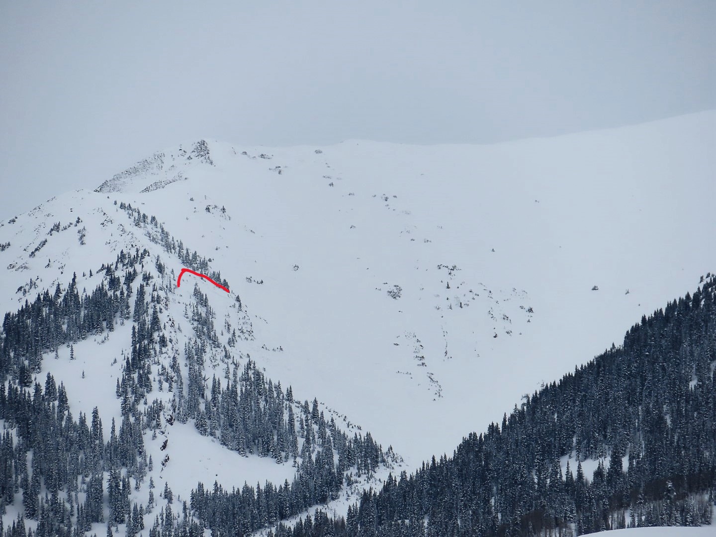
Zone: Southeast Mountains Route Description: Snowmobiled Cement Creek to the base of Hunter Hill.
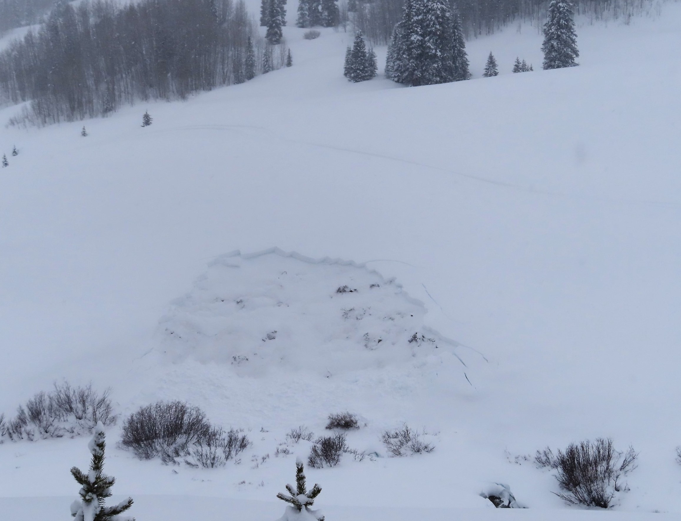
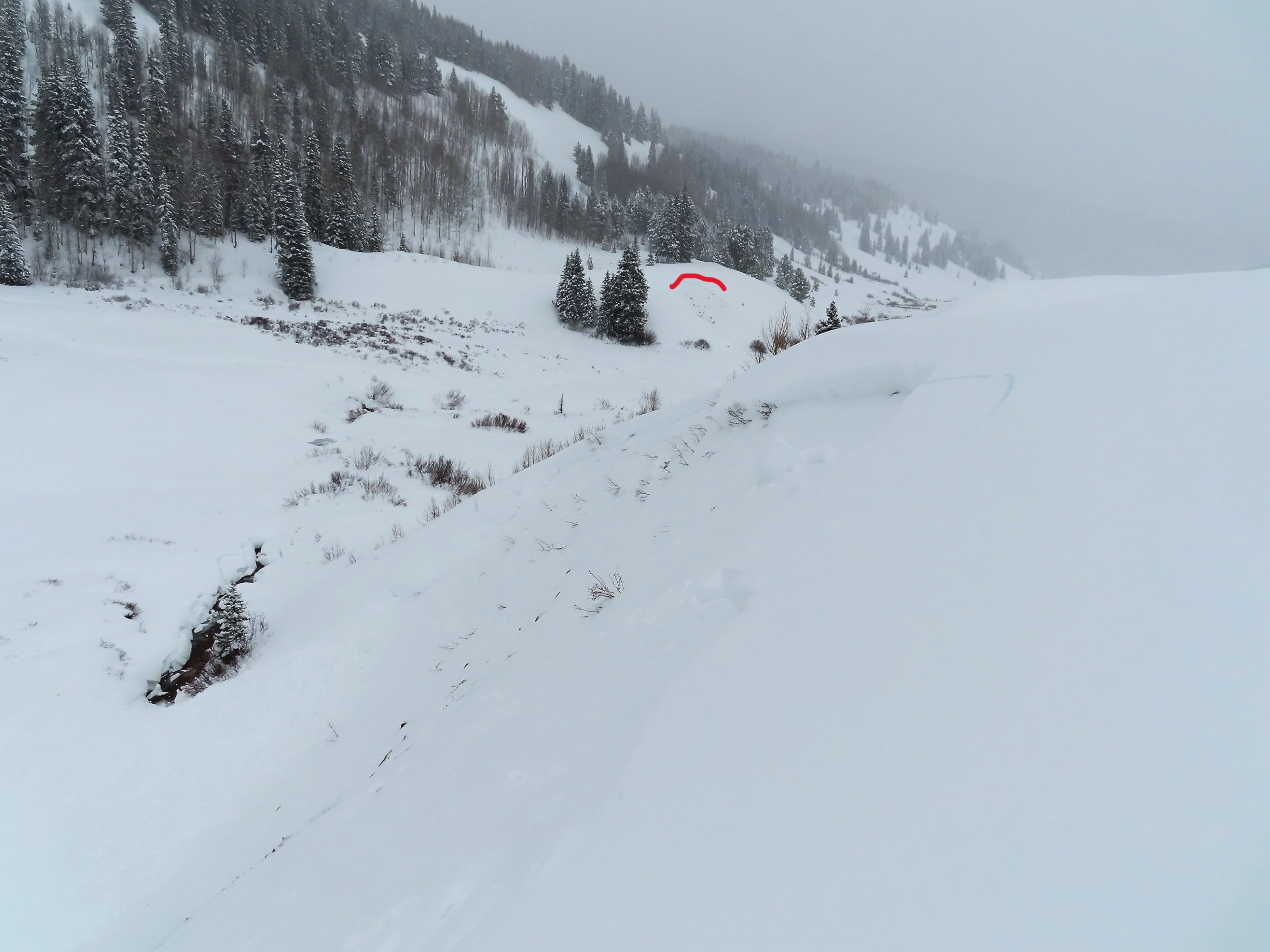
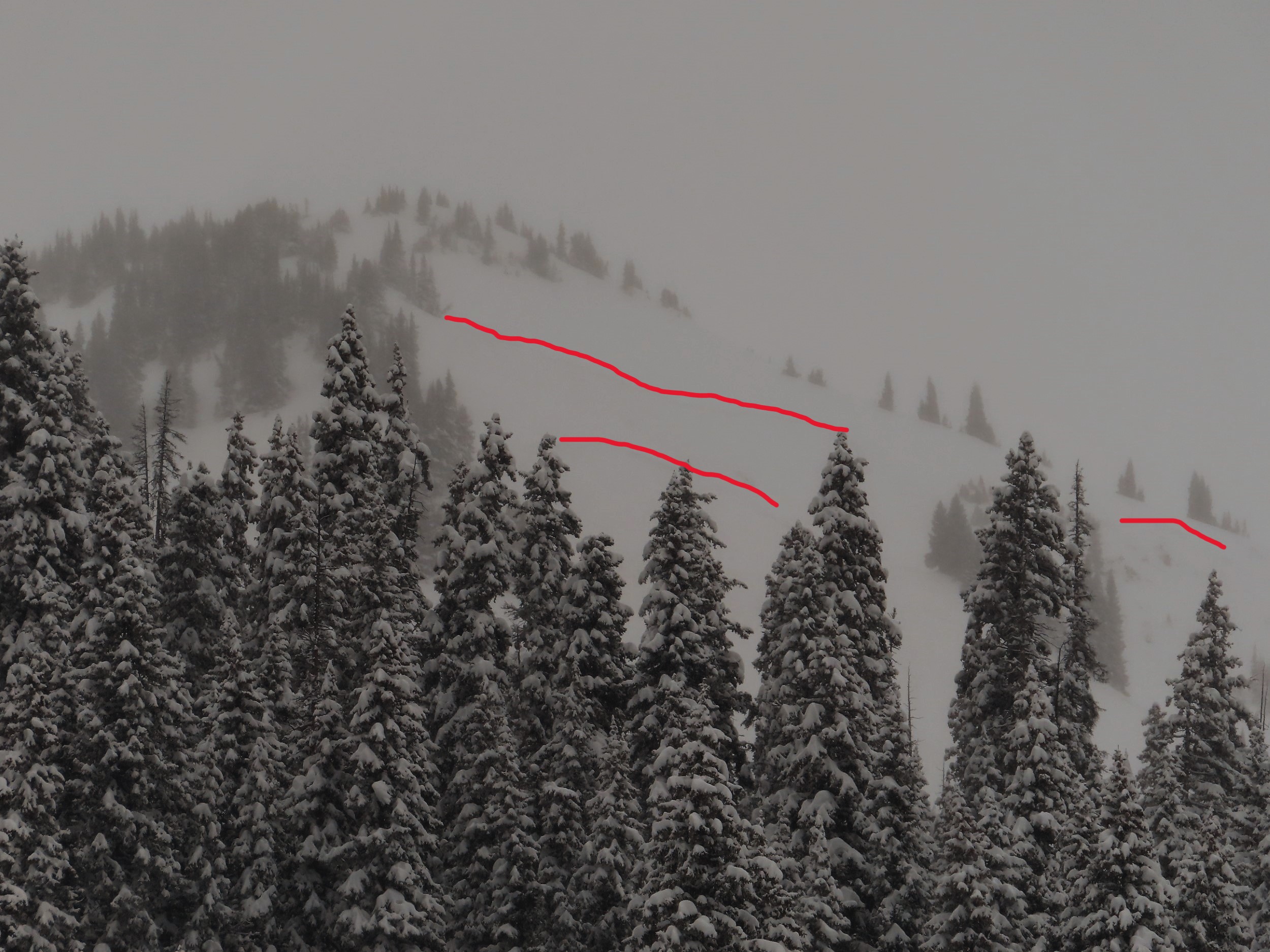
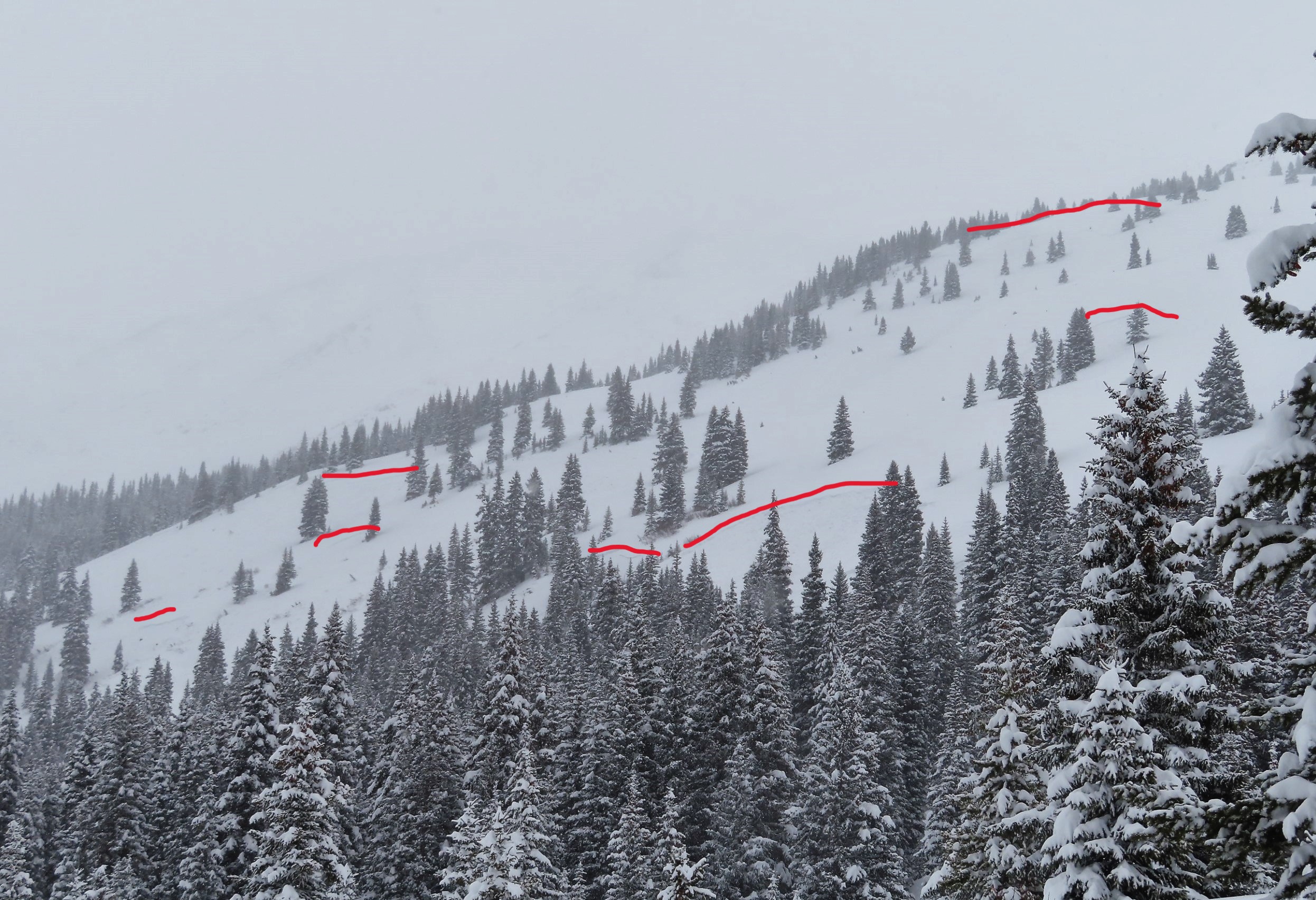
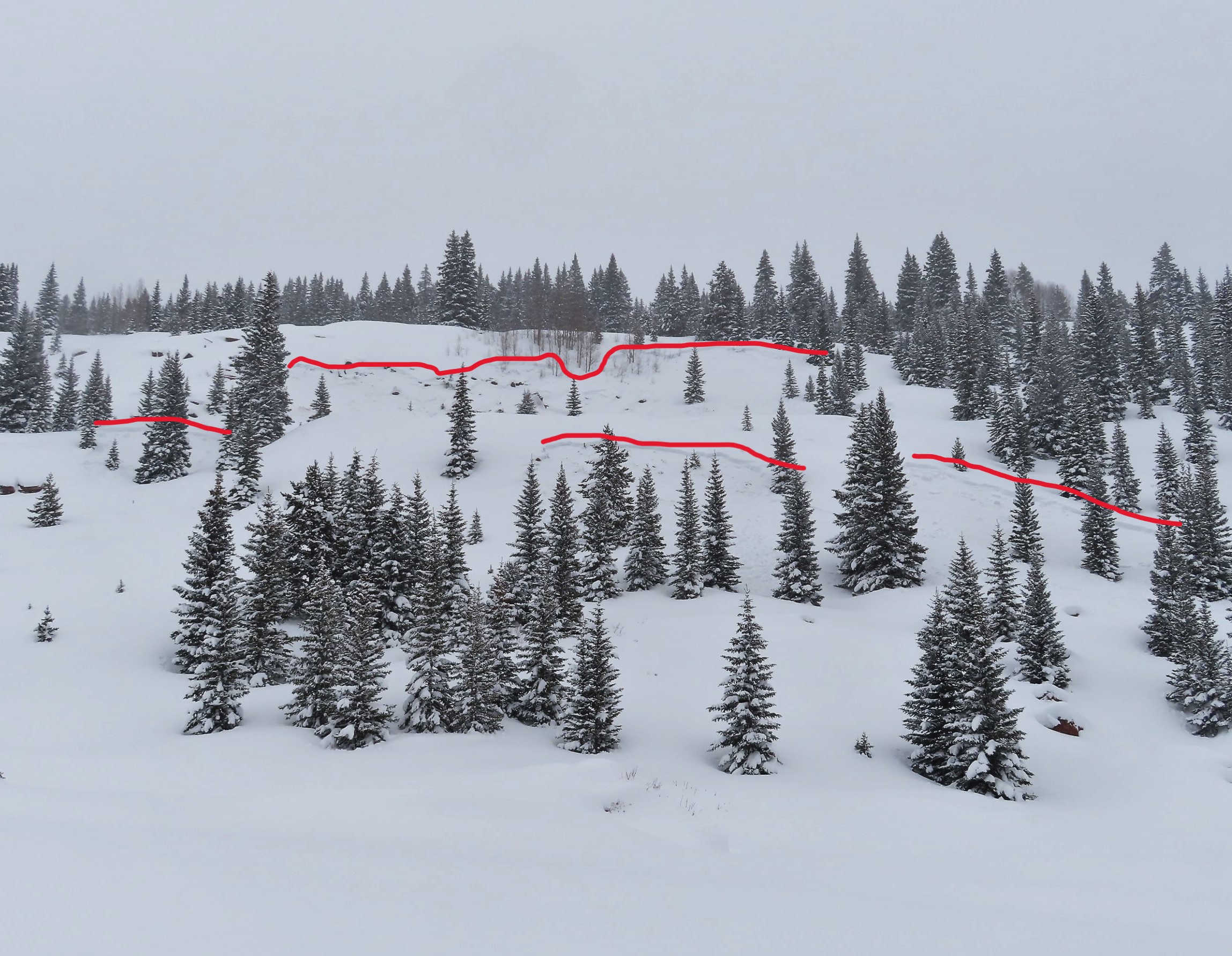
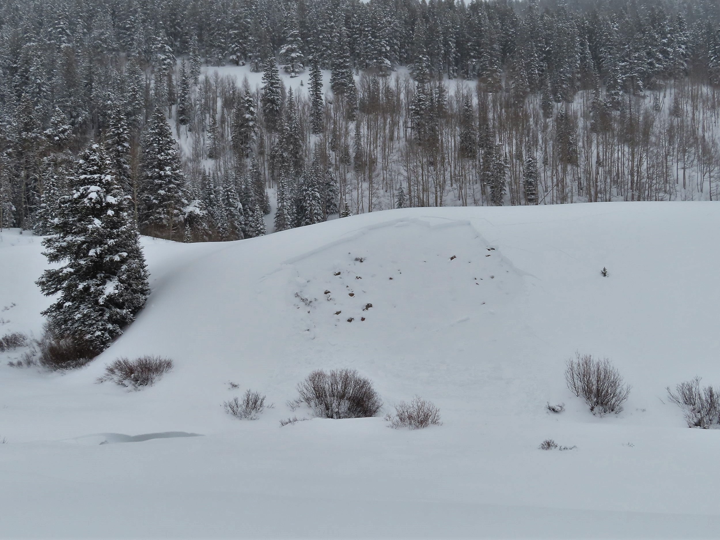
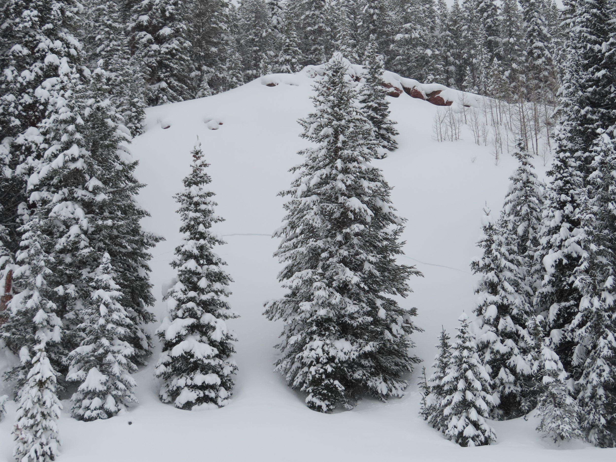
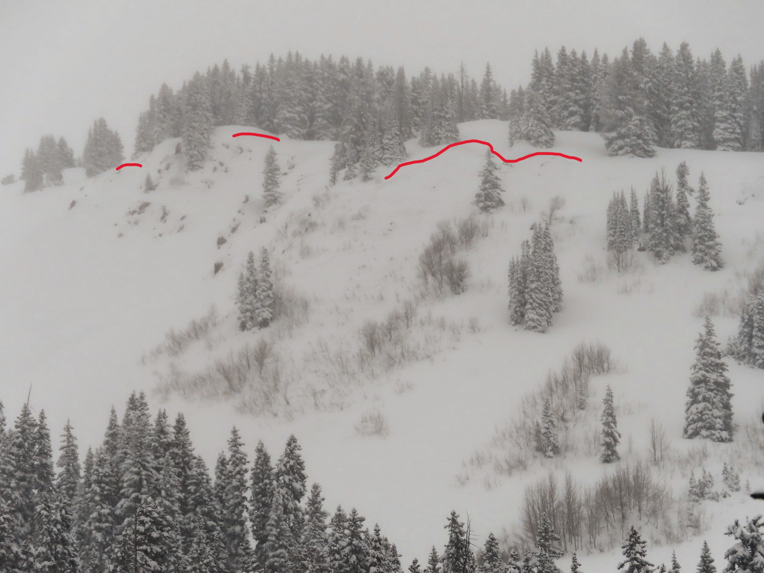
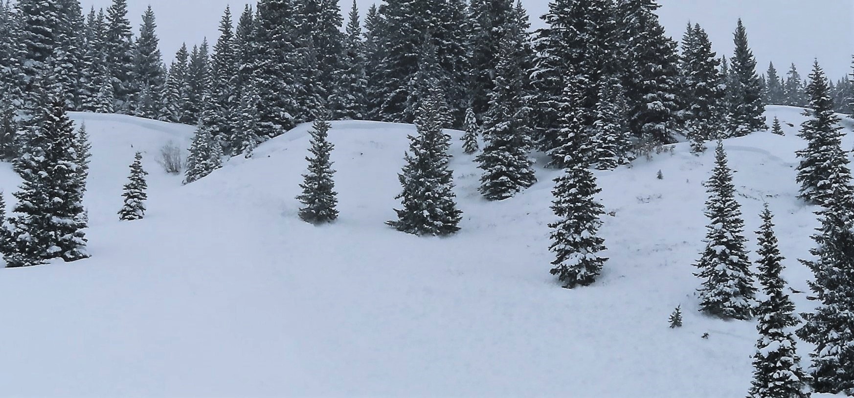
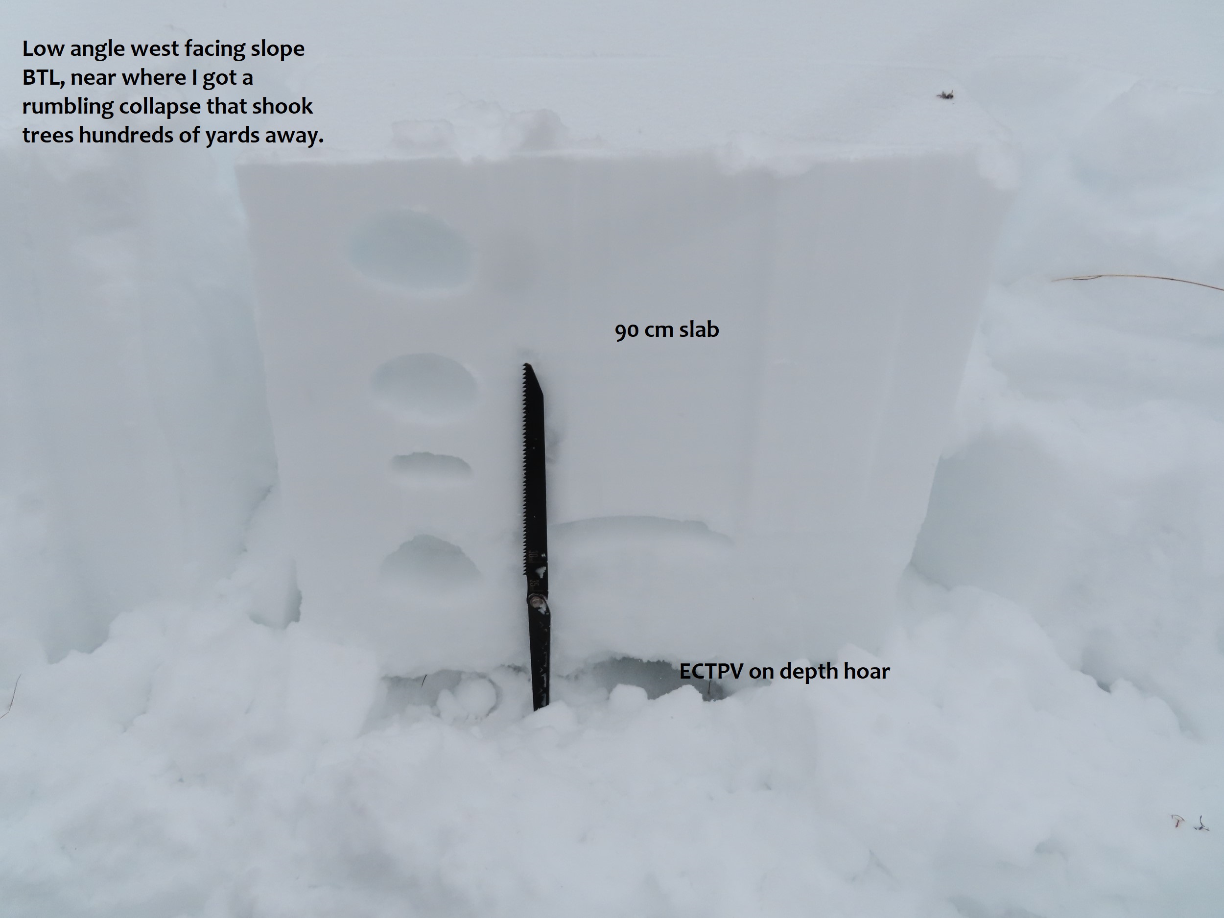
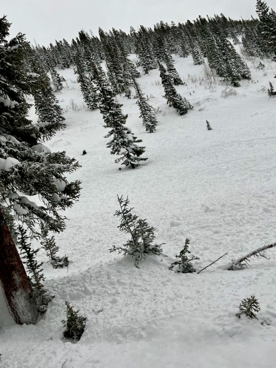
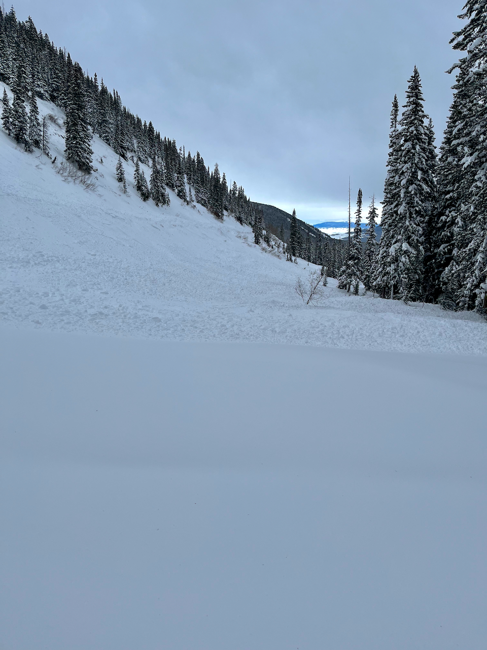
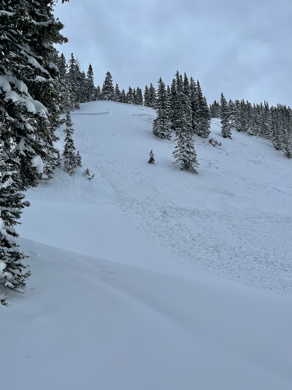
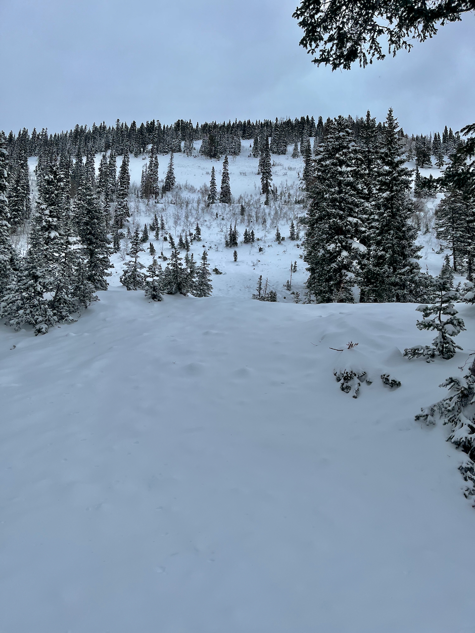
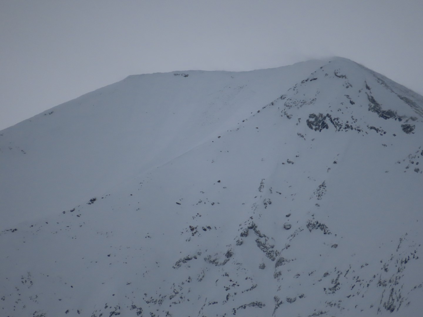
Observed avalanche activity: Yes Avalanches: Widespread and ongoing natural and remotely triggered persistent slab activity that appeared to start last night and go through today, localized to Upper Cement Creek (east of Deadman’s Trailhead). In that upper basin, almost every single steep slope that we rode near remotely avalanched if it hadn’t already gone naturally. Dozens of small creek beds released, and we triggered about half a dozen larger slopes just riding in the flats. More natural avalanches than I could count. Crowns were generally about 2 feet thick, and most appeared to fail on the mid-December facet layer. Small terrain features produced D1-1.5s, and larger terrain produced D2s. Avalanches were occurring on all aspects, which are generally E, SE, W, and NW below treeline in this basin. Couldn’t see the alpine. Weather: Light snowfall with a few moderate pulses. Calm winds below treeline. Snowpack: This might have been one of the most widespread, touchy persistent slab days I’ve ever experienced in my career; truly fascinating and blatantly dangerous. Human triggering felt almost certain. Riding into open slopes consistently produced rumbling collapses with trees shaking hundreds of yards away, shooting cracks opening on moderate angled slopes, and almost everything steeper than 35 degrees would slide. Collapses occurred on mid-December facets and depth hoar, which are now in the bottom 3rd of the snowpack below a 60 to 90 cm slab. Tests produced sudden collapses on isolation in the depth hoar (ECTPV). Near the trailhead, I watched a small dog step off the road and trigger a shooting crack across a slope. In Lower Cement, slabs are thinner (~30 cm), and better anchored by ground roughness, sagebrush, etc, thus the danger was less threatening.
Photos:
A dog triggered these shooting cracks near the trailhead.
One of numerous remotely triggered avalanches.
One of numerous remotely triggered avalanches.
Natural avalanches, Upper Cement Creek
Natural avalanches, Upper Cement Creek
Natural avalanches, Upper Cement Creek
Upper Cement. Potentially remote triggered, or fresh natural.
We saw many rumbling collapses and shooting cracks.
Relative Size: R2 small Destructive Size: D2 – could bury, injure, or kill a person Avg. crown height (inches): Avg. width (feet): Avg. vertical run (feet):
Involvements
# of people caught: # of partial burials: # of full burials:
Relative Size: R2 small Destructive Size: D2 – could bury, injure, or kill a person Avg. crown height (inches): Avg. width (feet): Avg. vertical run (feet):
Involvements
# of people caught: # of partial burials: # of full burials:
Relative Size: R2 small Destructive Size: D2 – could bury, injure, or kill a person Avg. crown height (inches): Avg. width (feet): Avg. vertical run (feet):
Involvements
# of people caught: # of partial burials: # of full burials:
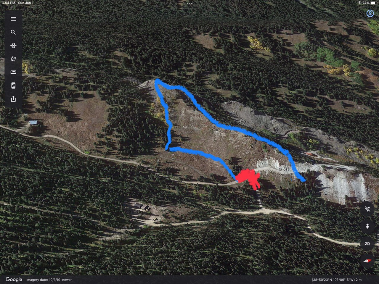
Zone: Northwest Mountains Route Description: Snowmobiling down the road.
Observed avalanche activity: Yes Avalanches: Message from a friend up Bracken Creek that I thought I would pass along. Blue is where it slid, buried the road where the red mark is. Possibly triggered by snowmobiles but unconfirmed. That’s all the info I have.
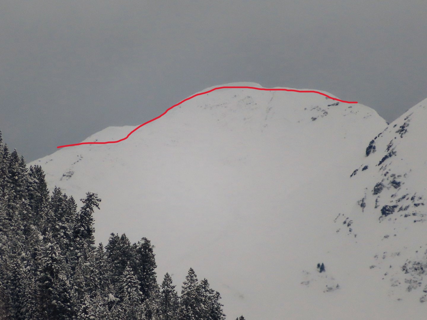
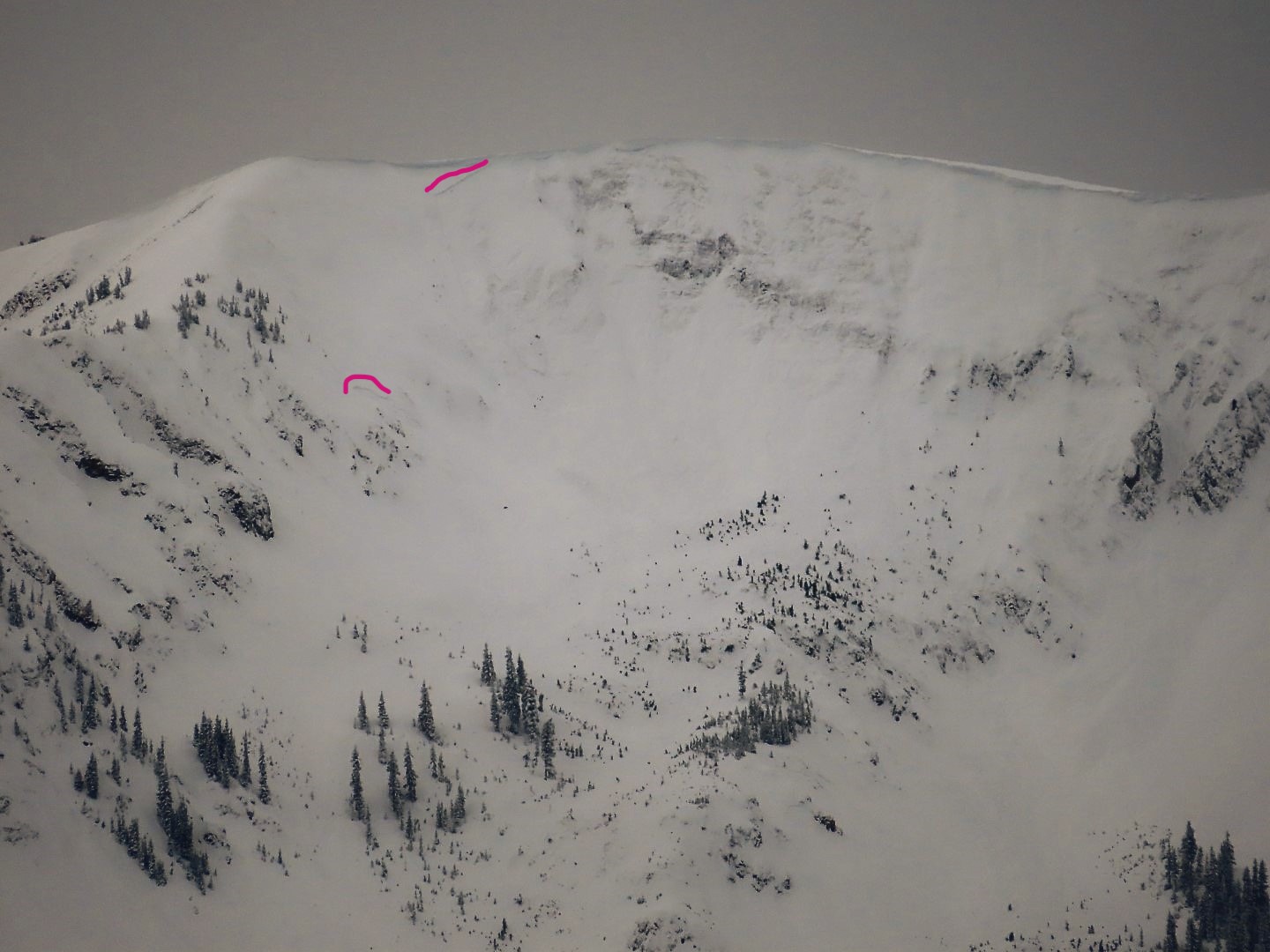
Observed avalanche activity: Yes Avalanches: A brief view (too short a window to get photos or code individual avalanches) of numerous natural avalanches on the down valley end of Whestone. Northeast, east, and southeast aspects near and above treeline. The ground was showing in some of the bed surfaces and some appeared to propagate widely like in Lucky Boy Basin. Large natural avalanche observed above Long Lake at the Washington Gulch TH. Weather: Consistent light snow after 1030am. Snowpack:
Photos:
This avalanche was visible above Long Lake Sunday morning.
Relative Size: R1 very small Destructive Size: D2 – could bury, injure, or kill a person Avg. crown height (inches): Avg. width (feet): Avg. vertical run (feet):
Involvements
# of people caught: # of partial burials: # of full burials:
Additional comments: estimated failure on 1/1 AM but could have been late 12/31.
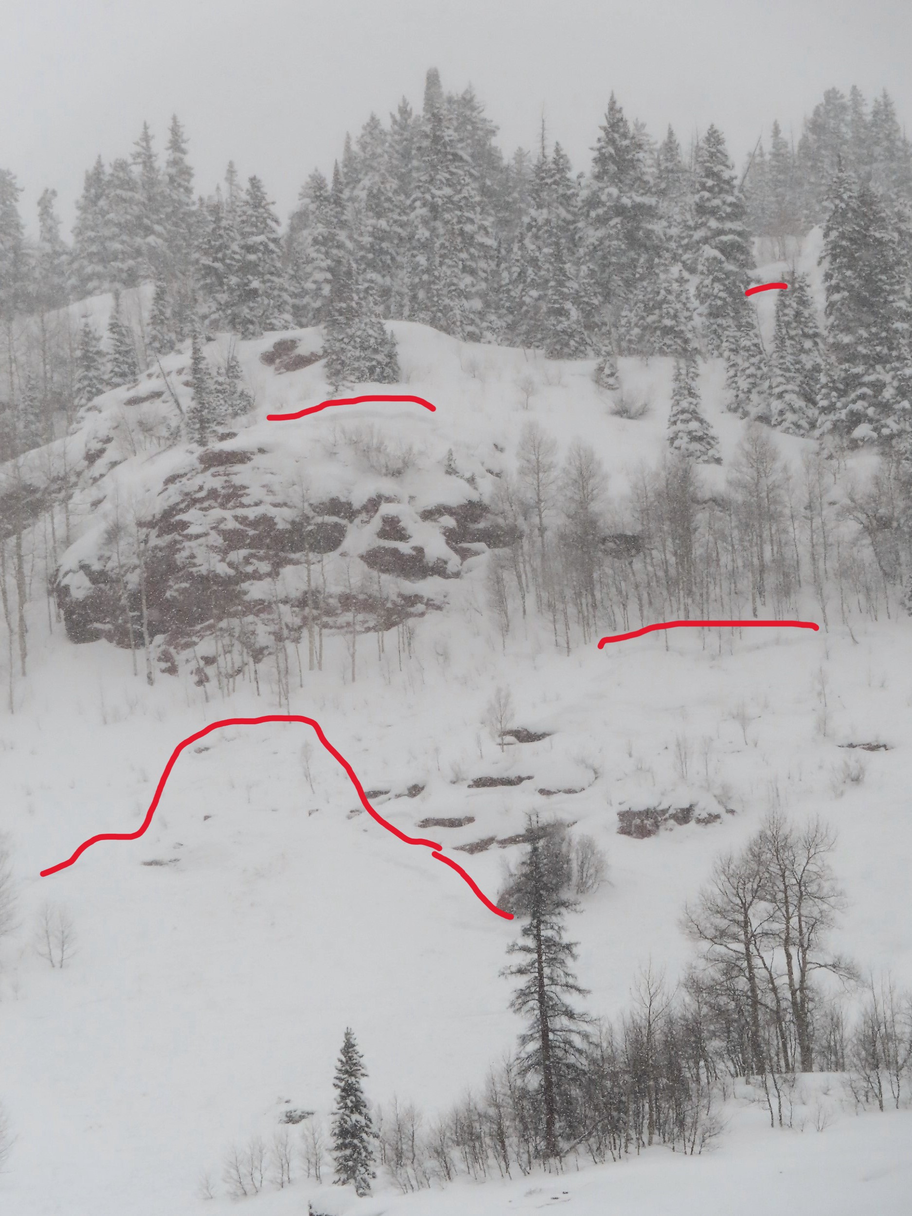
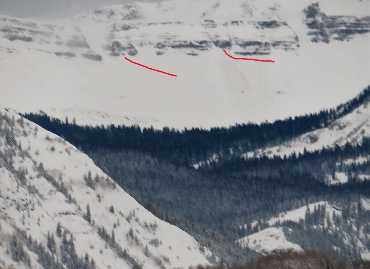
Observed avalanche activity: Yes Avalanches: Several large avalanches covered Ohio Pass Road. One of these ran yesterday reported by a group of snowmobilers. Unclear whether it was triggered or natural. The other two ran this morning.
Photos:
One of several avalanches that ran near Ohio Pass on steep southwesterly-facing terrain, burying the groomed snowmobile route between the Ohio Creek Valley and Kebler Pass
One of several avalanches that ran near Ohio Pass on steep southwesterly-facing terrain, burying the groomed snowmobile route between the Ohio Creek Valley and Kebler Pass
One of several avalanches that ran near Ohio Pass on steep southwesterly-facing terrain, burying the groomed snowmobile route between the Ohio Creek Valley and Kebler Pass
One of several avalanches that ran near Ohio Pass on steep southwesterly-facing terrain, burying the groomed snowmobile route between the Ohio Creek Valley and Kebler Pass
Relative Size: R3 medium Destructive Size: D2 – could bury, injure, or kill a person Avg. crown height (inches): Avg. width (feet): Avg. vertical run (feet):
Involvements
# of people caught: # of partial burials: # of full burials:
Relative Size: R3 medium Destructive Size: D2 – could bury, injure, or kill a person Avg. crown height (inches): Avg. width (feet): Avg. vertical run (feet):
Involvements
# of people caught: # of partial burials: # of full burials:
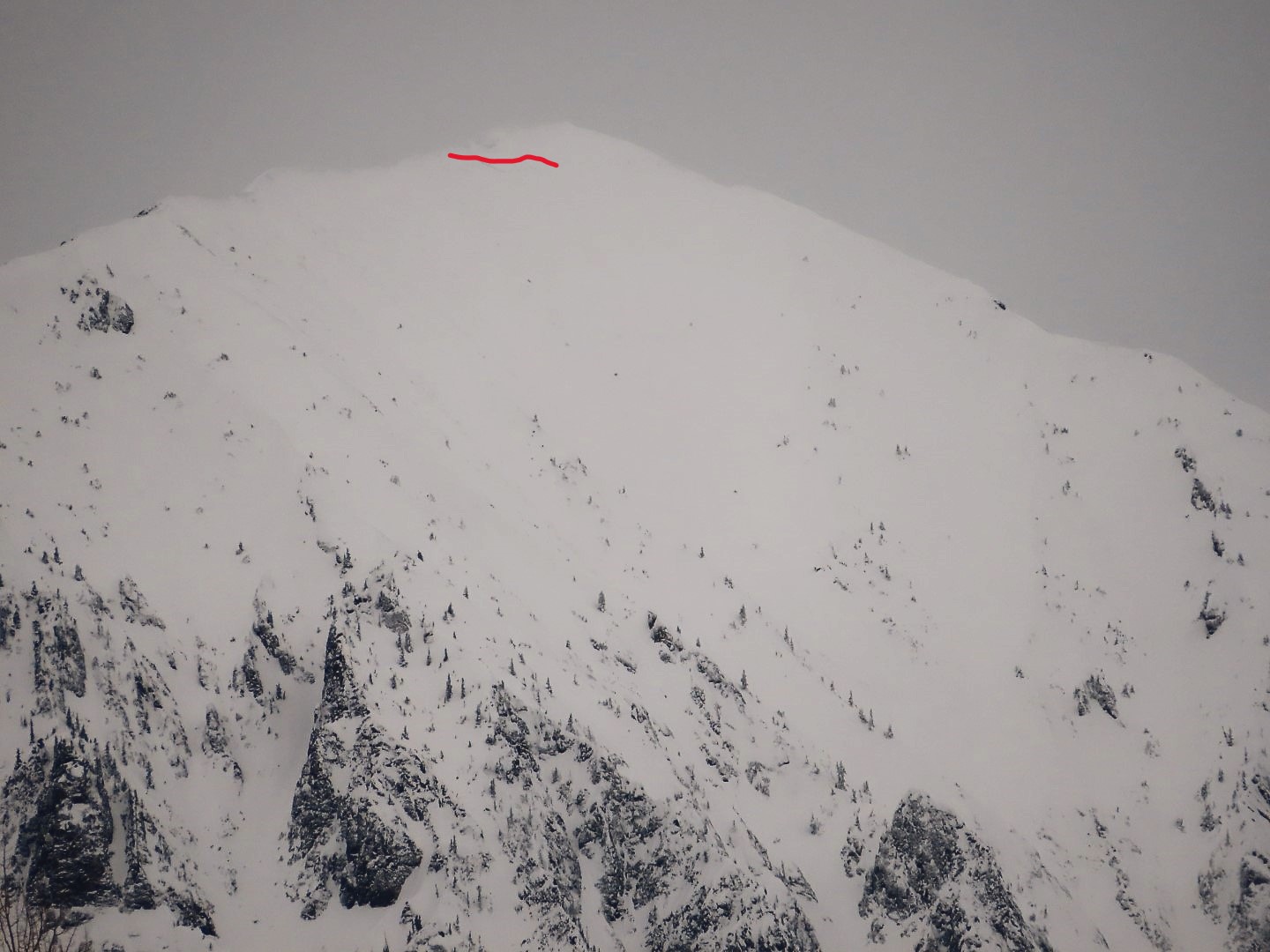
Estimated avalanche date: 01/01/2023 Number of Avalanches: 1
Location
Location: Mount Whetstone Location Specific: Start Zone Elevation: ATL: Above Tree Line Aspect: NE
Characteristics
Trigger: Natural Trigger modifier: Type: Hard Slab Failure Plane: Ground
Size
Relative Size: R3 medium Destructive Size: D3 – could destroy a car, wood-frame house, or snap trees Avg. crown height (inches): Avg. width (feet): Avg. vertical run (feet):
Involvements
# of people caught: # of partial burials: # of full burials:
Additional comments: Barcelona Bowl. Size estimated, couldn’t see runout
Relative Size: R2 small Destructive Size: D2 – could bury, injure, or kill a person Avg. crown height (inches): Avg. width (feet): Avg. vertical run (feet):
Involvements
# of people caught: # of partial burials: # of full burials:
Additional comments: Baby Bowl. Size estimated, couldn’t see runout
Relative Size: R2 small Destructive Size: D2 – could bury, injure, or kill a person Avg. crown height (inches): Avg. width (feet): Avg. vertical run (feet):
Involvements
# of people caught: # of partial burials: # of full burials:
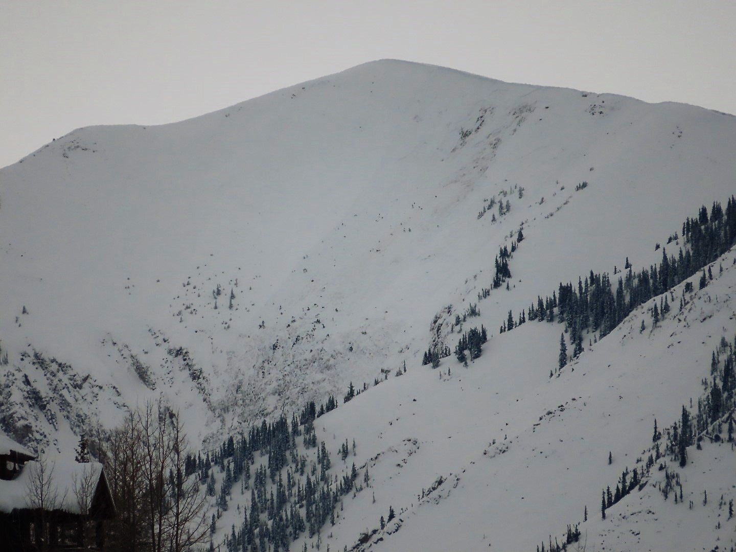
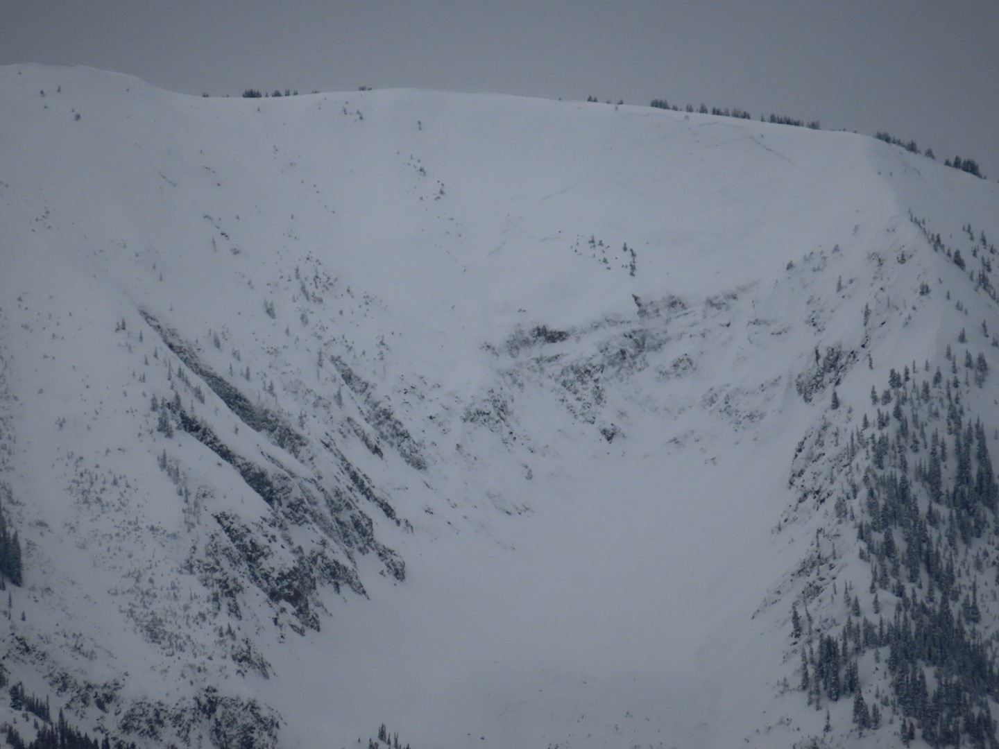
Observed avalanche activity: Yes Avalanches: Brief visibility this morning of large to very large avalanches on Axtell, Augusta, and Scarp Ridge. Unfortunately, by the time I got to a good vantage of the Ruby Range, the clouds were back.
Photos:
Very large avalanche that exposed ground on SE side of Augusta
Relative Size: R1 very small Destructive Size: D2 – could bury, injure, or kill a person Avg. crown height (inches): Avg. width (feet): Avg. vertical run (feet):
Involvements
# of people caught: # of partial burials: # of full burials:
Relative Size: R2 small Destructive Size: D2 – could bury, injure, or kill a person Avg. crown height (inches): Avg. width (feet): Avg. vertical run (feet):
Involvements
# of people caught: # of partial burials: # of full burials:
Date of Observation: 12/31/2022 Name: Benny Walter
Zone: Northwest Mountains Route Description: Text message ob sent in from Elkton
Observed avalanche activity: Yes Avalanches: East facing at 10,600 probably 40 degree slope remotely triggered from the tracks 200 feet to the lookers right. 50cmish at the crown 100 ft wide.
Observed avalanche activity: Yes Avalanches: Few small storm slabs.
Weather: Overcast. Light down-valley winds in the afternoon. Snowing S1 to S2
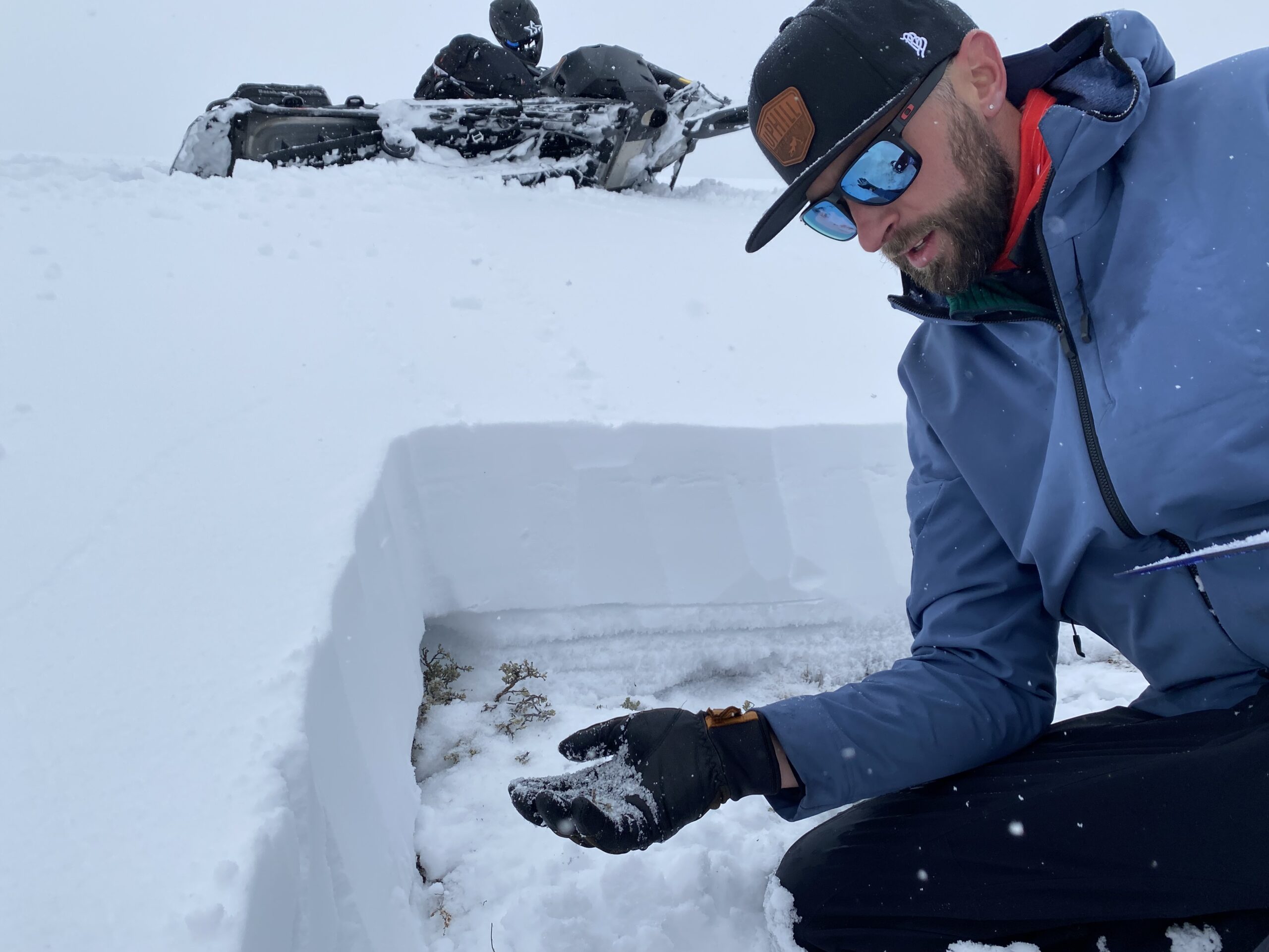
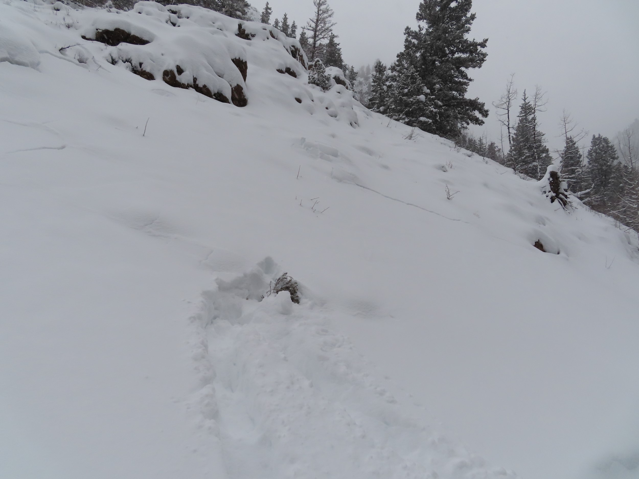
Snowpack: Quick tour, mostly targeting some NE slopes BTL in lower Elk Creek. Other than a few small storm slabs, nothing notable in the lower Elk Creek area or near the road on Kebler. Traveled on several small test slopes, and near-defined avalanche terrain with no obvious signs of instability.
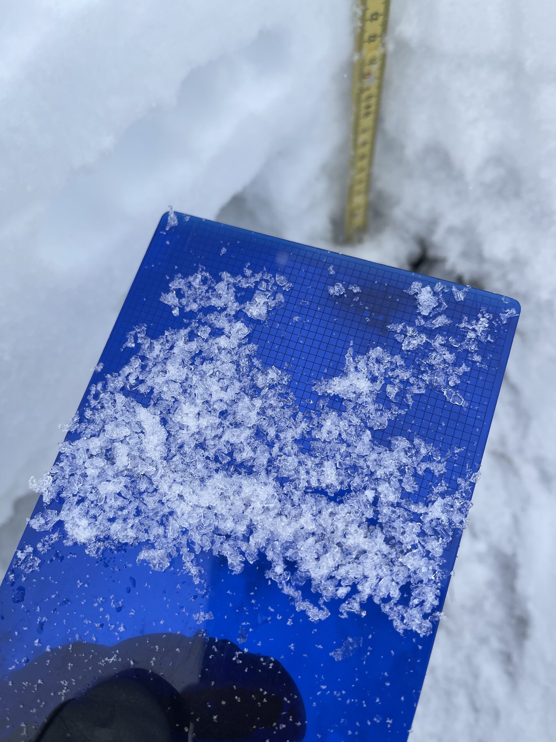
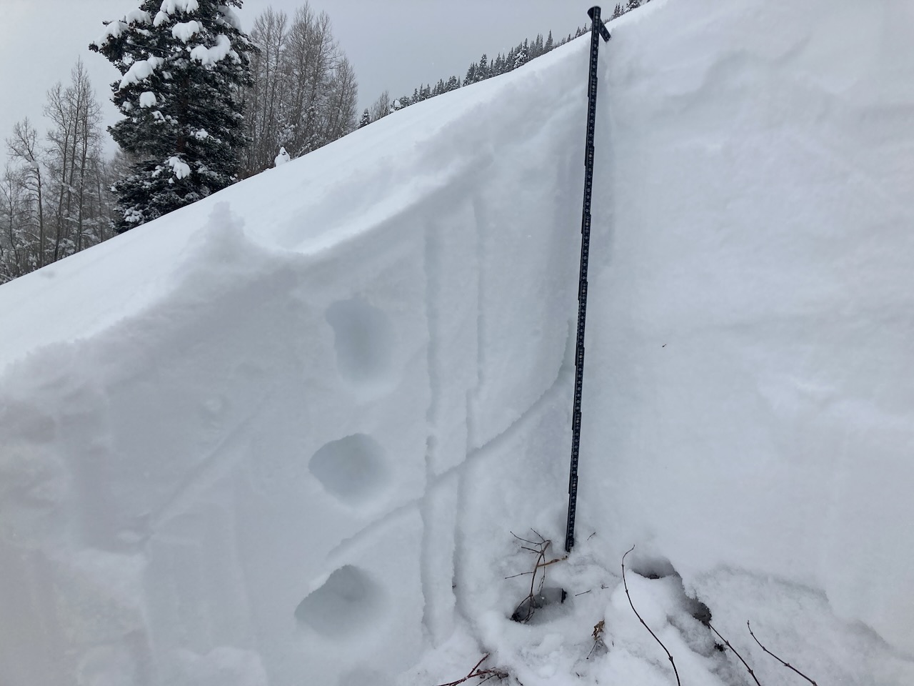
ENE, 31-degree slope, BTL that does see wind-loading. HS 153. The recent storm interfaces were down about 15cm and 25cm. December 20th was down about 70cm. ECTP 3 on the lower storm interface. ECTN 24 on 12/20. The 12/20 interface was very thin and difficult to see in the pit wall, but still defined 1mm NSF on the card.
Relative Size: R1 very small Destructive Size: D1- Relatively harmless to people Avg. crown height (inches): Avg. width (feet): Avg. vertical run (feet):
Involvements
# of people caught: # of partial burials: # of full burials:
Relative Size: R1 very small Destructive Size: D1- Relatively harmless to people Avg. crown height (inches): 6 Avg. width (feet): Avg. vertical run (feet):
Involvements
# of people caught: # of partial burials: # of full burials:
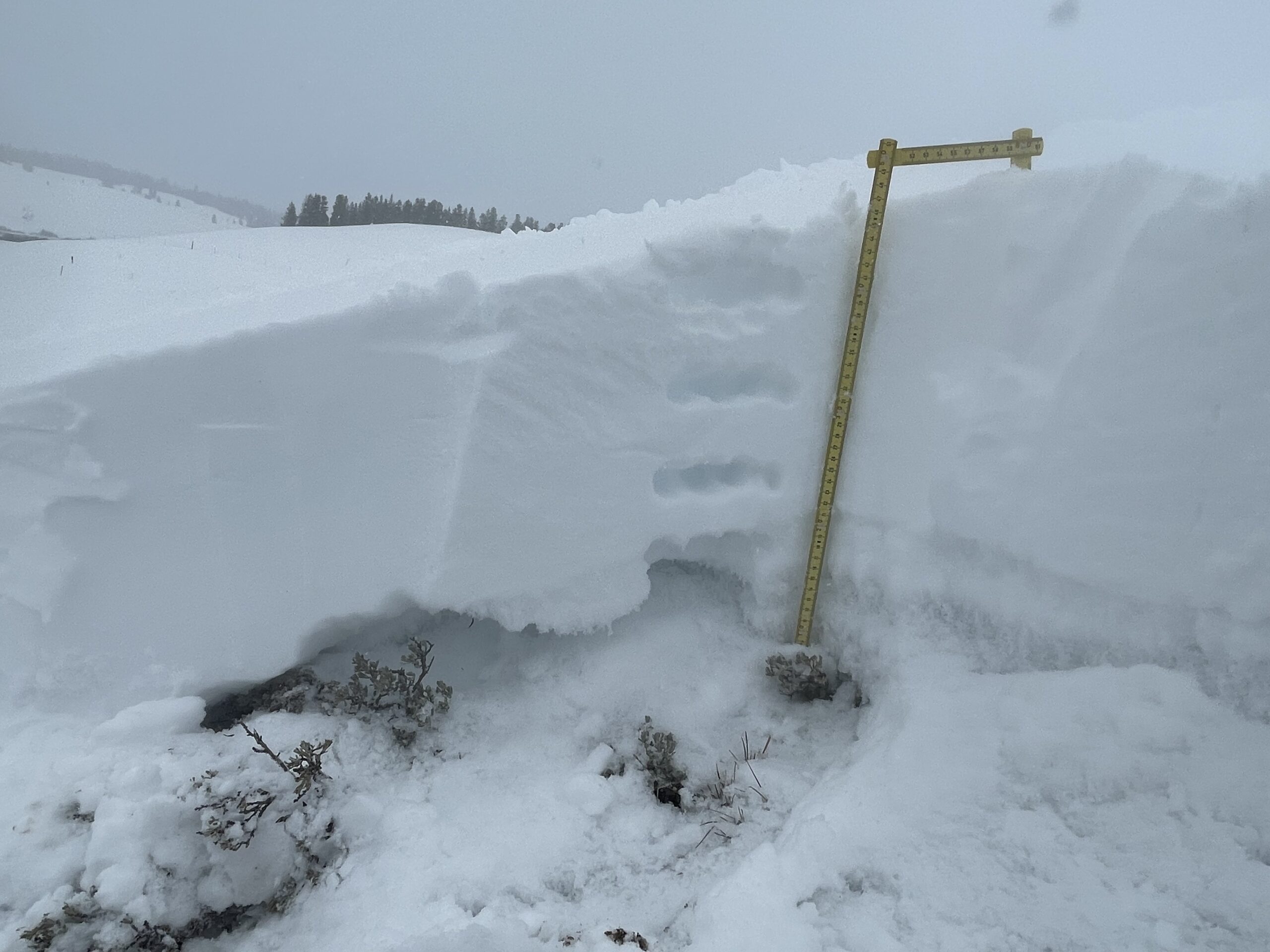
Zone: Southeast Mountains Route Description: Near town. 9,100ft. ENE.
Observed avalanche activity: No
Weather: Overcast. Calm winds. Lull in the snow this morning, otherwise snowing most of the day.
Snowpack: Skinning was horrible in the upside-down upper snowpack. Didn’t travel through much terrain, but no notable obvious signs to instability. Targeted one quick profile on a 36-degree, 90cm, ENE slope at about 9,100ft. The thick portion of the storm slab was only about 3cm, with soft snow above and below. Shovel tilts easily produced results in the upper 15cm of the snowpack. The December facets are still large and prominent, but the snowpack is still generally soft and soft. A small storm slab in this terrain would have easily gouged and entrained the weak snowpack if the slope was steep enough.