Date of Observation: 03/16/2016
Name: Zach Guy
Aspect: North, North East
Elevation: 9,300-10,400 ft.
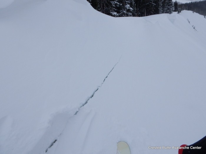
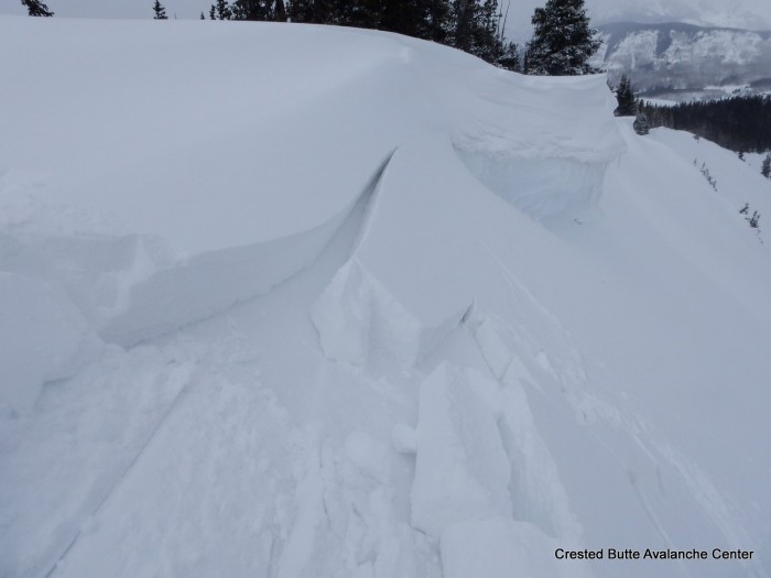
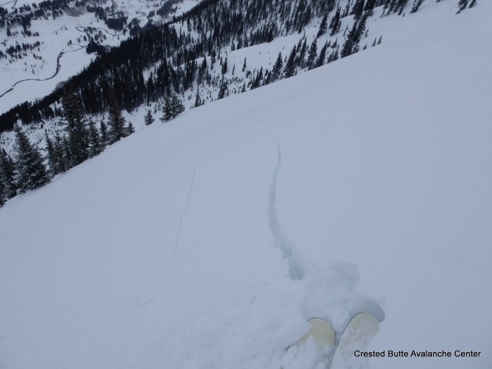
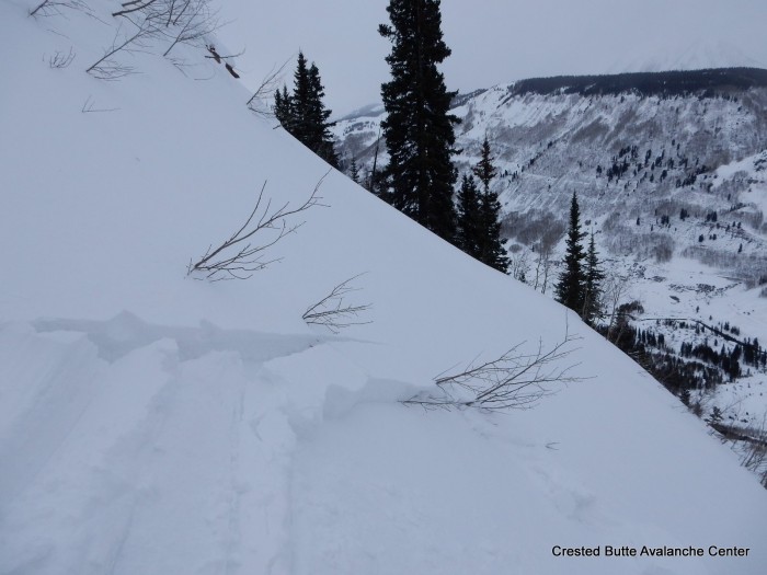
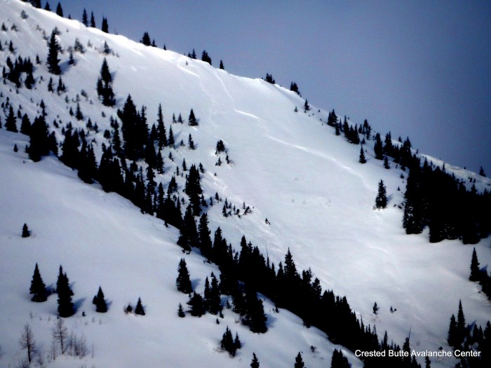
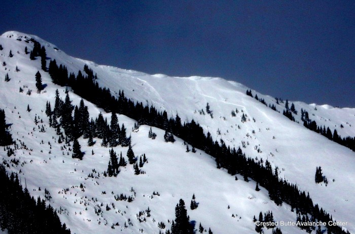
Avalanches: See photos. Observed 5 fresh natural soft slab avalanches on NE aspects N/ATL, and handful of minor sluffs or harmlessly small pockets. Two of these larger slides appeared to be several feet deep failing on the 3/6 facet layer as persistent slabs, with wide propagation and the dust layer faintly visible on the bed surface. One ran naturally sometime this morning. Two were repeat offenders that ran 3/6, that appeared to fail at the storm interface.
Weather: Scattered to broken clouds. Mild temps. Moderate down-valley valley winds with moderate snow transport visible up high from the NW. No precip.
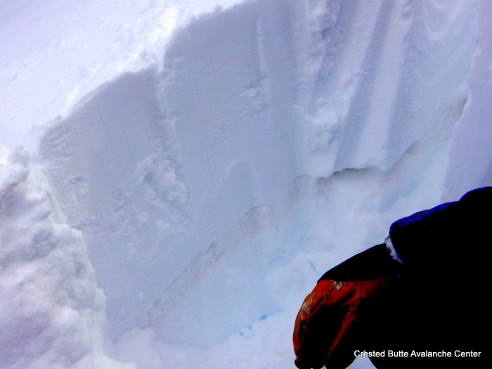
Snowpack: See video. Traveled on wind-sheltered N/NE aspects below treeline. 25-40 cm of storm snow began to settle under periods of direct solar. No signs of instability within the storm snow or at the storm interface, except some minor cracking on steep rollovers. On a 31 degree, NNE slope, I triggered one large collapse stepping out of my skis to dig a pit, 60 cm deep, on the 3/6 facet layer. Tests produced ECTP 14, SC results on this layer (F to 4F slab over F+, 1-1.5mm rounding facets). As slopes tilted towards sunnier NE aspects, this structure became less concerning because a crust layer from last week’s warm-up appears mid slab (3/14 crust layer, ~1” thick, 1F- hard), and slab below it (from our 3/6 storm) has faceted away.
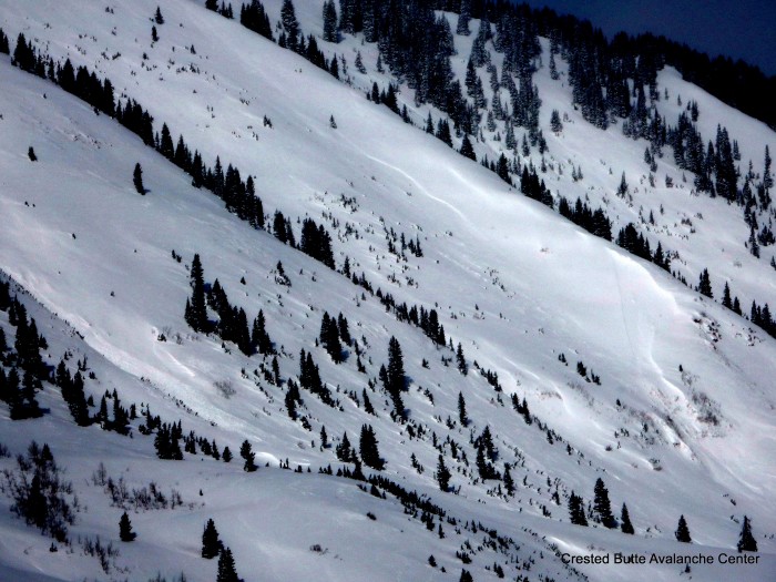
Climax Chutes, NE aspect NTL. Repeat offender this month. Ran full track, ~1800 vert. SS-N-R2-D2-I
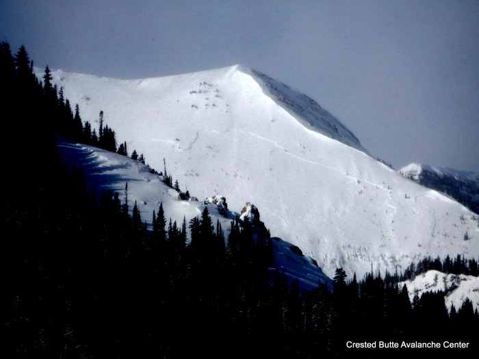
“The Shield” on Scarp Ridge. NE aspect ATL. SS-N-R3-D2-O
Schuylkill Ridge. NE aspect NTL. Repeat offender this month. SS-N-R2-D2-I
Schuylkill Ridge. NE aspect NTL. SS-N-R1-D1-U
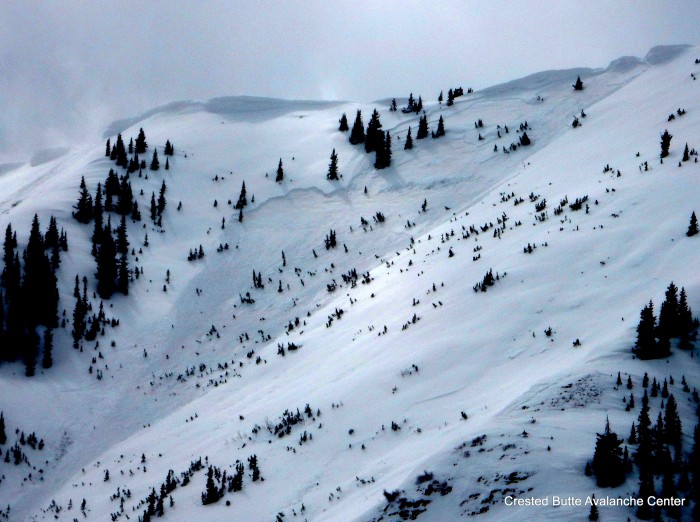
Schuylkill Ridge. NE aspect NTL. Ran naturally today. SS-N-R2-D2-O.