
Windy, Soft and Crusty

CB Avalanche Center2015-16 Observations

Location: Crested Butte Area
Date of Observation: 03/22/2016
Name: WN
Subject: Windy, Soft and Crusty
Aspect: North East, East
Elevation: 9,600’-11,300′

Avalanches:
Weather: Overcast, Cold, Mostly mod winds with pulses of strong gusts out of the S-SW.
Snowpack: The snows surfaces today varied from sun/MF crust (E aspect) to dry wind affected powder (NE Aspect). Hand shears showed old storm snow was bonding well with old interface, results also showed the slab popping out as a FF slab when applying pressure with hand on 1mm facets.

Mountain Weather

CB Avalanche CenterWeather

Date: 03/23/2016

The cold front swung through last night, dropping a quick 2-5″ across our zone. Northwest flow carrying some additional moisture is now filling in the wake of the east-bound system. Orographic snow showers should taper through the day, with the favored snowbelt picking up a few more inches, under gusty northwest winds. Unsettled but mostly dry and calmer weather carries us through Thursday as a couple of minor embed disturbances track to our north. On Friday, a stronger system drops in from the Pacific Northwest and digs out a trough across the 4-corners region. Looking ahead towards the Grand Traverse: Our first look at high-resolution models are calling for 3-5″ of snow on Friday near Star and Taylor Pass, with winds mercifully easing around midnight, and temps dropping into the single digits. These numbers will evolve as this dynamic system approaches.

Temperature Crusts Everywhere

CB Avalanche Center2015-16 Observations

Location: Crested Butte Area
Date of Observation: 03/22/2016
Name: JSJ
Subject: Temperature Crusts Everywhere
Aspect: North, North East, East, West
Elevation: 9,300’-11,300′

Avalanches:
Weather: Overcast, Warm, Steady moderate to strong winds with extreme gusts from the WSW
Snowpack: Temperature and MF crusts observed on almost all aspects and slopes below 11,000’, some very slick on the surface. Wind still transporting and depositing snow onto lee aspects. Zero precip as of 1530.

Mountain Weather

CB Avalanche CenterWeather

Date: 03/22/2016

High and mid level clouds will continue to stream into our area ahead of the moist Pacific storm rumbling across Utah and the Great Basin today. Strong southwest winds (avg 32mph max gust 92mph at Scarp Ridge, 12,000ft) will bring warm temperatures to the Elk Mountains once again, but thicker clouds will limit daytime heating. The cold front looks to arrive just before sunset (6pm-ish). Expect a short period of heavy snow, limited visibility and shifting winds. Light snow will continue throughout the night, taper early Wednesday morning, then re-develop mid-morning. Snow accumulations look to be in the 4-8” range with higher amounts northwest of Crested Butte.

Red Lady Glades

CB Avalanche Center2015-16 Observations

Location: Crested Butte Area
Date of Observation: 03/21/2016
Name: DB
Subject: Red Lady Glades
Aspect: South East, South
Elevation: 9-12000

Avalanches:
Weather: Partly cloudy with building clouds throughout the day. It was warm below tree line. Once in the alpine the wind raged, my face still hurts. Temps were super warm 35-40 at the trail head and it was cold up high.
Snowpack: The wind kept the snow surface hard in the alpine. Once at tree line the snow softness up and was creamy to slush down low. I saw no signs of instability.

Skiing low was still good due to warming. Top was not ideal but was not breakable, just hard pack skiing

Irwin Tenure

CB Avalanche Center2015-16 Observations

Location: Kebler Pass Area
Date of Observation: 03/21/2016
Name: Irwin Guides
Subject: Irwin Tenure
Aspect: East, South, West
Elevation: 10,000-12,000

Avalanches:
Weather: Sunny with thin clouds all day, winds were SW 20’s and gusts to 40’s. High Temps
45F/33F at 16:00.
Snowpack: Thin clouds and winds delayed warming of snow surfaces until noon ish. Corn like
skiing on southerly aspects most afternoon with wet snow on the surface, did not
test any steep southerlies but no wet loose activity observed.

Mountain Weather

CB Avalanche CenterWeather

Date: 03/21/2016

We will see one more day of warm, unseasonably warm weather with increasing southwesterly winds ahead of a major change in the weather for the workweek ahead. Starting Tuesday afternoon, a strong, moisture laden cold front will invade the Colorado Rockies. At this time snow amounts look promising, 10-14”+ and another storm on the way late in the week, possibly in time for the Grand Traverse race night. Stay tuned.

Avalanche observations Taylor Pass

CB Avalanche Center2015-16 Observations

Location: Cement Creek Area
Date of Observation: 03/20/2016
Name: J.Mortimer
Subject: Avalanche observations
Aspect: East
Elevation: 12100

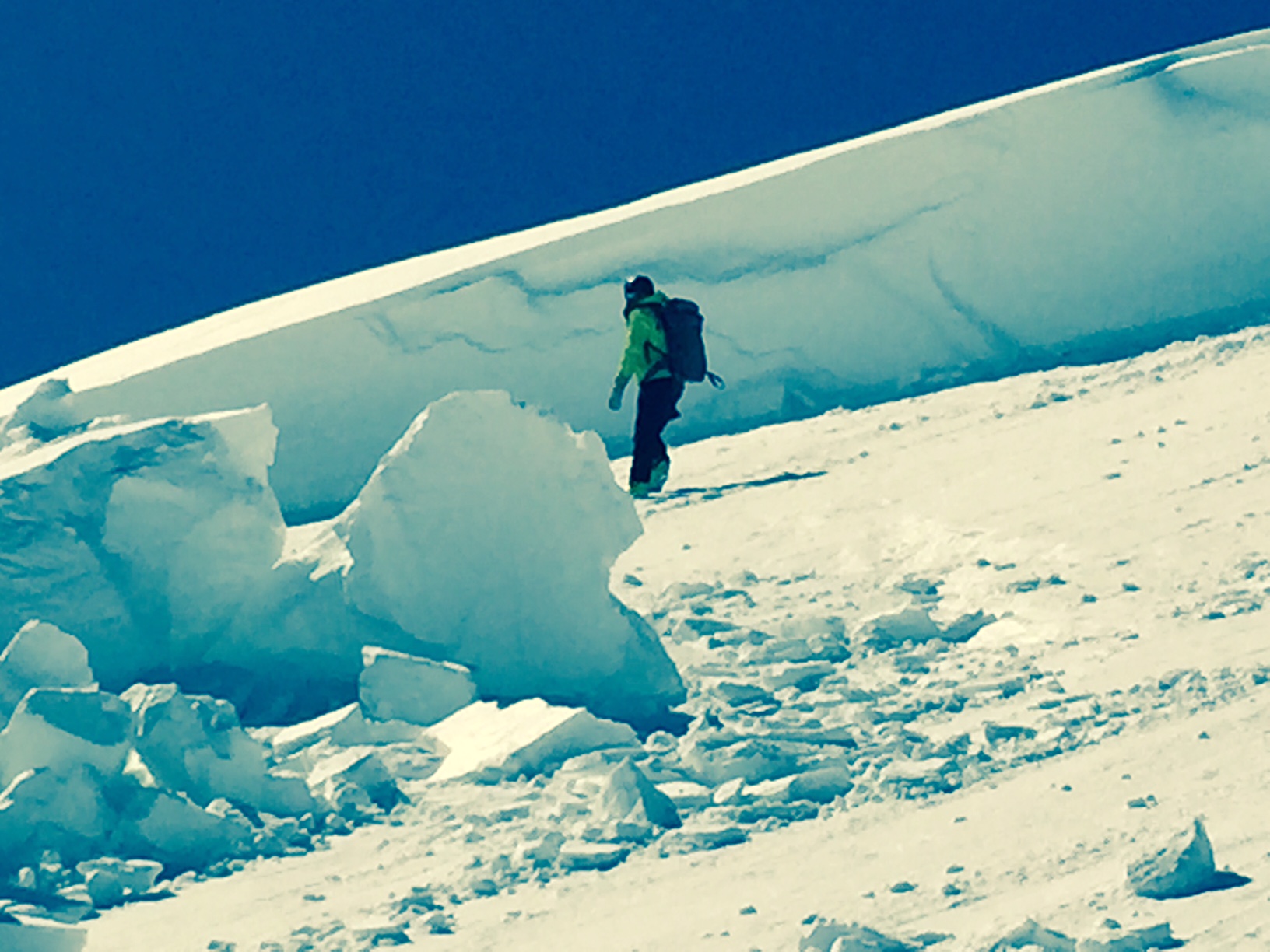
Avalanches: HS-AM-R2-D3-O
HS 370cm
Slab thickness 170cm
Slab width 150-200 yards
Vert. fall 400 ft.
East aspect
12100 ft.
This slide was triggered earlier today the 20 of March by an unknown snowmobiler.
It is location is on the ridge between Taylor pass and Taylor peak just below point 12,246
Two other avalanches were observed north of hunter hill.
These two other avalanches are very similar to the one off of the Taylor pass ridge in regards to aspect elevation incline as well as loading patterns.
The hunter hill slides most likely ran sometime around the 16th of march.
All three slides were in lee ridge top alpine locations and are deep, large HS avalanches
Weather: clera ,calm 30F
Snowpack: HS at the crown 370cm

Taylor-ridge-3
Taylor-ridge-2
Taylor-ridge-1

Mountain Weather

CB Avalanche CenterWeather

Date: 03/20/2016

A large scale ridge will slide over western Colorado today, allowing strong warming and dry weather through Monday. Higher elevations will still see those cool northwest winds that may give the scantily clad Al Johnson racers some pause today, but in general, very warm temperatures can be expected today and tomorrow before snow returns for the rest of the work week.

Scarp Ridge

CB Avalanche Center2015-16 Observations

Location: Crested Butte Area
Date of Observation: 03/19/2016
Name: AB
Subject: Scarp Ridge
Aspect:
Elevation: 9-12000

Avalanches:
Weather: Mild temps, Few clouds, Steady moderate winds with strong gusts from the W-NW
Snowpack: One old D1 persistent slab noticed on east aspect lover down on the Evan’s basin ridge.