Anthracites/Irwin Tenure

CB Avalanche Center2016-17 Observations

Location: Kebler Pass Area
Date of Observation: 11/28/2016
Name: Ian Havlick
Subject: Anthracites/Irwin Tenure
Aspect: North, North East, East, South East, South, South West, West
Elevation: 10,000-11200

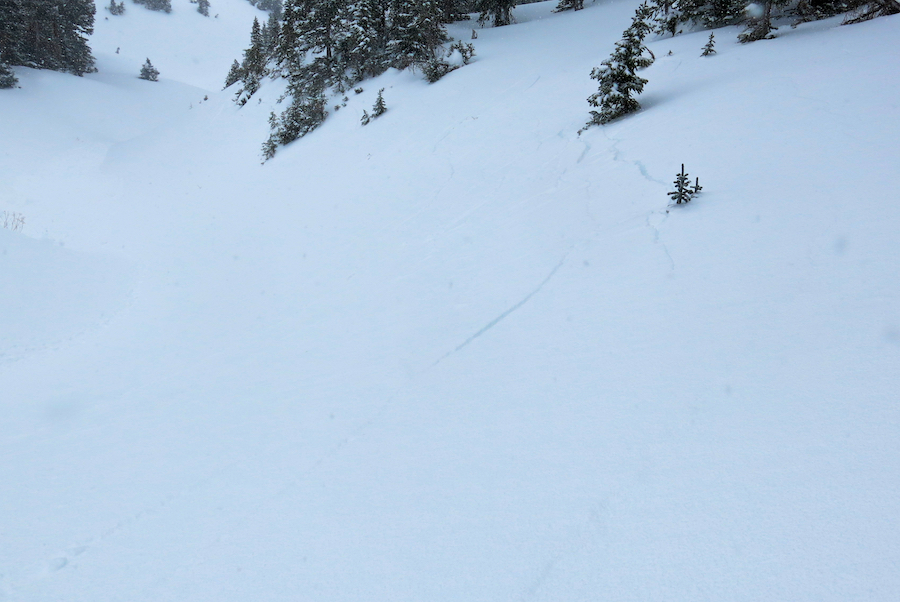
Avalanches: did not travel ATL, or on slopes steeper than 33º today, saw no avalanches, cracking, or collapsing.
Weather: Mid morning broken skies with spotty sun gave way to afternoon pulse with moderate snow showers becoming heavier and steadier throughout afternoon to sunset. Light to moderate west to north winds, especially on exposed ridgelines near treeline. Temperatures remained cold, with high of 16.
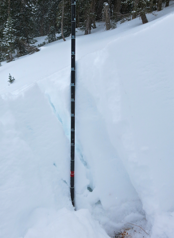
Snowpack: 21″ storm snow as of sunset, with 1.7″ SWE. Snow fell right-side up, lighter density snow falling on top as temps continued to plummet into late afternoon when we finished tour. Winds were actively transporting snow into 3-5 foot drifts. Nearer to treeline, wind was stiffening upper 10-12″ snow into a noticeably stiffer slab. Lots of terrain texture, downed trees, rocks, etc BTL…didnt seem like much avalanche concern in this type of terrain yet…

Dug several pits. On a 33º WSW facing slope, around 10,800ft, the nov. 21 facets were apparent and reactive with repeatable ECT failing on isolation.

On north facing, BTL, 25º slope in Anthracites, found 2 distinct layers of 3-4mm surface hoar 30cm from ground, ECTP17 RP. Digging on East bowl, found this surface hoar again–could be an issue with stiffening/settling slab in future?

IMG_0096
Screen-Shot-2016-11-28-at-6.03.17-PM
Screen-Shot-2016-11-28-at-6.08.50-PM

Gothic 7 a.m. report

CB Avalanche Center2016-17 Observations

Location: Crested Butte Area
Date of Observation: 11/28/2016
Name: billy barr
Subject: Gothic 7 a.m. report
Aspect:
Elevation:
Weather: Totals for the past 24 hours are 15″ of snow with 0.96″ water of which 9″ and 0.59″ came sunset to sunrise today.

Snowing steady and moderate right now with snowpack at 18½”. Temp. is 14F. No visibility but no sound of any slide activity and down low here it is still safe. Higher up starting to get a little shaky (he says sitting in the warmth of his house and not going anywhere near there). Wind 0-3 W. billy

Mountain Weather 11/28/2016

CB Avalanche CenterWeather

Date: 11/28/2016

There will be a break in the weather this morning as last night’s larger scale lift breaks down. We’ll still be sitting under northwest flow so clouds and some very light snow showers may continue in the mountains west of Crested Butte. The next wave of energy looks to arrive around mid-day. Snow showers should develop over the entire forecast area, but this wave will again favor the western and northern boundaries of our forecast area, thanks to northwest flow and orographics. Today’s total snow accumulations across the forecast area don’t look to impressive, especially compared to yesterday. Though I’ll put some higher numbers in the forecasted snow totals as orographics could really bump those snow numbers up in the favored Kebler Pass and Paradise Divide zones.
Mostly cloudy skys will persist on Tuesday with only a few lingering snow showers. The Crested Butte Area and further east will likely be mostly dry, while orographic will keep some snow showers going in those orographically favored area. Wednesday through Friday will see a continued drying weather pattern.

Near Treeline Obs

CB Avalanche Center2016-17 Observations

Location: Paradise Divide Area
Date of Observation: 11/27/2016
Name: Evan Ross
Subject: Near Treeline Obs
Aspect: North East, East, South East
Elevation: 11,000

Avalanches: Remote triggered one persistent slab from a couple hundred feet away. Shooting cracks spanning multiple aspects of a gully that pulled out a small avalanche on a steeper 40ish degree slope.
Weather: Snowfall rates in the S1-S5 range throughout the day. Gusty down valley winds blowing, swirling and drifting new snow about. Never made it to ridegline.
Snowpack: HS about 50-60 cm on East and Southeast Aspects. Generally fist hard snow consisting of the Thanksgiving and the current storm without an obvious or reactive interface between them. These storms where resting on a varying thickness and generally soft crust just above the ground. No signs of instability on the slopes traveled. This would have likely been a different story on slopes with additional wind loading.

HS about 65-70cm on Northeast aspects. The Thanksgiving storm had more slab structure 4f- and was sitting over about 10-15cm of 2mm faceted particles. Shooting cracks and collapses while traveling near these slopes. Persistent slab avalanches felt likely to trigger on convex terrain features or slopes over 35 degrees. Small NSF also looked to be present at the interface of the Thanksgiving and todays storm, though didn’t get much time to look into it more.

Below treeline slopes generally lacked enough snow for an avalanche problem, except for potentially a very isolated and wind effected terrain feature.

65cm crown of a small remotely triggered persistent slab.

IMG_2329

Flank profile dug into some shooting cracks.

IMG_2323

Shooting cracks ran down the middle (northeastern) and right (norther) slopes of this gully.

IMG_2324

Gothic 7 a.m. report

CB Avalanche Center2016-17 Observations

Location: Crested Butte Area
Date of Observation: 11/27/2016
Name: billy bar
Subject: Gothic 7 a.m. report
Aspect:
Elevation:

Avalanches:
Weather: Strong wind from 5:30 to 6:15 but now light again. Snow at sweep time 3″ new and 0.23″ of water. Temp. holding at 24F and clouds have lifted some. Snow paused the past half hour but just starting up again very light. Snow depth at winters deepest of 9″. billy
Snowpack:

Mountain Weather 11/27/2016

CB Avalanche CenterWeather

Date: 11/27/2016

Snow starting falling as forecasted early this morning as a trough of low pressure pulls moisture into the area on southwest flow. The San Juan Mountains have some nice new snow numbers this morning while we’ll be seeing our share a new snow as snowfall rates look to pick up around 9:30am this morning. The most recent weather models show the low pressure trough sagging a bit further south and east than previous forecast discussions, taking some of the best moisture and weather dynamics with it. That takes some of the excitement out of my sails and adds in a little bit of uncertainty in estimated total snowfall numbers as models are still forecasting some nice total snow numbers in our area for Sunday and Monday. So we’ll have to wait in see how it all shakes out. After this morning pulse of snowfall we’ll likely see a decrease in snowfall rates this afternoon, before another pulse arrives after dark this evening and winds becoming more westerly to northwesterly. A third pulse of snowfall is forecasted to arrive mid-day Monday favoring Central and Northern Colorado as winds continue from the west to northwest. Wednesday through Friday will bring dryer air as we sit in cool northwest flow between low pressures to our East and West. The next system moving across the US towards the end of the week looks to mostly miss Colorado and dive even further south.

Anthracite area

CB Avalanche Center2016-17 Observations

Location: Kebler Pass Area
Date of Observation: 11/26/2016
Name: Alex Banas
Subject: Anthracite area
Aspect: North, North East
Elevation: 10-11,200′
Weather: Clear skies, calm wind from the west. Temps in the mid 20’s.
Snowpack: Overall weak and shallow snowpack observed throughout Anthracite Zone. The persistent slab problem was not observed below treeline. At treeline the persistent slab problem produced numerous collapses and visible cracking throughout the test slope area. 11,200′ NE 33* Surface grains: .5-1.5mm Facets/DF HS: 53cm CT 13 SC ECTP 9 SC Both failed 37cm down in 2-6mm depth hoar.

HS showed a shallow snowpack from 15-53cm. Surface hoar was observed on shady slopes below treeline while none was observed near treeline in open wind affected areas.

10,325′ North East
HS: 20cm Surface hoar observed wide spread on shady slopes.

10,900′ N 30* slope
HS: 35cm. Depth hoar capped by a 1cm melt freeze crust. Facets to the surface.

11,200′ NE 33* Persistent slab structure found
HS: 53cm CT 13 SC ECTP 9 SC Both failed 37cm down in large facets

IMG_1663-1
FullSizeRender

Mountain Weather

CB Avalanche CenterWeather

Date: 11/26/2016

One more pleasant day in the mountains before our pattern shifts towards active and wintery weather. Sunny skies and mild temps will give way to thickening clouds this evening, signaling the onshore arrival of a deep trough tapping into Pacific moisture and supported by the jet stream. The trough elongates over the Western U.S. and slowly migrates eastward into next week. This brings a series of strong snowfall pulses through Wednesday to the Elk Mountains that may require a yardstick to measure when all is said and done. The action kicks off Sunday morning as strong southwest flow spreads snowfall across the region accompanied by strong winds. Snowfall gets an orographic boost through the day as flow shifts towards the west. An embedded shortwave brings increased snowfall again on Monday.

South aspect

CB Avalanche Center2016-17 Observations

Location: Paradise Divide Area
Date of Observation: 11/24/2016
Name: EM
Subject: South aspect
Aspect: South East, South, South West
Elevation: 10000 – 12500

Avalanches: several small windslabs were visible throughout the range. All were confined to Wednesday nights snowfall.
Weather: Clear skies with cold valley temps and strong winds transporting snow off many alpine features and peaks in AM. Around noon winds had eased off and snow transport mostly stopped.
Snowpack: Many low elevation areas closer to 10k were composed of snowfall from just this past week. With snow from earlier storms melting off. Closer to treeline there was generally a suncrust at the ground covered by the previous weeks snowfall. Some slopes above 115000 had cohesive slab developed above this crust from past weeks snow and wind. Several locations showed this interface to be bonded relatively well.
At one location, 12500, south facing, 29*, start zone just below ridge top, we found that the wind blown snow from Wednesday night had bonded poorly to the snowfall from earlier in the week. Easy to moderate, Q2 results 18 cm down on surface facets (seemed slighly to thick of layer to be surface hoar). This location had clearly been stiffened by winds that came with the previous nights snowfall. We actively avoided this area of slabby snow. More protected features down slope didnt have this surface slab structure.