Date of Observation: 01/12/2017
Name: Evan Ross
Aspect: North East, South
Elevation: 9,600-10,300
Avalanches:
Weather:
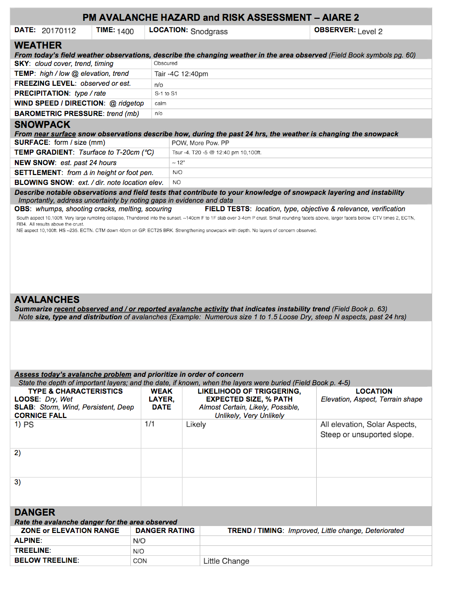
Snowpack: See Attachment
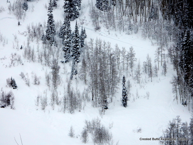
Avalanches: Had views of the lower runout of Coon Bowl and the starting zones of a couple Climax Chutes and saw no signs of recent activity.
Weather: Obscured skies, S-1 to S1. Light winds with light transport at NTL location.
Snowpack: HS on a flat, windsheltered slope NTL was 280cm. Snowpack is settling quickly, ski pen was about 20 cm and boot pen was about 60 cm. Low angle is skiing nice now.
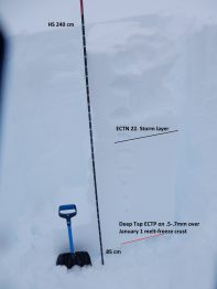
Dug one pit on a windward, S aspect NTL. The January 1 crust was 85 cm above the ground and buried by a 155 cm, right-side-up slab from F down to P-. ECT produced several non-propagating fractures in mid-storm layers. A deep tap ECT crossed the column on 3rd hit, sudden planar, on the January 1 crust. The weak layer was 0.5 to 0.7 mm rounding facets. No signs of instability breaking trail along a low angle, gladed ridgeline.
Avalanches: Havlick and Ruby Mining District resident both heard a very large Avalanche off Ruby at 0835. Saw one large crown above Elk Basin.
Weather: Continues to snow S1-2.
Snowpack: Snow: 18″ 1.8″ SWE since 1/10 at 1600 (40hrs). Storm stake was completely buried, dug it out, 41″ with storm water 6.6″ since Jan 8th. Total snow since 1/1 is 98″ with 11.3″ water.
Kebler has 2-3′ on the road, more in classic wind loaded areas. The road is starting to merge with the surrounding terrain. One single track had run the gauntlet early this AM. We only saw evidence of 2 of the 7 Sisters have avalanched. We called off operations upon Snow Safety Team arriving to the trailhead this AM. We need a day to muck out, let alone high avalanche danger. Over 100″ since Jan 1 and the roads are extremely soft and the slopes are the most loaded I’ve in my 20 years.
Avalanches: No idea of slide activity- cannot see a thing.
Weather: Light snow during the day Wed. with 5″ new, then strong wind late day and only light snow before wind lets up and snow increases some, dying down around 3 a.m. or so. The 24 hour totals are 12 1/2″ new snow and 0.86″ of water as the snowpack is at years deepest of 88″. Currently light SW wind and a very light snow and of course obscured clouds, which is all we have had for the past week or century (I get confused anymore). I hear it may clear by June though.
Snowpack:
Date: 01/12/2017
The low pressure system off the coast of California will continue to sag toward Baja, and eventually “cut off” from the main atmospheric flow. As this low pressure slides south, it will spin one last significant plume of moisture across the desert southwest and into the central and southern Colorado mountains. This moisture will bring along warmer temperatures and bump snow lines to around 7500ft. Southwest winds will not be as strong as previous days, with speeds in the 30-40mph range at ridge top. The outlook for Friday and beyond look unsettled, with minor accumulations through the weekend. The next significant storm does loom late next week.
High Temperature: 22
Wind Speed: 20-30
Wind Direction: SW
Sky Cover: Mostly Cloudy
Snow: 3-5PM
Low Temperature: 15
Wind Speed: 15-25
Wind Direction: SW
Sky Cover: Mostly Cloudy
Snow: 7-9″
High Temperature: 23
Wind Speed: 10-20
Wind Direction: S, SW
Sky Cover: Mostly Cloudy
Snow: 2-4″
Avalanches:
Weather:
Snowpack: Only 1″ during the day yesterday and then 6.5″ last night so total is 7.5″ with a light- for this storm- 0.44″ of water. We have reached 84″ on the ground- the most for this date on record (as was the past 2 days). Winds are calm and cloudy cover is overcast with currently no snow. Overnight temp. range 21 to 22.
Date: 01/11/2017
The jet stream and associated zonal flow are transporting deep Pacific moisture into the West this morning. The largest plume is tracking to our north across Northern Utah this morning, while the other is steering towards the 4 corners region and into the Elk Mountains today. 6-8″ fell last evening and we are in a brief lull early this morning before snowfall begins to intensify today. This system does not look as intense as some of our recent pulses, but we’ll see today’s snow totals approaching a foot by sunset. Winds will increase through the day and peak around sunset, as a disorganized cold front sags south. A closed low dives south along the California/Baja coast line steering unsettled, but less intense weather our way the rest of the week.
High Temperature: 20
Wind Speed: 15-25 G50
Wind Direction: SW, W
Sky Cover: Overcast
Snow: 9-13″
Low Temperature: 12
Wind Speed: 15-25
Wind Direction: SW, W
Sky Cover: Overcast
Snow: 3-5″
High Temperature: 18
Wind Speed: 10-20
Wind Direction: S, SW
Sky Cover: Overcast
Snow: 2-4″
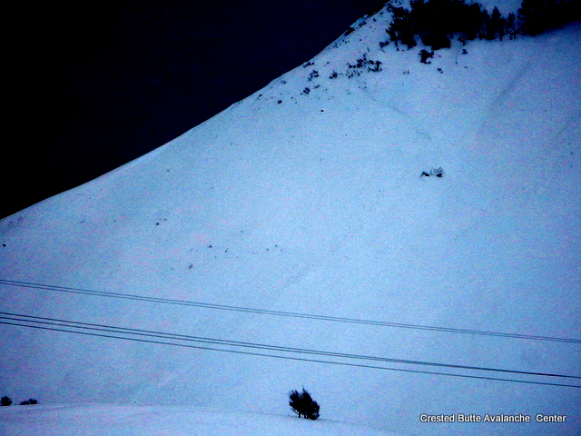
Avalanches: Big slide in E-SE-S facing terrain Near treeline (Land of Lost) from big airblast in PM, obvious windloaded terrain. Failed 3-5ft deep, on NYE crust, and stepping down to ground in places on 2-3mm facets. HS-AE-R3-D2.5-O
Weather: Showery throughout day, period of heavier snow after lunch, then another lull at 1545. SW-W winds steady 30mph gusting 50-60mph range throughout day at ridgetop. Temps in teens and low 20s.
Snowpack: Snow was showery, 3″ accumulation throughout day, bringing storm water totals 4.8″ water since 1/8 and 7.5″ since 1/1/2017.
Winds re-drifting roads with 3-4ft between work cat passes
Avalanches: Lots of natural soft slab avalanches below treeline, mostly D1.5 to D2 in size, various aspects. Limited vis of higher elevations. Observed one large powder cloud come off of NW aspect NTL of Whetstone, but couldn’t make out the crown. One debris pile off of Whetstone looked about D3, came down from alpine.
Weather:
Snowpack: