Mountain Weather 1/20/2017

CB Avalanche CenterWeather

Date: 01/20/2017

Storm one of three in this forecast period arrived last night on southwest flow. We’ll continue seeing fairly light winds and continued snowfall through today, with a break in weather late this afternoon into tonight. The next storm will arrive early tomorrow morning again on southwest flow. Number 2 is very similar to number 1, but being its younger brother. Number 2 will pack a little better punch. A brief ridge will bring drier conditions and a break in the weather Sunday, before the little step child, storm number 3, decides to come play too. Number 3 looks to bring the wind with upper-level jet support and heavy snow if everything lines up right. Number 3 will again start out on southwest flow Monday, and finish with northwesterly flow around Tuesday evening/Wednesday timeframe.

January 7th-12th: A Storm for the History Books

CBAC2016 - 17 Weekly Snowpack Summaries, Weekly Snowpack Summaries

By Arden Feldman            CBAC Intern

The week started off dry and extremely cold with valley temperatures on the morning of January 7th ranging from -25 to -35 F and mountain temperatures hovering just above zero. That weather did not last long as a very moist and warm air mass started infiltrating the area on the 8th from the west-southwest causing snow showers to ramp up again after last week’s snow. This air mass continued flowing into the area from the Pacific through the 9th bringing with it impressive amounts of precipitation and strong winds. With temperatures hovering right around the freezing mark, the precipitation fell as very wet snow. On the night of the 9th a cold front passed over initially causing heavy snowfall and strong winds, but eventually allowing for a lull in the storm on the 10th. From the 8th through the 9th Schofield picked up 5” of SWE and 26” of snow with 3” of SWE falling in a mere 16 hours on the 9th. CBMR received 2.5” of SWE and 30” of snow. On the 9th, the Crested Butte Community School closed for the first time since 1970 and CBMR closed early due to safety concerns. People were calling it the snowpocalypse.

1/9/17 – Satellite image from the National Weather Service showing the abundant moisture beginning to hit Colorado from the Pacific.


Staying true to its character, during the “lull” on the 10th, the storm still brought in 6-8” of new snow and strong winds. Elkton had sustained winds of 16 mph and gusts up to 94 mph. On the 11th we saw pacific moisture flowing into the area from the west-southwest yet again and another cold front passing over that night. This resulted in yet another pulse of heavy snow and strong winds. During this pulse, Schofield picked up 1.6” of SWE and 9” of snow and CBMR received 10” of snow. Elkton recorded sustained winds of 18 mph and gusts up to 76 mph.

On January 12th a low pressure system off the coast of California began to sag towards Baja and cut off from the main atmospheric flow. The southerly flow of this cut off storm sent warm temperatures and one more significant plume of moisture into our area resulting in another 1.4” of SWE falling at Schofield.

1/12/17 – Satellite image from the National Weather Service showing moisture from the cut off low impacting Colorado.


Since January 1st, the Gunnison Valley has been in the bull’s-eye for moisture from the Pacific. After that last plume of moisture on the 12th, Schofield pass now stands at 14” of SWE since the storm cycle began on January 1st. That makes this storm the largest in history since the Schofield Snotel was established in 1985! As of January 12th, the Gunnison River Basin snowpack is at 166% of normal for this time of year. That means the snowpack is already deeper than it ever got during the 14/15 season, and it’s only early January!

1/12/17 – Gunnison River Basin snowpack summary showing our deep snowpack.


The week began with avalanche conditions beginning to stabilize after the previous week’s snow with considerable danger on the 7th dropping to moderate on the 8th. The impressive snow amounts that fell on the 8th and 9th added a large load to the snowpack, causing the avalanche danger to rise to high with an avalanche warning on the 9th. With heavy snow and strong winds continuing through the week, the avalanche danger never fell below high. On the 11th, an extreme (L5) avalanche danger was issued, a rare occurrence. Since 1985 we have only seen 4 or 5 events that met that criteria. In this case, the historic amount of snow that fell since January 1st created a massive slab that was sitting on a number of persistent weak layers that were detailed in last week’s summary, including crusts, facets, surface hoar, and depth hoar. Very large storm slabs were also running. Both of these problems were forecasted to be widespread and large enough to run into valley bottoms and reach historic lengths.

With snow continuing to fall through the end of the week, we haven’t gotten good enough visibility to observe this storm’s avalanches out in the mountains. Still, we have had reports from across the state that indicate the historic nature of this storm with avalanches running across Taylor Canyon, I-70, and Red Mountain Pass, local roofs collapsing and historic mine structures demolished by avalanches. Locally, two avalanches ran across Kebler Pass road (first, second), a patroller was caught in a slide at CBMR, and many avalanches up to size D2.5 were reported even with our limited visibility. Large roof avalanches were also common in town.

1/9/17 – Natural D2.5 persistent slab avalanche on Red Ridge that ran to the ground in places.
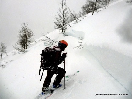
 

1/9/17 – Crown of natural D2.5 persistent slab avalanche that ran across Kebler Pass Road.


1/12/17 – Debris of an avalanche that crossed Taylor canyon into a popular fishing hole. Definitely large enough to kill a fish!


January 1st – 6th: Major Storm Impacts the Area

CBAC2016 - 17 Weekly Snowpack Summaries, Weekly Snowpack Summaries

By Arden Feldman            CBAC Intern

The New Year began with two low-pressure systems, one in the northwest, and another off the California/Baja coast creating a stream of moisture from the Pacific into Colorado. This produced 12-18” of low density snow across the area. CBMR reported 14” of snow and .3” SWE over the two days. Winds out of the southwest averaged 10-25 mph above tree line with gusts in the 50’s.

1/1/17 – Satellite image from the National Weather Service showing the two low-pressure systems, one in the northwest and another off the California/Baja coast. Clouds can also be seen beginning to form over Colorado.


The storm picked up in intensity from the night of January 3rd through the 5th. The jet stream lined up overhead producing a west-southwest flow and providing abundant moisture from the Pacific. By the morning of January 5th, Schofield had received 3.7” of SWE and 30” of snow since January 1st. On the 5th, a powerful cold front slowly sagged south over Colorado and the Crested Butte area got pummeled with snow falling at 2-3” per hour rates throughout the day. After the cold front passed, measured storm totals since New Year’s Day were 5.56” of SWE and 57” of snow at Irwin, 5” of SWE and 41” of settled snow at Schofield, and 47” of snow at CBMR. Behind the front, colder, drier air moved in, leaving clearing skies and frigid temperatures in its wake for January 6th.

1/4/17 – Satellite image from the National Weather Service showing the abundant moisture flowing into Colorado from the Pacific.


There were a number of problematic surfaces at the storm interface that had formed over the previous dry week, including near surface facets, surface hoar, melt-freeze crusts, and slick wind crusts. The storm created a sizeable slab that was sitting on those interfaces and persistent weak layers. The observed human triggered and natural avalanches grew larger in size as the storm progressed. Initially, there were touchy, relatively shallow storm slab instabilities, even with surprisingly low density and incohesive slabs. By the later parts of the storm, larger avalanches were failing naturally on these interfaces. The avalanche danger was rated as HIGH on both January 4th and 5th and a major natural avalanche cycle occurred with reports of many D2 to D3 avalanches around the zone. There was even some avalanche activity that 45-year locals had rarely seen.

1/3/17 – Skier triggered D2 storm slab on Schuylkill Ridge that failed on a surface hoar layer buried at the beginning of the storm.


1/6/17 – Natural D2.5 Persistent Slab avalanche on a southeast aspect of Purple Peak.


1/6/17 – Natural D2.5 persistent slab avalanche on an east aspect of Mt. Owen.


1/6/17 – CBAC Snodgrass Snow Study Plot profile showing the snowpack after this week’s major storm.

December 20th – 31st: Small Storms with Strong Winds lead into a Brief Dry Spell

CBAC2016 - 17 Weekly Snowpack Summaries, Weekly Snowpack Summaries

By Arden Feldman            CBAC Intern

From December 20th to 22nd, the snowpack continued to stabilize after the major December 16/17th storm. Valley inversions dipped to -15 in town.

12/22/16 – CBAC Snodgrass Snow Study Plot profile showing the stabilizing snowpack after the December 16/17th storm. 


A warm southwestern system impacted the Elks on 22nd. The storm brought with it snowfall rates up to 2” per hour and 20-30 mph west winds above tree line. Schofield received 14” of snow and 1.3” of SWE and CBMR received 8” of snow and .8” of SWE. The avalanche danger rose to considerable at all elevations on the 23rd and observers reported natural and skier triggered storm slabs.

On the 23rd and 24th, winds out of the south averaged 15 mph with gusts up to 64 mph at the Elkton weather station. These strong southerly winds created unusual loading patterns on north faces. For example, the north face of Ruby Peak had been wind scoured near to the ground during the 12/16 storm, but was reloaded by southerly winds, and produced two natural slabs, breaking 2-3 feet deep. A large slide also ran to the valley floor off of Gothic.

12/24/16 – Pair of 2-3 foot soft slabs that ran naturally on the north face of Ruby Peak, failing on old snow at the ground.


12/24/16 – Natural avalanche on northeastern aspect of Gothic Mountain.


A cold front brought snow and strong winds from the west on the 25th. 7-14” of snow fell across the zone with Schofield picking up 8” and .8” of SWE. The strong winds formed sensitive wind slabs on leeward slopes.

12/24/16 – Satellite image from the National Weather Service showing the Christmas storm on its way to Colorado.


12/25/16 – Small skier triggered wind slab near tree line on an easterly aspect.


The 26th of December through the end of the year was characterized by dry conditions, with powerful southwesterly winds, cold temperatures, and strong solar radiation. Over this time period, the avalanche danger slowly fell. Wind slabs were a significant issue during the first part of this timeframe due to the strong winds and ample snow available for transport. The wind slabs did eventually heal and persistent slabs became the main avalanche concern. Although slowly healing there were still instabilities in the middle of the snowpack in the form of near surface facets and surface hoar buried during the Christmas storm. And of course the snowpack’s basal weak layers still provided cause for concern of deeper instabilities especially near and above tree line on steep, rocky faces and bowls. Several large avalanches ran naturally on basal weak layers over this time.

12/27/16 – Slab avalanche on Schuylkill Ridge that failed on a mid pack instability.


12/26/16 – Natural, 3-5 foot deep, D2.5 persistent slab avalanche in the Anthracites that ran on or near the ground.


With clear skies, cold temperatures and strong solar radiation, future persistent weak layers formed at the snow surface during the dry spell at the end of the year. On southerly aspects, stout melt freeze crusts formed, while northerly aspects experienced near surface faceting.

Unusual surface hoar event

CB Avalanche Center2016-17 Observations

Location: Crested Butte Area
Date of Observation: 01/19/2017
Name: Ben Pritchett
Subject: Unusual surface hoar event
Aspect: North, North East, East, North West
Elevation: 9400-11400

Avalanches:
Weather:
Snowpack: I saw 5-12mm SH between 9,400′ and 11,400- today on open an gladed NW-E slopes, irrespective of previous snow surfaces. It had grown on old tracks, on old wind crusts on windward features, groomers and undisturbed pow surfaces with impunity. Certainly widespread on the shady side of the compass near and below TL.

Schuylkill Surface Hoar

CB Avalanche Center2016-17 Observations

Location: Paradise Divide Area
Date of Observation: 01/19/2017
Name: Arden Feldman and Jack Caprio
Subject: Schuylkill Surface Hoar
Aspect: North, North East, East, South East, South, South West, West
Elevation: 9000-11400

Avalanches: Skier triggered two D1 sluffs in the surface snow that travelled surprisingly far.
Weather: Increasing clouds throughout the day from clear to overcast with light snow beginning late in the afternoon. Generally calm winds with some light winds developing in the afternoon.
Snowpack: The surface hoar was present everywhere we travelled. Practically all aspects B/NTL including ridge tops. Did not travel ATL. On northerly aspects the SH was generally .5-2 cm in size, even in densely wooded areas, and in protected spots it was up to 3 cm in size with stunning crystals. On southerly aspects the SH was generally .5-1 cm in size and often sitting on a thin crust. At lower elevations in the valley, on flat and southerly aspects, the SH crystals were not as well formed but still present. Did not travel in densely wooded southerly aspects. With snow beginning at the end of the tour, the SH was almost certainly buried and preserved.

Surface Hoar

CB Avalanche Center2016-17 Observations

Location: Kebler Pass Area
Date of Observation: 01/19/2017
Name: Evan Ross
Subject: Surface Hoar
Aspect: North East, South East, South, South West
Elevation: 10,500 to 12,000

Avalanches: Surface hoar/near surface facet sluffs on steep northerly aspects at 12,000ft.
Weather: Clear and calm throughout the morning. Sky’s transitioning to overcast around 1pm. S1 starting at 4:30pm.
Snowpack: Oooo surface hoar, you suck. Fairly widespread surface hoar beginning to be buried late this afternoon.. Looked to be cooking off on steep southerly aspects, but maybe not fully cooked. On south surface hoar had formed over a soft crust, on northerly aspects the surface hoar was forming over near surface facets.

South west aspect, surface hoar over a soft crust

IMG_2097

Northeasterly aspect at 12,000ft, surface hoar has formed over near surface facets.

IMG_2091

SH

CB Avalanche Center2016-17 Observations

Location: Crested Butte Area
Date of Observation: 01/18/2017
Name: Jake Beren
Subject: SH
Aspect: East
Elevation: 9,000-11,000

Avalanches:
Weather: Sunny skies and cool temps (no batts in the ol thermometer, but skinning in more layers than usual). Calm winds with a minor amount of blowing snow at ridge tops observable up toward the White Widow couloir.
Snowpack: No digging due to a bad back and late start (1200), but boot pen is less than Will’s ob from 1/15, at 25 cms. Settlement cones look to be about a foot tall on the Aspens in the valley. Roller balls off the West face of Gothic (and a skinner up with no tracks on the Spoon or W Face- hope one of you folks got on the East today!). HS at the top of the bowl was 240+. Some Southerly aspects picked up a weak crust (infer frowny face emoji).
The star of the show was widespread Surface Hoar everywhere, from the valley floor to ridge top. Up to 2 cms in size, and present even on sunnier Eastern aspects. The fog seems to have left us a present and I hope it deteriorates before the next round of weather. Keep your heads on a swivel out there friends!

Mountain Weather 1/19/2017

CB Avalanche CenterWeather

Date: 01/19/2017

Our recent beautiful weather sure was nice but lets dive back into some more storms! We have three storms coming down the line in the weather forecast. Clear skys allowed temps to drop last night and will be slower to rebound this morning. Warmer air on southwest flow and building clouds will be the theme for most of today as our next pulse of weather approaches. Snow showers will begin this afternoon but accumulations don’t look to significant. Though continued unsettled weather in the forecast should help those numbers add up. We’ll see a slight break in the weather Friday evening before the next round arrives Saturday. Then we’ll see a more pronounced break in the weather around Sunday as a small ridge builds over the western US. The biggest and best looking snow produces arrives as the third storm early next week.

Surface Hoar-Redwell Tour

CB Avalanche Center2016-17 Observations

Location: Kebler Pass Area
Date of Observation: 01/17/2017
Name: Chris Pruden
Subject: Surface Hoar-Redwell Tour
Aspect: North, North East, East, South East, South
Elevation: 9000-12100

Avalanches: Many loose snow avalanches on both sunny and shady aspects from small cornice failures and running from trees/rocks. Most of these were a day old (1/16/17). One of these stepped down to a slab on a lower eastern flank of redwell basin.
Weather: Foggy in the morning at the Kebler Pass TR. Climbed out of the clouds and into the sunshine for the rest of the day. Clouds lingered to the south and in valley bottoms. Fairly warm (25-30 F) on the way up to gunsight pass from. Cooler on shady aspects (20 F). No snow. Winds light and variable but seemed to be mostly out of the southeast.
Snowpack: Moist snow surface on sunny aspects all the way up to 12000 ft. Widespread surface hoar (some of it large) on all of the aspects we traveled on. I assume these will get baked off on sunny sides but they may persist on sheltered and shady aspects if they get buried.

IMG_2152
IMG_2149