Slate River Ob

CBAC2020-21 Observations

Date of Observation: 02/11/2021
Name: Evan Ross Jack Caprio

Zone: Northwest Mountains
Aspect: North East, South East
Elevation: 9,000-11,000

Weather: The NE Mountains cloud cover was mostly cloudy, becoming partly cloudy and back to over cast by the afternoon. Ooo fun. Plenty of sun out there to warm and thicken the snow surfaces on sunny slopes. We didn’t have much wind exposure. However those winds were obviously cranking in the alpine and even moving snow down in the open valleys at times.

Snowpack: Basically, we ended the day with another BTL tour on NE that continued to highlight the decreased sensitivity of the persistent slab avalanche problem below treeline. Despite what the weak layer is, those weak layers are hiding below a growing and strengthening slab. We only observed one collapse. That was after like 12 He-Man jumps on a small slope connected to a bigger slope, 10,500ft at ridgeline, NE. That collapse shot cracks through the connected slope for a good 100ft or so. Otherwise, we traveled on other steep slopes with no red flags and chose terrain features with lower consequence. For these NE slopes, the HS averaged in the 120 to 140cm range. Heading into the next storm, it will be the same December and January persistent weak layers of concern.

We spent a little time on some mid 30 degree SE facing slopes around 10,500ft. The early February crust was now down about 45cm’s. That crust and any facets below the crust were not particularly notable at this location. Unfortunately, we didn’t get to spend more detailed time looking at that interface. It didn’t give us any feedback toward obvious signs of instability. The early January interface still felt like the layer of concern and that interface was laying in the lower 1/3 of the snowpack.

Recent naturals out Washington Gulch

CBAC2020-21 Observations

Date of Observation: 02/11/2021
Name: Eric Murrow


Zone: Southeast Mountains
Location: Gothic and Baldy
Aspect: South East, South, South West
Elevation: near and above treeline


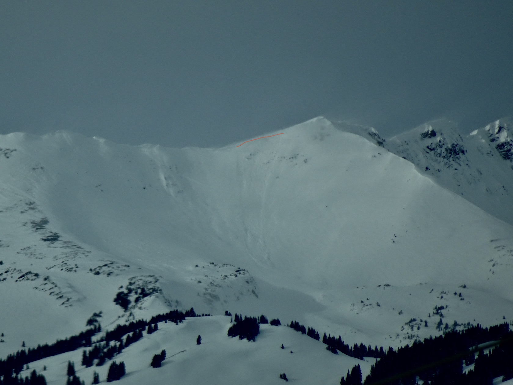
Avalanches: While binocular-ing from town I spotted a couple recent avalanches. Two avalanches on the southwest side of Gothic on drifted features and another in Rock Creek Bowl of Baldy. See pictures

Photos:


A few naturals today from wind loading

CBAC2020-21 Observations

Date of Observation: 02/11/2021
Name: Zach Guy

Zone: Southeast Mountains
Location: Mt. Emmons
Aspect: East, South East, South

Avalanches: Fresh-looking persistent slab in Evans Basin, likely ran today, on a SE aspect ATL, D2. A few small wind slabs above treeline ran today. Also some loose dry and loose wet sluffing.
Weather: Spring-like temperatures. Moderate to strong W/NW winds once we emerged above treeline, with periods of strong wind transport. Mostly to partly cloudy skies.
Snowpack: Snow surfaces got moist on below treeline southerlies. Easy to produce cracking in wind drifted features, about a foot thick.


Photos:

Gothic 7am Weather Update

CBAC2020-21 Observations

Date of Observation: 02/11/2021
Name: billy barr

Zone: Southeast Mountains

Weather: Light snow yesterday morning, then a pause in the afternoon until more snow towards sunset, then only light snow overnight with the 24 hour total of 4″ new and 0.30″ of water with the overnight snow 6% water while late afternoon was 9%. Currently mostly cloudy and calm as the snowpack reached 44″ deep. Temperature just reached freezing with the morning low 18F and current 20F as the wind stays calm. Since Jan. 17 there have been just 2 days that were clear or partly cloudy all day.
Snowpack:

Slate River Snow

CBAC2020-21 Observations

Date of Observation: 02/10/2021
Name: Eric Murrow


Zone: Northwest Mountains
Location: Pittsburg area
Aspect:
Elevation: 8,900 – 10,400′


Avalanches: Visibility obscured much of the day. Did observe a couple of small Dry Loose avalanches running in the storm snow near treeline.
Weather: Cloudy skies and very light snow from 11 – 3. New snow accumulations of 10″ at 9,400′ near Pittsburg around 3pm. No wind transport at valley bottom, could here the wind from time to time up high, but during periods of vis never observed transport on near treeline ridges.

Triggered slabs at Irwin

CBAC2020-21 Observations


Date of Observation:
02/10/2021
Name: Zach Guy


Zone: Northwest Mountains
Location: Irwin Tenure
Aspect: South East, West
Elevation: NTL


Avalanches: Intentionally ski triggered several fresh wind slabs (6” to 16”) thick, small in size (D1 to D1.5) on leeward and crossloaded features near treeline.
On west facing terrain, airblasts triggered 2 persistent slabs that broke into older snow layers, 12” to 18”, about D1.5 in size.
Weather: Light to moderate snowfall, moderate southwest winds.
Snowpack: 6” low density new snow was poorly bonded to previous wind hardened surfaces: shallow sluffing and easily triggered slabs in the new snow where winds were drifting it. Persistent slab structure is thin on windward aspects due to previous wind erosion.


Photos:


Gothic 7am weather update

CBAC2020-21 Observations

Date of Observation: 02/10/2021
Name: Billy Barr


Zone: Southeast Mountains
Location: Gothic Townsite
Aspect:
Elevation:

Weather: So, i guess this is what snow looks like. Vaguely familiar. –Moderate snow much of the night (8″) after light snow during the day Tuesday so the 24 hour total is 9″ new with 0.61 water. Snowpack has reached the winters deepest of 42″ (average depth for this date is 49″). There was a pause in the snow an hour ago and now starting up very lightly. Sky is overcast with no wind. Temperature holding overnight between 21 and 22F after a high of 31F on Tuesday. billy

Snodgrass

CBAC2020-21 Observations

Date of Observation: 02/09/2021
Name: Evan Ross

Zone: Southeast Mountains
Location: Snodgrass
Aspect: North East, East
Elevation: 9,400-10,500

Weather: Overcast. Very light snow through most of the day. 1″ new. Calm winds

Snowpack: Mostly managing the avalanche problem through terrain selection. We skied in the mid to low 30-degree range and avoided higher consequence or more likely areas to trigger. In the end, we didn’t find any obvious signs of instability, confidence was improving, though we didn’t let that change our mindset for the day. For the areas we traveled, I would have higher confidence saying the avalanche problem was not widespread, but I’d have lower confidence in trying to say whether it is isolated or specific in the terrain. The snowpack structure was variable, mostly due to previous wind and avalanche events. Given that variable snowpack structure, it’s hard to say what it would take to further activate the avy problem. HS for the area traveled was in the 85 to 120 HS range. Soft slabs of various strength covered the January interface.

A few more recent slides below treeline

CB Avalanche Center2020-21 Observations

Date of Observation: 02/09/2021
Name: Zach Guy


Zone: Southeast Mountains
Location: Happy Chutes, East River
Aspect: East
Elevation: BTL

Avalanches: Saw a few more slides below treeline that appeared to have run in the last few days, probably over the weekend. A D1 slab in Happy Chutes and a D2 and D1 on the east side of Mt. Crested Butte.


Photos: