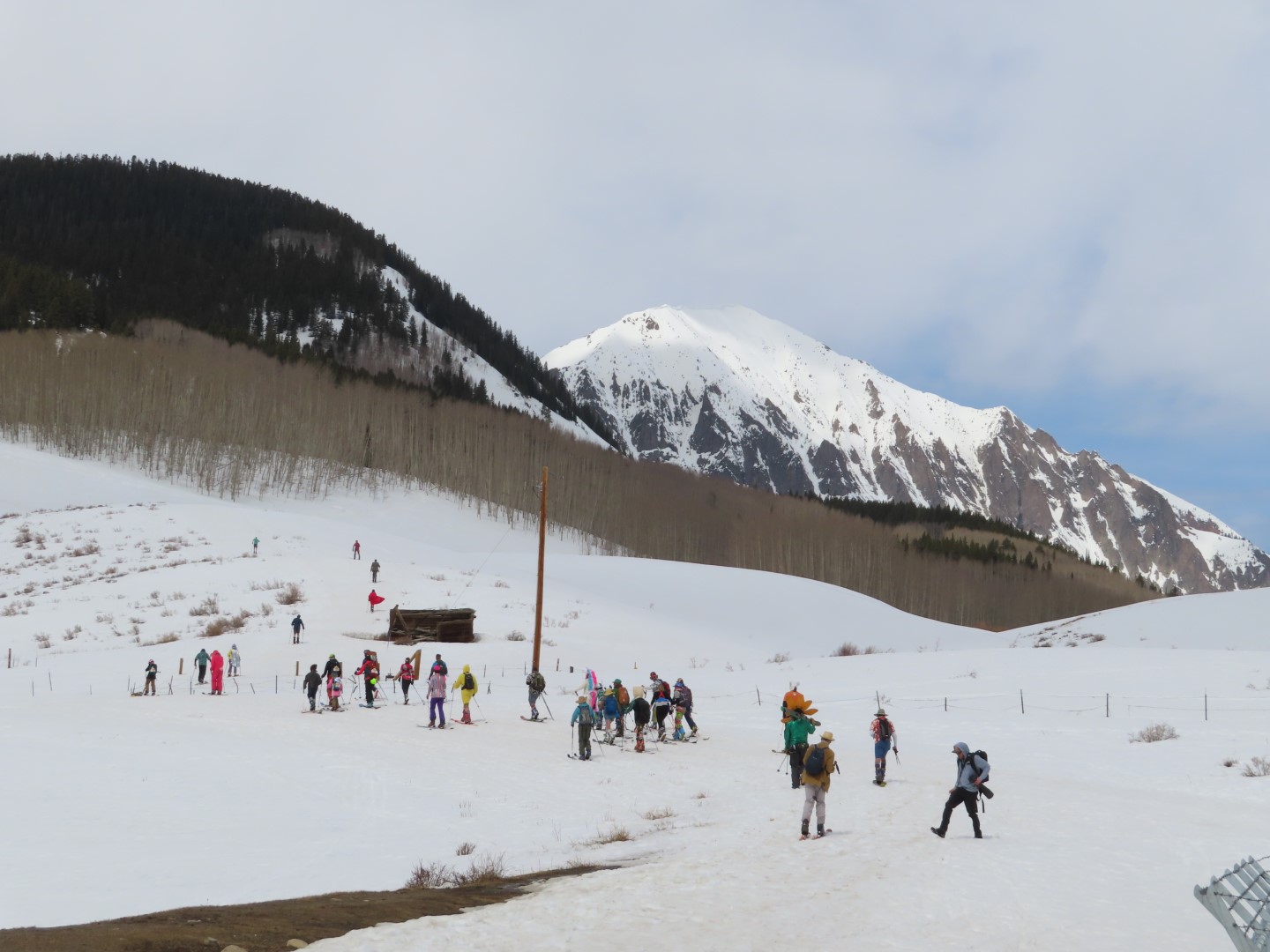
Date of Observation: 04/07/2021
Name: Evan Ross
Zone: Northwest Mountains
Location: West Side Kebler and East Beckwith
Aspect:
Elevation: 9,000-10,500
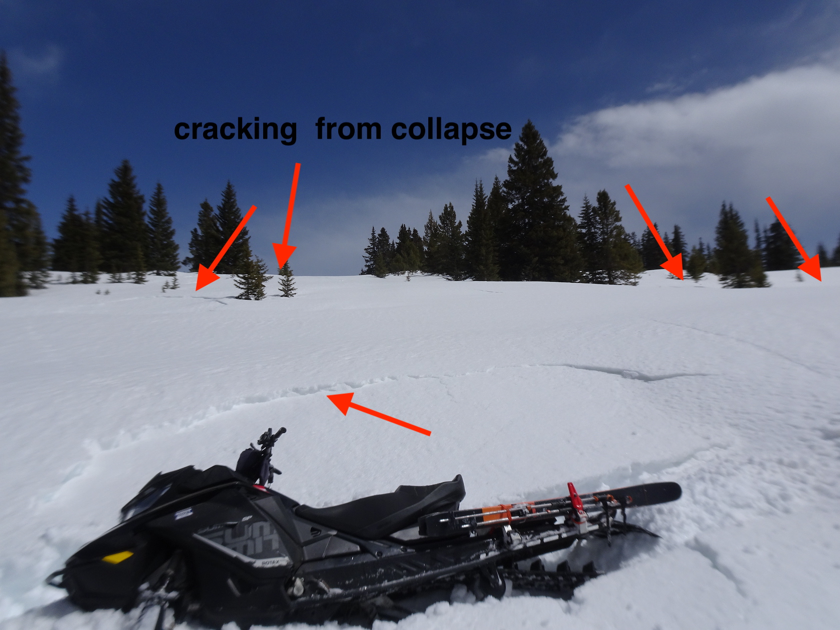
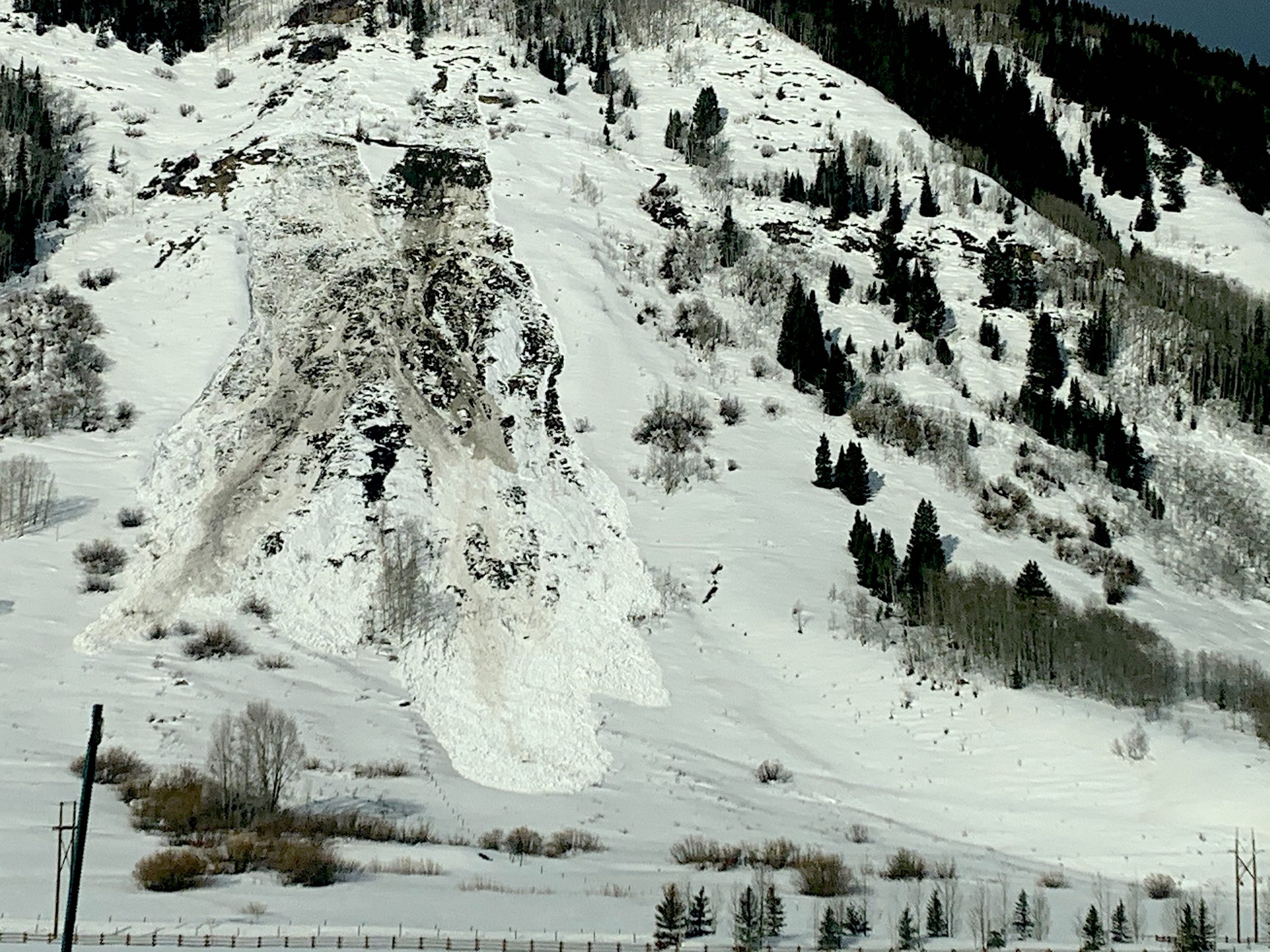
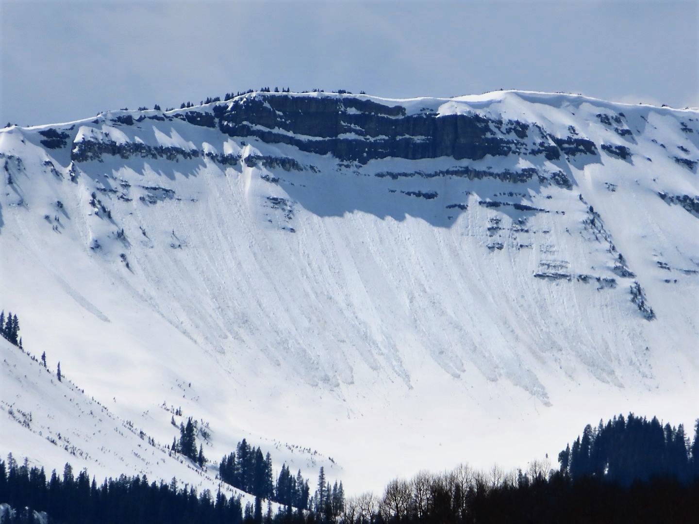
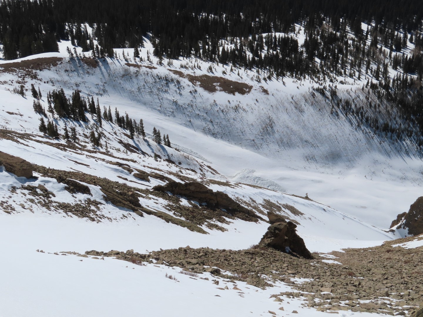
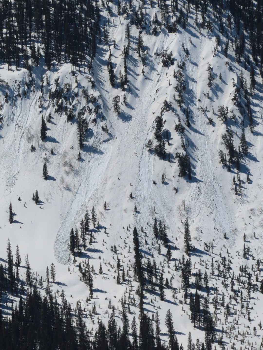
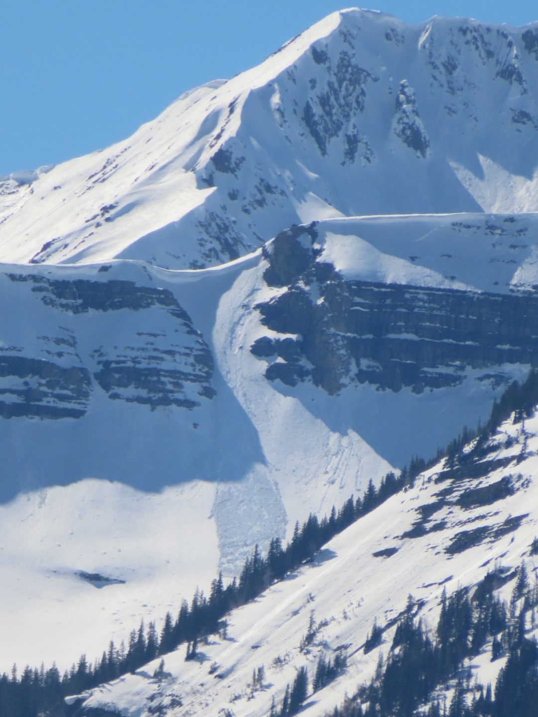
Avalanches: Old avalanche activity was similar to other locations around our greater forecast area. Loose wet avalanches or rollerballs on all aspects except some high north. Some loose wet avalanches also gouged deeply into the snowpack or triggered wet slab avalanches. Only noticed a couple of proper wet slabs. No fresh avalanche activity from today.
Weather: Partly cloudy and winds helping keep the snow cool. Down low on the east side of Kebler pass the cold winds where holding a steady breeze. Down low on the west side of Kebler Pass the winds were calm.
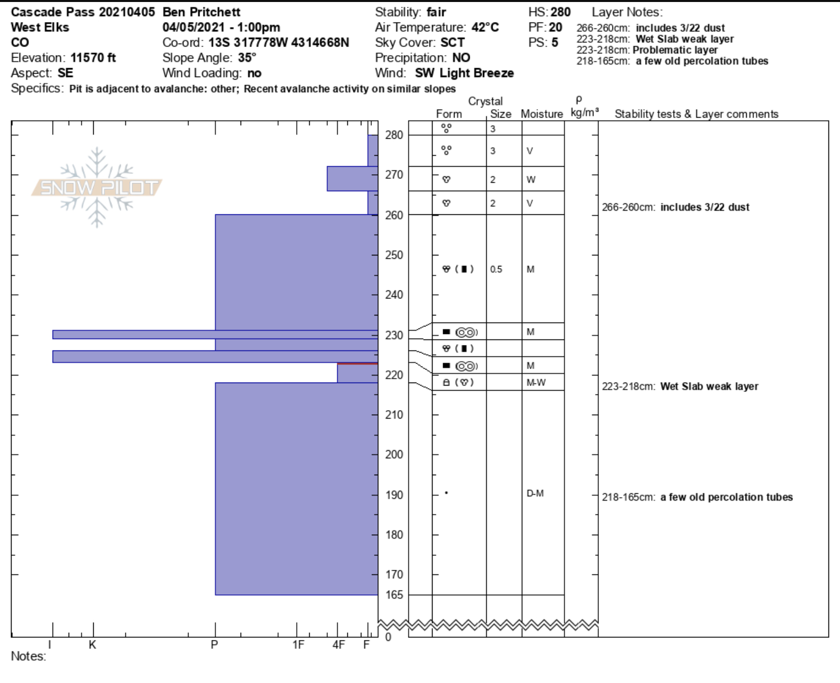
Snowpack: Snow surfaces softened in the afternoon on all aspects below treeline. On northeast to east slopes around 10,000ft by east beckwith you could push small loose wet avalanches on steep terrain in the top 2″ of the snowpack. Not really much of a problem unless in bigger terrain maybe. Snowpack stayed supportable to boots on a variety of aspects down low. Dug into some NE to E aspects around 10,000ft near east beckwith with an HS in the 100 to 120 range. These couple of holes didn’t show any wet slab issues with water having already drained through the snowpack or the old depth hoar had at least become wet, and changing grain type. In the end, nothing too notable.
-

- Couple small wet slabs near or below 10,500ft W and SW aspects.

-

- ESE Marcellina. Wet rock between the snow fields but no notable running water at noon.

-

- East facing sup peaks of East Beckwith