Date of Observation: 10/27/2021
Name: Zach Guy
Zone: Northwest Mountains
Route Description: Emerald Bowl. Traveled on E and NE aspects to 11,800′
Observed avalanche activity: Yes
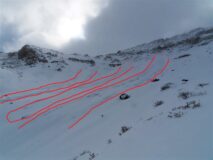
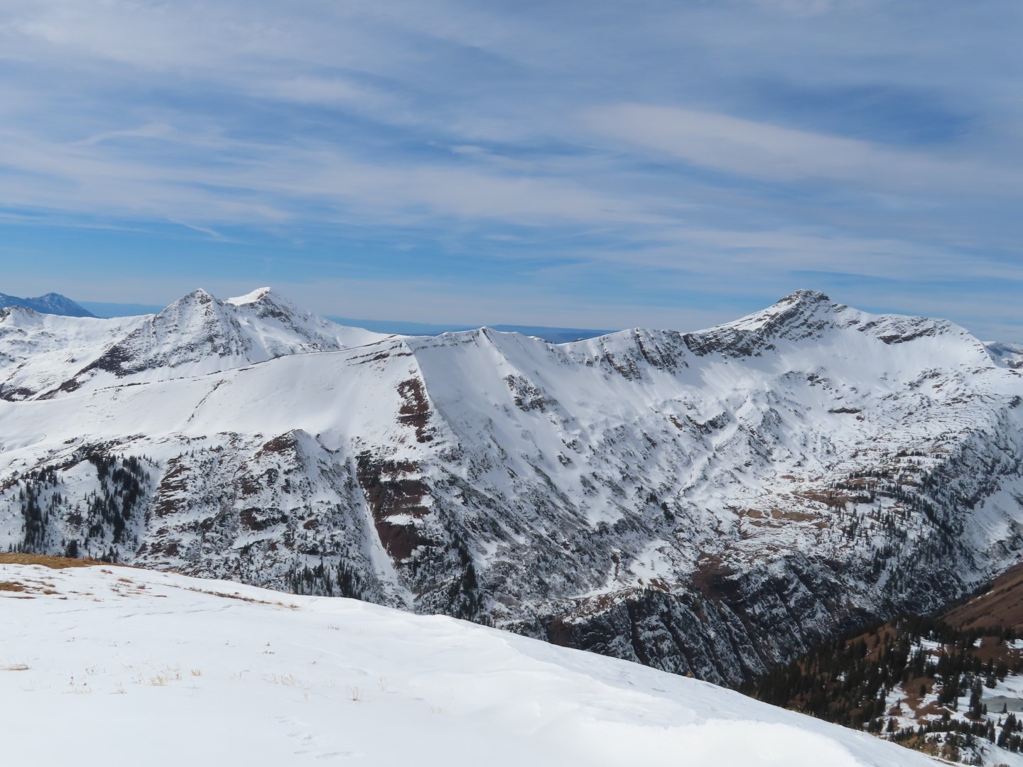
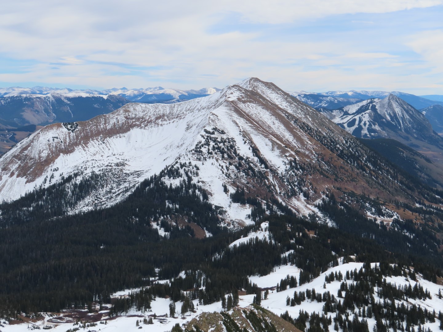
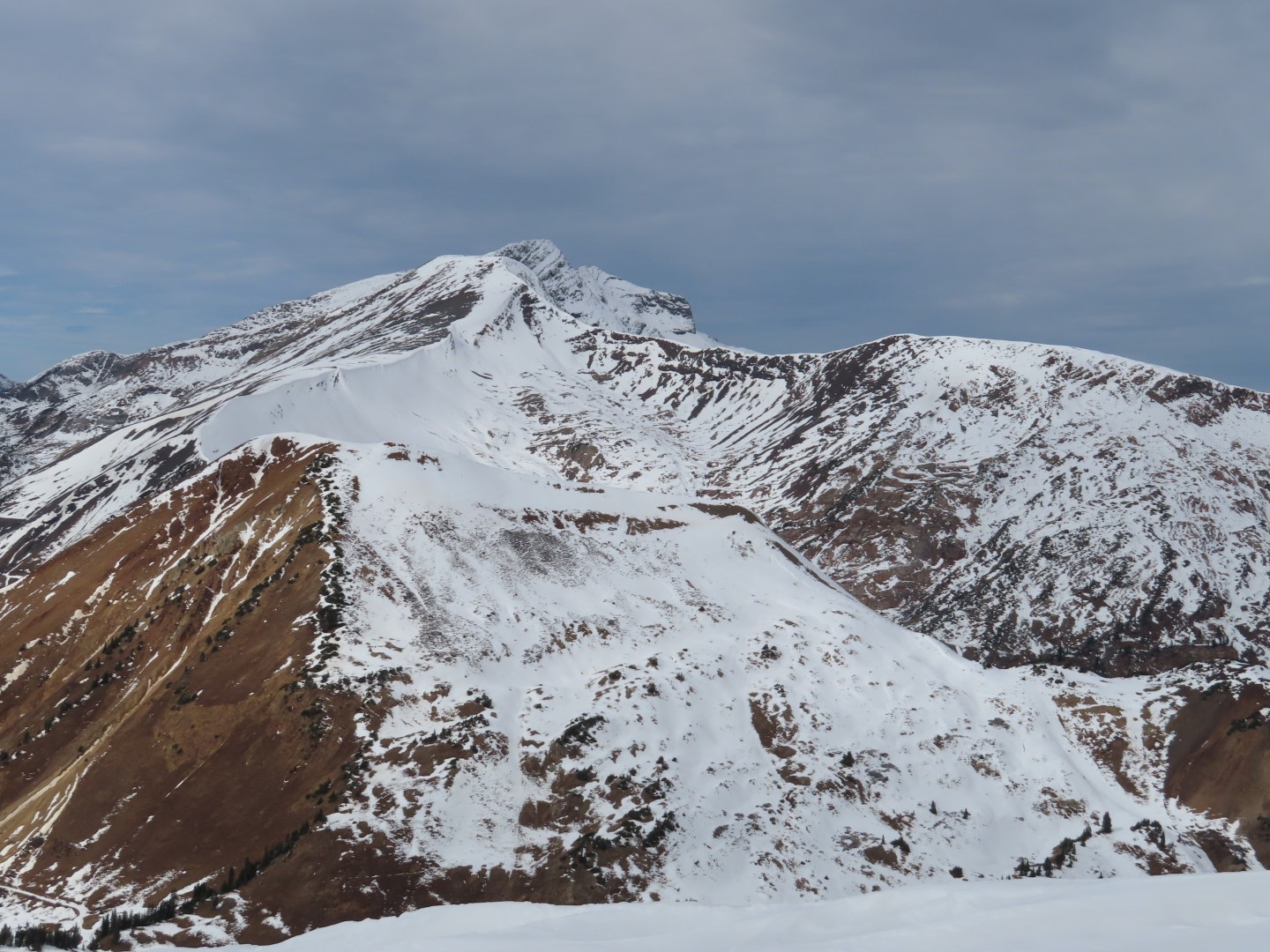
Avalanches: A natural cycle of avalanches, D1 to D2 in size, came off of Baldy’s Emerald Bowl sometime in the past 12 hours. Likely wind slabs, although the start zones were already blown smooth again. Also a small windslab ran today on Bellview.
Weather: Cold and blustery. Moderate to strong northwest winds were actively transporting snow all day at all elevations. Mostly cloudy skies with a few light snow showers.
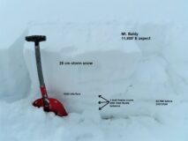
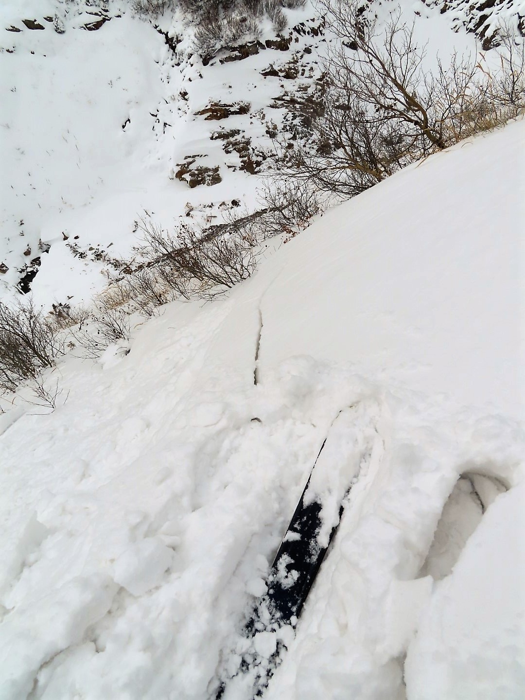
Snowpack: Several red flags pointed towards dangerous conditions at upper elevations today: fresh naturals, active windloading, storm totals approaching 12″, and shooting cracks in wind drifted slopes. Drifts were generally 2 to 3′ thick, up to 4F hard. In windsheltered(ish) terrain, I did not see evidence of storm slab instabilities; no cracking, and no unstable test results. The 8″ to 12″ of storm snow was fist hard, right-side-up on top of fist hard, 1mm facets (NE aspects) or crust/facet sandwiches or just homogenous crusts (East aspects).
Photos:
-
-
Several naturals on Baldy
-

-
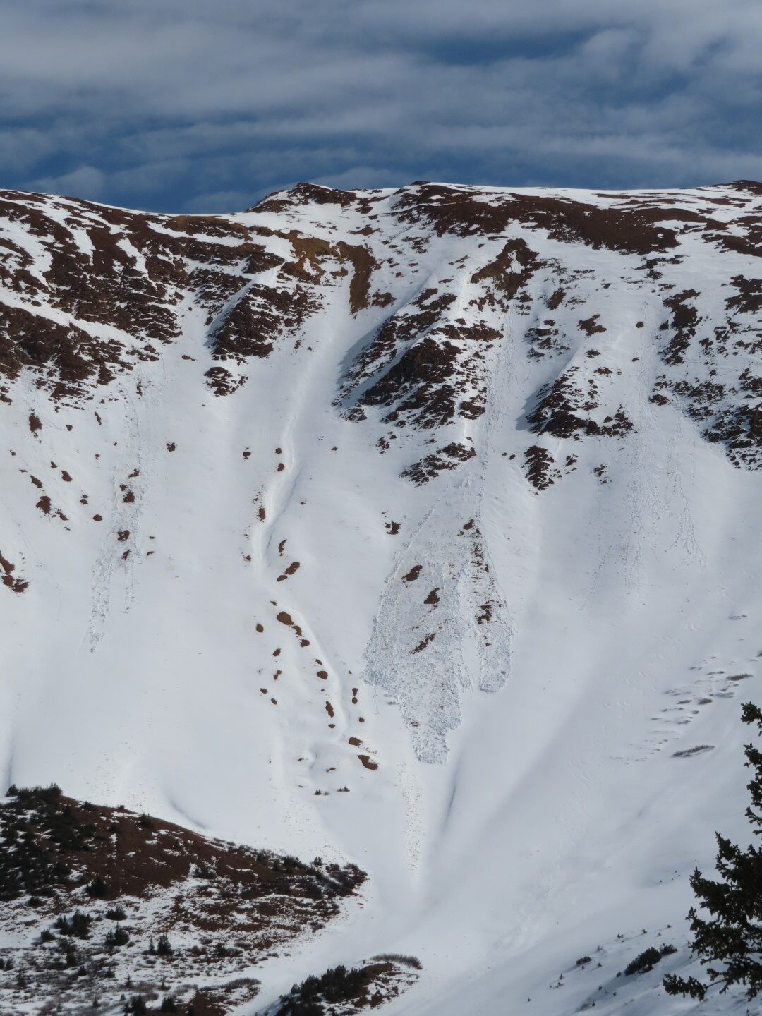
One slide ran 1800 vert and was large enough to bury someone (D2)
-

-
Cracking in wind drifted snow
-
-
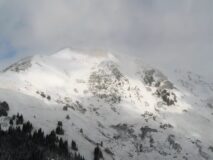
Wind erosion and loading on Bellview
-

-
Test pit on NE aspect of Baldy
-
-
Test pit on E aspect of Baldy
Estimated avalanche date: 10/27/2021
Number of Avalanches: 3
Location
Location: Mount Baldy
Location Specific:
Start Zone Elevation: ATL: Above Tree Line
Aspect: NE
Characteristics
Trigger: Natural
Trigger modifier:
Type: Soft Slab
Failure Plane: Unknown
Size
Relative Size: R1 very small
Destructive Size: D1.5
Avg. crown height (inches):
Avg. width (feet):
Avg. vertical run (feet): 600
Involvements
# of people caught:
# of partial burials:
# of full burials:
Additional comments: Emerald Bowl. Most likely wind slabs; crowns obscured by recent drifting.
Estimated avalanche date: 10/27/2021
Number of Avalanches: 1
Location
Location: Mount Baldy
Location Specific:
Start Zone Elevation: ATL: Above Tree Line
Aspect: NE
Characteristics
Trigger: Natural
Trigger modifier:
Type: Soft Slab
Failure Plane: Unknown
Size
Relative Size: R2 small
Destructive Size: D2 – could bury, injure, or kill a person
Avg. crown height (inches):
Avg. width (feet):
Avg. vertical run (feet): 1800
Involvements
# of people caught:
# of partial burials:
# of full burials:
Additional comments: Emerald Bowl. Most likely a wind slabs; crown obscured by recent drifting.
Estimated avalanche date: 10/27/2021
Number of Avalanches: 1
Location
Location: Schofield Pass/Rustler Gulch
Location Specific:
Start Zone Elevation: ATL: Above Tree Line
Aspect: S
Characteristics
Trigger: Natural
Trigger modifier:
Type: Soft Slab
Failure Plane: Within storm snow
Size
Relative Size: R1 very small
Destructive Size: D1- Relatively harmless to people
Avg. crown height (inches):
Avg. width (feet):
Avg. vertical run (feet):
Involvements
# of people caught:
# of partial burials:
# of full burials:
Additional comments: Bellview
Estimated avalanche date:
Number of Avalanches:
Location
Location:
Location Specific:
Start Zone Elevation:
Aspect:
Characteristics
Trigger:
Trigger modifier:
Type:
Failure Plane:
Size
Relative Size:
Destructive Size:
Avg. crown height (inches):
Avg. width (feet):
Avg. vertical run (feet):
Involvements
# of people caught:
# of partial burials:
# of full burials:
Additional comments:
4984


