Mt. Emmons
DATE: 3.3.15
Gothic Updates
Tuesday A.M.
Not a lot of new snow but terrible wind going strong most the night but letting up a bit after midnight though still at it. Gusts reached 50 mph during the night. Only 4″ new snow with 0.46″ water but substantial snow transport such that breaking trail this morning was easy as the snowpack has already set up. Water content of snow the past 3 days has gone from 6% to 9% to 11%. Visibility still flat but i have seen slide debris on lower portions of Snodgrass (though not as much as i had hoped). Wind continues but with gusts only in the 20 mph area now. Not a nice day, oh no, not at all. billy
Mid-day Tuesday
Gothic Morning Update
Date: 3/2/15 – 8AM
Only very light snow Sunday afternoon, then moderate much of the night so 8″ new and water a very dense 0.67″ with snowpack at 59″. Warmer wetaher made for overnight snow at nearly 9% water compared to just over 6% the day before so a heavy snow sits on top a light one. –Overcast now and warm (27ºF) but light is flat and though i do not see signs og slides it is difficult to tell. billy
Irwin Multiple Triggered Slides
Date: 3/1/15
Location: Irwin, Kebler Pass.
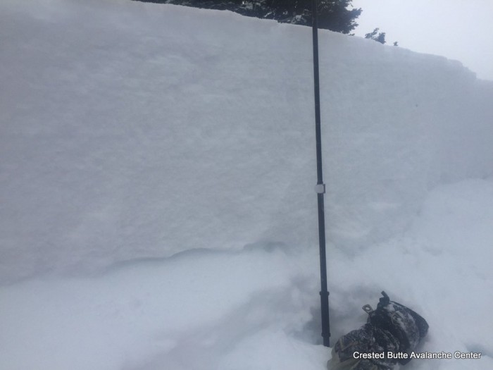
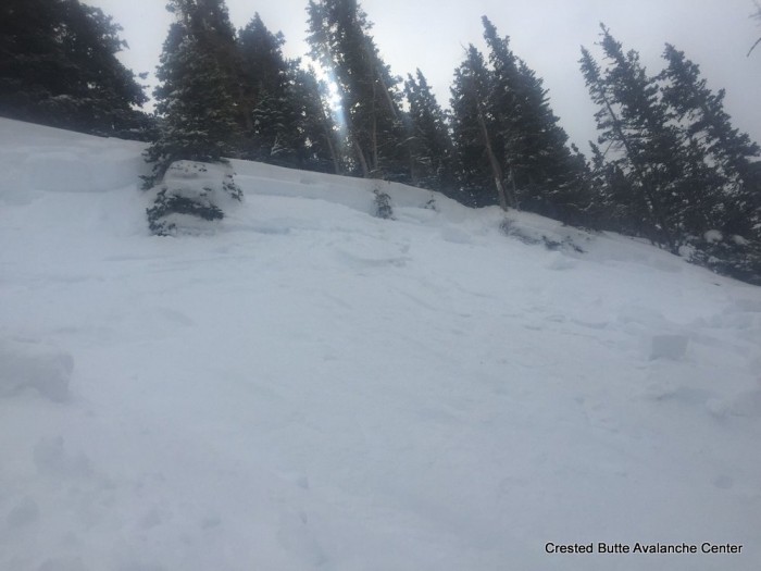
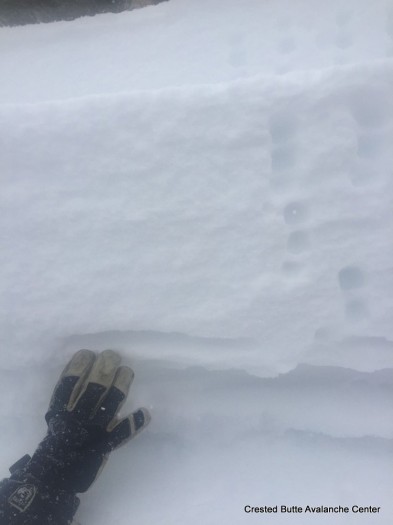
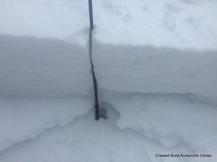
Wind slabs developed on higher terrain, persistent slabs 1-2ft deep resting on Feb 24th greenhouse crust with 1-1.5mm facets resting on top of crust. Wide propagation, and fast running slides.
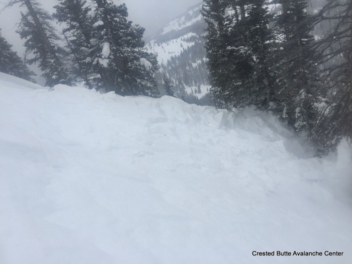
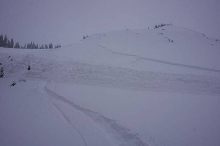
BOTTOMLINE: Several large explosevly triggered slides (1.5-2) failing on storm inversion, and near crust facets above Feb. 24th greenhouse layer.
Anthracite Range
Date: 3/1/15
I was out this weekend at a good buddy’s cabin in the anthracite Range this weekend. Friday afternoon about 10″ of light density snow .. wind picked up in late afternoon. Snowing and and winds from the west early morning Saturday. One of our party remotely triggered an avalanche on NE facing slope whilst skiing low angle terrain. By 10 pm Saturday eve over a foot no wind.
Sunday over 18″. Saturday morning widespread natural avalanche activity..all new snow going big and scary.
Gothic
7:30am on 3/1/15
Only 1½” snow Saturday but 12″ last night so 24 hour total is 13½” with water 0.85″ and snow pack the winters deepest at 57″. No wind and currently overcast and not snowing. Temp. between 19 and 20ºF all night. No sign of slides but light is flat. billy
Coney’s
LOCATION: Coney’s
ASPECT: N NE
WEATHER: Overcast sky. Pluses of snowfall throughout the day and becoming continues snowfall in the afternoon. About 2″ total today. Light winds at ridgeline and now drifting snow.
SNOWPACK: The snowpack is becoming interesting again. Storm snow accumulations where around 15″ near ridgeline or at the top of Coney’s bowl. Didn’t find thicker windslab deposits and the fist hard storm snow was behaving more like a well distributed, soft, persistent slab. At the top of the bowl a quick test pit produced a CT13 SC result on the old snow interface of weak facets and ski tests where only producing cracks about 5 feet in length. No collapses or any further cracking while traveling on slope angles under 35 degrees.
On a north facing slope below treeline the snowpack structure was extremely poor. About 60cm of large fist hard facets with about 50cm of recent fist hard storm snow. Storm snow was to soft to produce propagating results in an ECT but I still wouldn’t trust that slope.
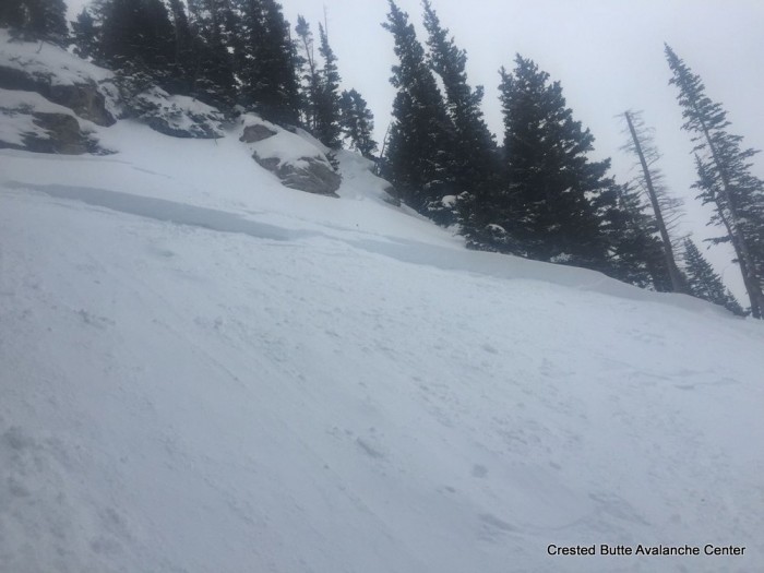
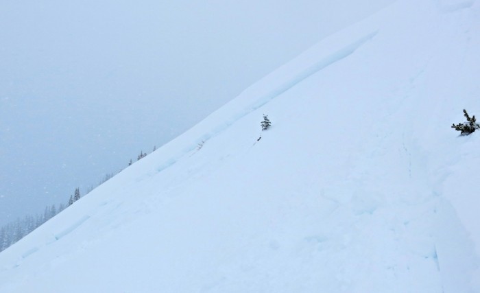
AVALANCHE OBS: At ridgeline, a good ski cut on a slope around 37 degrees produced no result. Then skied a 33 degree slope a few hundred feet away that remote triggered that same slope with the ski cut. The storm snow of the last weak failed on the old snow surface of weak facets as described above. Crown was around 1.5 feet deep and 60 feet wide. Ran a couple hundred feet down slope into lower angled terrain. This avalanche was harmless to a human but only because of the relatively small size/exposer of the slope. AS-SS-R1-D1.5-I
Take home point, no obvious sings to instability such as whomping and only a couple forced 5 foot cracks, but still a remote triggered avalanche on a slope greater then 35 degrees.
Kebler Pass Area
LOCATION: Kebler
ELEV: 9,000-12,000
ASPECT: N-NE
AVALANCHE/SNOWPACK OBS: Many sluffs spindrift off steep terrain & cliffs, slashed a couple 35-40* small roll overs & only got one tiny slab to pop off, the rest sluff’d
SNOWPACK: Numerous (>12) collapses & shooting cracks on flats & N-NE slopes up to 30* 9,500ft to 12K failing ~30-40cm into the old NSF with the underside of the slab (can hold it in your hand) from last week embedded with facets. Ski pen 30-40cm


