Location: Kebler Pass Area
Date of Observation: 03/11/2020
Name: Eric Murrow
Subject: Afternoon wet snow check
Aspect: North, North East, East, South East, South
Elevation: 9,200′ – 11,500′
Weather: Overcast skiers after 11 am with a lowering ceiling throughout the afternoon. By 3pm visibility became obscured from low clouds. Light snow throughout the afternoon but no real accumulations. Light winds at ridgetop.
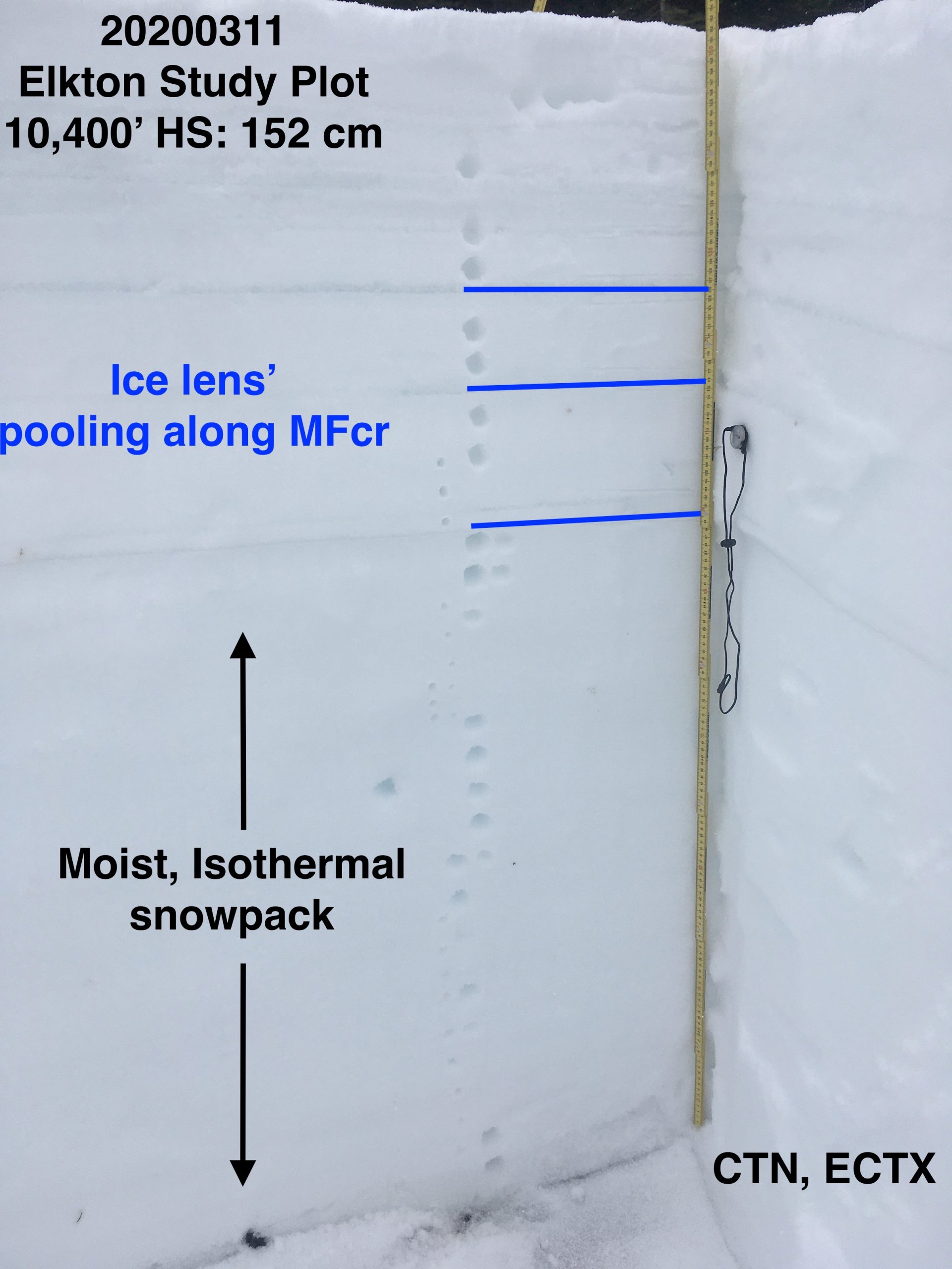
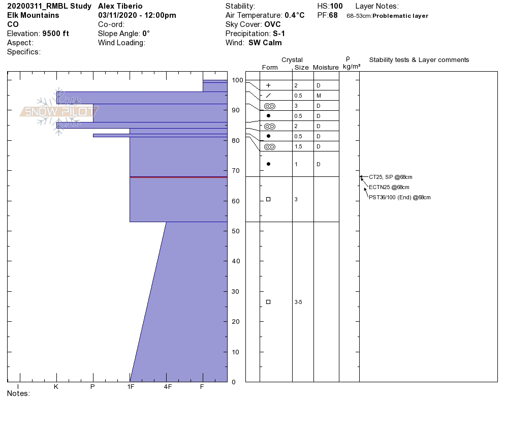
Snowpack: Poked a few holes on south and southeast facing slopes below treeline in the snow favored part of the forecast area. HS ranged from about 90 to 120 cm. Water from last week’s warm spell drained to the ground at all locations on south and southeast below treeline. Surfaces were 1-2 inches of moist, recent snowfall with crust between 5 to 10 cm below. Crusts were supportive to boots and wet loose avalanches concerns were not present through 330pm. One additional pit on a slightly drifted, southeast slope at 11,400′, I found snow depth around 180cm with numerous ice lens’ and percolation columns throughout the snowpack. Water appears to have drained through the snowpack to the ground at this site as well.
Shaded slopes through 11,500 feet had 5 to 6 inches of accumulations over the past few days. The top inch or two of recent snow was moist, and produced pinwheels and roller balls while skiing, but was short of producing Wet Loose avalanches. Snowpack below the surface was dry and winter-like.
Photos:
-
-
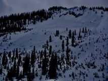
Roller balls and pinwheels on east-facing slope below treeline. Representative of numerous E and NE slopes in the area.