Mountain Weather for 11,000ft. Saturday 3/28

CB Avalanche CenterWeather

Date: 03/28/2020

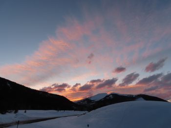
This morning we are sitting under northwest flow behind the last storm that has headed east. The change to west then northwest flow overnight has produced some good snow numbers out Kebler Pass. As of 5am 6” looks to have accumulated overnight with storm totals there now reaching 11”. Only a couple inches of snow apparel to have accumulated near Crested Butte.

Low-level moisture will keep some lingering snow showers going this morning. Mainly to the west and north of Crested Butte. Otherwise, we are in a drying trend as we move under some brief ridging.

Sunday starts off dry, then we’ll see increasing high-level clouds through the day creating mostly cloudy sky as the next low-pressure trough begins pushing moisture in on southwest flow. Snow showers start-up in the late afternoon or evening. By Monday morning we are looking at 2 to 4” of snow, then we should double that by the evening.

  • Today

    High Temperature: 24 to 28
    Winds/Direction: 7 to 17/NW
    Sky Cover: Partly Cloudy
    Irwin Snow: 0 to 2
    Elkton Snow: 0 to 2
    Friend’s Hut Snow: 0 to 1

  • Tonight

    Low Temperature: 8 to 12
    Winds/Direction: 5 to 15/W
    Sky Cover: Partly Cloudy
    Irwin Snow: 0 to 1
    Elkton Snow: 0 to 1
    Friend’s Hut Snow: 0 to 1

  • Tomorrow

    High Temperature: 30 to 34
    Winds/Direction: 5 to 15/WSW
    Sky Cover: Increasing clouds
    Irwin Snow: 0 to 1
    Elkton Snow: 0 to 1
    Friend’s Hut Snow: 0 to 1

Schuylkill Ridge near treeline

CB Avalanche Center2019-20 Observations

Location: Paradise Divide Area
Date of Observation: 03/27/2020
Name: Eric Murrow & Evan Ross
Subject: Schuylkill Ridge near treeline
Aspect: North, North East, East
Elevation: 8900 – 11400′

Avalanches:By early afternoon we could trigger quick running D1 Dry Loose avalanches on steep terrain running on crusts or stiff windboards.

Weather: Overcast skies with light snowfall. Snowfall rates picked up around 1pm to S1 rate. Winds were blowing from the southwest at the ridgetop transporting the new snow. New snow accumulations were 4.5 inches at 345pm (11,400′).

Snowpack: Ascended through shaded below treeline terrain up to 11,400′. Below treeline slopes had melt/freeze crusts on all aspects except those very close to due north. No signs of instability while ascending shaded terrain – found around 40cm snow above the 3/18 interface on sheltered slopes.

We dug a test profile near a recent avalanche – just one small terrain feature away. Expected to find a stout Wind Slab below ridge top, but dense wind-deposited snow tapered off quickly to just a few inches thick 20 feet below ridgetop. At this drifted site there was 65cm of snow resting above the 3/18 interface. ECT produced propagating results at three interfaces – an easy result beneath the stout windboard (from the recent wind event), a moderate result in a soft layer in the middle of the slab, and a hard result above the 3/18 crust (likely interface for the nearby recent avalanche). The column slid into the pit with energy above the 3/18 crust ‘cash register’ style. See profile photo.

We could easily produce Dry Loose avalanches in the 6 or so inches of new snow on the leeward side of the ridge. They quickly picked up speed on the old surfaces of melt/freeze crusts or windboard.

Cement mtn slides

CB Avalanche Center2019-20 Observations

Location: Cement Creek Area
Date of Observation: 03/26/2020
Name: Cosmo
Subject: Cement mtn slides
Aspect: North East

Avalanches:Numerous slides on NE facing slope below wind loaded ridge. Ridgeline elevation is just below 12k’. Some look like wind slabs failing. Others might have been triggered by cornice fall or roller balls falling off cliffs on afternoon of 3/25. A couple stepped down into deeper layers further down the slope.
Photos:


Mountain Weather For 11,000FT. Friday 3/27.

CB Avalanche CenterWeather

Date: 03/27/2020

The low-pressure system over the Great Basin will continue to slide towards Colorado today bringing an increase in cloud cover and light snowfall. The brutally fast jet stream will finally push to the east of Crested Butte in the middle of the day. Snowfall will be showery in nature for much of the day with some convective potential to increase snowfall rates. The flow will shift more westerly today and the air mass will cool to some degree. Snowfall totals do not look impressive but the area could pick up 5 to 9 inches by Saturday morning. Saturday the area will be under a cool northwest flow on the backside of this system which may keep light snow showers going for terrain that have positive orographics under northwest flow like Kebler Pass and Paradise Divide areas.

Skies will clear late Saturday and into Sunday morning before the next storm system approaches. Moisture will begin to reach Colorado sometime during the second half of Sunday. This storm does not currently look impressive, but we will watch it as it develops and moves closer to Colorado.

  • Today

    High Temperature: 25 to 29
    Winds/Direction: 9 to 19/WSW decreasing in afternoon
    Sky Cover: Mostly Cloudy
    Irwin Snow: 2 to 4″
    Elkton Snow: 2 to 4″
    Friend’s Hut Snow: 2 to 4″

  • Tonight

    Low Temperature: 6 to 10
    Winds/Direction: 6 to 16/NW
    Sky Cover: Mostly Cloudy
    Irwin Snow: 2 to 4″
    Elkton Snow: 2 to 4″
    Friend’s Hut Snow: 2 to 4″

  • Tomorrow

    High Temperature: 24 to 29
    Winds/Direction: 7 to 17/WNW
    Sky Cover: Mostly Cloudy
    Irwin Snow: 1 to 3″
    Elkton Snow: 1 to 3″
    Friend’s Hut Snow: 0 to 2″

Lots of avalanche

CB Avalanche Center2019-20 Observations

Location: Crested Butte Area
Date of Observation: 03/26/2020
Name: Eric Murrow
Subject: Lots of avalanches from wind event

Avalanches:Numerous large and very large avalanches in near and above treeline terrain. Many appeared to have been triggered by cornice fall yesterday evening, last night, and this morning. See photos for a tour.
Whetstone – Main Bowl D2, 2x Hidden Lake Bowl, D2 & D3
Baldy – Nirvana Bowl, D2.5
Schuylkill Ridge – D2
Angle Pass- D2
Gothic – 2x East Face, D3
Mt Emmons – Wolverine, D2
Scarp Ridge – 4x D3, 2x D2
Western Basin in Anthracite Range – 2x D2.5

Photos:

Gothic megatour

CB Avalanche Center2019-20 Observations

Location: Paradise Divide Area
Date of Observation: 03/25/2020
Name: Lee
Subject: Gothic megatour
Aspect: North, North East, East
Elevation: 10000 and above

Avalanches: Many. 500 foot crown on ne baldy, ~2 ft deep, on emerald couloir headwall, 200 ft wide glide avvy that went to ground on the flank dividing emerald and Quigley. These slides occured somewhere around 9am
The northeast slide path on gothic ripped wall to wall around noon, leaving an extremely deep crown

Lots of wind effect but no slides in queens basin. Nachos cornice may be too large to enter the line now.

As I skied out white ridge, a massive cornice failure occured on ef gothic, ripping the fall line to dirt. 7pm

Didnt get many pictures, light wasn’t playing ball
Weather: Cloudy as, windy as

Snowpack: Extremely variable

Photos:

[/gravityforms]

Mountain Weather For 11,000FT. Thursday 3/26

CB Avalanche CenterWeather

Date: 03/26/2020

A large low-pressure trough is dominating the weather pattern in the mountain west. An exceptionally strong jet stream is moving directly above Colorado early this morning and will remain over the state for much of the day. The area is under a heavy southwest flow. The strong jet produced gusts up to 80mph last night and is expected to persist much of the day. Along with the strong winds much warmer air pushed into the area setting freezing levels near 10,500 feet in elevation. There is relatively little moisture associated with this system but a few flakes might fall today.

As the low-pressure trough moves eastward today, it will push the jet stream to the east of Colorado bringing a reprieve from the winds. The small amount of moisture will arrive on Friday as the trough axis approaches, but accumulation do not look impressive. Air temperatures will cool as the trough approaches to below seasonal norms. The Crested Butte area may sneak out a handful of inches by Friday night with the best chance of accumulating snow coming on Friday evening and into the night.

  • Today

    High Temperature: 34 to 38
    Winds/Direction: 20 to 30/SW G60
    Sky Cover: Mostly Cloudy
    Irwin Snow: 0 to 1″
    Elkton Snow: 0 to 1″
    Friend’s Hut Snow: 0 to 1″

  • Tonight

    Low Temperature: 14 to 18
    Winds/Direction: 6 to 16/SW
    Sky Cover: Partly Cloudy
    Irwin Snow: 0 to 1″
    Elkton Snow: 0 to 1″
    Friend’s Hut Snow: 0 to 1″

  • Tomorrow

    High Temperature: 28 to 32
    Winds/Direction: 8 to 18/WSW
    Sky Cover: Mostly Cloudy
    Irwin Snow: 0 to 2″
    Elkton Snow: 0 to 2″
    Friend’s Hut Snow: 0 to 2″

Carbon Peak

CB Avalanche Center2019-20 Observations

Location: Crested Butte Area
Date of Observation: 03/25/2020
Name: Evan Ross
Subject: Carbon Peak
Aspect: North, North East, East, South
Elevation: 9.500-12,000

Weather: Late afternoon outing. Mostly cloudy sky, warm temps, and lighter winds then expected. Around 4pm at an exposed 12,000ft the westerly winds were light to moderate.

Snowpack: This area represents one of the dryer portions of our forecast area. I mostly traveled on northerly facing slopes as everything else was crusty and not much fun to ride. So this summary is for northerly facing slopes. The Continental Snowpack here was very evident with a randomly punchy structure in some places. In general there was a weak slab over a weak layer of facets. Sometimes the snowpack felt strong as the snowpack was supportive, and other times you would punch through the slab and into the weak facets in the lower half of the snowpack. I spent plenty of time finding trigger points and punching into the weak layer with no signs to instability. Still that type of snowpack structure is hard to trust and I looked over my shoulder more than once.

Came across a small slab avalanche that failed within the last 24hrs. Some of the cracks above the crown had been drifted over, but everything else was fairly sharp. NE, 11,950ft SS-N-R1-D1.5-I. The slab was 30cm thick and F+ hard. It released on the 3/18 interface. That interface was a 2cm crust. ECT, CT, and PST tests were inconsistent and not effective given the thin and soft slab. Even pulling on the slab in hand pits was difficult to pull a cohesive column of snow off the curst. Slope angle was about 36 at the crown and the slope rolled over steeper below the crown. Of other particular note was how quickly the flanks tapered away. That was either due to the Stauchwall location, or from previous wind-loading. HS was 150cm.

Recent avalanches

CB Avalanche Center2019-20 Observations

Location: Crested Butte Area
Date of Observation: 03/25/2020
Name: Eric Murrow
Subject: Recent avalanches
Elevation: 8900 – 11400′

Avalanches: Two fresh deeper avalanches in Red Well basin. Both look to be triggered by cornice fall. One slide was present by 10am the other ran sometime after but before 1pm.
Some small Wet Loose avalanche activity noted – mostly pinwheels but a few accumulated mass.
Weather: Mostly cloudy skies and warm temperatures. Winds on a 11,400 ridgetop were light with occasional gusting to 20. High peaks had on and off flagging for much of the day loading onto easterly aspects.

Photos: