Name: Matt Zia
Title: Snodgrass pits
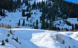
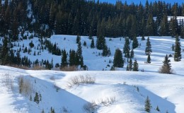
Location: Crested Butte Area
Date of Observation: 01/07/2015
Aspect: North East
Elevation: 9600
Avalanches: Observed natural avalanche activity across the valley on the S Face of Avery Peak (~10,000 feet and maybe 40º slope?) as well as on W facing slopes further south (approximately same elevation and angle as Avery) . Too far to really see, but appeared to be loose wet snow, no noticeable crown or slab fracturing.
Weather: Clear skies, no wind, ~40ºF in the sun, 30ºF in shade
Snowpack: Approximately 20º slope, NE facing at 9600 feet. Small meadow just off the Snodgrass road and above a large rollover.
0-5cm: Surface hoar, approx. 2.5mm grain size, F hardness, some rollerballs from digging a pit
5-50cm: consolidated slab, 4F-1F hardness
50-55cm: December 13th weak layer, 1-2mm facets
55-90cm: 1F hardness
90-95cm (ground): F hardness, facets and depth hoar
Conducted two compression tests, both failed at December 13th layer. First: CT22-SC-Q1. Second: CT21-SC-Q1. Top 10cm of snow easily disintegrated under shovel blade.
Crossed paths with another party who dug a pit higher up on a steeper slope of 35º. They found a similar snowpack in terms of depth, but compression test yielded a result of CT7. Additionally, on the steeper terrain, the top 10cm which disintegrated on a 20º slope instead slide as its own slab before the thicker slab reacted on the December 13th interface.
Uploads: