Problematic surfaces

CB Avalanche Center2016-17 Observations

Location: Crested Butte Area
Date of Observation: 01/01/2017
Name: Zach Guy and Evan Ross
Subject: Problematic surfaces
Aspect: North East, East
Elevation: 9,000-12,200 ft

Avalanches: No signs of instability. No recent activity.
Weather: S-1 to S1 throughout the day. Overcast skies. Light winds with minimal transport.
Snowpack: ~2″ of new, low-density snow.
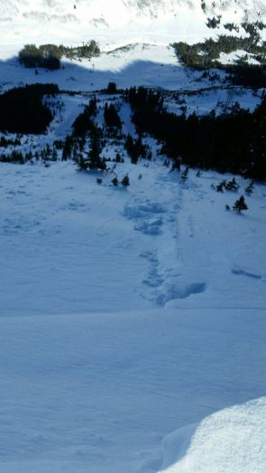
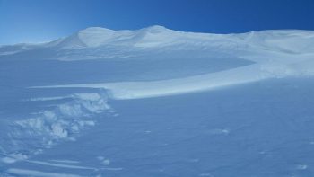
On NE and E aspects near treeline, the storm interface is smooth windboard, and the new snow was not bonding well to this surface. Lots of shallow, harmless sluffing. Dug one pit on a wind loaded NE aspect. About 120cm of 1F+ slab over 4F+ 1.5mm rounding facets. No results in ECTs or with additional loading steps on deep tap ECTs. The surface (below the new snow) was 1cm, 1F wind crust over small grained facets. The starting zones that we traveled near had variable snow depths due to previous avalanches and wind affects.

Below treeline, the storm interface is fist hard near surface facets, ~1mm, and several hand pits showed multiple facet layers in the upper 25 cm of the snowpack; not problematic until a slab arrives. Snow depth was generally about 70 to 90 cm deep, with a few shallower and faceted/unsupportive areas on steep rollovers.

Cement Creek to Point 12251

CB Avalanche Center2016-17 Observations

Location: Cement Creek Area
Date of Observation: 12/31/2016
Name: Ian Havlick
Subject: Cement Creek to Point 12251
Aspect: North, South West, West, North West
Elevation: 10,000-12,250

Avalanches: Observed several fresh windslabs from wind earlier this week on E-SE facing slopes, one D2, but far away and hard to photograph.
Weather: Clear, Sunny, Calm. Intense solar. temps ranged between 0-15ºF
Snowpack: Still a relatively deep snowpack out cement creek. Near and above treeline areas definitely still hold concerning structure and producing concerning long column results. ECTP18 SC at basal facets in 85cm pit at 11,800ft, at alpine transition was concerning. PST80/100arr 20161127. Key word is variable! some places scoured to ground, others 250cm+.

Xmas surface hoar distribution is spotty, but present. Found in meadows BTL, 15cm deep from surface. 2-3mm SH. shovel tilt produced clean shears but slab not stiff enough where I tested to see propagating ECT results.

Slide20

Mountain Weather 1/112017

CB Avalanche CenterWeather

Date: 01/01/2017

This morning we have one low-pressure eating fish tacos down on the Baja/California border while another low pressure is eating fish sandwiches up in the northwest. These two systems are going to squeeze the pressure gradient between them with strong winds aloft and a turbulent atmosphere. Atmospheric lift and some moisture will bring us light snow showers today through tonight. Heading into Tuesday and Wednesday winds look be very strong with lots of turbulences in the atmosphere as the pressure gradients tighten and a trough forms over Colorado. So we’ll have that unsettled, turbulent atmosphere, and we just need to add moisture to see those snowfall numbers start adding up. The best chance of increased moisture arriving looks to be around Tuesday afternoon into Wednesday.

Day 2 avy 1 course

CB Avalanche Center2016-17 Observations

Location: Crested Butte Area
Date of Observation: 01/31/2016
Name: Casey, Krista, Level 1
Subject: Day 2 avy 1 course
Aspect: North East, East
Elevation: 9,800 to 10,250

Avalanches:
Weather: Few clouds , no new precip, calm to light winds from the W, felt warm to day with a temp of -5C @ 10,0125’ @ 14:45
Snowpack: Overall improving below TL, noticed some rounding in the basel facets with a supportive mid-layer. Warm today, sun crusts developing on just about all S aspects below TL and some wind affected snow in open terrain below and near TL.

No current instablitys

CB Avalanche Center2016-17 Observations

Location: Crested Butte Area, Snodgrass
Date of Observation: 01/31/2016
Name: Evan Ross
Subject: No current instabilities observed
Aspect: North East, East
Elevation: 10,700 BTL

Avalanches:
Weather: Mostly sunny with sun warming snow surfaces on southerly facing slopes. Calm winds.
Snowpack: Quick test pit BTL on an ENE aspect showed more of the same with the basal facets 1.5/2mm in this area and rounding. CT result was moderate and sudden on the NSF interface 25cm down under a F to 4F- slab. No time for an ECT but ski tracks on suspect slopes showed this interface to be a non-issue currently. No signs to instability on suspect terrain other then some sluffing in steep terrain as the snow surface continues to weaken with the recent cold weather.

Schuylkill Avalanche

CB Avalanche Center2016-17 Observations

Location: Paradise Divide Area
Date of Observation: 12/30/2016
Name: Chris Baldwin
Subject: Schuylkill Avalanche
Aspect: North East
Elevation: 11,300 NTL

Avalanches: Observed 12/30
There were tracks to the left of it, but seemed like cornice fall trigger. Not a massive crown, almost like a point release that stepped down and ran on xmas layer, R3D1.5
Weather:
Snowpack:

Augusta Cirque Tour (Cascade, Mineral Point, Augusta, Unnamed 12104)

CB Avalanche Center2016-17 Observations

Location: Paradise Divide Area
Date of Observation: 12/30/2016
Name: Ian Havlick
Subject: Augusta Cirque Tour (Cascade, Mineral Point, Augusta, Unnamed 12104)
Aspect: North East, East, South East, South, South West, West
Elevation: 9400-12550

Avalanches: none observed.
Weather: Mostly sunny, strong radiation, becoming windier and cloudier from WNW by 1300. High temps in mid teens at 12,000ft.
Snowpack: Pretty encouraging snowpack across areas travelled today. Definitely evidence of significant wind transport, wind sculpted snow surfaces. Dug one profile, 10,800ft, near treeline, 33º, south facing. 150-200cm deep, right-side up snowpack, majority 4F-1F-P. Tested 12/22 interface with PST. no propagating results (PST60/100arr 20161222). Travelled steep, windloaded features with no cracking, no obvious instabilities.

Xmas surface hoar lying flat (good!) found as “ghost layer” when dropping column after tests.
Moderate wind transport at 12,000ft below Augusta

Mountain Weather

CB Avalanche CenterWeather

Date: 12/31/2016

Warm moisture is spinning out of the southwest today ahead of two closed lows lined up over Nevada and California. We should see partly to mostly cloudy skies today, but all of the precipitation will get hung up on the San Juan Mountains to our south. A shortwave trough out of the northwest merges with these lows and kicks off 2017 with light snowfall. The polar jet then sags over Colorado on Sunday night, increasing snowfall rates and dropping the mercury into midweek. Look for accumulations to approach a foot of new snow by Tuesday night.

Snow surface obs

CB Avalanche Center2016-17 Observations

Location: Kebler Pass Area
Date of Observation: 12/30/2016
Name: Zach Guy
Subject: Snow surface obs
Aspect: East, South, West
Elevation: 10,000-12,000ft

Avalanches: None.
Weather: Increasing clouds. Light winds. High of 37F.
Snowpack: Snow surface obs:
West aspects N/ATL: Heavily wind textured and scoured, highly variable across slopes from P to F hard wind packed rounds and facets.
East/Southeast aspects ATL. Mostly smooth, P to 1F .2mm wind packed rounds with early surface faceting.
South aspects NTL: Moderately smooth, 2cm breakable melt-freeze crust with early faceting beneath.

Mountain Weather 12/30/2016

CB Avalanche CenterWeather

Date: 12/30/2016

We will have a near carbon copy to yesterdays weather.  Temperatures nearing 32º, strong solar radiation, and generally light winds.  Look for a slight uptick in westerly winds this afternoon, and then high clouds move in ahead of series of storms next week. Details are emerging on this next stormy pattern, and it looks to be a long, windy, and cold event. Soak up that vitamin D now!