Mountain Weather 3/29/2017

CB Avalanche CenterWeather

Date: 03/29/2017

The closed low pressure system that brought yesterday’s spring squalls has moved eastward, putting us under a mild North flow today. We can expect another greenhouse cooker of a day under high thin clouds. Tonight we’ll see a good freeze, before the temps climb back into the forties tomorrow on the leading edge of another storm on tap for Friday.

Ruby Range

CB Avalanche Center2016-17 Observations

Location: Kebler Pass Area
Date of Observation: 03/28/2017
Name: Ian Havlick
Subject: Ruby Range
Aspect: East, South East, South
Elevation: 10,000-12,000

Avalanches: Widespread cycle of loose snow avalanches (
Weather: Moderate snow tapered to broken skies by mid morning. 9″ (.55 swe) 6% density at nearby Irwin study plot. Calm winds and balmy low to mid 30ºF temps, but intense solar when sun poked through.
Snowpack: New snow warmed and moisted quickly after snowfall stopped around 8am. Interesting structure in new snow that has fallen on old, dusty, spring snow surface. Observed a couple melt freeze crusts with .5-1mm facets below on mid elevation, S-SE facing apron of Ruby Peak.. With more snow load, could hold potential for another round of persistent slab avalanches. Should be monitored. No blowing snow observed by 1200pm.

Due north slopes and westerly slopes remained dry, but any slope with even a hint of east and south had moistened by 10am.

Ruby Apron profile
ENE facing storm snow activity on E-Ridge of Mount Owen (Jenga ridgeline)
East facing Ruby Ridge, widespread storm slab and dry loose avalanche activity transitioned to wet loose slides later in the day.

Welcome Ben Pritchett as the new ED and Lead forecaster for CBAC!

CB Avalanche CenterAvi Blog, Avi-Off-Season

It comes with a heavy heart to announce I’m moving on from the Crested Butte Avalanche Center to take on a new role as the director of the Flathead Avalanche Center.  I’m looking forward to an opportunity for personal and professional growth in Montana. I’m grateful for the strong sense of community here that has made this place my home, both in town and in the backcountry.  Our mountain town is unique in how our backcountry users respect and look out for each other, and this energy is what has helped our little avalanche center thrive and grow to what it is.  Your observations, support, and donations help to make the CBAC one of the best forecast centers in the country.  Thank you for that, Gunnison Valley, and I hope that is something that won’t change here as the backcountry evolves and becomes more crowded.
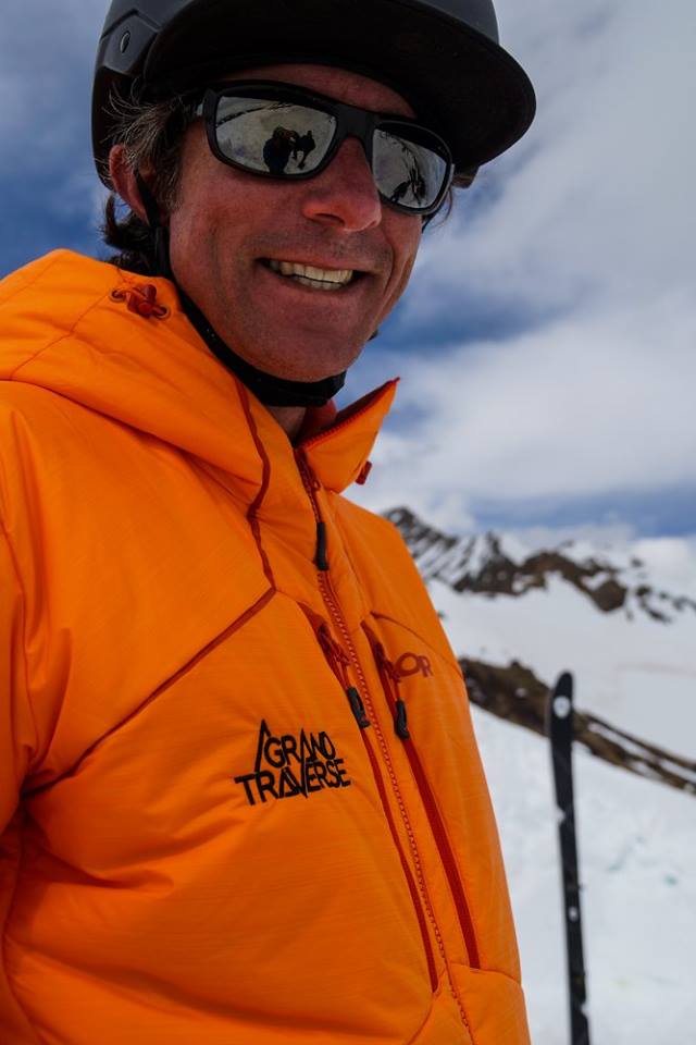
I’m excited to announce our new executive director and lead forecaster:  Ben Pritchett.  Ben brings a broad skill-set and diverse experience in the avalanche industry to the CBAC.  In the past 12 years, Ben has served as the program coordinator for AIARE and avalanche education coordinator for the CAIC, gaining valuable experience working with backcountry users, educators, and forecasters around the country.  Ben is a former forecaster for the CBAC and leads the forecasting program for the Grand Traverse.  He also owns and runs a backcountry guiding business here in Crested Butte.  Ben’s industry connections and local understanding of our terrain, weather, and snowpack will contribute to the quality of our forecast products.
Ben at the 2017 Grand Traverse
Over the past 5 years, I have poured my heart into making this center the best it could be.  One of the hardest parts about leaving the CBAC was my sense of investment here and the fear of leaving the center high and dry on my way out.  The folks at the Flathead Avalanche Center were patiently willing to negotiate for a delayed start date which helped us conduct a thorough interview and hand-off process, and I’m glad we landed Ben.  Evan and Ian are two of the most dedicated and passionate forecasters I’ve had the pleasure of working with, and they are both planning on returning next year.  We brought on a new development director this past fall, Karen Williams, who has been working with us to improve our fundraising and outreach.  And with Ben joining the team,  I know now that the CBAC is in good hands moving towards a promising future with the goal of educating our community and saving lives from avalanche hazards. 
Sincerely,
Zach Guy 

Mountain Weather 3/28/2017

CB Avalanche CenterWeather

Date: 03/28/2017

Last night we picked up 3-4″ of new snow around the area, with totals a little higher to the west. Today, the snow will taper off by midday. Overnight winds were light out of the southwest but look for the North winds to pick up a little bit this afternoon and into tonight as this storm passes.  Looks like another one on tap for later this week.

Triggered Cornice Break – Owen

CB Avalanche Center2016-17 Observations

Location: Kebler Pass Area
Date of Observation: 03/27/2017
Name: Anonymous
Subject: Triggered Cornice Break – Owen
Aspect: South East
Elevation: ~12500′

Avalanches: Accidentally triggered a large cornice break near Owen/Ruby saddle. Noticed snow next to rocks on the ridge was icy, took two steps away from rocks, punched through snow triggering a large cornice fall. About 40 yards wide and the size of a couple buses. Didn’t appear to trigger slab avalanche, but a large amount of debris ran length slope with loose recent snow. Occurred around 11:15am.
Weather: Warm partly cloudy. Little to no wind
Snowpack:

FullSizeRender
IMG_2493

Mountain Weather 3/27/2017

CB Avalanche CenterWeather

Date: 03/27/2017

Temperatures dipped into the low 20s last night, under clear skies and generally light to moderate west winds at ridge top. Clear skies this morning will allow temperatures to rebound, before high clouds work into the area from the southwest this afternoon. Tomorrow looks stormy with snow (4-8″) and increasing northwest winds. Looking ahead, we get a breather on Wednesday and Thursday before another low pressure system and snow arrives Friday.

Irwin Tenure

CB Avalanche Center2016-17 Observations

Location: Kebler Pass Area
Date of Observation: 03/27/2017
Name: Irwin Guides
Subject: Irwin Tenure
Aspect: East, South, West
Elevation: 10,000-12,000

Avalanches: none
Weather: FEW to OVC skies back and forth all day with pulses of convective snowfall not accumulating at all. Solar radiation helped soften snow surfaces. Light winds with Moderate Gusts from the NW and then W not really transporting any snow, High temps 36F / 25F:
Snowpack: 1-2″ of fresh snow overnight skied ok over smooth supportive surfaces, Sun came in and out today warming the snowpack. Westerlies were a bit of sticky pow while east, south, and sw were more spring like schmoo. All surfaces are supportive, not breakable and the pack is mostly transitioned to Spring isothermal but new snow sticky in places. No threats of wet loose today.

Irwin Tenure

CB Avalanche Center2016-17 Observations

Location: Kebler Pass Area
Date of Observation: 03/25/2017
Name: Irwin Guides
Subject: Irwin Tenure
Aspect: East, South, West
Elevation: 10,000-12,000

Avalanches: none
Weather: Thin clouds all day but warm temps and strong solar radiation, Some green housing effect helped as well, calm winds & High Temps: 47F / 35F
Snowpack: Frozen locked up in the morning and then good spring in the pm. Straight west still transitioning hot pow while East, South, & SW were more mature corn and spring Schmoo. Rocks appearing all over the place behind blind rolls and mellow terrain

Mountain Weather 3/26/2017

CB Avalanche CenterWeather

Date: 03/26/2017

Snow showers associated with the fast moving trough of low pressure will exit Colorado today, with clearing skies and decreasing northwesterly winds throughout the afternoon. High temperatures will climb into the low 30s at 11,000ft and drop into the upper teens tonight. Our next storm system looks to arrive Monday afternoon and produce another round of light to moderate snowfall through Wednesday night.

Mt Axtell

CB Avalanche Center2016-17 Observations

Location: Crested Butte Area
Date of Observation: 03/25/2017
Name: Zach Guy
Subject: Mt Axtell
Aspect: North, North East, East
Elevation: A/NTL

Avalanches: Skier triggered a 3″ by 8′ wind slab in a north facing couloir ATL, harmless in size. No other instabilities in steep terrain.
Weather: Increasing clouds. Warm temps.
Snowpack: 1″ of settled storm snow, mostly scoured away ATL except in cross loaded drifts up to 3″ or 4″ thick. Some minor rollerballs on cross loaded easterly aspects (see photo), but not enough snow to slide.

image