Mountain Weather January 21, 2018

CB Avalanche CenterWeather

Date: 01/21/2018

The current low-pressure storm impacting the area remains interesting to watch in how it’s going to pan out, as confidence isn’t high on which way it’s going to go. The low pressure is moving right through central Colorado today. This makes the wind forecast a bit more difficult, and how much those wind directions are going to contribute local orographic lift. Will the right wind directions set up before the atmosphere starts drying out behind this low-pressure system? We will see. A cold front moving in with this system will help keep the precipitation intensity up this morning at least, and will keep the high temperature from creeping up much today. We’ll see clouds breaking up tonight and into tomorrow before a little blip in the weather Monday night with increasing clouds and maybe a flurry. By Tuesday we’ll be back in a high-pressure ridge taking us into the rest of the week.

  • Today

    High Temperature: 15
    Winds/Direction: 10 to 20/NNW
    Sky Cover: Overcast
    Irwin Snow: 6 to 9
    Elkton Snow: 5 to 8
    Friend’s Hut Snow: 3 to 5

  • Tonight

    Low Temperature: 0
    Winds/Direction: 10 to 21/NW
    Sky Cover: Increasing clouds
    Irwin Snow: 0 to 1
    Elkton Snow: 0 to 1
    Friend’s Hut Snow: 0 to 1

  • Tomorrow

    High Temperature: 20
    Winds/Direction: 5 to 15/NW
    Sky Cover: Partly Cloudy
    Irwin Snow: 0
    Elkton Snow: 0
    Friend’s Hut Snow: 0

Anthracites avalanches from a week ago

CB Avalanche Center2017-18 Observations

Location: Kebler Pass Area
Date of Observation: 01/20/2018
Name: Ben Pritchett & Jeff Deems

Subject: Anthracites avalanches from a week ago
Aspect:
Elevation: 10,000 to 12,000′

Avalanches:

Several old avalanches from Jan 11-13 period:
Below 7 Bowl x 3, Northwest Bowl, Playground x 3, ridge that divides Floresta and Bracken, Ohio Peak SE face.

Weather: Approaching weather. Convective showers started around 11am, under a strong south flow. No significant accumulation or wind transport until around 3pm.
Snowpack: North through east aspects were settled and quiet, topped with large and durable surface hoar (up to 3cm). HS averaged 110.
On southerly aspects found thick slick melt-freeze crusts up to 11,500′, thin zipper sun crust observed from 11,500 – 12,000′.
No cracking, collapsing or fresh avalanches.

Photos:

crown profile above NW bowl slide

very broad crown, estimated ~1,200′ wide

North end of the crown in NW bowl

D2 on SE aspect off Ohio Peak

Broad avalanche in relatively low angled terrain

the largest of 3 D2’s in the Playground

looking across at the Northwest bowl avalanche

Large durable SH (3cm)

D1.5 on small slope below 7 bowl

Surface Hoar, in most open slopes on Northwest to East aspects up to 11,500′

Mountain Weather

CB Avalanche CenterWeather

Date: 01/20/2018

The warm before the storm! Expect warm, windy and overcast skies today, ahead of a decent storm arriving this evening. The low pressure storm system is currently tracking across the Great Basin, bringing with it modest moisture, high winds and much colder temperatures for the days ahead. The storm looks to hang up on the Uintas and stall, delaying its arrival until after sunset. The Elk mountains should do fairly well in this increasingly cold northwest flow, with 4-8” looking like a good bet, but some uncertainty exists. Don’t stress if you see a few sprinkles before the flakes fly, we should see primarily snow (the fact I even have to write that sentence does cause me stress for mid-January though!)…Sunday, the storm departs quickly, and cold, somewhat unsettled weather remains into the work week, with a few small disturbances trying to produce some moisture. Another more significant storm looks possible for next weekend.

  • Today

    High Temperature: 36
    Winds/Direction: 20-30 G50/SW
    Sky Cover: Increasing clouds
    Irwin Snow: 1-3″ PM
    Elkton Snow: 1-3″ PM
    Friend’s Hut Snow: 0-2″

  • Tonight

    Low Temperature: 15
    Winds/Direction: 15-25/WSW
    Sky Cover: Mostly Cloudy
    Irwin Snow: 4-8″
    Elkton Snow: 4-6″
    Friend’s Hut Snow: 2-4″

  • Tomorrow

    High Temperature: 18
    Winds/Direction: 10-20
    Sky Cover: Partly Cloudy
    Irwin Snow: 2-4″
    Elkton Snow: 1-3″
    Friend’s Hut Snow: 1-3″

Eleven Guides PM Report (Cat tenure)

CB Avalanche Center2017-18 Observations

Location: Kebler Pass Area
Date of Observation: 01/19/2018
Name: Eleven Guides

Subject: Eleven Guides PM Report (Cat tenure)
Aspect: East, South East, South, South West, West
Elevation: 10-11,500

Avalanches:

Two additional small WL D1’s ~1130 East Aspect above Robinson
Party Hats Left HS-AB-R1-D0.5-O FC-12/21 (20cm x 50m x 50m) Peeling the wind board
Hs 65-90cm, top 15 cm P hardness over 4F_F Party Hats Right HS-AB-R1-D1-O FC-12/21 (25cm x 30m x 50m) Peeling the wind Board, slick bed surface

Weather: Skies Few throughout the day with strong solar. Moderate SW winds, high temp of 40* held from 1100-1400. Strong SW gusts Flagged peaks for a couple hours @ 1330 but subsided to calm by 1600.
Snowpack: Snowpack continues faceting but growing MFCR on Southerlies and zippers throughout
most aspects & elevations. First day venturing into UUWW: Party Hats L&R HS 30-100 cm’s, capped with a 15cm
P+ supportive HardSlab (isolated to gulley features) sits over 4F-F snowpack, MFcr layers not present in this
terrain. Large collapse approaching Vodka, the rolling thunder continues.
SBM: HS 60. 4 distinct MFCr, ECTX

Photos:

Mountain Weather

CB Avalanche CenterWeather

Date: 01/19/2018

We will see the beginnings of a change in the weather this afternoon. Warm, mild southwest flow will dominate today, bringing high clouds and balmy temperatures to our forecast area. The much anticipated storm system seems to continue to stall in the last 48hrs worth of model runs. This system will bring strong winds ahead of the precipitation, as well as rain/snow line considerations as high as potentially 9500ft. before the cold front sweeps across Colorado just after sunset tomorrow. Once the cold front (finally) moves through  Saturday evening, winds will shift dramatically, bringing significant snowfall. Looking like a hot and heavy 3-6” with the cold front and another 3-5” Sunday. The possibility exists once again that cold, northwest flow treats those certain areas near Kebler and Schofield Passes right, and snowfall exceeds the forecast numbers currently.

  • Today

    High Temperature: 38
    Winds/Direction: 10-20 G 30/WSW
    Sky Cover: Partly Cloudy
    Irwin Snow: 0
    Elkton Snow: 0
    Friend’s Hut Snow: 0

  • Tonight

    Low Temperature: 15
    Winds/Direction: 10-20/SSW
    Sky Cover: Increasing clouds
    Irwin Snow: 0
    Elkton Snow: 0
    Friend’s Hut Snow: 0

  • Tomorrow

    High Temperature: 36
    Winds/Direction: 10-20/SW
    Sky Cover: Increasing clouds
    Irwin Snow: 1-3″PM
    Elkton Snow: 1-3″PM
    Friend’s Hut Snow: 0-2″ PM

Eleven Guides PM Report (Cat tenure)

CB Avalanche Center2017-18 Observations

Location: Kebler Pass Area
Date of Observation: 01/18/2018
Name: Eleven Guides

Subject: Eleven Guides PM Report (Cat tenure)
Aspect: East, South East, South, South West, West
Elevation: 10-11,500

Avalanches:

No significant avalanches despite heavy shots (10£ ANFO) on old hard slabs. Small WL on easterly aspect above Robinson ~1300.

Weather: Cold morning warmed up to mild temperatures with highs near 39* @ 1300! Light westerly
winds, Overcast this morning, clearing to FEW in the afternoon.
Snowpack: Snow continues to erode from faceting process. Significant melt freeze crusts (3-6cm)
dominate anything that has southerly tilt. On southerly slopes, 3 significant crusts with facets 1-2mm
developing underneath. Near surface facets and surface hoar was primarily destroyed today by solar.
Couple significant collapses in Katie’s while boot packing.

Photos:

Frozen Dinner

CB Avalanche Center2017-18 Observations

Location: Kebler Pass Area
Date of Observation: 01/18/2018
Name: Kirk H

Subject: Frozen Dinner
Aspect: North, North East, East
Elevation: 11400

Avalanches:

No evidence of any recent activity .
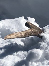
However we did ski upon a buried Bull Elk . Someone has been lucky to have his frozen dinner close by for the season. Hard to tell if this guys fate was met by and Avalanche or a wound from Hunting Season.

Weather: Calm , Sunny
Snowpack: Not too many changes from past observation , less whumphing and more facets.

Quiet On Snodgrass

CB Avalanche Center2017-18 Observations

Location: Crested Butte Area
Date of Observation: 01/17/2018
Name: Evan Ross

Subject: Quiet On Snodgrass
Aspect: North East
Elevation: 9,400-10,400. BTL

Avalanches:
Weather: Not a cloud in the sky and no wind.
Snowpack: Quiet out there. Not a single collapse. Kept it under 35 degrees and didn’t see any obvious signs to instability. The upper snowpack has lost a lot of strength and there wasn’t much mid-pack left. The bottom of the snowpack is still junk. Really its all junky. Even some wind boards were faceting out. Seems like you could trigger a slab somewhere were you found better mid-pack structure, but we sure didn’t find it during our short couple of runs. Thoroughly tested the snowpack with a number of head penetrator tests.

Photos:

Mountain Weather January 18, 2018

CB Avalanche CenterWeather

Date: 01/18/2018

Today is our last day of high pressure before the ridge axis shifts east and we fall under the influence of an approaching trough of low pressure for the weekend. This approaching trough is currently just off the Pacific Coast, and as it comes onshore tomorrow, we can expect strong southwest pre-frontal winds and an increase in clouds Friday night. Saturday afternoon into the evening looks like it will be our best window of precipitation during this storm, though snow showers should linger into Sunday.

  • Today

    High Temperature: 37
    Winds/Direction: 5 to 15, Northwest
    Sky Cover: Partly Cloudy
    Irwin Snow: 0
    Elkton Snow: 0
    Friend’s Hut Snow: 0

  • Tonight

    Low Temperature: 20, colder in the valley
    Winds/Direction: 5 to 15, West
    Sky Cover: Partly Cloudy
    Irwin Snow: 0
    Elkton Snow: 0
    Friend’s Hut Snow: 0

  • Tomorrow

    High Temperature: 39
    Winds/Direction: 10 to 20, gusting to 30, Southwest
    Sky Cover: Partly Cloudy
    Irwin Snow: 0
    Elkton Snow: 0
    Friend’s Hut Snow: 0

Mountain Weather January 17, 2018

CB Avalanche CenterWeather

Date: 01/17/2018

High pressure will carry us through tomorrow, keeping Crested Butte under a light northerly flow and some high thin clouds. By Thursday night, the ridge of high pressure will be to our east and we’ll see a strong southwest flow in advance of a weekend storm. This morning the models have slowed the timing of this storm, meaning it looks like the snow will begin on Saturday into Sunday.

  • Today

    High Temperature: 30
    Winds/Direction: 5 to 15, North
    Sky Cover: Mostly Clear
    Irwin Snow: 0
    Elkton Snow: 0
    Friend’s Hut Snow: 0

  • Tonight

    Low Temperature: 15, colder in the valleys
    Winds/Direction: 5 to 15, North
    Sky Cover: Clear
    Irwin Snow: 0
    Elkton Snow: 0
    Friend’s Hut Snow: 0

  • Tomorrow

    High Temperature: 38
    Winds/Direction: 5 to 15, Northwest
    Sky Cover: Partly Cloudy
    Irwin Snow: 0
    Elkton Snow: 0
    Friend’s Hut Snow: 0