Location: Paradise Divide Area
Date of Observation: 02/13/2018
Name: Ben Pritchett
Subject: Elkton Knob look about
Aspect: South East, South, South West, West, North West
Elevation: 9,400-11,300′
Avalanches:
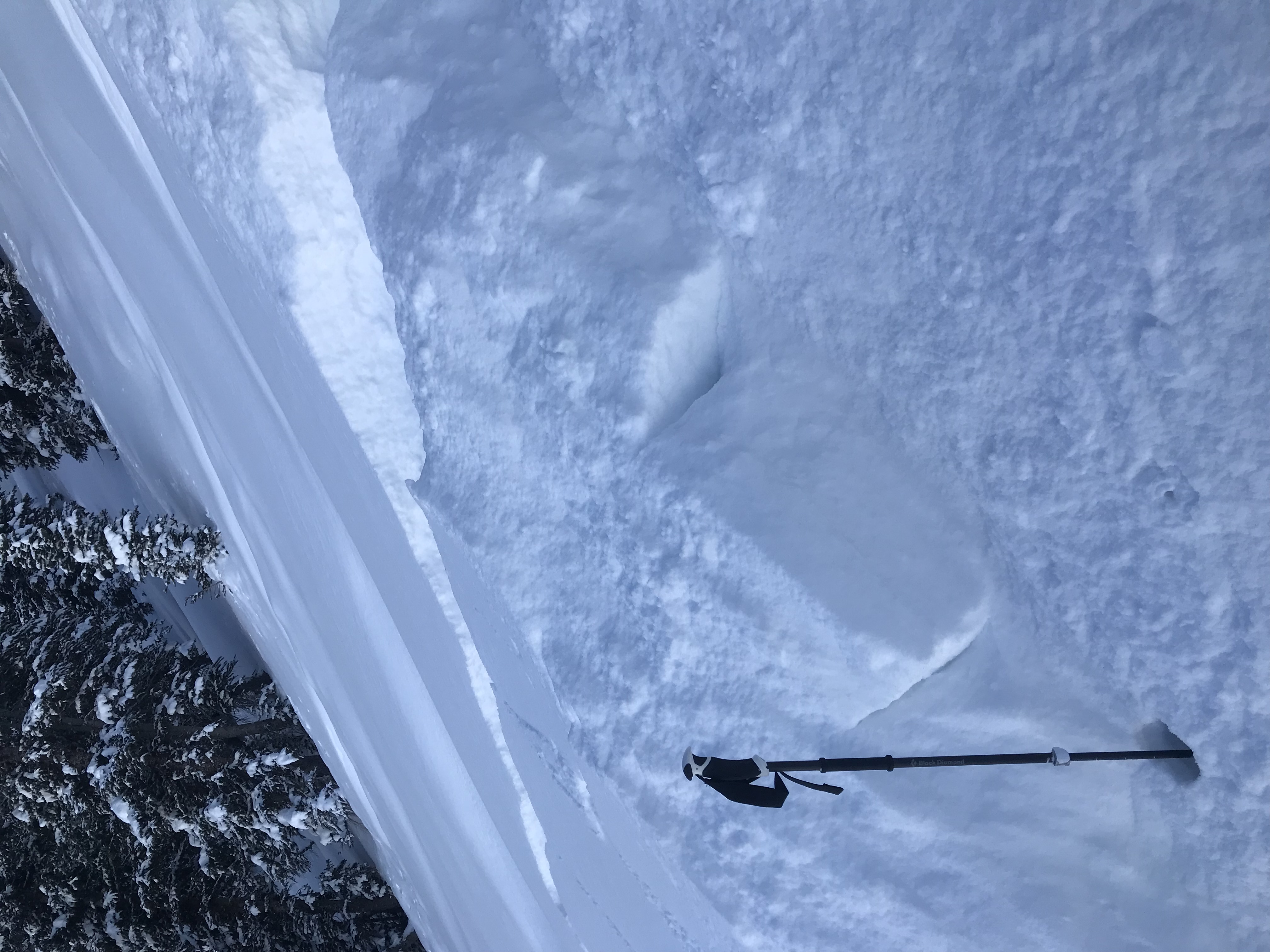
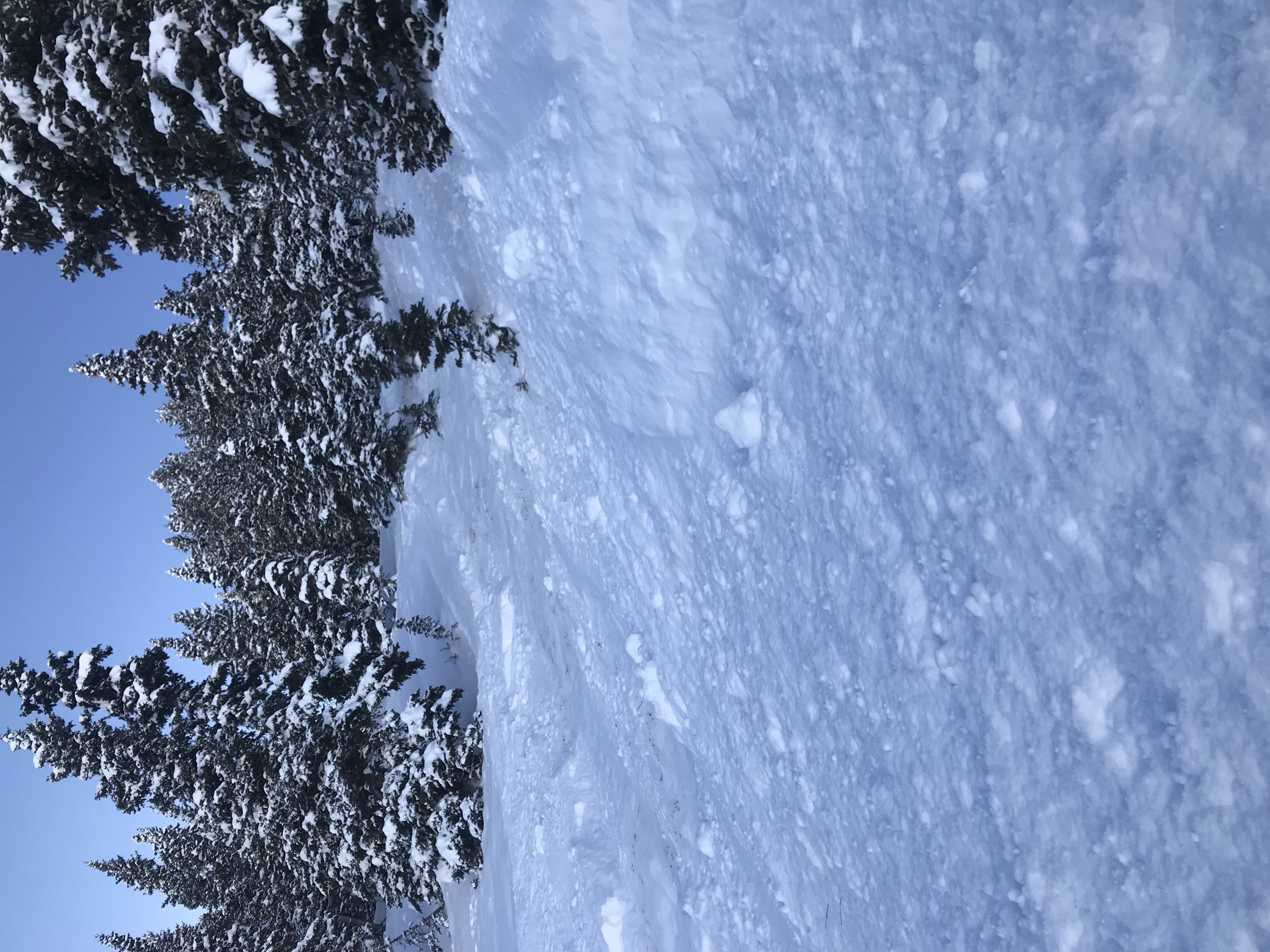
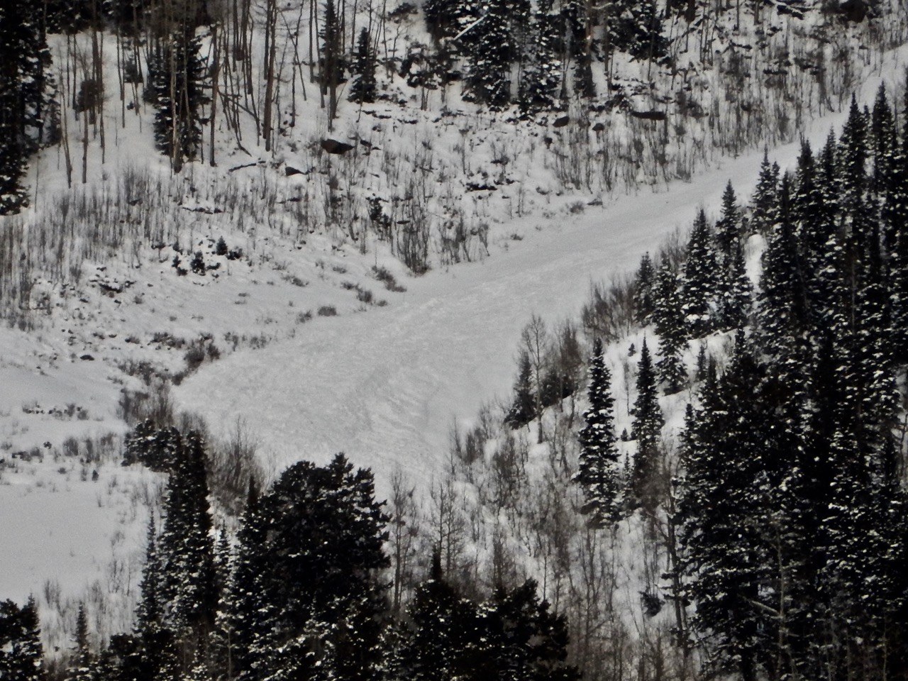
Generally poor visibility, but avalanche problems seemed spot on. Observed at least two D2 Persistent Slab avalanches that ran naturally, and numerous small Wind Slabs. One off Schuykill Ridge, one out of the Banana (patrol will provide more detail today).
Weather: Continuous snow showers all afternoon. Breaks in the clouds warmed the snow surface quickly, but the breaks were rare. HST 16″ w/ 1.7″ SWE. Steady light SW winds, picked up to Moderate around 4pm.
Snowpack: Surprisingly no cracking. Several deep grumbly rumbles in open meadows with the new load sitting on a crust on West aspects above 10,500′. On west and northwest aspects I went looking to see if the character and strength of the crust made an impact on propagation potential. Only ECTX results observed. Still lacking a good stiff slab below 10,500′, then the snowpack becomes more noisy above.
Lots of evidence of wind transport from the night of the 12th.
Photos:
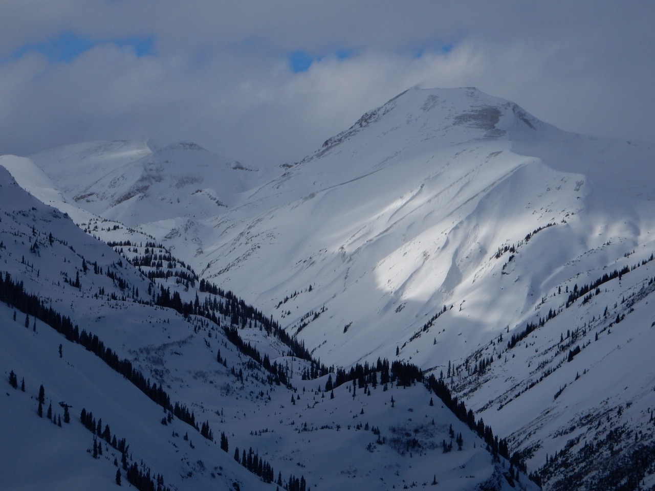
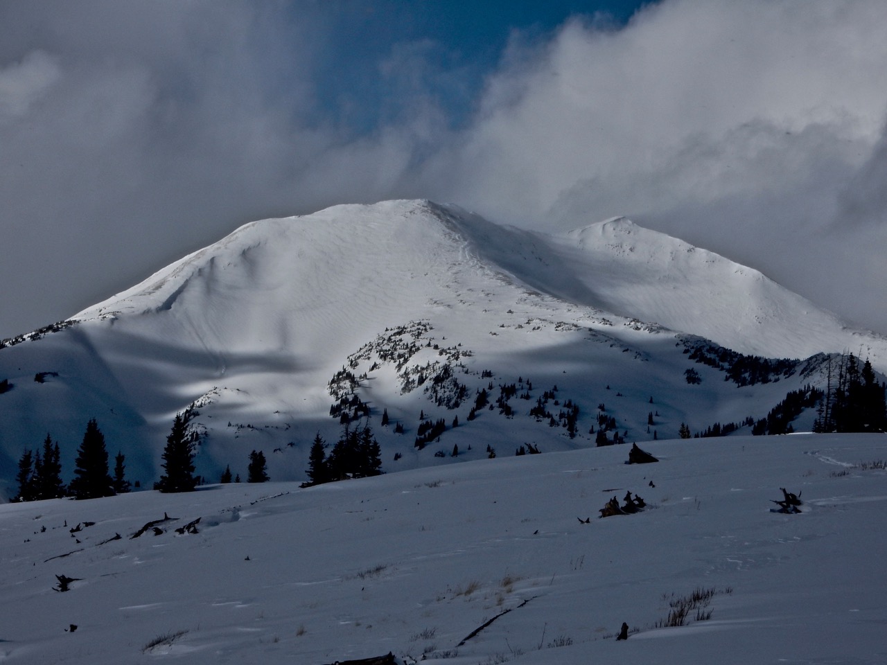
efficient loading on Treasury’s SW face, and that’s the windward side.
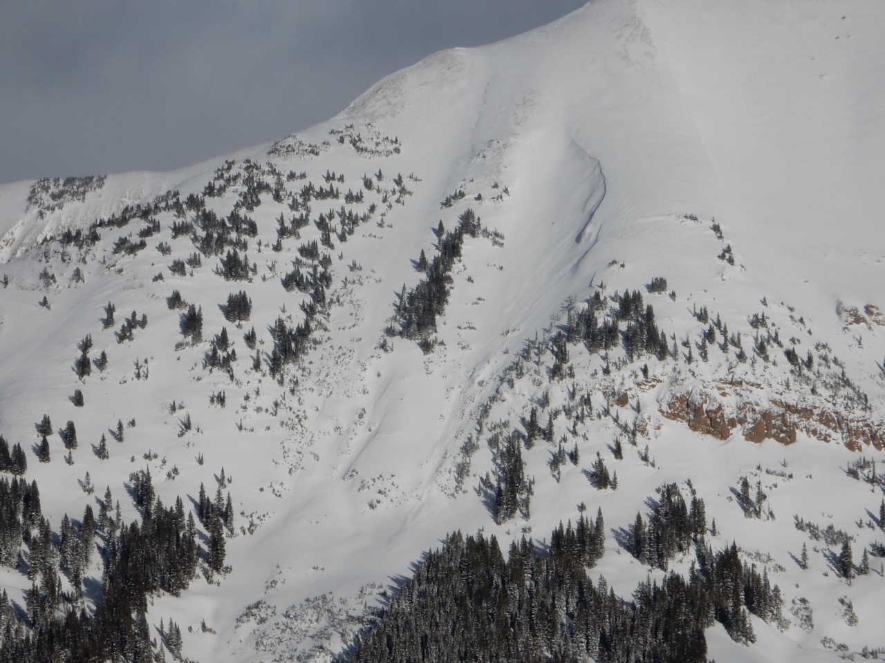
Efficient wind transport, Cinnamon Mtn. South Aspect
Efficient wind transport, Cinnamon Mtn. South Aspect
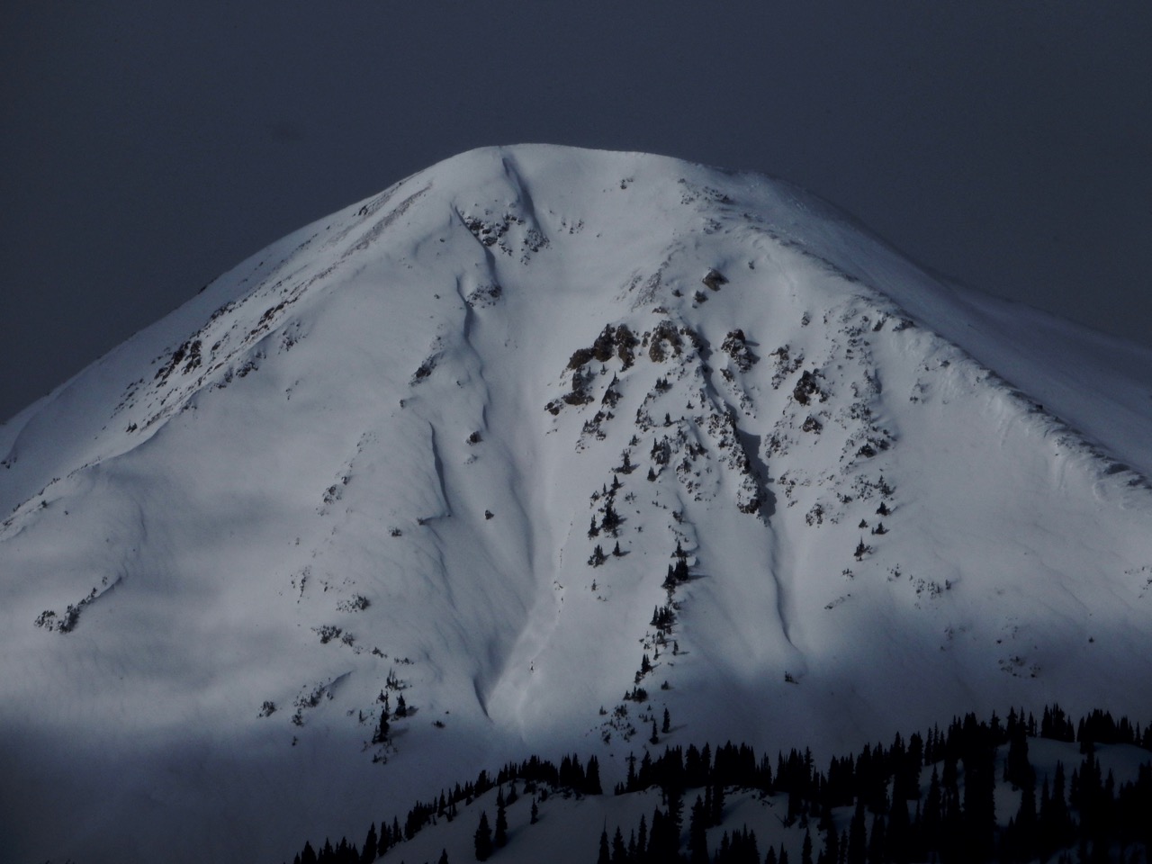
Efficient wind transport, Cinnamon Mtn. South Aspect

Generally poor visibility, but avalanche problems seemed spot on. Observed at least two D2 Persistent Slab avalanches that ran naturally, and numerous small Wind Slabs.
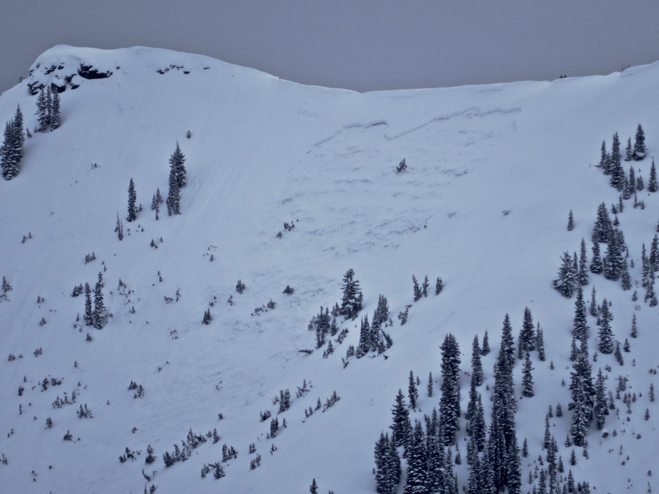
Generally poor visibility, but avalanche problems seemed spot on. Observed at least two D2 Persistent Slab avalanches that ran naturally, and numerous small Wind Slabs.
Generally poor visibility, but avalanche problems seemed spot on. Observed at least two D2 Persistent Slab avalanches that ran naturally, and numerous small Wind Slabs.