Location: Brush Creek Area
Date of Observation: 01/09/2019
Name: Evan Ross
Subject: Fun With Avalanches
Aspect: North, North East, East
Elevation: 9,500-10,800
Avalanches:
Ooo boy. This is going to be long.
The highlights: One bounce, producing a collapse, that remote triggered 1 x D2, 1 x D1.5, and slumped the snow off a another rock outcrop. Two other separate collapse each remote triggered a D2 and separate D1 at the same time. The furthest point from a human triggered collapse to the furthest point of a crown, measured on google earth, was about 2,200ft. Yea baby.
2 x SS-ASr-R1-D2-O, NE, BTL
1 x SS-ASr-R1-D2-O, E, BTL
4 x SS-ASr-R1-D1.5-O, NE, BTL
1 x SS-N-R1-D1.5-I, South, ATL. Fresh Natural today. Steep rocky terrain.
There were many more natural avalanches to D2.5 in size from the 1/6 cycle. Mainly on N to E facing aspects at BTL elevations. Other aspects and elevations had a few old Persistent Slabs, but most avalanches looked to have failed within the storm snow and were often confined to gully features or wind-loaded terrain.
Weather: High clouds hung around for much of the day. Calm wind. Warm temps.
Snowpack: The holiday slab is the slab… while the January 6th storm just added the load to tip the balance. The 1/6 storm snow was about 10 to 12″ in sheltered terrain at the elevations traveled. The 1/6 snow was very soft on NE and becoming moist on E, and other sunny slopes. The very weak NSF below the holiday slab was the layer of concern. This layer was failing in collapses and triggered avalanches, and those avalanches were either running at the interface or gouging to the ground. Boot pen to hip and ski pen about 25cm. HS in the 100-120cm range.
Collapses that produced human triggered avalanches were very very quiet and subtle. No shooting cracks where ever observed from the same area I got a collapses that remote triggered and avalanche. After a collapses, it was a long 10sec before remote triggered avalanches started running.
Photos:

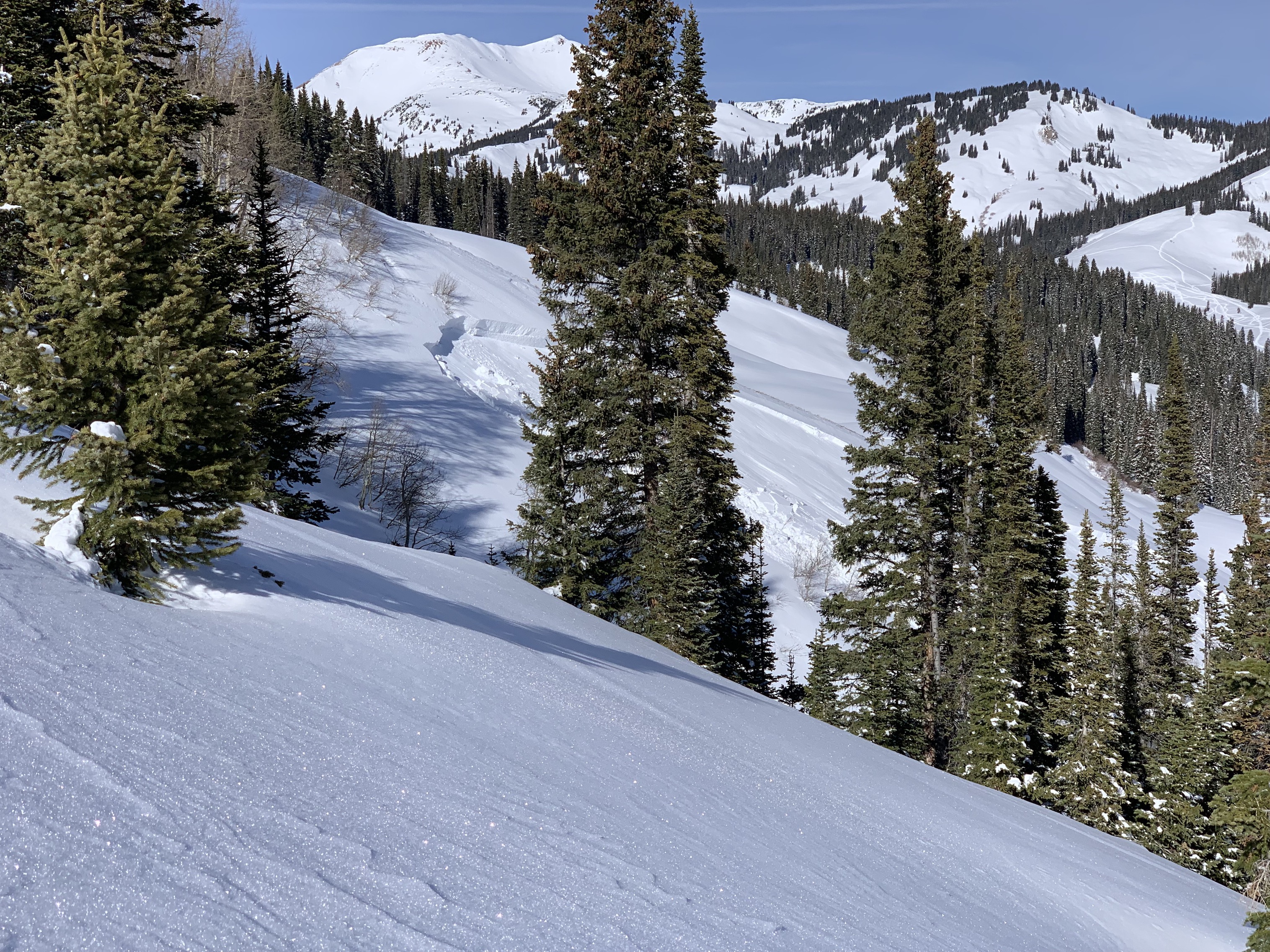
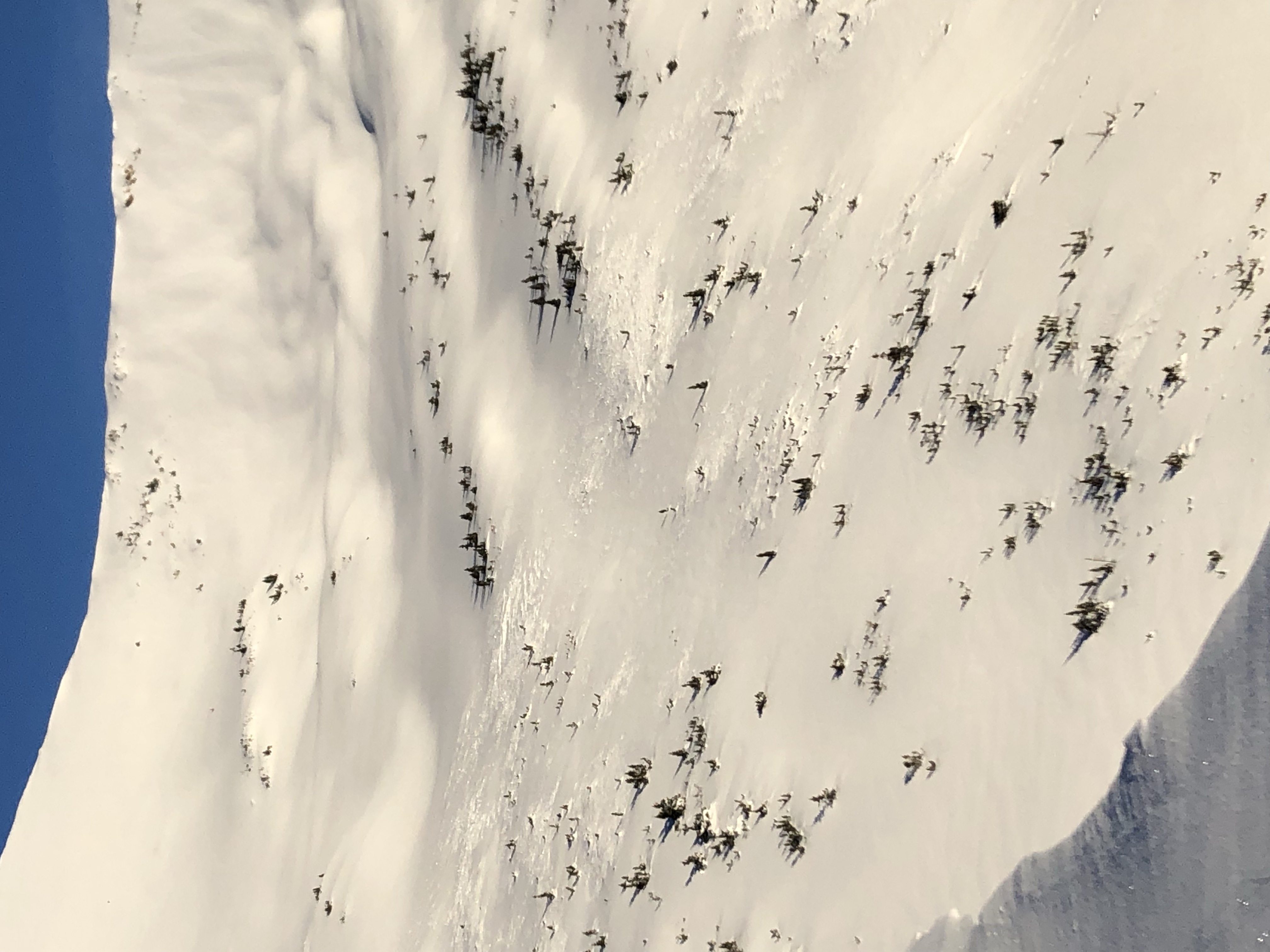
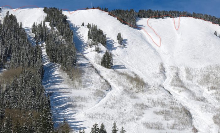
A collapse from where the picture was taken, slumped the snow off the rock in the foreground, released the d1.5 in the middle, and further released the D2 2,200ft away hidden in the back right of the photo. 
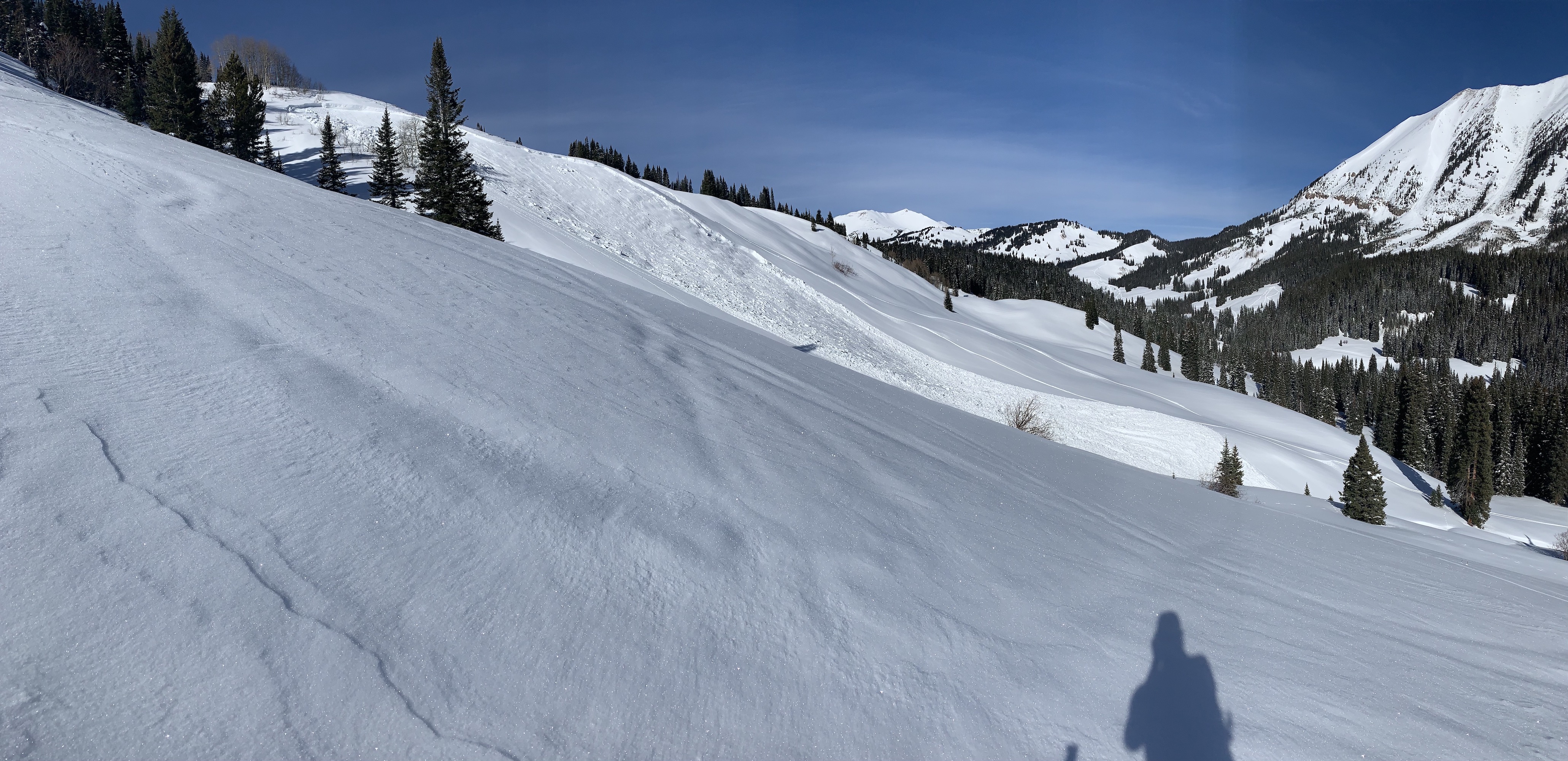
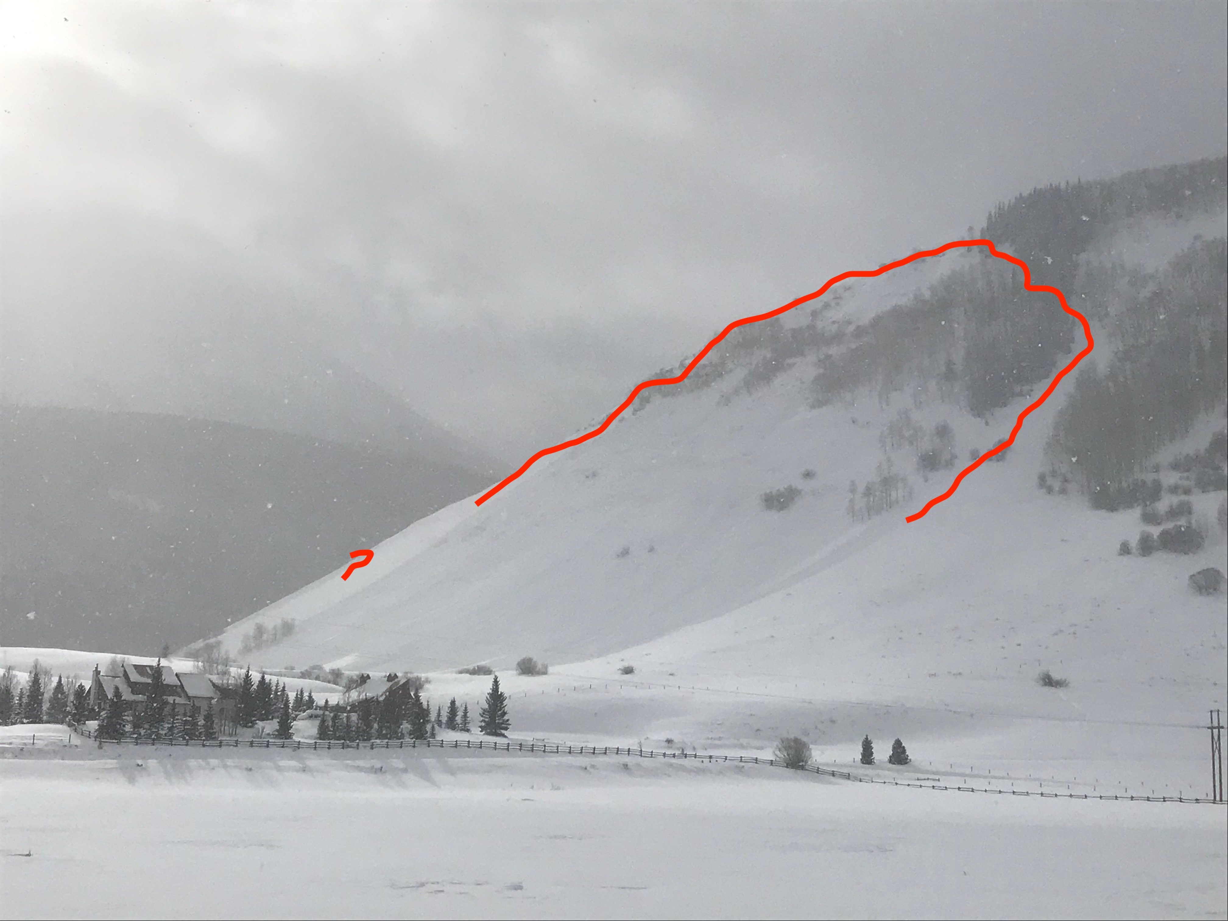
Another remote triggered D1 
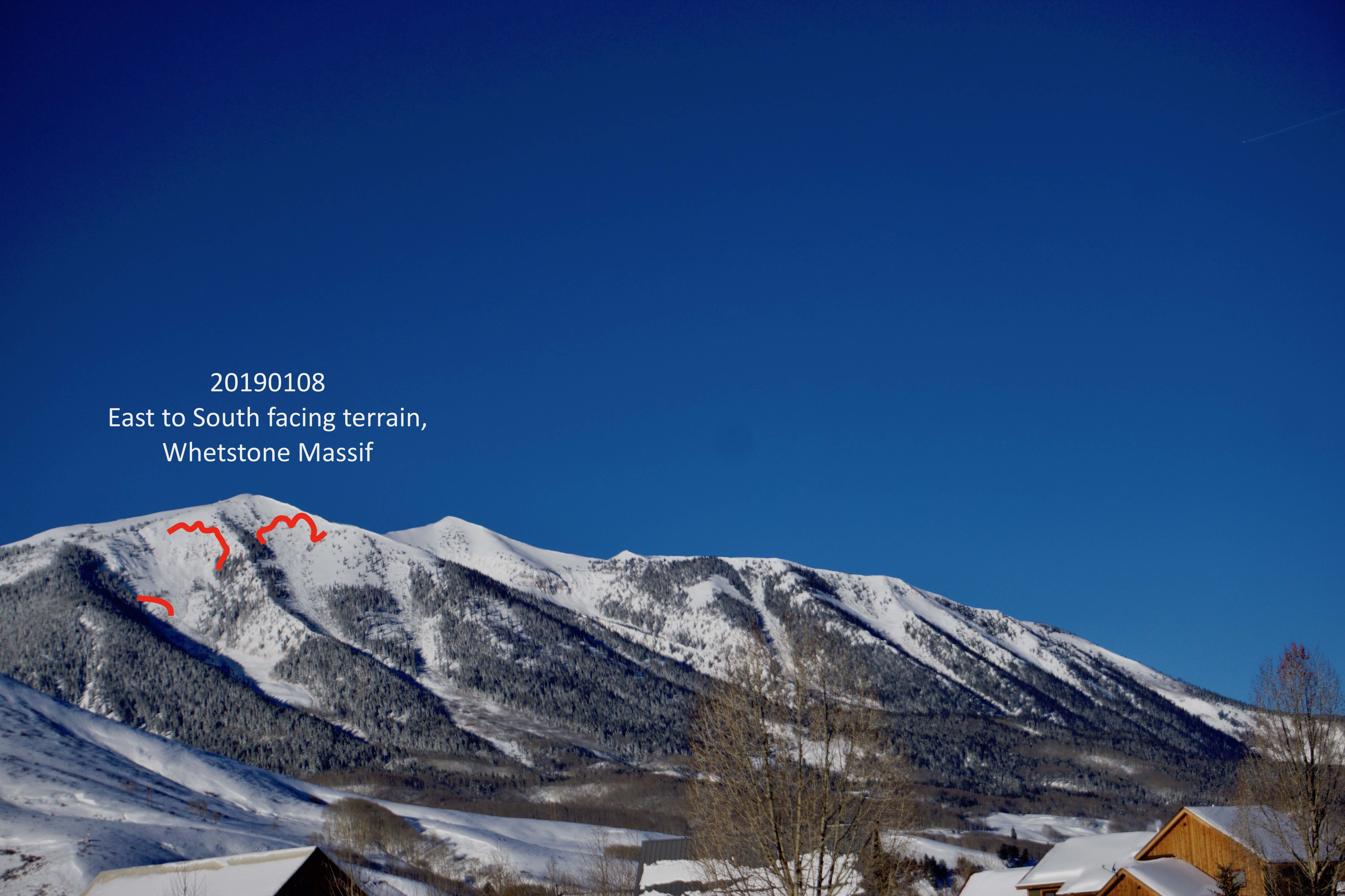
Old natural avalanche from the 1/6 cycle 
Fresh D1.5 today on the south side of Teo. 
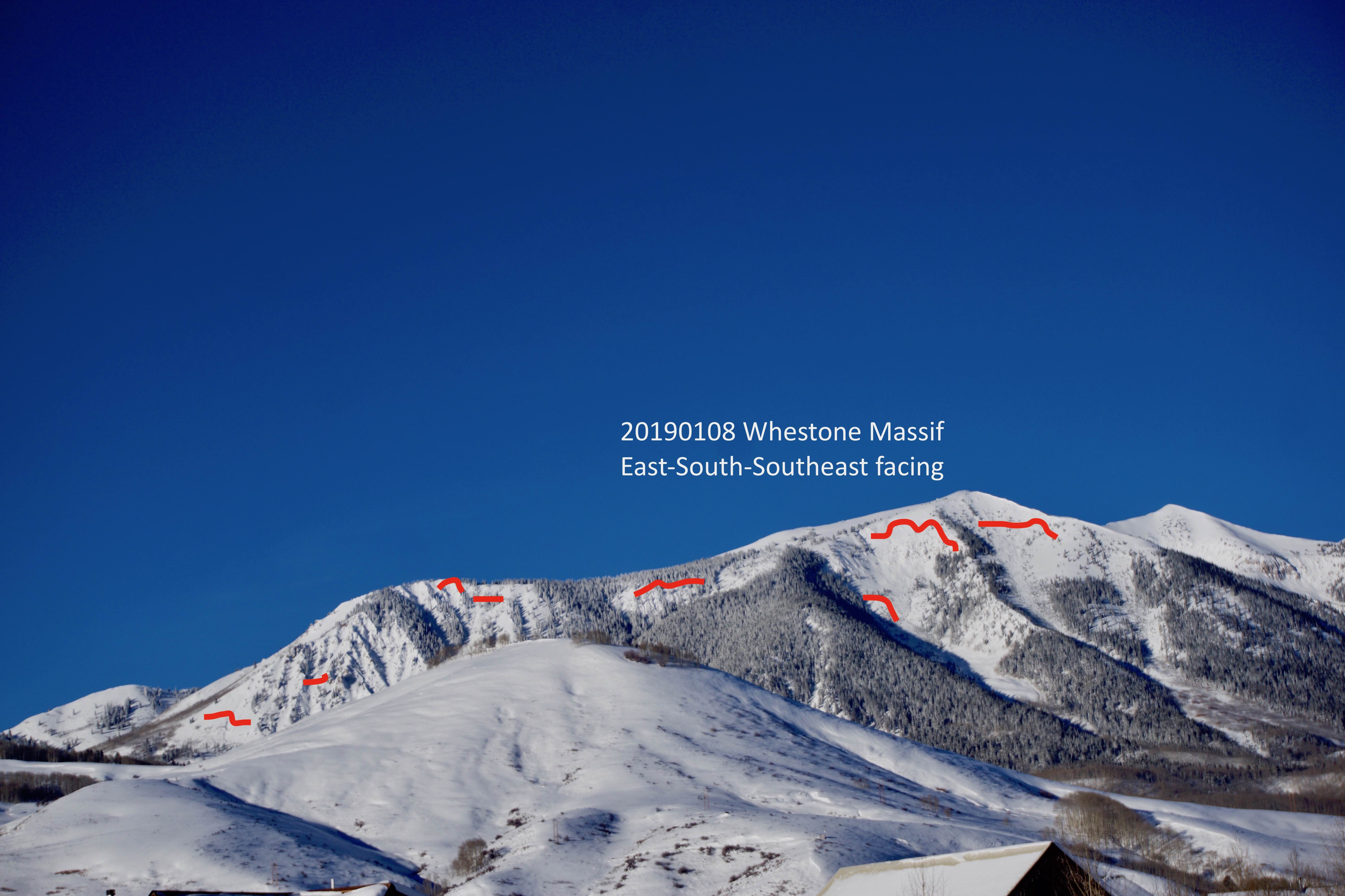
Destruction. BTL East. Natural avalanches from the 1/6 cycle 
Destruction. BTL East. Natural avalanches from the 1/6 cycle 
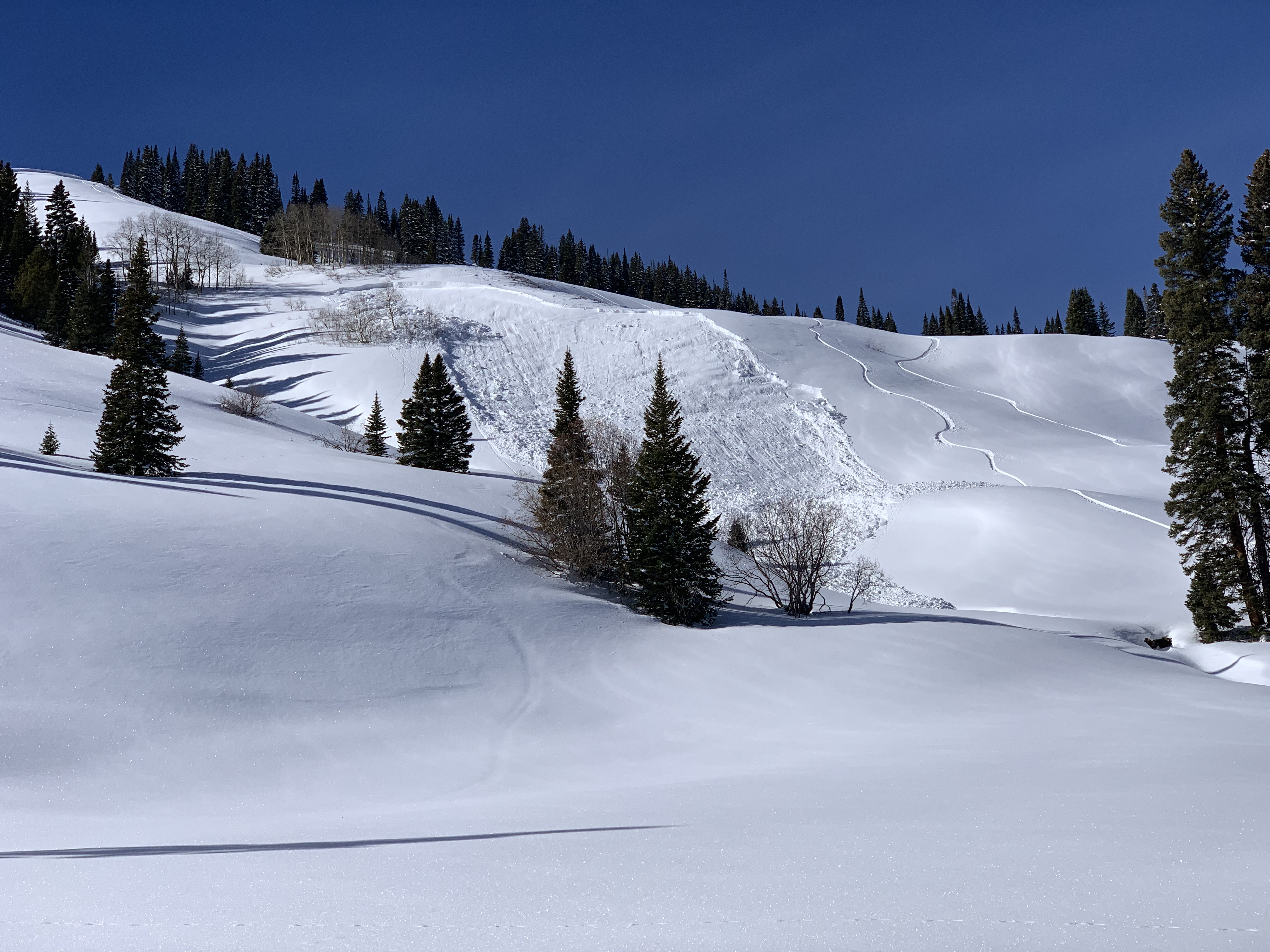
Remote Triggered D2 
Remote trigger D2 and D1, The foreground slab fractured but did not release until the bigger slab in the background overran the lower slope in the foreground. 
D2 from the 1/6 natural cycle E ATL 
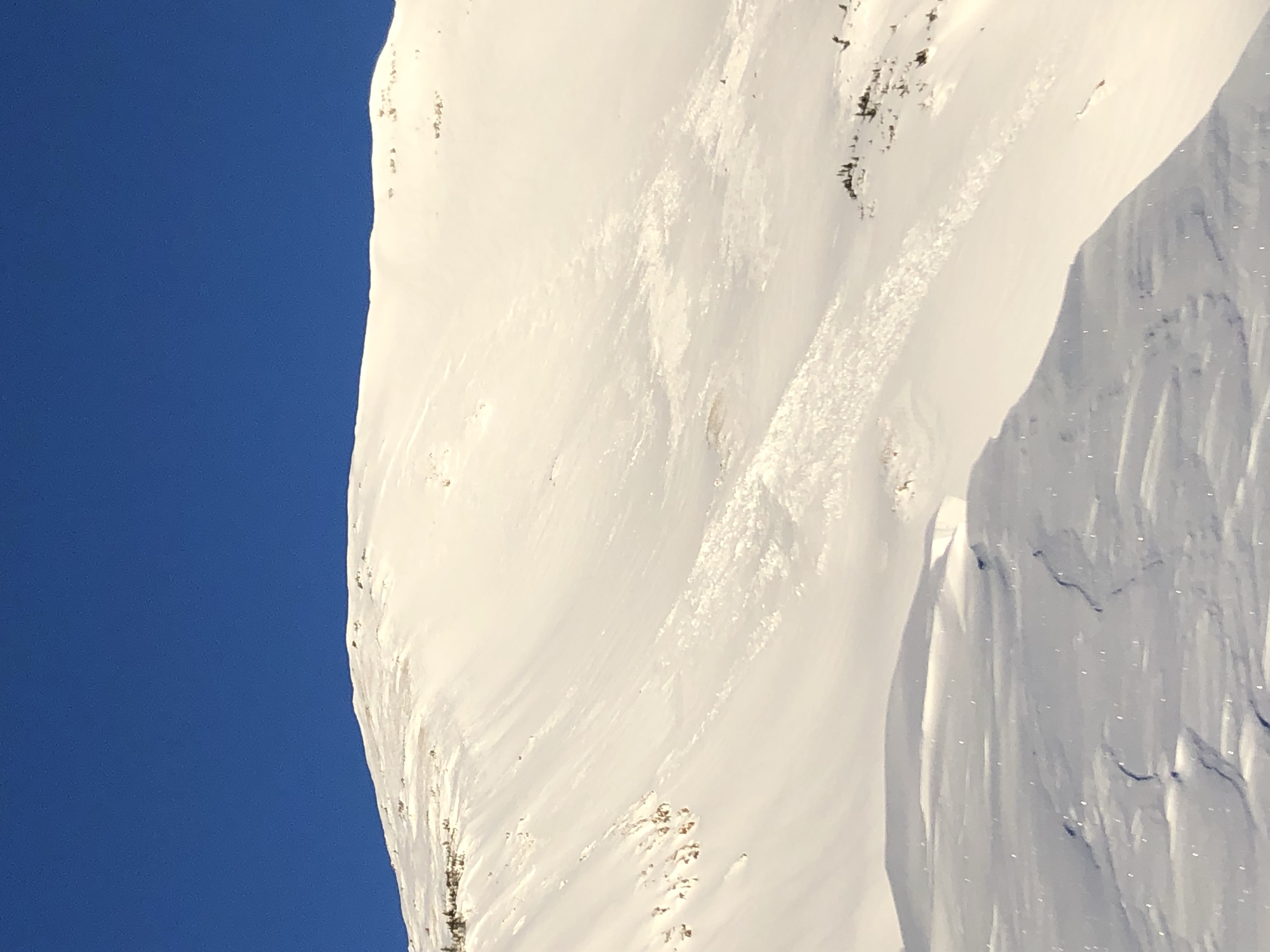
Better view of one of the wide propagating remote triggers.