Round Mt Avalanche

CB Avalanche Center2018-19 Observations

Location: Crested Butte Area
Date of Observation: 03/13/2019
Name: Zach Kinler

Subject: Round Mt Avalanche
Aspect: West
Elevation: 8,600-10,000

Avalanches:

WS-N-R2-D2-O

West aspect. Ran sometime late morning. Debris appears like wet slab debris with recent warm days and rain in last 24 hours.

Weather: S-1, wet snow, temps ~32F, strong NW winds blowing snow in exposed areas.

Snowpack: Thin and weak
Photos:

Round Mountain!

CB Avalanche Center2018-19 Observations

Location: Cement Creek Area
Date of Observation: 03/13/2019
Name: Cosmo Langsfeld

Subject: Round Mountain!
Aspect: West
Elevation:

Avalanches:

Avalanche on west side of Round Mtn. Same path above the highway that slid in early March (reported 3/3). Smaller volume of snow than the last slide there but ran almost as far. Debris looked fairly fresh as of midday 3/13.

Weather:

Snowpack:
Photos:

Mountain Weather for 11,000′

CB Avalanche CenterWeather

Date: 03/14/2019

The strong low pressure system has exited to the east as we are setting up for our first prolonged period of high pressure in the month of March, after a pretty epic start to the month. A cold Northwest flow moved in last night, bringing cold air which will fuel some lingering clouds and orographic over the Western portion of the mountains today, but any accumulations should be minimal. Winds are diminishing and moving to the North/Northwest keeping temperatures on the colder side of normal. Look for bright sunny skies tomorrow and rebounding temperatures as we head into the weekend and expect this to continue into the middle of next week.

  • Today

    High Temperature: 15
    Winds/Direction: Northwest 10-15 mph
    Sky Cover: Partly Cloudy
    Irwin Snow: 1-3″
    Elkton Snow: 0-2″
    Friend’s Hut Snow: 0-2″

  • Tonight

    Low Temperature: 0
    Winds/Direction: Northwest 5-10 mph
    Sky Cover: Mostly Clear
    Irwin Snow: 0
    Elkton Snow: 0
    Friend’s Hut Snow: 0

  • Tomorrow

    High Temperature: 21
    Winds/Direction: West 5-10 mph
    Sky Cover: Clear
    Irwin Snow: 0
    Elkton Snow: 0
    Friend’s Hut Snow: 0

Large Whetstone Natural – North/NW

CB Avalanche Center2018-19 Observations

Location: Crested Butte Area
Date of Observation: 03/13/2019
Name: Scott Hetherington

Subject: Large Whetstone Natural – North/NW
Aspect: North, North West
Elevation: ~12000′

Avalanches:

Looks like a very large natural slide on Whetstone. Too far away to estimate crown height. Almost looks like it went to ground, perhaps on the buried persistent slab. Estimated it ran sometime, late morning, early afternoon of 3/13. Sorry about the low quality pic.

Weather: Overcast, Snowing Light to Moderate, Observed winds SSW, gusts to 20 mph at 8800′

Snowpack: No obs

Photos:

Poverty Gulch

CB Avalanche Center2018-19 Observations

Location: Paradise Divide Area
Date of Observation: 03/12/2019
Name: ESN

Subject: Poverty Gulch
Aspect: South West, West
Elevation: 9-11k

Avalanches:

South and south west aspects of Purple Ridge slid full track. Hundreds of trees destroyed, ski lines altered. Workshop destroyed, no injuries, no one was in the vicinity last Wednesday-Thursday when avalanches occurred.

Weather: Snowing

Snowpack:
Photos:

Mountain Weather for 11,000ft

CB Avalanche CenterWeather

Date: 03/13/2019

To our south is the low-pressure system that has been mentioned for several days now; it will continue to slowly move eastward as a trough moves down from the northwest. The two will combine to form one strange storm in eastern Colorado and Kansas. Weather geeks are having a field day with this setup. For today you can expect moderate to heavy snowfall with accumulations ranging from 8″ to 12″. Strong NW winds will be associated with this system and will blow the new snow around. Temperatures will drop throughout the day and will be below average by tomorrow morning. Skies will begin to clear on Thursday and dry weather will set in through the weekend.

  • Today

    High Temperature: 20 to 25
    Winds/Direction: 15 to 25 G40, NW
    Sky Cover: Overcast
    Irwin Snow: 7 to 10″
    Elkton Snow: 7 to 10″
    Friend’s Hut Snow: 3 to 5″

  • Tonight

    Low Temperature: 4 to 9
    Winds/Direction: 12 to 22, NW
    Sky Cover: Overcast
    Irwin Snow: 1 to 4″
    Elkton Snow: 1 to 4″
    Friend’s Hut Snow: 0 to 2″

  • Tomorrow

    High Temperature: 19 to 24
    Winds/Direction: 6 to 16, NW
    Sky Cover: Mostly Cloudy
    Irwin Snow: 0 to 1″
    Elkton Snow: 0 to 1″
    Friend’s Hut Snow: 0 to 1″

Brush Creek and wet slabs near town?

CB Avalanche Center2018-19 Observations

Location: Brush Creek Area
Date of Observation: 03/12/2019
Name: Eric Murrow

Subject: Brush Creek and wet slabs near town?
Aspect: North, North East, East, South East
Elevation: 8,900-10,000

Avalanches:

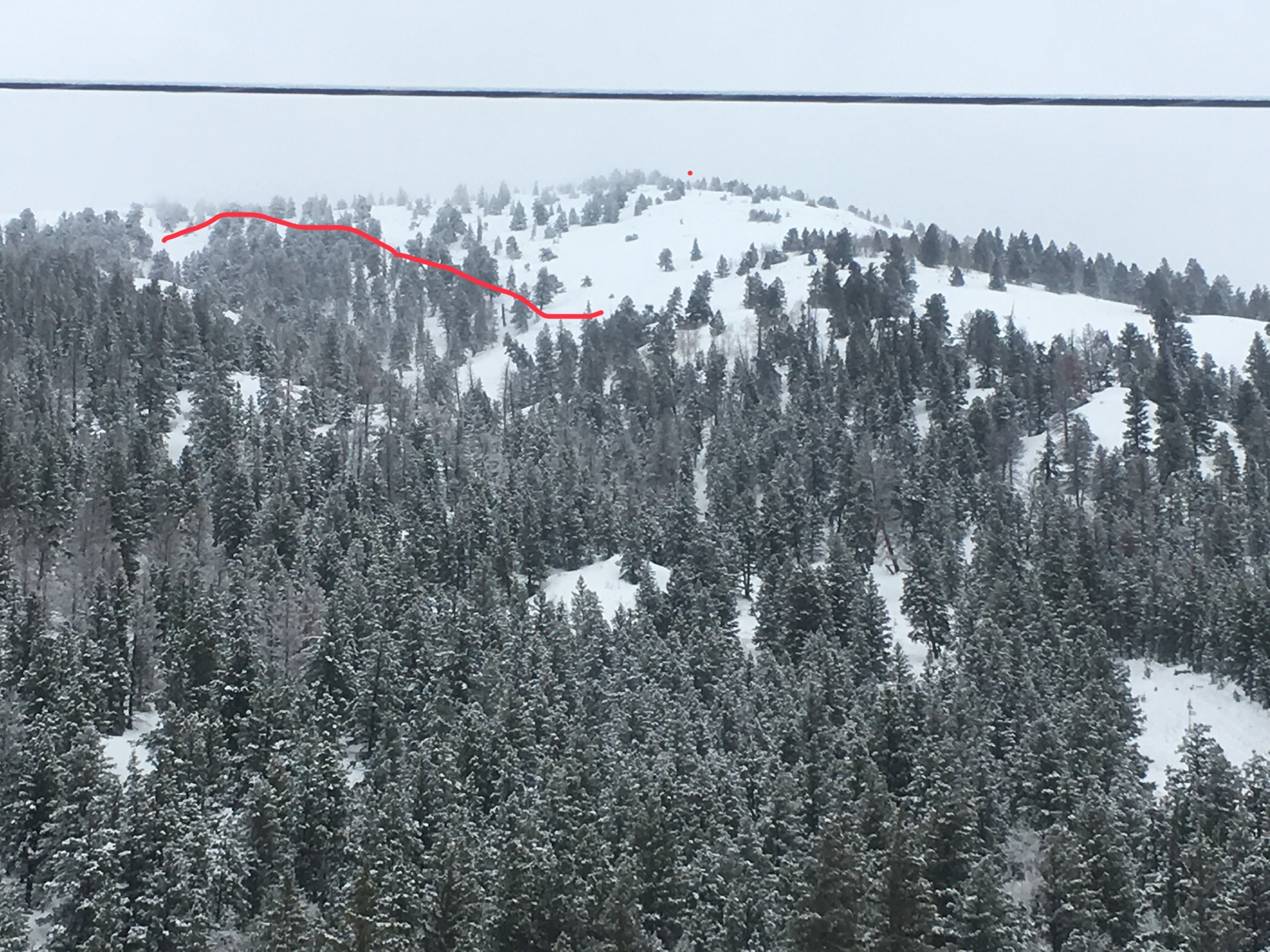
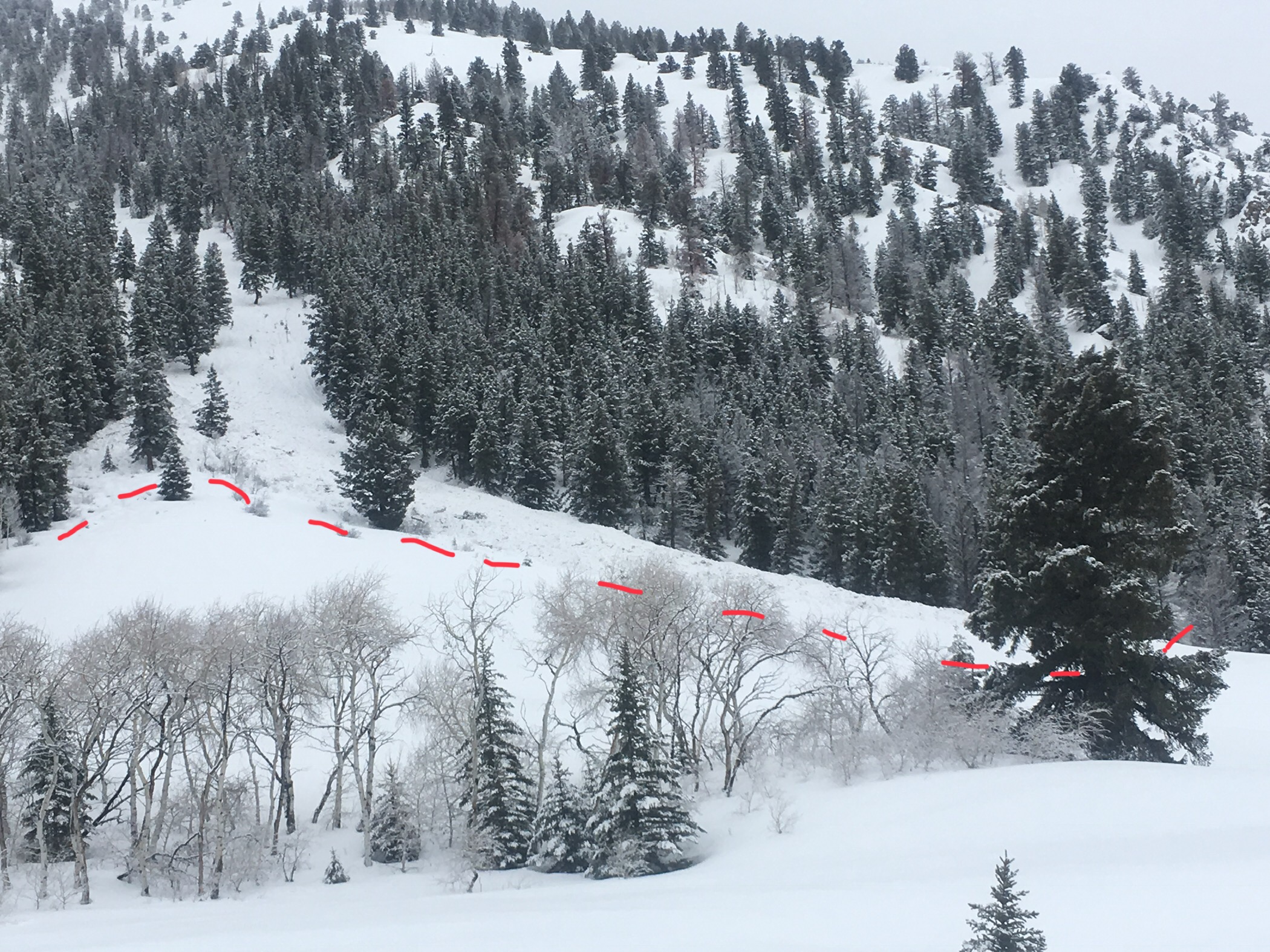
Numerous BTL avalanches around the compass. Most of these looked to have failed around 3/7 and a few failed around 3/1-3/3 period. Shallest areas failed in basal facets and deeper locations looked to have failed at the new/old interface. Some crowns on sunny slopes propagated impressive distance through aspen forests.

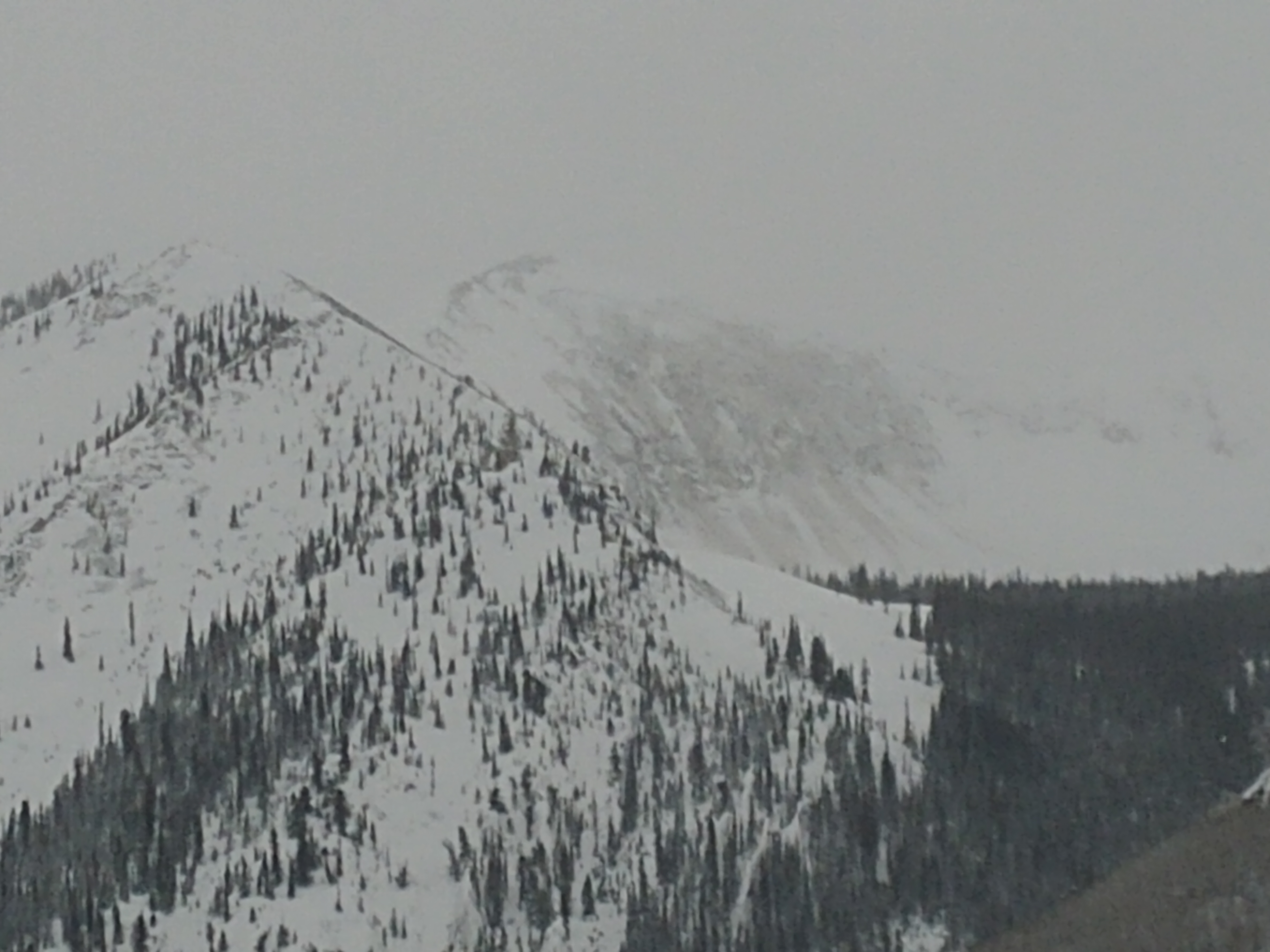
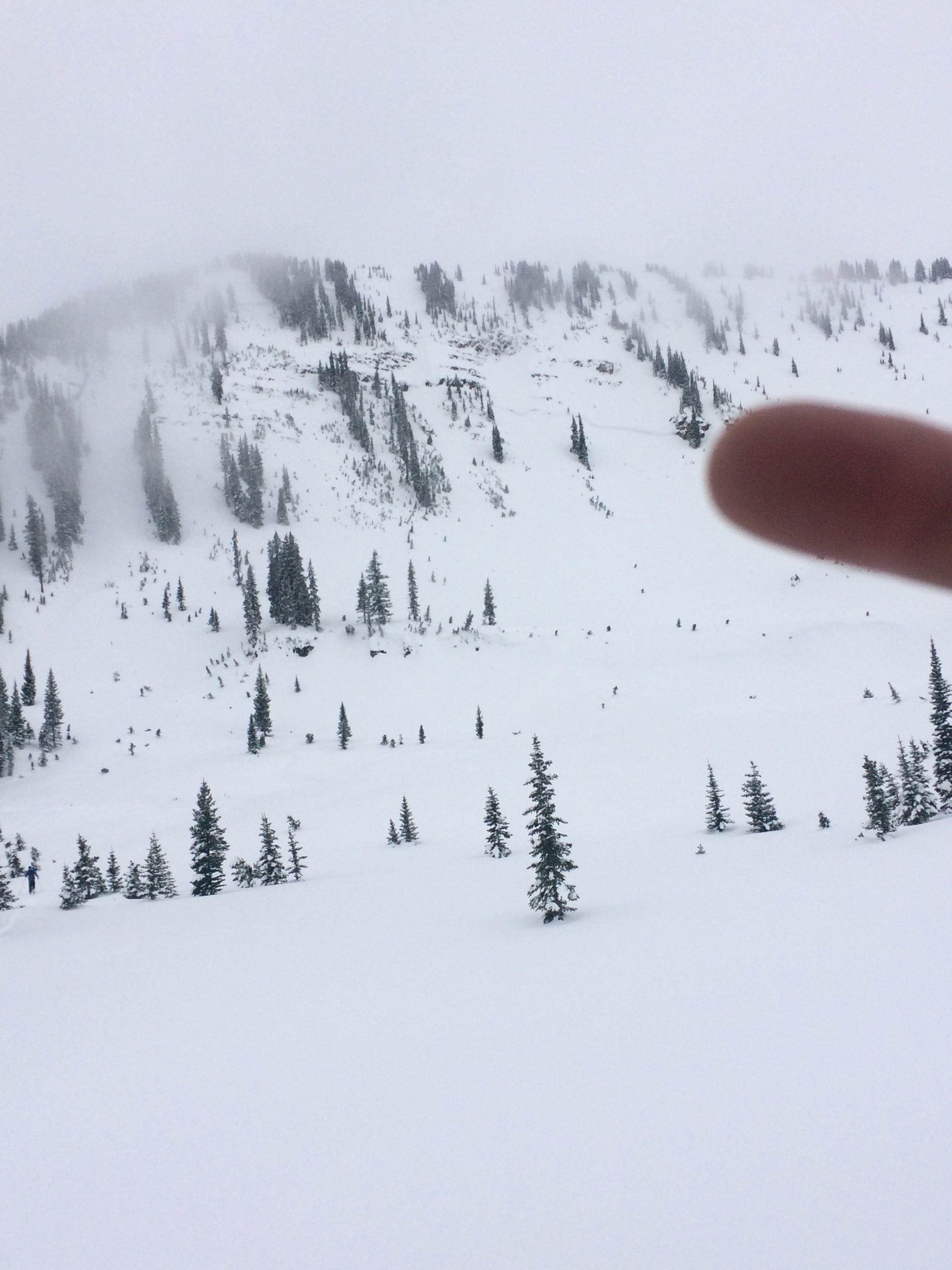
When we returned to Crested Butte at about 445-noticed Gibson Ridge failed during the day, D2 (see photo). This slope had avalanches earlier in the season. From talking to others it appears as though it failed sometime maybe in the afternoon around 4pm. Additionally, another low elevation avalanche failed at a similar time. Air temperatures were in the mid 30’s at this time with light sprinkles of rain. I would guess that these were wet slabs.

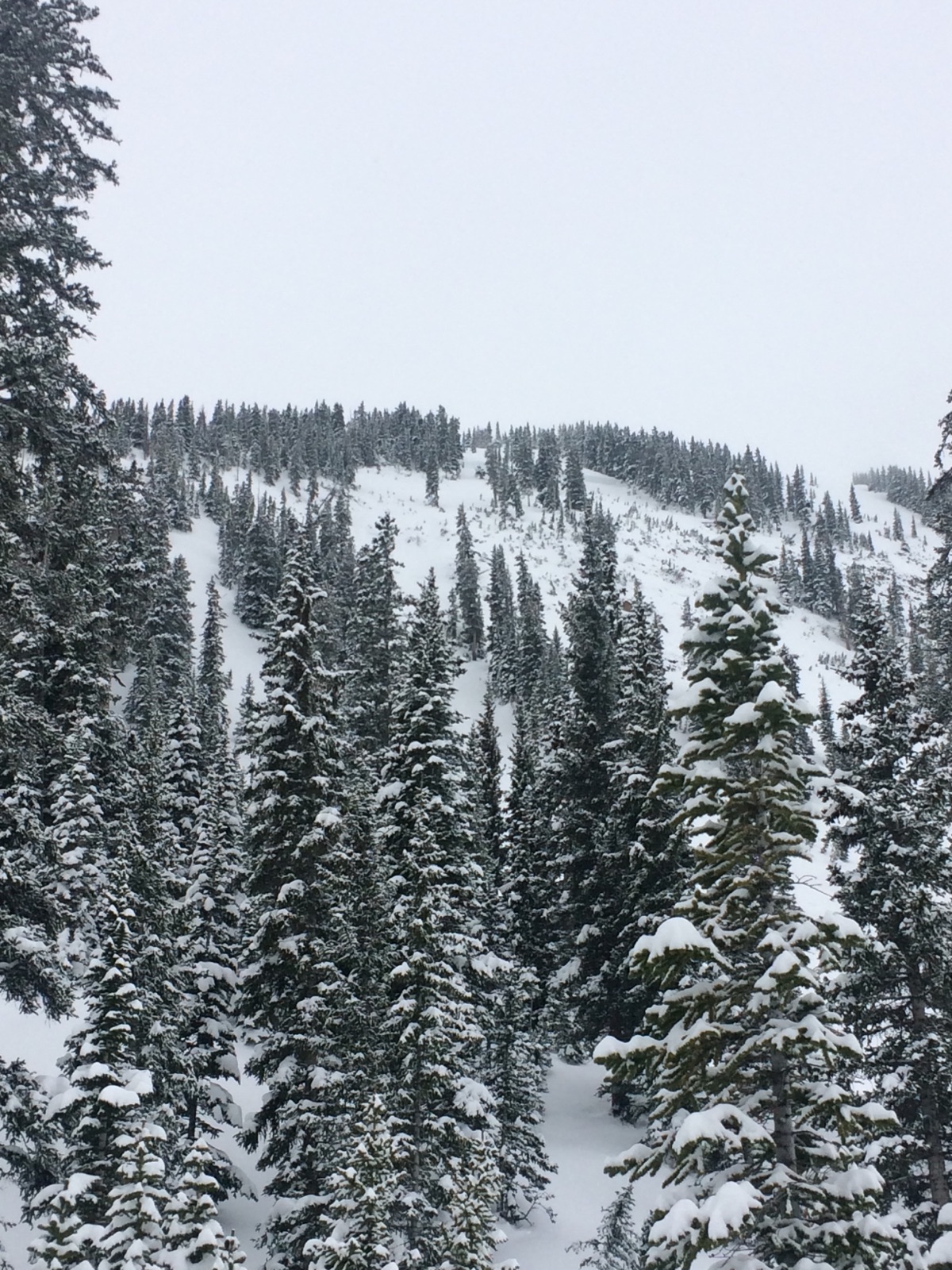
Weather: Day started off with moderate snowfall before 10am but tapered off. Overcast skies with increasing temps during the day to above freezing at 10,000′

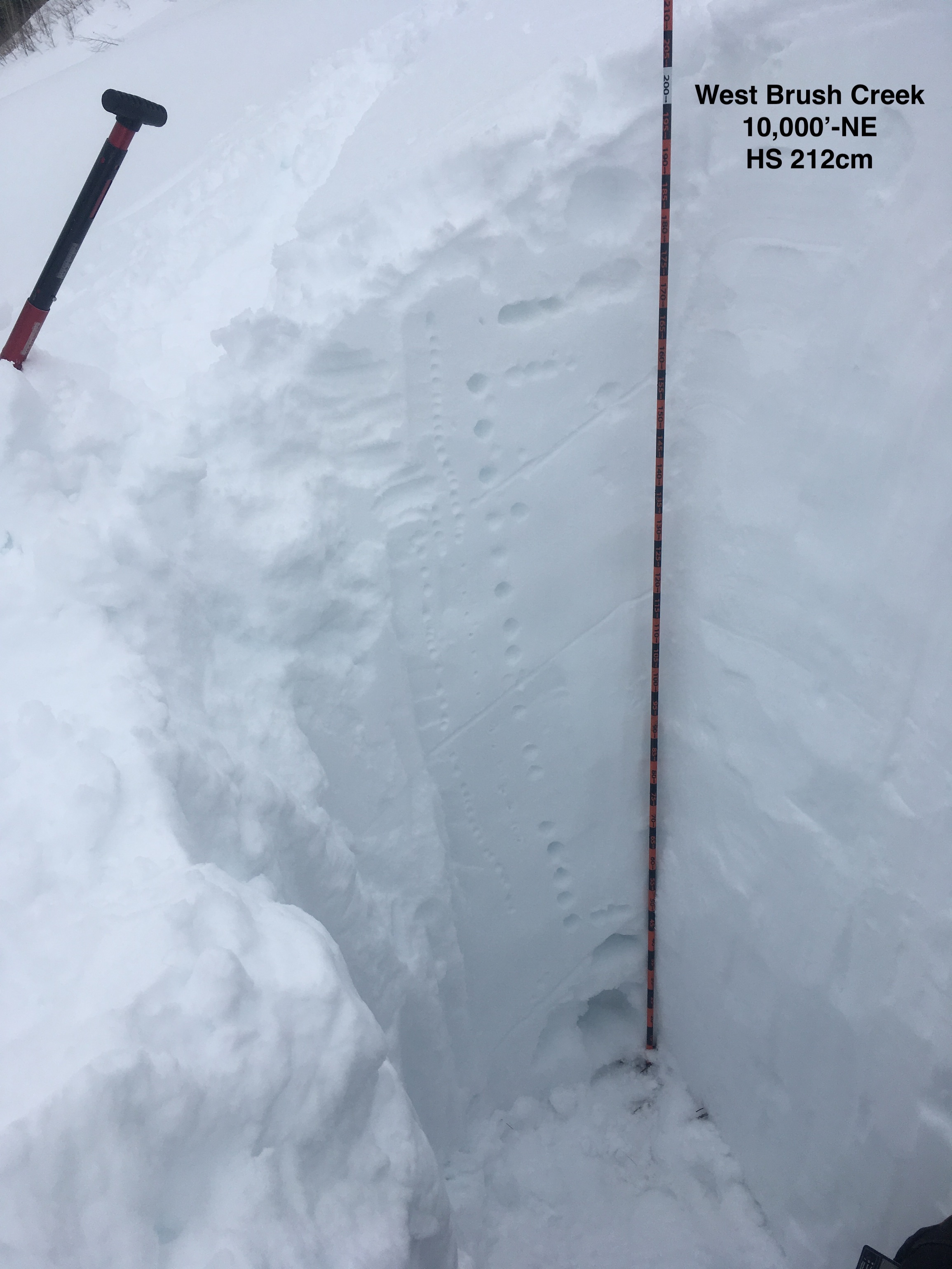
Snowpack: Went out lower Brush Creek and West Brush Creek. Poked a couple of holes. Lower Brush Creek near valley bottoms at 9,200′ had HS around 160cm. West Brush Creek at 10,000′ HS around 210cm. Main Brush Creek area was a SE slope – here the layer of concern were well developed basal facets. February and March snowfalls have created a thick slab just over a meter thick. Crusts in the mid-pack did not show much sign of faceting above or below.  No concerning test results in upper snowpack – there looked to be a little faceting above and below dense rain-wetted snow from 3/6 down about 30cm – ECTN.
West Brush snow volumes increased quickly as we ascended the valley to HS of 210cm. NE facing slope at 10,000′ had one layer of buried near surface facets down about a meter but they are rounding- ECTX. Even hammering on column and smashing block produced no result on mid-pack weak layer. Basal facets in bottom 50cm of snowpack here were F to 4f hard and looked like the layer of concern for full depth slopes without previous avalanches. Top 15cm of this shady slope was moist to wet right at surface.
In these shallow parts of forecast area, basal weak layers were between 100 and 150cm below the surface.

Photos:

Carnage

CB Avalanche Center2018-19 Observations

Location: Paradise Divide Area
Date of Observation: 03/12/2019
Name: Than

Subject: Carnage
Aspect: North, North East, South West
Elevation: BYL

Avalanches:

Tons of them from the past two days. Good ones off of the south and southwest facing slopes with two larger ones that crossed the Slate River Road, especially by the cattle guard/cow camp area.
Several off of northeast and north facing slopes, some out in the open and some deep in the timber. Crowns estimated to be anywhere from 4 to 6 feet.

Weather: Light snow interrupted by short bursts of heavy snow

Snowpack: 4-5 inches of new lighter snow from Monday night, ski pen 8-10 inches skiing, 14 inches skinning.
Photos:

Red Lady Glades

CB Avalanche Center2018-19 Observations

Location: Kebler Pass Area
Date of Observation: 03/12/2019
Name: Will Nunez

Subject: Red Lady Glades
Aspect: South East, South
Elevation: 9,500-12,000

Avalanches:

No instabilities other than the old crowns and debris piles for this past week historical cycle.

Weather: Overcast, steady S1 from 8:00-11:00pm, calm winds SW, strong solar around noon.

Snowpack: New snow ranged from 3-5″, the pack supported a great ski quality on low angle slopes with a ski pen 10cm and a boot pen at 20cm. HS ranged for 230-290cm.
Photos:

Mountain Weather for 11,000ft

CB Avalanche CenterWeather

Date: 03/12/2019

The closed low-pressure system continues to inch its way slowly on to land near Baja. Heavy southerly flow is pushing moisture into the area with an inch or so around CB this morning. Light to moderate snowfall looks to continue during the day. Late on Tuesday and early Wednesday morning, a second system will drop down out of the northwest bringing cold air and will combine with the closed low near Colorado. This merging will help produce snowfall into Wednesday for the area and will bring a change in wind direction from the northwest and a dramatic increase in wind speeds. Total accumulations by Wednesday night will range from 10 to 18 inches across the mountains surrounding Crested Butte. As this merging system moves out, we will be left with below average temperatures on Thursday.

  • Today

    High Temperature: 30 to 35
    Winds/Direction: 4 to 14, S
    Sky Cover: Overcast
    Irwin Snow: 4 to 6″
    Elkton Snow: 4 to 6″
    Friend’s Hut Snow: 4 to 6″

  • Tonight

    Low Temperature: 19 to 24
    Winds/Direction: 8 to 18, SSW
    Sky Cover: Overcast
    Irwin Snow: 1 to 3″
    Elkton Snow: 1 to 3″
    Friend’s Hut Snow: 1 to 3″

  • Tomorrow

    High Temperature: 24 to 29
    Winds/Direction: 12 to 22 G40, NW
    Sky Cover: Overcast
    Irwin Snow: 5 to 7″
    Elkton Snow: 5 to 7″
    Friend’s Hut Snow: 2 to 4″