Greenhousin’ and wet snow

CB Avalanche Center2018-19 Observations

Location: Kebler Pass Area
Date of Observation: 04/02/2019
Name: Eric Murrow & Zach Kinler

Subject: Greenhousin’ and wet snow
Aspect: North, North East, East, South East, South
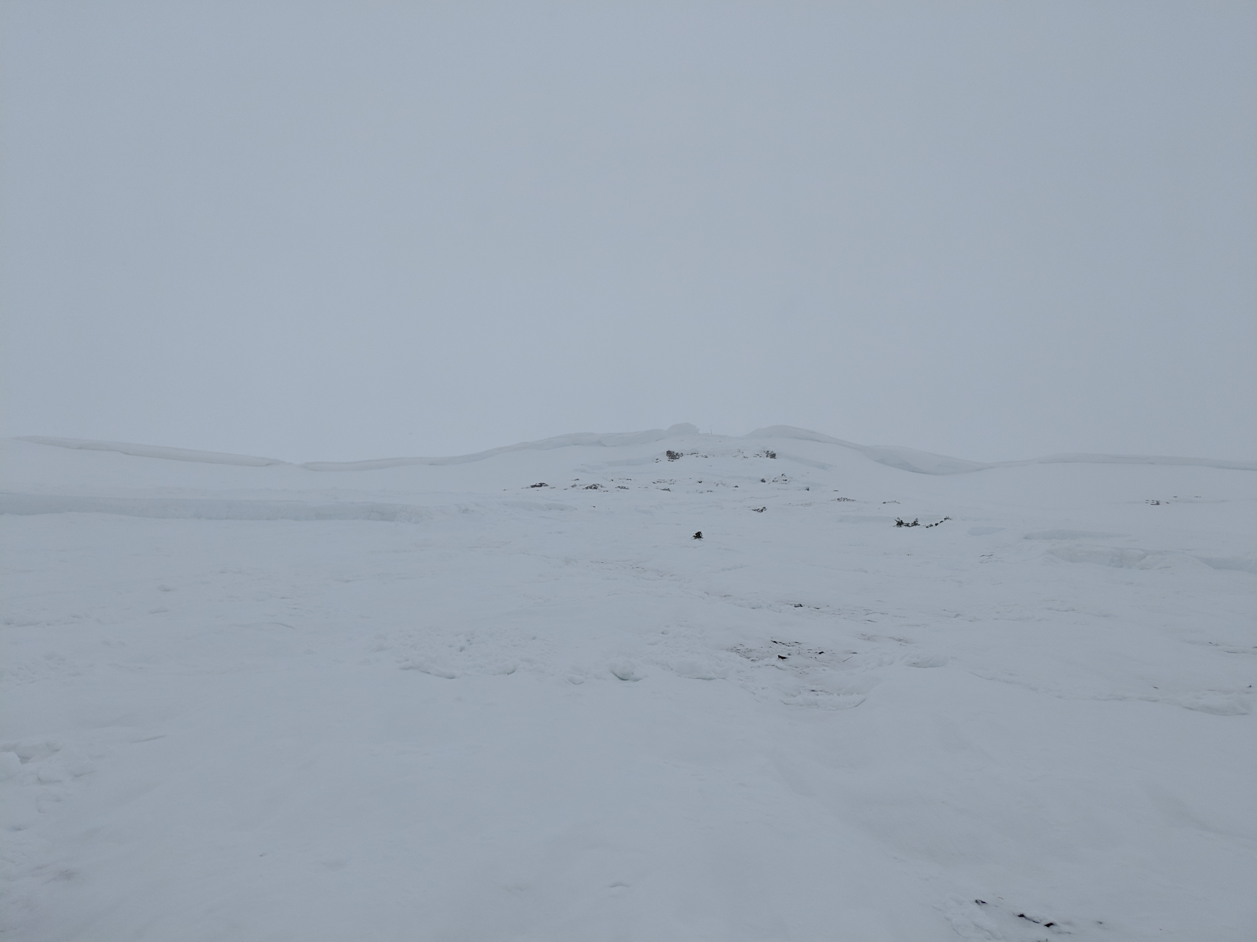
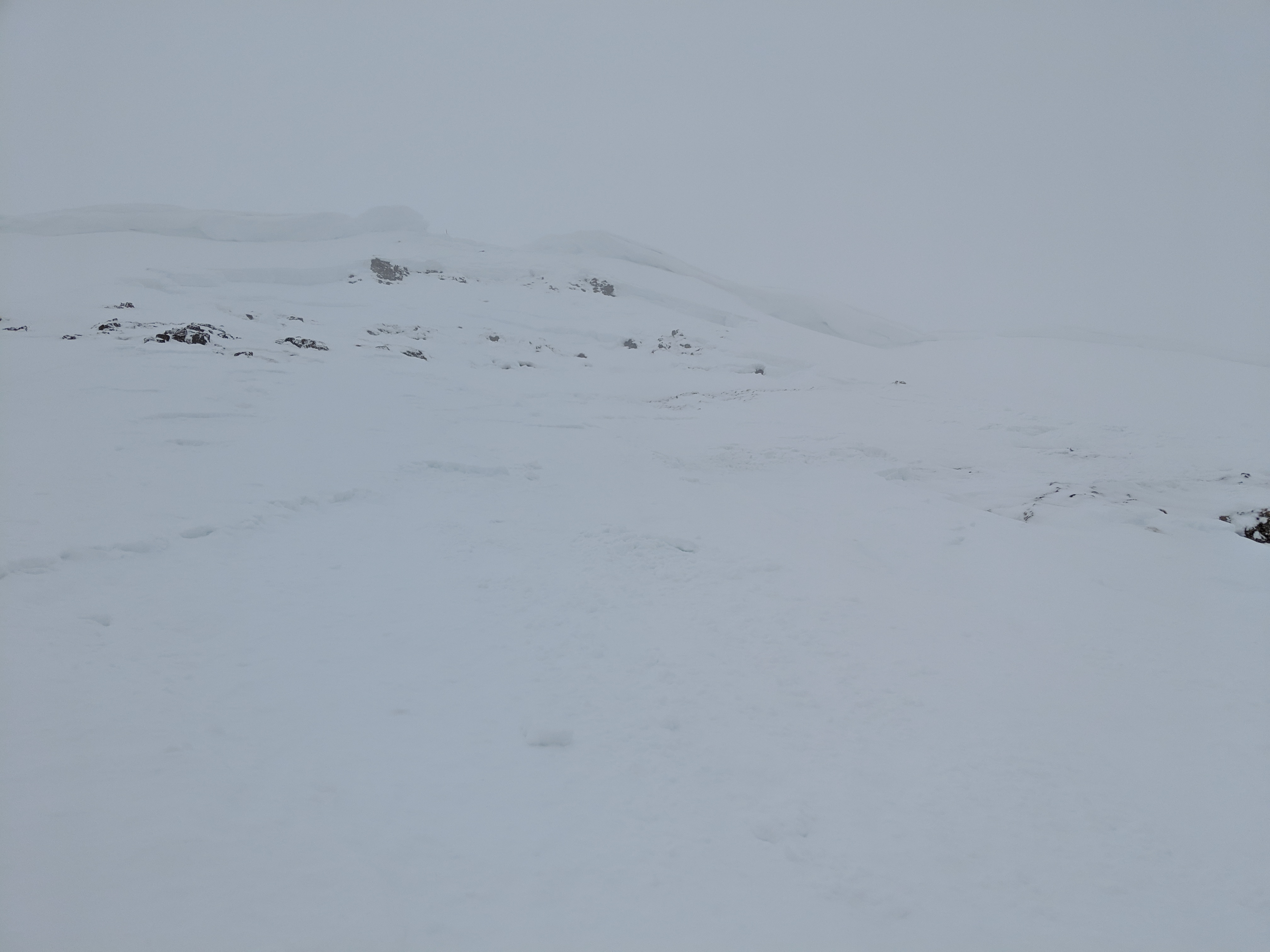
Elevation: 9200′ – 11500′

Avalanches:

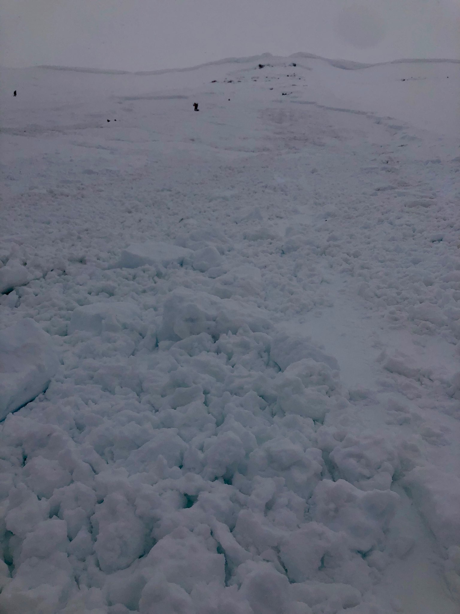
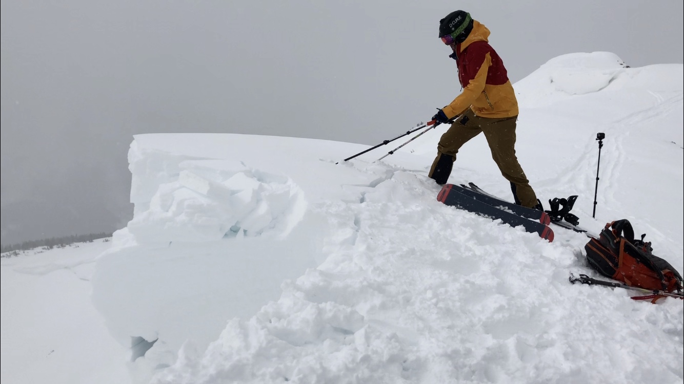
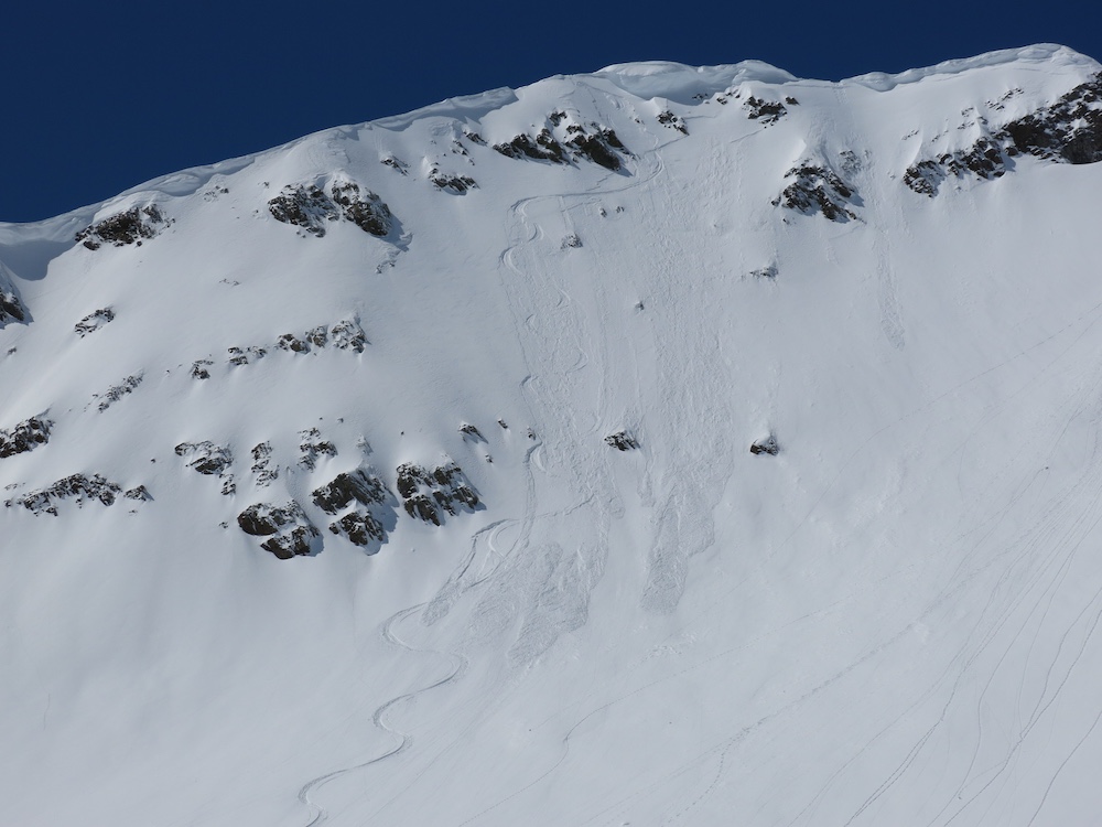
A couple natural D1 wet loose avalanches on southerly slopes near treeline. Easily triggered D1 wet loose slides on southerlies in the top couple inches of snow running on a crust – entrained little mass. Northerly slopes near treeline also produced skier triggered shallow loose avalanches in steep terrain – the snow was just slightly moist.

Weather: Partly cloudy skies in the morning with a mix of thin high clouds. Temperatures warmed near the freezing mark up to 11500′. Winds were out of the west blowing light with occasional moderate gusts. Skies increased to mostly cloudy around 2pm with a few flurries.  Snow surfaces warmed more than expected from good solar input in the AM along with the mild temperatures.

Snowpack: Less than an inch of new snow overnight, no accumulations during the day. Snow surfaces became moist at valley bottom and southerlies by 1030am and by 130pm, it was easy to trigger shallow, slow-moving wet loose avalanches on southerly slopes at 11,500 feet. North facing slopes became slightly moist up to around 11,500′. Shaded slopes had around 10 inches of snow resting on the 3/29 interface near treeline.
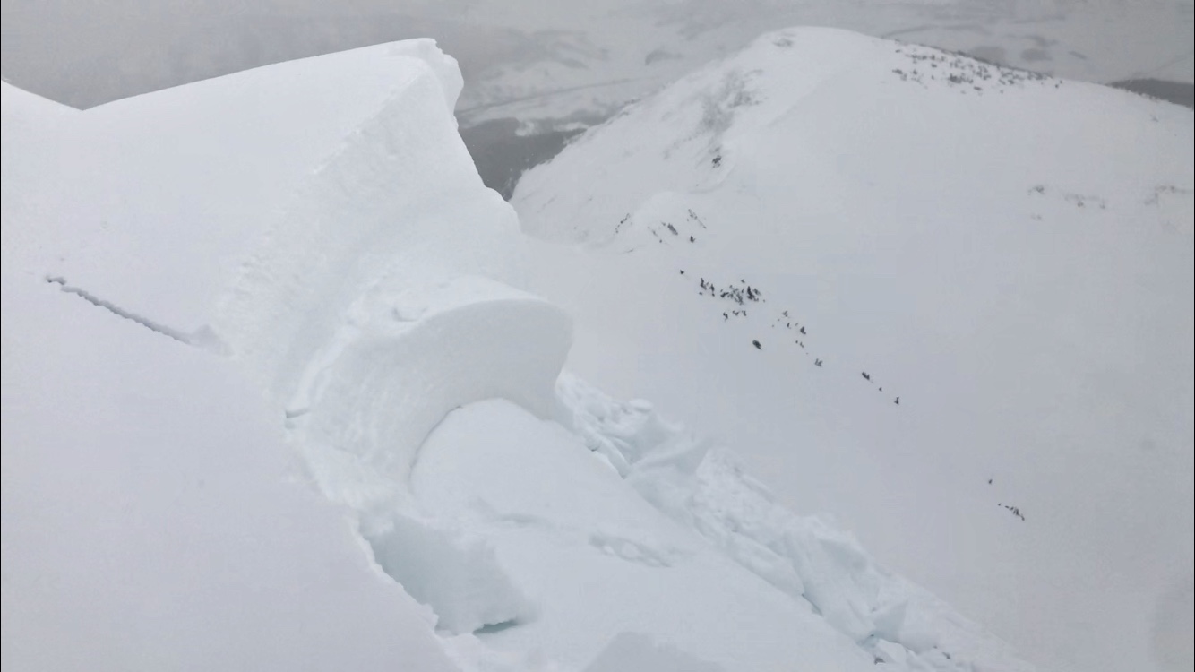
Photos:

Mountain Weather for 11,000ft

CB Avalanche CenterWeather

Date: 04/02/2019

Moisture out in front of the next trough began to impact the area last night and dropped a skiff to 1″ of snow. The snow showers will continue this morning from orographic lift. This afternoon the snowfall will largely be driven by convection which will make it a bit harder to predict amounts and locations for accumulations. Tonight the flow will turn southwesterly as the approaching trough moves closer to Colorado. Accumulating snowfall will last through Wednesday, but with relatively modest totals ranging from 4 to 7 inches. Thursday and Friday look to be dry with filtered sunshine.

  • Today

    High Temperature: 30 to 35
    Winds/Direction: 5 to 15, WSW
    Sky Cover: Mostly Cloudy
    Irwin Snow: 0 to 2″
    Elkton Snow: 0 to 2″
    Friend’s Hut Snow: 0 to 2″

  • Tonight

    Low Temperature: 20 to 25
    Winds/Direction: 5 to 15, WSW
    Sky Cover: Overcast
    Irwin Snow: 2 to 4″
    Elkton Snow: 2 to 4″
    Friend’s Hut Snow: 3 to 5″

  • Tomorrow

    High Temperature: 33 to 38
    Winds/Direction: 5 to 15, W
    Sky Cover: Mostly Cloudy
    Irwin Snow: 1 to 3″
    Elkton Snow: 1 to 3″
    Friend’s Hut Snow: 1 to 3″

Mt Emmons

CB Avalanche Center2018-19 Observations

Location: Crested Butte Area
Date of Observation: 04/01/2019
Name: Eric Murrow and Zach Kinler

Subject: Mt Emmons
Aspect: South East, South, South West
Elevation: 9,000-12,343

Avalanches:

Only a couple very small skier triggered loose dry in steep and extreme terrain.

*Received at a report of a skier triggered wind slab on a south aspect at 12,500′, 8 to 10 inches deep* – this came in the evening via test message, not from Mt. Emmons

Weather: Morning fog and low clouds burned off by mid morning with partly cloudy skies and strong solar following. WNW winds were moderate at times with stronger gusts at ridge top. Temperatures remained in the lower to mid 20s.

Snowpack: Trace to 2″ new snow on supportive MFcr that was 5 to 8cm thick on SE-S aspects above treeline. Winds were moving small amounts of snow onto leeward slopes in the alpine.  Drifting up to 10″ deep was found on SE slopes above treeline immediately below ridge tops and cornices.  Very minor cracking in drifts.  Snow surfaces remained cold on southerlies near and above treeline where temps remained below freezing and cold winds prevented warming. On a quick check of a Cornice triggered slab avalanche in Red Lady Bowl, we found the avalanche failed in a layer ~60 cm from the surface and stepped down another 60 cm or so. Perculation columns were found in the area of the first failure layer.  It is unknown if those were recent and contributed to this avalanche or if they occurred during the warming last week and the avalanche was solely a product of the weight of the cornice overloading dry weak layers.  This slope also had avalanched catastrophically during the early March storm cycle.

Photos:

RMBL Study Plot

CB Avalanche Center2018-19 Observations

Location: Crested Butte Area
Date of Observation: 04/01/2019
Name: RMBL

Subject: RMBL Study Plot
Aspect:
Elevation: 9500

Avalanches:

Weather:

Snowpack:
Photos:

Mountain Weather for 11,000ft

CB Avalanche CenterWeather

Date: 04/01/2019

Fog has set up in the valley bottoms this morning but should burn off by mid-morning. A few orographic flurries, from a northwest flow, will linger this morning as well but should dissipate early in the day leaving the area under partly cloudy skies. Temperatures are running a bit cooler than seasonal norms and generally at 11,000′ locations will struggle to reach the freezing mark. Tonight clouds look to be on the increase with several small waves of energy passing by on Tuesday and Tuesday night ahead of the next trough which is set to arrive on Wednesday. There is the potential for a little refresh in riding conditions on Tuesday night and Wednesday but models are not predicting anything major at this time.

  • Today

    High Temperature: 27 to 32
    Winds/Direction: 6 to 16, WNW
    Sky Cover: Partly Cloudy
    Irwin Snow: 0″ to trace, AM
    Elkton Snow: 0″ to trace, AM
    Friend’s Hut Snow: 0″

  • Tonight

    Low Temperature: 15 to 20
    Winds/Direction: 4 to 14, WSW
    Sky Cover: Mostly Cloudy
    Irwin Snow: 0″
    Elkton Snow: 0″
    Friend’s Hut Snow: 0″

  • Tomorrow

    High Temperature: 32 to 37
    Winds/Direction: 7 to 17, WSW
    Sky Cover: Mostly Cloudy
    Irwin Snow: 0 to 2″
    Elkton Snow: 0 to 2″
    Friend’s Hut Snow: 0 to 2″

Red Lady Cornice Slide

CB Avalanche Center2018-19 Observations

Location: Crested Butte Area
Date of Observation: 03/31/2019
Name: Brooke Warren

Subject: Red Lady Cornice Slide
Aspect: South East
Elevation: 12,400

Avalanches:

A Sprinter van-sized cornice was accidentally triggered when a snowboard was placed in the snowpack during transition at the flags at the top of Red Lady bowl. The cornice triggered an avalanche directly below the drop that propogated about 10-15 meters wide. The avalanche was about 80 cm deep, to the ground, exposing rock and grass. The debris slid to the rollers at the bottom of the bowl. One person’s pack and poles were lost in the debris, but the pack was found on top of the debris at the base of the slide.

Weather: Overcast, slight wind and light snowfall.

Snowpack: Snow conditions ranged from crusty to icy with a thin layer of fluff.

Photos:

Mountain Weather for 11,000ft. Sunday, March 31.

CB Avalanche CenterWeather

Date: 03/31/2019

There is a spinny thing down south, doing its thing by spinning and hanging out south of us. That spinny thing can also be called a closed low if you want to sound smarter. It’s going to keep spinning and pulling moisture through southern Colorado and up to our area in Central Colorado. Winds remain light and any snow that develops will mostly come from the storms own energy creating lift, as well as convection. This all could add up to some variable snow totals for us depending on how and where those convective cells set up and just how much moisture gets pulled into our area. 2 to 4” of snow would be the best average to put out there. Just remember, some places may get skunked and some could exceed with this setup. I’m sorry if the spinny thing throws a skunk at your doorstep.

Dry air will start moving in Sunday night and Monday is setting up to really be a beautiful one! Definitely a call in sick kind of beautiful day. I mean, if a skunk was hanging out at your doorstep, you might just feel a little sick right? Moisture starts moving in on Tuesday with the potential for some very light snow in the afternoon. The next storm looks to arrive on Wednesday and we’ll have to wait and see what kind of snow is associated with that storm.

  • Today

    High Temperature: 27 to 31
    Winds/Direction: 2 to 12, SE
    Sky Cover: Mostly Clear
    Irwin Snow: 1 to 3
    Elkton Snow: 1 to 3
    Friend’s Hut Snow: 2 to 4

  • Tonight

    Low Temperature: 12 to 16
    Winds/Direction: 2 to 12 NW
    Sky Cover: Increasing clouds
    Irwin Snow: 0 to 2
    Elkton Snow: 0 to 1
    Friend’s Hut Snow: 0 to 1

  • Tomorrow

    High Temperature: 29 to 33
    Winds/Direction: 5 to 15 WNW
    Sky Cover: Mostly Clear
    Irwin Snow: 0
    Elkton Snow: 0
    Friend’s Hut Snow: 0

Fresh Very Large Avalanche Paradise Divide

CB Avalanche Center2018-19 Observations

Location: Paradise Divide Area
Date of Observation: 03/30/2019
Name: Evan Ross

Subject: Fresh Very Large Avalanche Paradise Divide
Aspect: North East, South East, South West
Elevation: 9,500-12,940

Avalanches:

Skier triggered a very small surface slab just off a high summit and some sluffing. All easy to manage and small in size.

The outlier: I came across a freshly triggered very large avalanche on the way home. S to SW aspect at about 11,800ft. A snowmobile track entered and exited this very large avalanche. The track appeared to go through a thin spot in the slab near some bushes and raised ground. The track further appeared to have splatted on the crown face but had enough momentum to keep going up. I checked out two parts of the crown that were near where the snowmobile track exited. The first was to the lookers right. HS was thin and about 80cm. Basal depth hoar was massive and estimated at 5mm. An ice lens capped these facets and they were also moist. The next quick crown profile was closer at about 20 ft to the looker right of where the track exited. Here HS was 180cm. The crown was 90cm. The basal facets where smaller, also moist and again an ice lens capped these facets. The avalanche appeared to have failed at this ice lens or at the interface with the basal facets. Shortly after getting to that location water started running like a faucet out of the new/old snow interface and I quickly packed up and left. Slope angles were estimated to be near 40 degrees where the snowmobile track left the crown. Crown hight averaged an estimated 70cm. The crown appeared to propagate into a deeper snowpack area.

Weather: Partly Cloudy over the greater forecast area, but my face will tell you that I was in an area that was in the sun all day. Convective clouds where moving very slow, keeping some areas in the clouds and other hanging in the sun all day. Calm winds. Strong Solar.

Snowpack: The March sun was doing its thing and warming snow surfaces. Storm totals were only about 1″ down in the valleys and about 5 to 6″ at upper elevations. The new snow posed little avalanche issues. Sluffing in steep terrain and some deeper drifts to stay mindful of.

Red Lady Glades

CB Avalanche Center2018-19 Observations

Location: Crested Butte Area
Date of Observation: 03/29/2019
Name: ADB

Subject: Red Lady Glades
Aspect: South
Elevation: BTL
Snowpack: Snow Survey at Keystone:

Depth 62 inches or 5 feet
SWE: 22 inches
Density: 30%

Ice lens near the ground.

Mountain Weather for 11,000ft. Saturday, March 30.

CB Avalanche CenterWeather

Date: 03/30/2019

Colorado is sitting under a large low-pressure trough with our forecast area seeing a break in storms on Saturday. Cloud cover will be moving between mostly to partly cloudy. As moisture drys out a bit today and we may even get lucky and see some Sun. Winds became light overnight and are forecasted to stay that way into Sunday.

A closed low forms over Utah Saturday night and moves over Southern Colorado on Sunday. We’ll remain under light winds and see that wind direction becoming south and eventually east on Sunday. Most of the snow associated with this closed low looks to be to our south and east. If the storms lift increases over our area we could see a little better snow accumulation, otherwise, we’re only looking at a couple of inches of new snow.

Dry weather moves in for Monday under northwesterly flow. Then by Wednesday, the next low-pressure trough looks to be moving over Colorado and bringing a return to unsettled weather.

  • Today

    High Temperature: 25 to 29
    Winds/Direction: 0 to 10 SSW
    Sky Cover: Partly Cloudy
    Irwin Snow: 0 to 2
    Elkton Snow: 0 to 2
    Friend’s Hut Snow: 0 to 2

  • Tonight

    Low Temperature: 10 to 14
    Winds/Direction: 0 to 10, S
    Sky Cover: Mostly Cloudy
    Irwin Snow: 0 to 2
    Elkton Snow: 0 to 2
    Friend’s Hut Snow: 0 to 2

  • Tomorrow

    High Temperature: 27 to 31
    Winds/Direction: 3 to 13, ENE
    Sky Cover: Mostly Cloudy
    Irwin Snow: 2 to 4
    Elkton Snow: 2 to 4
    Friend’s Hut Snow: 3 to 5