Observations

04/23/21

Sensitive soft slabs

Date of Observation: 04/23/2021
Name: Zach Guy and Eric Murrow

Zone: Southeast Mountains
Location: Copper Creek
Aspect: West, North West
Elevation: N/ATL

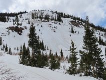
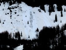
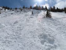
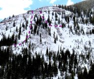
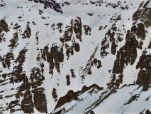
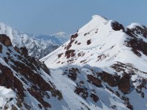
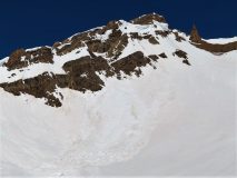
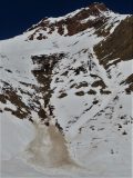
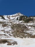
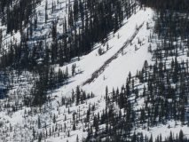
Avalanches: We found sensitive storm slab conditions today at upper elevations. Numerous thin soft slabs released naturally this morning, and we ski cut a handful of similar slabs. All of the slabs were small in size: most were 2″ to 4″ thick, 10 to 20 feet wide. In wind drifted areas, slabs were up to 8″ thick. In sustained steeper terrain, slides ran up to 1500 vertical feet.
Weather: Pulses of moderate to heavy snowfall between periods of quiet weather. Some moderate gusts with wind transport at higher elevations.
Snowpack: About 3″ of new since yesterday.

Read Full Observation
04/17/21

Sprinter

Date of Observation: 04/17/2021
Name: Andrew Breibart

Zone: Southeast Mountains
Location: Coneys
Aspect: North East, East
Elevation: BTL

Avalanches: NA
Weather: Mostly cloudy and calm. On skate out, intermittent S-1 snowfall.
Snowpack: 4 inches of 12 hour snow in CB South at my house at 6:30 AM.
<2 inches of new snow at trailhead and <1 inch of new snow on ridge line of Anthracite Mesa. Snow in the bowl was 100% supportive spring snow.
Bare areas are appearing around trees with expansive branch system that extends outward from the trunk.

Read Full Observation
04/17/21

Gothic 7am weather Update

Date of Observation: 04/17/2021
Name: billy barr

Zone: Southeast Mountains
Location: Gothic

Weather: Cloudy with light snow overnight with 2″ new and water a light 0.12″ on top of a frozen snowpack. Wind is calm and the snowpack back up to 27″. Currently only a few flakes of snow and clouds look to be thinning with a low of 18ºF after a high yesterday of 38.

Read Full Observation
04/17/21

Cement Creek Snow 7am update

Date of Observation: 04/17/2021
Name: Cosmo Langsfeld

Zone: Southeast Mountains
Location: Cement Creek Ranch
Elevation: 9250’

Weather: 4” of new snow overnight

Read Full Observation
04/14/21

Wet Loosies and even a gouger’

Date of Observation: 04/14/2021
Name: Zach Kinler Eric Murrow


Zone: Southeast Mountains
Location: Wolverin Basin, Mount Emmons
Aspect: North, North East, East, North West
Elevation: 8,900′ – 11,400′


Avalanches: Observed two unreported Wet Slabs on a northwesterly aspect below treeline from the big warm up during the first week of April. Intentionally triggered a couple of Wet Loose avalanches on northeast slopes below treeline D1 to D2 in size. The D2 was able to gouge to the ground, low elevation slope at 9,800′.
Weather: About an inch of new overnight. Partly cloudy skies, mild air temps, and light winds with moderate gusts on alpine ridges.
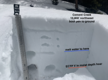
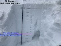
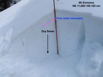
Snowpack: Largely traveled on northerly slopes near and below treeline. Shaded slopes at 10,000′ appeared to have meltwater drain very near basal depth hoar, but depth hoar was still angular with little evidence of meltwater infiltration (see photo). As we climbed higher near treeline meltwater on a northeast slope had only moved down around 20cm from the surface (see photo). Shaded slopes above 9,600′ feet still have structures to produce Wet Slab avalanches once the meltwater faucet gets turned back on later this spring. Surface refreeze below around 11,000′ was pretty superficial with wet snow grains lingering just below the crust. We descended a short east-facing slope near treeline around 130pm and found quality corn skiing without too much concern for wet avalanche activity. Cloud cover and winds seemed to keep sunny slopes at upper elevations cooler and prevented them from getting too wet.


[/gravityforms]

Read Full Observation
04/14/21

Gothic 7am Weather Update

Date of Observation: 04/14/2021
Name: billy barr

Zone: Southeast Mountains
Location: Gothic
Weather: Scattered light snow Tuesday and overnight into Wed. with just 1½” new snow and 0.15″ of water. Snowpack sits at 28″, up 1″ from the year’s low. The snowpack did not harden much overnight so could get quite rotten if we get decent sun as there was a bit of clearing starting just before sunrise. Breezy overnight and currently around 3-6 mph SW. Not much to write about but it is the heaviest snow ‘storm’ this month so far.

Read Full Observation
04/11/21

Off season for avalanches

Date of Observation: 04/11/2021
Name: Zach Guy

Zone: Southeast Mountains
Location: Mt. Emmons
Aspect: North East, East
Elevation: Below treeline

Avalanches: Skier triggered a couple of shallow wet loose slides in very steep terrain. They didn’t run far or entrain more than the top few inches of mush.
Weather: Another beautiful day. Light winds below treeline. Temps in the 40’s. Clear skies.
Snowpack: Early afternoon tour on suspect below treeline slopes to assess the effects of last night’s warming trend. Ski cut wet sluffs were confined to very steep terrain and are still not entraining volume or gouging deeper than the top few inches. The snowpack is wet throughout with drainage to the ground now well established where we traveled. The snow was supportive to skis but boot pen is thigh deep.


Read Full Observation
04/11/21

Tipsy cornices!

Date of Observation: 04/11/2021
Name: Ben A

Zone: Southeast Mountains
Location: Wolverine Ridge
Aspect: East
Elevation: ATL

Avalanches: Skier triggered very small wet looses on E aspects, and very small dry looses on due north. Both confined to very steep terrain.
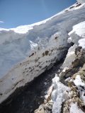
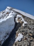
Snowpack: Cornice about 100 yards long pulling way back from the Wolverine Ridge. See photos, pretty cool if you’re on the right side of it.

Photos:

Read Full Observation
04/09/21

Hunting for normal caution

Date of Observation: 04/09/2021
Name: Zach Guy and Zach Kinler

Zone: Southeast Mountains
Location: Copper Creek
Aspect: South East, South
Elevation: 9500 – 13000′

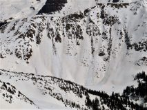
Avalanches: Nothing new today. Documented more D1 to D2.5 wet activity and cornice falls from the recent cycle; see photos of the most noteworthy slides. Also crossed a couple of the larger debris piles (D3.5+) I’ve come across from one of the February cycles; one knocked over a few mature trees.
Weather: Cool and breezy up high kept surfaces frozen at ridgetop. Clear skies.
Snowpack: Snowpack looks and feels like a May snowpack. No signs of instability or avalanche problems noted throughout the tour. Snow surfaces stayed frozen or thawed to ideal corn near and above treeline by 12:30 or so. The snowpack stayed mostly supportive to skis below treeline this afternoon, although some valley locations became punchy and unsupportive. Ski cuts on steep pitches where the snow was getting too sloppy didn’t produce anything.


Photos:

Read Full Observation
04/06/21

Punchy Cement Creek

Date of Observation: 04/06/2021
Name: Eric Murrow Zach Kinler


Zone: Southeast Mountains
Location: Cement Creek drainage
Aspect: East, South East, South, South West, West, North West
Elevation: 9,000′ – 11,400′


Avalanches: Several gouging loose avalanches below treeline on east and west aspects (see photos). Views into the upper elevation terrain of Brush and Cement Creeks revealed far less recent wet avalanche activity than areas closer to Crested Butte. Did not observe any obvious Wet Slab activity, even on terrain features that had the same characteristics of observed Wet Slab avalanches nearer to Crested Butte.
Weather: Mostly clear skies transitioning to partly cloudy by mid-day. Moderate westerly winds at ridgetop. Temperatures cooled throughout the day.
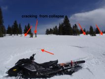
Snowpack: Traveling on snowmobiles in the AM was fairly straightforward off-trail with minimal trenching, but as the sun softened, but never fully broke down, surface crusts in the afternoon, snowmobiling off-trail became a challenging task with relentless trenching. Traveled off-trail at 11,100′ and produced a collapse that traveled about 150′ causing around an inch or so of vertical displacement in the snowpack (see photo). Boot penetration in this area was consistently to the ground (see photo). Ski penetration was mostly supportive on surface crusts.

Dug a quick profile on a northwest aspect at 10,800′ with a depth of 100cm (similar snowpack to large collapse) and found meltwater had descended around 50cm down stopping just short of the weak bottom half of the snowpack. The upper 50cm of the snowpack was composed of a 15cm surface crust with 35cm of 4f+ slab (with ice columns present) resting on weak, moist depth hoar. I performed an extended column test and it failed on isolation. The bottom half of the snowpack was moist but did not appear to have been flooded with meltwater yet. Surface crusts on all terrain traveled remained intact during the day; some softened on sunny aspects, but a thin “egg shell” remained which helped to limit Wet Loose avalanche potential. Shoulder and shady aspects below treeline continue to have enough slab structure in the upper snowpack to present future Wet Slab concerns once the meltwater faucet turns back on.


Photos:

Read Full Observation
The blog.