Date of Observation: 02/11/2021
Name: Evan Ross Jack Caprio
Zone: Northwest Mountains
Aspect: North East, South East
Elevation: 9,000-11,000
Weather: The NE Mountains cloud cover was mostly cloudy, becoming partly cloudy and back to over cast by the afternoon. Ooo fun. Plenty of sun out there to warm and thicken the snow surfaces on sunny slopes. We didn’t have much wind exposure. However those winds were obviously cranking in the alpine and even moving snow down in the open valleys at times.
Snowpack: Basically, we ended the day with another BTL tour on NE that continued to highlight the decreased sensitivity of the persistent slab avalanche problem below treeline. Despite what the weak layer is, those weak layers are hiding below a growing and strengthening slab. We only observed one collapse. That was after like 12 He-Man jumps on a small slope connected to a bigger slope, 10,500ft at ridgeline, NE. That collapse shot cracks through the connected slope for a good 100ft or so. Otherwise, we traveled on other steep slopes with no red flags and chose terrain features with lower consequence. For these NE slopes, the HS averaged in the 120 to 140cm range. Heading into the next storm, it will be the same December and January persistent weak layers of concern.
We spent a little time on some mid 30 degree SE facing slopes around 10,500ft. The early February crust was now down about 45cm’s. That crust and any facets below the crust were not particularly notable at this location. Unfortunately, we didn’t get to spend more detailed time looking at that interface. It didn’t give us any feedback toward obvious signs of instability. The early January interface still felt like the layer of concern and that interface was laying in the lower 1/3 of the snowpack.
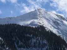
- Wind loading into Wolverine. Mt Emmons.


