Beer, music, and stoke for a deeper season next winter. See you there!
Beer, music, and stoke for a deeper season next winter. See you there!
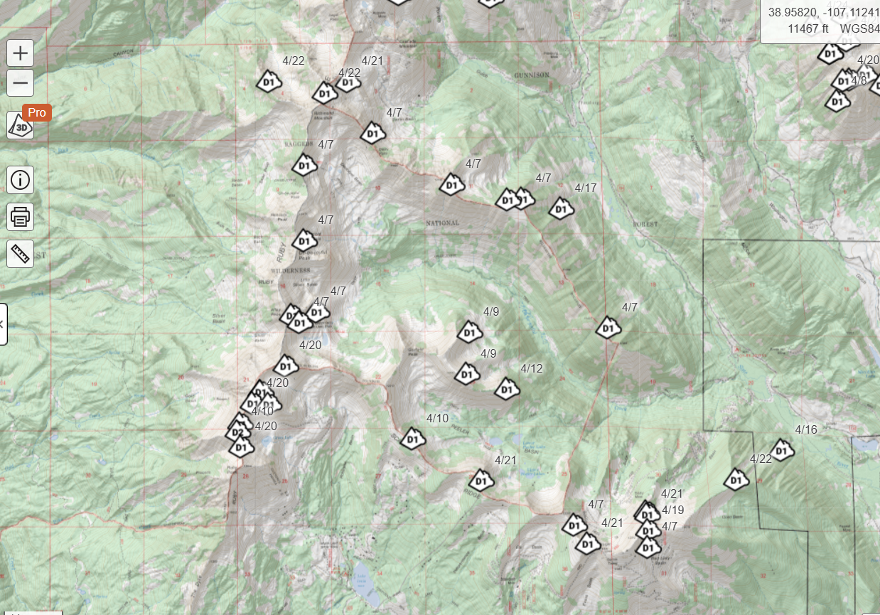
CalTopo has partnered with participating avalanche centers around the country, including CBAC, to overlay avalanche occurrences onto their mapping platform. Another tool you can use for planning your outings in the backcountry.
Join us at the Talk of the Town for our end-of-the-season party. Thursday, April 10 at 5 p.m. Free beer! Live music! Need we say more?!
We want to thank everyone who participated in our CBAC survey over the summer. Our staff and board have reviewed the public’s feedback to consider improvements that we can make as an organization. The survey also highlighted an opportunity for us to better explain some CBAC resources and protocols that not everyone is aware of. We’ve addressed some of the more common feedback points below.
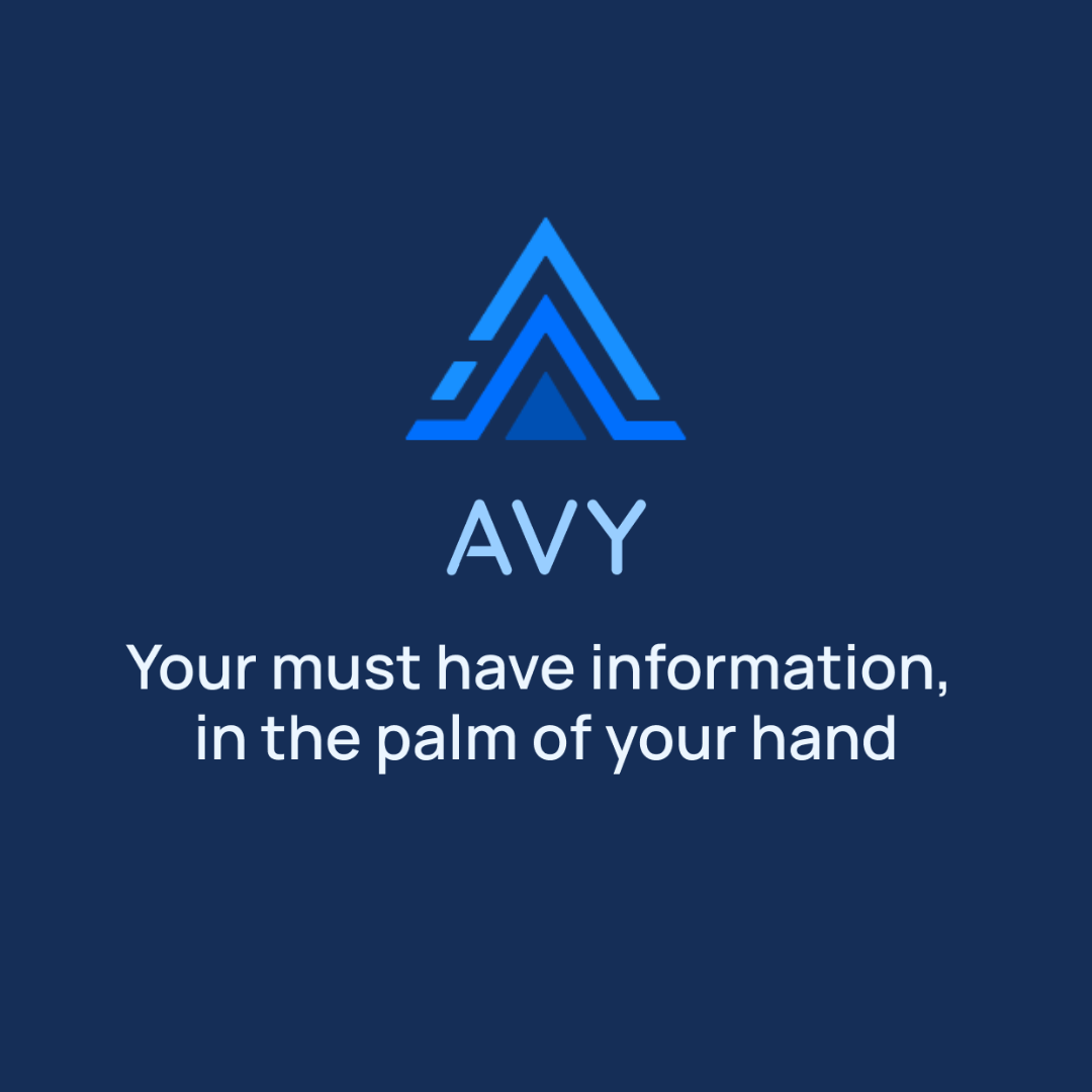
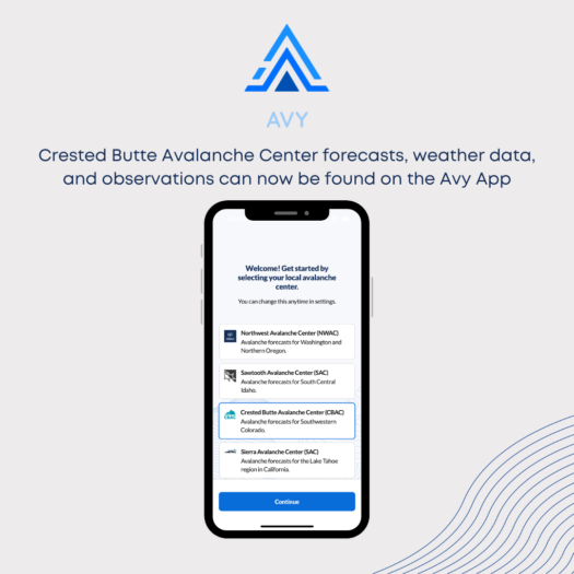
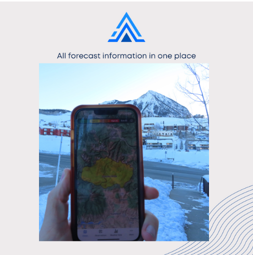
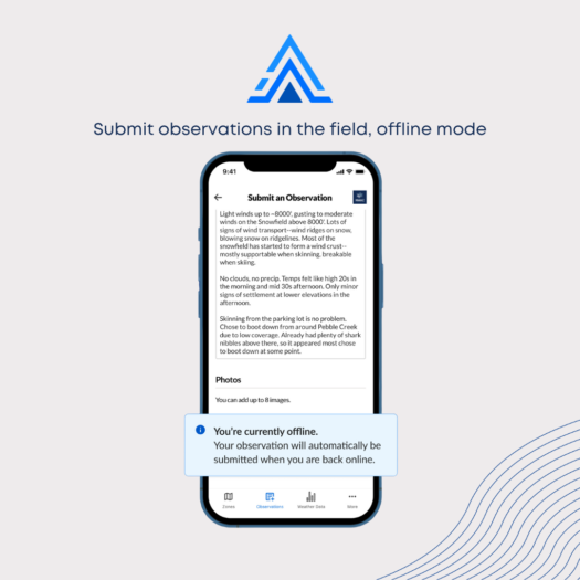
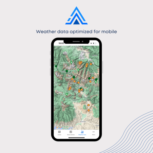
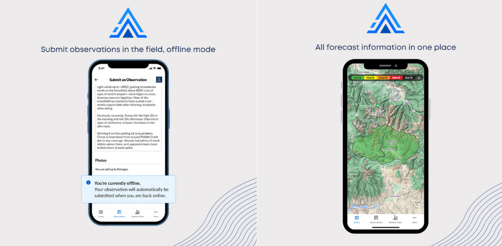
We heard your feedback and have partnered with the Northwest Avalanche Center to offer a mobile app. You can download the “Avy” app for iPhone and Android; CBAC forecasts should be available on the app by the end of November. The app will offer offline functionality for retrieving forecasts and submitting observations. Our website will continue to be the most comprehensive resource for all things CBAC.
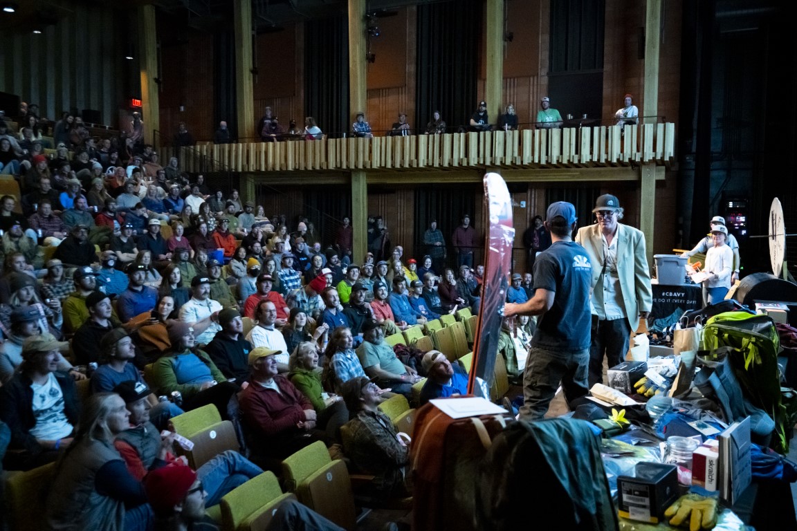
We hear you, so we are mixing things up this year. The first half of the night will be presentations and a shorter raffle. The second half of the night will be live music! December 7th at the Center for the Arts.
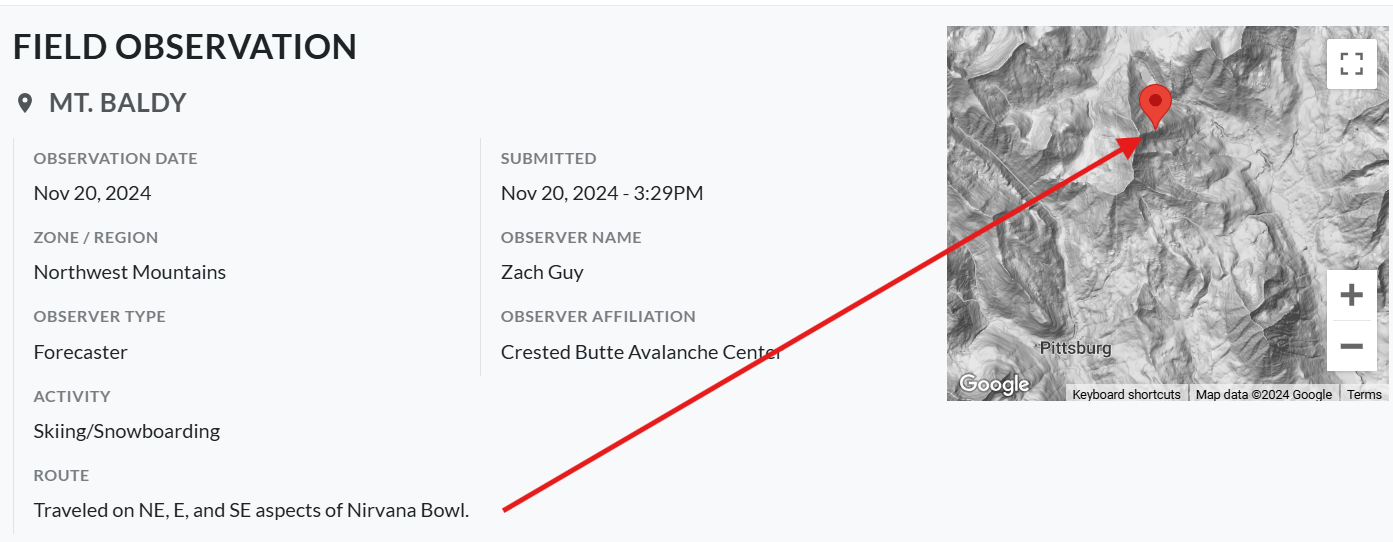
Yes, there are many local names out there (e.g., Birthday Bowl, Friendly Finish, PBR, etc.), and we understand the frustration. Our forecasters do their best to use the placenames listed in the Crested Butte Terrain Atlas and OnX Backcountry app. We use placenames from the USFS topo maps in areas lacking established guidebook names. More importantly, we also geotag all of our observations and avalanche activity on our observations page. If you are confused by a placename, look at the corresponding dot on the observations or avalanche maps.
Our avalanche terrain map shows both! Simple terrain (green) is below the threshold slope angle for nearly all avalanche releases, or it covers heavily forested terrain that is well anchored. The map also considers runout zones below avalanche start zones. If you see challenging (blue) or complex (black) terrain on a low-angle slope, it is because there are overhead hazards. Remember, this map is independent of snow and avalanche conditions; it only classifies avalanche terrain severity. Read this for more information about what this map shows and how it was made.
So do we! There were many benefits to adopting the new NAC observation platform, but one of the unfortunate losses is that the avalanche rose developed by Michael and Reggie is no longer functional. The developers of our new shared platform have limited resources to take on supplementary projects like integrating CBAC’s old rose. However, the new platform has many tools for visualizing the data, similar to the colored avalanche rose. By using filters for avalanche problem, aspect, elevation, size, date, etc, you can still explore patterns of avalanche activity.
We moved to two different forecast zones a few years ago to more clearly illustrate differences in avalanche danger and avalanche problems between our deeper zone (the Northwest Mountains) and our shallow zone (the Southeast Mountains). Our forecast discussion is always the same for each forecast product, and it typically discusses nuances between the zones, forecast data and evidence, etc. On days when conditions vary across the region, we may write different “Bottom Lines” and show different danger ratings or avalanche problems for each zone. So if you are trying to decide which zone to travel to, just read the forecast discussion once and compare danger ratings and problems. If you already know which zone you are headed to, then it’s a one-stop shop with the forecast for your zone of choice.
Some users asked for a longer forecast season, especially in the spring. This year, we’ve allocated the resources to extend daily forecasts into the first weekend of May if we have an active spring like last year. That’s about two weeks later than usual. We typically monitor conditions during the shoulder seasons (early fall, late spring) and post updates if conditions change from our early or late-season travel advisories.
When we first divided the Crested Butte area into two forecast zones, we looked at historical patterns for snow depth, avalanche activity, and snowpack structure to draw the boundary where it is. One of the challenging outcomes is that the boundary line splits some areas that see a lot of use: Mt. Emmons and Washington Gulch. Our forecasts generalize conditions across entire forecast zones, so frequently, conditions near the boundary will be a blend of the deeper zone and shallower zone conditions. With that being said, we added a list of popular travel zones to our forecast zone map to help you determine which zone you are traveling in. For example, Coney’s and Red Lady Bowl is in the Southeast Mountains Forecast Zone, while Redwell Basin and Schuylkill Ridge are in the Northwest Mountains Forecast Zone.
Our goal is to monitor conditions across our whole forecast zone, in areas that are used by skiers, snowmobilers, pedestrians, and everyone else. We rely on various modes of winter travel to move efficiently and connect with different at-risk users, following the winter travel plan outlined by the Gunnison National Forest. Our fieldwork goals are often to validate or get feedback on avalanche problems, which means we may be traveling to the type of terrain that our forecasts warn about. For example, our forecast might say, “The safest travel is in wind-protected terrain below treeline” yet you’ll notice our forecaster triggered numerous slabs from wind loaded alpine slopes. These field days often involve lots of ridgeline travel, attempts to remote trigger or ski cut when terrain and impacts are appropriate, and advanced understanding of terrain/avalanche behavior — they aren’t a model for where or how to go to have an easy, fun, and risk-free day in the backcountry. Please look to our forecast products for the appropriate travel advice each day.
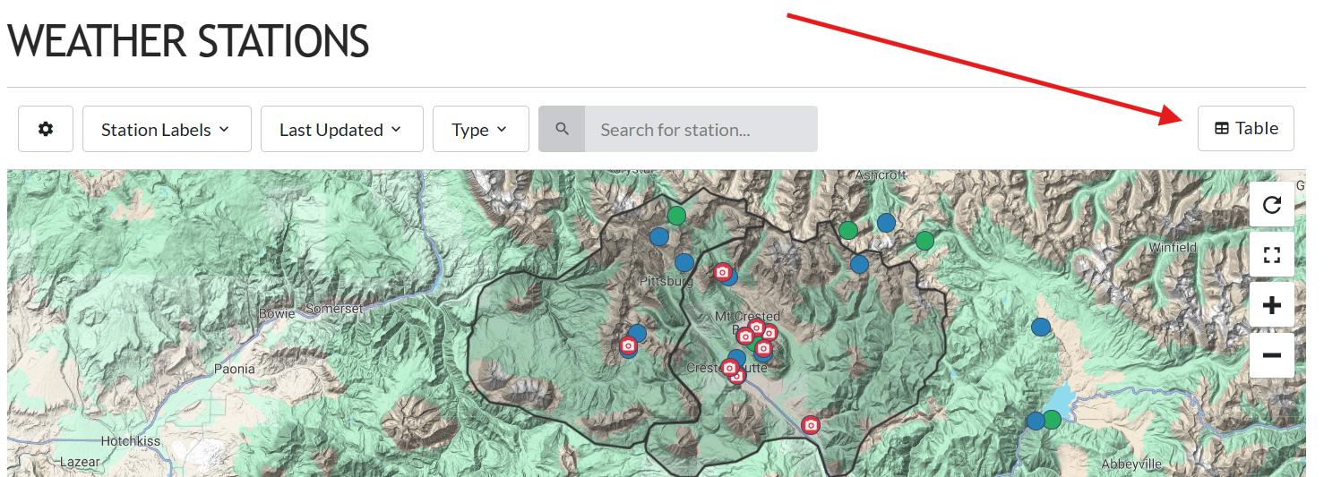
We have that option! From our weather station page, click on the “Table” icon on the top right of the page. You’ll be able to view, sort, filter, and color code the data. Bookmark this page if you like the tabular format.
We get it, submitting observations can be time-consuming, intimidating, and more. Avalanche forecasting is challenging and always involves uncertainty; public observations are an important resource for us to increase forecast confidence and accuracy. Thus, your observations help foster a safer backcountry community. Here are some things to think about regarding the most common obstacles to submitting observations.
Save the date!
CBAC’s Annual Avalanche Awareness Night is set for December 7, 2024 at the Center for the Arts. We’re rolling out a new format this year: first half education, second half PARTY! More details to come.
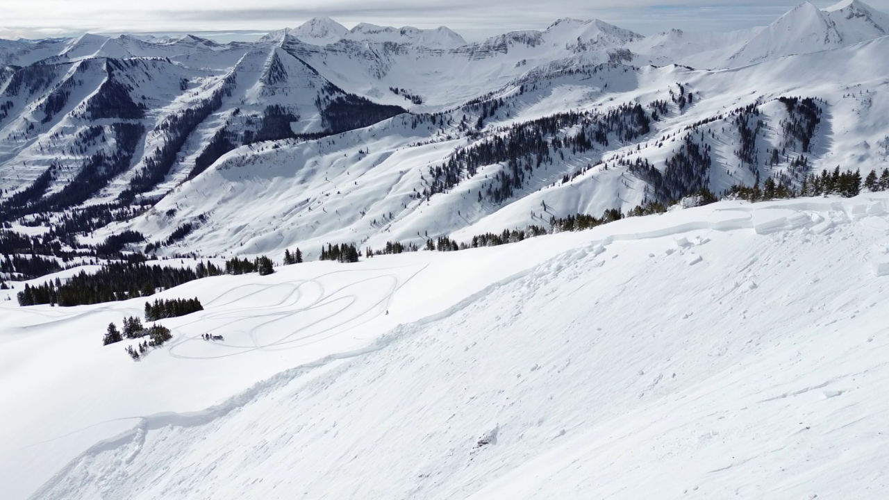
The season was a mixed bag of emotions for all of us at the CBAC and in the community. While it was another great season of skiing and riding, we were hit hard by the loss of two friends to the mountains. Our 24th season forecasting for the Gunnison Valley was defined by two treacherous weak layers – the source of challenging, unique, and tragic persistent slab issues. The report also highlights successes from our outreach and operations and recognizes the many partners and sponsors who support the CBAC.
To read the full annual report, visit this link or use the pdf viewer below.