Snodgrass Storm Slab

CB Avalanche Center2019-20 Observations

Location: Crested Butte Area
Date of Observation: 03/19/2020
Subject: Snodgrass Storm Slab
Aspect: North East
Elevation: 10,500

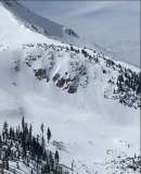
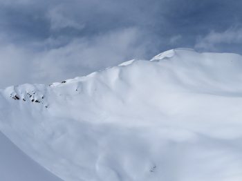
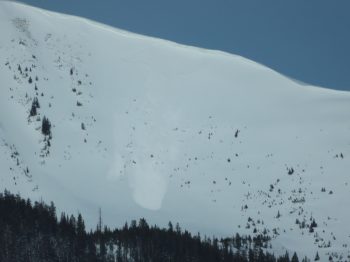
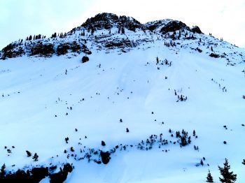
Avalanches: Skier triggered a couple storm slabs on 3rd bowl crown was 6 to 8” deep

Weather: Moderate snow and low visibility most of the day

Snowpack: New snow wasn’t bonding very well with the crust below

Wet snow and dry pow

CB Avalanche Center2019-20 Observations

Location: Crested Butte Area
Date of Observation: 03/16/2020
Name: Eric Murrow
Subject: wet snow and dry pow
Aspect: North, North East, East, South East
Elevation: 8700′ – 12500′

Avalanches: observed a couple of recent small Wet Loose avalanches on steep rocky east-facing near treeline feature.

Weather: Warm day, with light winds, and increasing high-clouds.

Snowpack: Shaded slopes below about 10,000 feet had thin soft crusts at the surface in the morning that softened by late afternoon but I did not find any concerns for loose activity on shady low elevation slopes.

While ascending east-southeast near treeline terrain at 1pm, found 4 to 5 inches of wet snow sitting on an old crust. The old crust was often supportive to boots except for shallowest spots or around vegetation. Felt like you could trigger small loose slides in this terrain by afternoon, but the intact crust would have limited the amount of entrainment. Beneath the old curst, the snowpack was uniform, soft and very moist. Snow depths through this terrain were 65-85cm.

Descended northerly-facing terrain at all elevation bands without signs of instability.  Surfaces were generally soft, well-settled snow.

Photos:

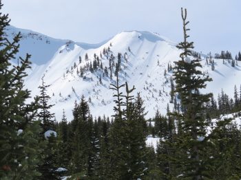
Near and Below tree line surface conditions

CB Avalanche Center2019-20 Observations

Location: Crested Butte Area
Date of Observation: 03/16/2020
Name: Zach Kinler
Subject: Near and Below tree line surface conditions
Aspect: North, North East, East, South East, South, South West, West, North West
Elevation: 9000-11,000′
Avalanches:
A few very small Wet Loose releases from steep southerly slopes which remained in the surface snow.

Weather: Increasing high-level clouds for this afternoon tour. Temps were above freezing at 11K. Calm winds even near ridgeline.

Snowpack: North aspects above 10K are dry while below 10K there are surface crusts and a crust from the previous warming cycle just over a week ago. These get thicker as you descend below 9K where they will soon be welded together. There were no wet loose concerns on this aspect. NW and NE aspects above 10.5K were dry while below, crusts were similar to N aspects getting thicker as you descended or moved towards S. Minimal Wet Loose concerns were seen here.

Moving towards the sunny side of the compass, the upper few inches of recent snow have been wetted down to the previous crusts which are still supportive. With strong overnight freezes and gradual warming trends, these aspects have transitioned very well. Most concerning areas are the steep, shallow areas near rocks, cliffs and dark timber. Cornices have grown large on certain easterly slopes and are starting to see warming…


A few small wet releases on a SE aspect with some overhanging cornices catching some sun.

Redwell Cornice Release

CB Avalanche Center2019-20 Observations

Location: Crested Butte Area
Date of Observation: 03/15/2020
Subject: Redwell Cornice Release
Aspect: East
Elevation: 12,000ft

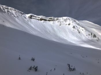
Avalanches: Estimated 3/14. A large cornice released above Redwell Basin on an easterly facing slope. That cornice gouged into a thin snowpack over rocky cliffs.

Northern Ruby Range

CB Avalanche Center2019-20 Observations

Location: Paradise Divide Area
Date of Observation: 03/15/2020
Name: Zach Kinler & Evan Ross
Aspect: North, North East, East
Elevation: 9,000-12,400′

Avalanches: D1.5 slab avalanche Augusta Mt. SE 12,400′. Estimated 3/14 early AM.
D1.5 Wind Slab in Coon Basin SE 11.800′ , just below the ridge. Estimated 3/14 early AM.
3x D1 Wet Loose avalanches on an East aspect 10,000′

Weather: Partly Cloudy, Calm winds up to ridgeline in the am, light SW winds in the afternoon. Temps remained below freezing in the alpine while areas near and below treeline warmed above freezing.

Snowpack: 4-5″ of recently settled snow from late Fri/early Sat. The newest snow was bonding well with the old interface which was 2-4 mm graupel. No wind slab issues encountered on leeward slopes. Northerly slopes above stayed dry down to our observed elevation of 10,500ft on that aspect. East aspects 11-12K were slightly moist with no wet loose activity while below 11K had enough moisture to initiate rollerballs and a few small wet loose slides from steep, rocky terrain. Southerly aspects were moist with rollerballs.


Obs around Crested Butte

CB Avalanche Center2019-20 Observations

Location: Crested Butte Area
Date of Observation: 03/12/2020
Subject: Obs around Crested Butte

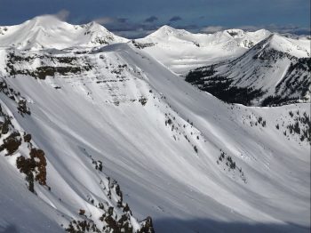
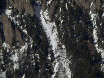
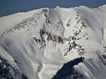
Avalanches: Small wet loose avalanche cycle in the warming storm snow. In very shallow areas below treeline a few gouged to ground. The cycle appeared confined to areas close to Crested Butte where temps warmed up more. In the high peaks of the Elks and Ruby Range, no evidence of a wet cycle. Also numerous shallow avalanches in steep terrain that ran during the 3/11 rain event, with debris piles buried by the few inches of new snow overnight.

Weather: Warm calm day. Felt greenhouse-like.

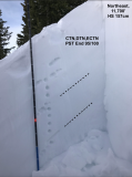
Snowpack: Tested persistent weak layers on northeast and southeast facing slopes near treeline. No problematic structures observed at this location. On the southeast-facing slope, recent meltwater has drained down through the upper snowpack leaving frozen vertical ice bodies, with frozen spreading ice lenses welding the upper weak layers to the slabs. The deepest ice bodies were around 70 cm from the surface. On the northeast facing slope, we dug not in a deep spot, not in a shallow spot, but a mid-slope site with about average depth. The snowpack is right side up, with no propagating test results on any faceted layers.

Photos:

Nice Creamy Conditions

CB Avalanche Center2019-20 Observations

Location: Paradise Divide Area
Date of Observation: 03/12/2020
Name: Evan Ross
Subject: Nice Creamy Conditions
Aspect: North East, East, South, West
Elevation: 9,200-12,200

Avalanches: Good views across the Ruby Range from upper Slate and Washington Gulch with nothing more than a few roller balls or a couple small loose wet avalanches noticed.

Weather: Overcast in the morning, decreasing to party cloudy in the afternoon. Another warm day with light winds.

Snowpack: Traveled through a bunch of different aspects and elevations with know real issues encountered. At upper elevations, there was 10″ snow that has accumulated this week. That snow was a lovely creamy sustenance that was fast and carvey. This new snow was thick enough that loose dry avalanches were not a problem. Simple hand shears were inconsistent and all in all stability was good. Got on a couple of smaller wind-loaded terrain features without any results, but didn’t make it to the highest ridgelines along the Ruby Range. Upper elevations southerly slopes had the same 10″ of thick cold new snow. At 3pm around those upper elevations southeast slopes were still nice and creamy, while straight south was a little thicker but not moist.

This weeks snow accumulations decreased with elevation. Northeasterly slopes, down to the lowest point I traveled on that aspect at 9,500, had the same thick and creamy good snow. No avalanche concerns were found. Easterly slopes warmed a bit with rising temperatures, but otherwise didn’t get much sun thanks to the AM clouds. Mid to lower elevation southerly slopes held onto intact old crusts, with variable punching through the snowpack near thin areas. Resent snow has been zapped down into the old crusts and there wasn’t much snow available for loose wet concerns. Where the old crusts did break down and the snowpack was unsportive, if something got moving some how then it could gouge into that wet snowpack becoming large in size. Just barley touched some westerly near treeline at the end of the day with no real concerns to report.

The best place to trigger an avalanche I suspect, would have been somewhere very steep with a thin and punchy snowpack. Or late in the afternoon at mid to upper elevation southwesterly facing slopes that had some recent snow that was becoming wet and could Loose Wet Avalanche on the old crusts. While avalanche concerns were not necessarily encountered on this tour, paying attention to heightened avalanche conditions for warming snow in the afternoon felt spot on. Definitely some interesting weather with all the warm temps and last nights drizzle of rain.

Afternoon sled about

CB Avalanche Center2019-20 Observations

Location: Paradise Divide Area
Date of Observation: 03/12/2020
Name: Eric Murrow
Subject: Afternoon sled about
Aspect: East, South East, South, South West
Elevation: 9,400′ – 11,000′

Weather: Partly cloudy in the afternoon with light winds.

Snowpack: Took a couple of quick looks at east-facing slopes near 11,000′ feet in the afternoon checking on new snow accumulations and the impact of last week’s warm weather. Unlike more southerly slopes, east-facing terrain has yet to see water move through the snowpack much. It remains in the upper 30cm of the snowpack with dry winter-like conditions below. Snow surfaces on the east aspects observed remained dry, except for slopes at very low elevations below 10k, from the cloud cover early in the day with about 4″ of recent snow.

While traveling through sunnier slopes, I did not find much terrain with a concerning Wet Loose problem. Sunny slopes in the afternoon, below 10k, had a couple inches of wet storm and rain-soaked snow, but old crusts below seemed to hang on just enough to keep a lid on the Wet Loose problem. The few spots that may have presented a problem for skier-triggering were very shallow, less than 100cm deep and at very low elevations near valley bottoms.

Axtel

CB Avalanche Center2019-20 Observations

Location: Kebler Pass Area
Date of Observation: 03/12/2020
Subject: Axtel
Aspect: North East

Snowpack: Axtel this morning. There was about 3” of yesterday’s new snow that was capped with a little rain crust, then about 3” of wet pow (from this morning’s blast) on top of that. It appeared all well bonded when I dug around and it only sluffed slowly on steeper angles.

Gothic snowfall

CB Avalanche Center2019-20 Observations

Location: Crested Butte Area
Date of Observation: 03/12/2020
Name: Billy
Subject: Gothic snowfall

Weather: Only light snowfall but with a lot of water and the 2″ that fell overnight was 0.28″ water and almost all graupel which will not bond to anything until it warms up and melts. Total 24 hour total is 3½” new snow and 0.44″ of water. Currently overcast with a very light off and on snowfall. Snowpack holding at 46″ deep and very warm overnight with the temp. range 29 to 33F and currently 30F. Only light to no west wind. billy