Washington Gulch and Paradise Divide

CB Avalanche Center2017-18 Observations

Location: Paradise Divide Area
Date of Observation: 12/11/2017
Name: Ben Pritchett

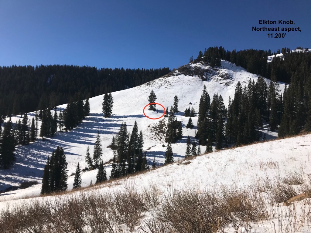
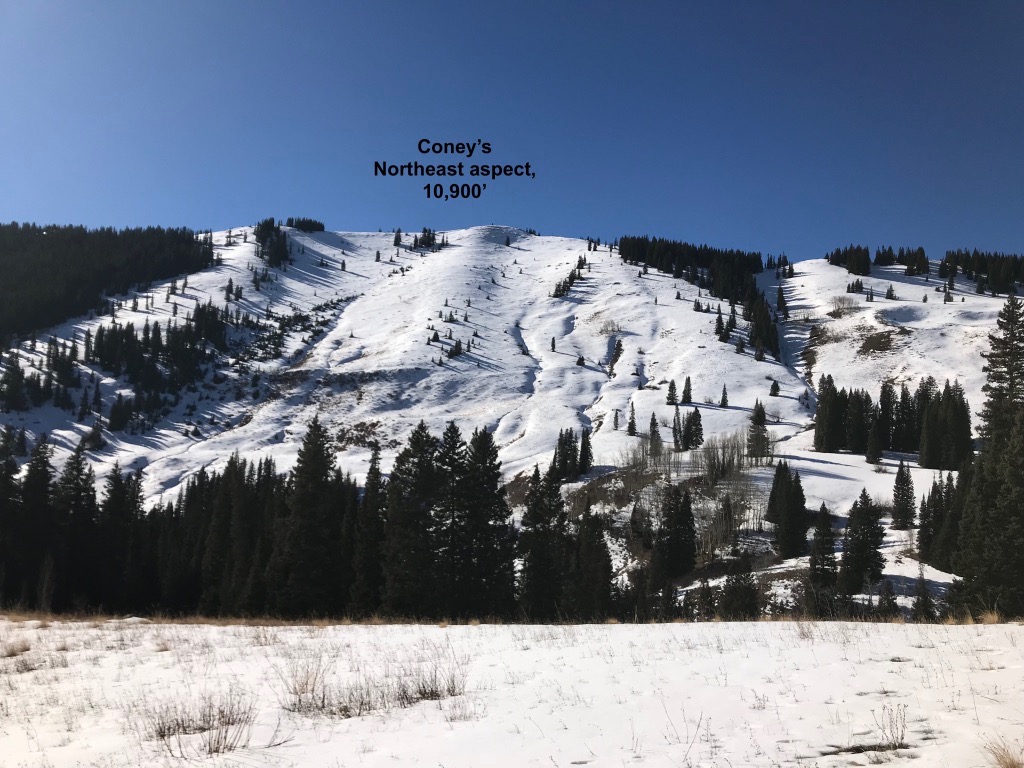
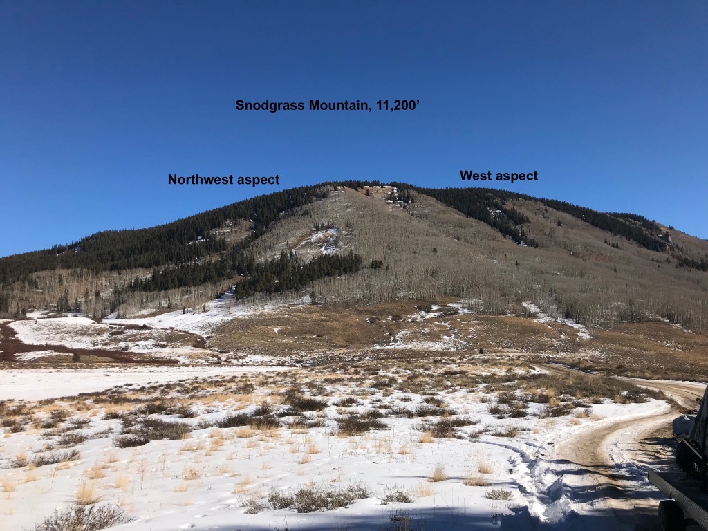
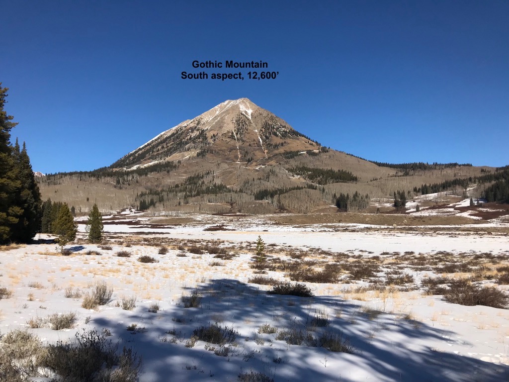
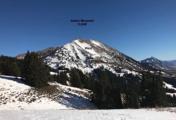
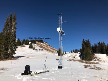
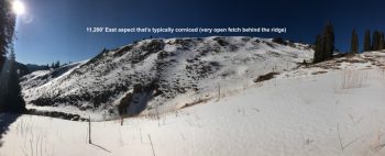
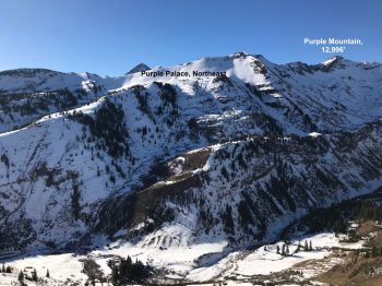
Subject: Washington Gulch and Paradise Divide
Aspect: North, North East, East, South East, South, South West, West, North West

Weather: Bluebird day with mild temperatures and light northwest winds.
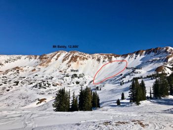
Snowpack: Went in search of the elusive near treeline persistent slab structure. Evidence was very difficult to find. Only in Paradise Divide proper (behind Baldy) was there enough snow for any slab structure, and there it was extremely discontinuous and isolated to small pockets. Bumped into our CBAC intern, digging a profile near a profile we dug prior to the November 17th storm. Interestingly, the HS was nearly identical. The slab was less stiff today than a month ago. Elsewhere in the zone, away from the micro-snowclimate at Paradise Divide, the near treeline snowpack is simply too thin.

Photos:

Treasury Ridge

CB Avalanche Center2017-18 Observations

Location: Paradise Divide Area
Date of Observation: 12/10/2017
Name: Sydney Dickinson

Subject: Treasury Ridge

Snowpack: We spent the last two days on treasury ridge. Saw that the wine couloirs don’t go yet and a huge mt goat is living up there! Yesterday we skied south aspect. It was supportable but awful skiing. Today after getting denied from the couloir we dropped into rock creek on more of the east aspect and found some good turns in the wind riffles. Also supportable. Finished off the day with some sled laps on Baldy. Someone high marked the gut, got pretty high, no results.

Slate River/Cinnamon Mountain

CB Avalanche Center2017-18 Observations

Location: Paradise Divide Area
Date of Observation: 12/07/2017
Name: Ian Havlick

Subject: Slate River/Cinnamon Mountain
Aspect: East, South, South West, West
Elevation: 9500-11500

Avalanches:no new avalanches observed, but did see evidence of pretty widespread wet loose cycle in valley bottom. Weather: Overcast, flurries, cold and steady north wind all day. accumulations 1/2″. temps 14-19ºF.
Snowpack: did not encounter any persistent slabs in terrain travelled. Obvious crusts, sometimes supportable on more southerly slopes, 3mm facets below. Safe generalization would be that snowpack with depths less than 3ft is entirely faceted out, capped by 3-10cm melt freeze crust. Ice climbing is shaping up though and spelunking in 2017 snowpack is novel! New fallen snow was blowing into 2-4″ windslabs-no hazard.

Photos:

Mt. Axtell

CB Avalanche Center2017-18 Observations

Location: Kebler Pass Area
Date of Observation: 12/03/2017
Name: Thomas Ney
Subject: Mt. Axtell
Aspect: North, North East, East
Elevation: 11,000 ft

Avalanches:

Observed an old large debris pile from a wet slide on a North facing slope at around 11,000ft, WS-N-R2-D2/3-O. In the debris there are small trees around 3inches thick that where broken and microwave to large tv size pieces of debris. The avalanche cut out a 5.5 foot trench on the lower angle slopes underneath the steep rocky slopes above (See picture). The surface that was exposed in the trench was isothermal snow (See Picture). The avalanche or avalanches must have came down from the steep rocky train above after our unseasonable warm up following our last major snow storm on November 18.

Weather: Partly sunny in the morning turning into mostly overcast by mid day. Temps in the morning where in the high 20s and by mid day were near 30 degrees Fahrenheit at 10,000ft to 11,000ft.
Snowpack: So so thin…. My partner and I dug a snow pit on a 27 degree east facing slope around 10,400ft. We found the depth to be 33cm. At the bottom there is a 5cm isothermal crust. After the isothermal crust there is a 12cm of finger density crust. After the finger density crust there is a 13.5cm of facets/sugar snow. On top is a 2.5cm of breakable crust.

IMG_2219
IMG_2249
IMG_2246
IMG_2231


Upper Slate Recon

CB Avalanche Center2017-18 Observations

Location: Paradise Divide Area
Date of Observation: 12/02/2017
Name: Ian Havlick
Subject: Upper Slate Recon
Aspect: North, North East, East, South
Elevation: 10-11,500

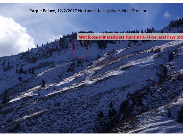
Avalanches:  Observed several D1 wet loose avalanches that looked a few days old, and one wet loose triggered persistent slab below steep cliffed terrain on a northeast facing slope near treeline. Observed through binoculars and did not investigated, but debris looked to have run like a wet loose, scouring to talus below.

Weather: Scuddy clouds this morning cleared to partly cloudy skies midday, occasional high clouds during the afternoon. Very warm temperatures with 46º in valley, and 41º at 11,000ft at 1500. Skiff of new snow from flurry overnight.

Snowpack: Quite low snowpack overall with dry conditions on south and west facing slopes near and below treeline. On shady north and northeast facing slopes, snowpack varied between shallow, moist, isothermal snow near and below treeline to more faceted snowpack with thickening, slick surface crusts 5-8cm thick.

Slide4
Slide3
Slide2
Slide1

Site visit to Gothic East Face apron

CB Avalanche Center2017-18 Observations

Location: Crested Butte Area
Date of Observation: 11/27/2017
Name: Ben Pritchett
Subject: Site visit to Gothic East Face apron
Aspect: North, North East, East, South East

North to northeast = weak, faceting snow, topped w/ temperature crust, avg HS 40-50cm.

East = dense, moist, supportive surfaces, with frozen ice columns through dry snow connecting to the ground (“percolation tubes”), avg HS 10-30cm.

Southeast to south = moist to wet well-developed Melt Forms (“corn”), avg HS 5-20cm.

November Wet Slab

CB Avalanche Center2017-18 Observations

Location: Crested Butte Area
Date of Observation: 11/26/2017
Name: Ben Pritchett
Subject: November Wet Slab
Aspect: East
Elevation: 12,200

Avalanches:

This avalanche was first observed at 8am on Nov 26th, and reported to the CBAC around 3pm. The debris was described as gleaming white, looking fresh at 8am, though the observer assumed it likely ran the afternoon prior (Saturday, November 25). By the time I got eyes on the slide at around 3:15pm, it was in the shadows, so all details reported here are based on the attached photo and phone call with the observer.

A photo from prior to Nov. 17 storm does show the presence of old snow in the particular location of this avalanche, and the avalanche photo does show a white bed surface. Reports from East facing terrain on Mt. Bellview indicated that snow surfaces were wet ~15cm from the surface at around 12,000′, so I presume melt-water pooled on the Nov. 17 interface, releasing this slide on the afternoon of Nov. 25.

Weather:
Snowpack:

IMG_4835

Old Wind Slab on Mt. Bellview

CB Avalanche Center2017-18 Observations

Location: Paradise Divide Area
Date of Observation: 11/23/2017
Name: Turner Peterson
Subject: Old Wind Slab on Mt. Belliview
Aspect: South East
Elevation: 12,000′

Avalanches:

Saw this old avalanche that probably ran Nov 20th during the North winds, after the Nov 17th storm.

Weather:
Snowpack:

Belleview-old-wind-slab

Snodgrass obs

CB Avalanche Center2017-18 Observations

Location: Crested Butte Area
Date of Observation: 11/21/2017
Name: Alex Tiberio
Subject: Snodgrass obs
Aspect: North East, East
Elevation: 10,000

Avalanches:
Weather: Light snow with 1.5″ new overnight
Snowpack: The E/NE aspects held snow from October and this was noticeable in a couple quick hand pits. Crappy sugary snow below the more recent snow. Some whumpimg and shooting cracks near 10,000 feet. No reaction on a ski cut. Snow still quite thin hit several small rocks on descent.

Maritime in the Rockies

CB Avalanche Center2017-18 Observations

Location: Paradise Divide Area
Date of Observation: 11/20/2017
Name: Ben Pritchett
Subject: Maritime in the Rockies
Aspect: North East
Elevation: 10,600′
Tried to go hunting for a persistent slab problem in the Anthracites, but the snowpack was simply too thin to pose an avalanche threat.  Reversed course and drove to Rustler’s Gulch to see if the persistent slab problem existed around the Schofield Pass elevation.

Avalanches:

Observed several old avalanches, previously reported, off Baldy’s NE face into Emerald Lake.

Snowpack:

Pretty thin out there overall.  Generally 30-4ocm in most of the upper East River Valley.  Only very near Schofield Pass did we get into a deeper snowpack that averaged ~50cm.

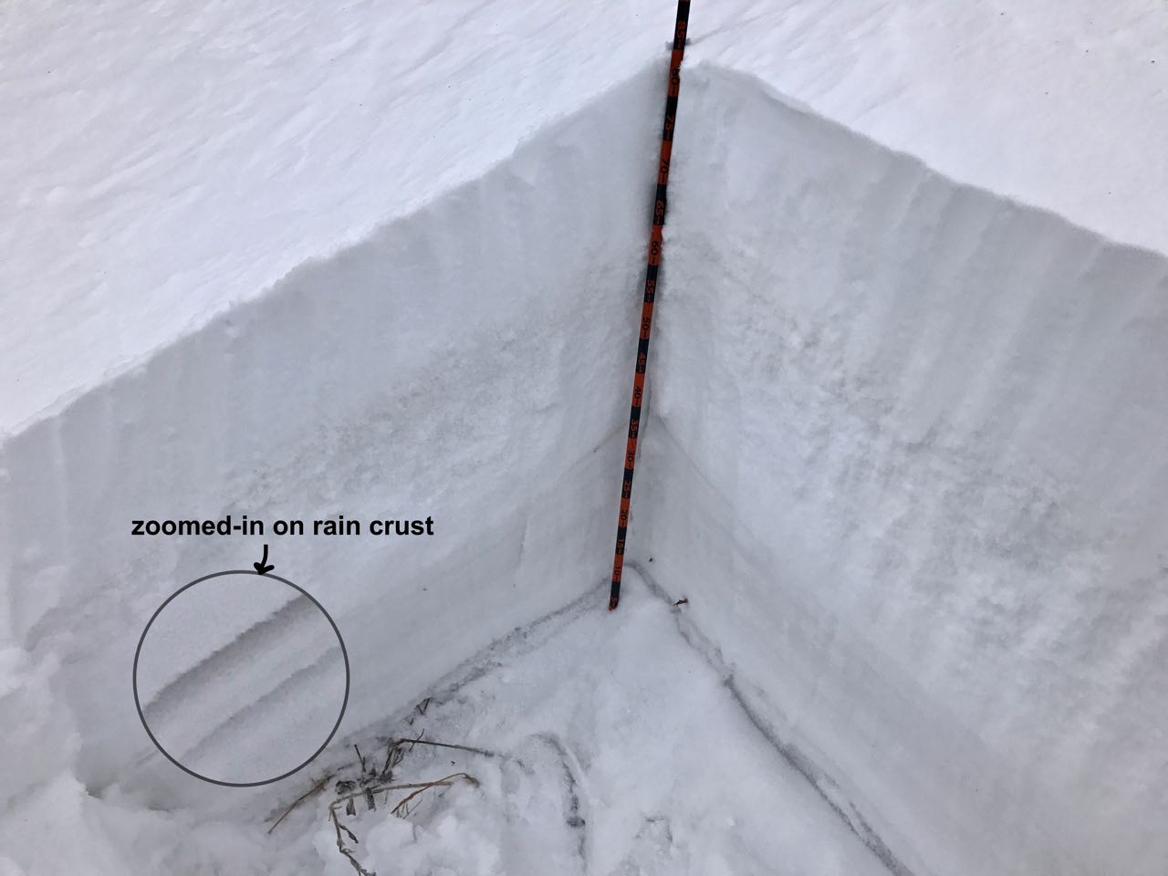
The low snow levels at the beginning of the November 17th storm limited accumulations until the second half of the storm, when the graupel began to pile up!  During the beginning of the storm slashing rain fell in downtown Crested Butte, and here in the upper East River valley mixed rain and snow fell and formed a crust at the bottom of the storm snow.

The snowpack we observed at this site was “right side up” with, with no results in multiple snowpack tests.

Looking at the landscape, the Persistent Slab problem appears isolated across the mountain range, found only in a small proportion of the higher elevation Northly slopes of the Ruby Range and Schofield Pass area.

IMG_0876-1
IMG_0875-1
IMG_0874-1
IMG_0873-1