Valley bottom ob.

CB Avalanche Center2017-18 Observations

Location: Crested Butte Area. Washington Cultch
Date of Observation: 12/23/2017
Name: Evan Ross

Subject: Valley bottom ob.
Aspect: East
Elevation: 9,600-10,000

Weather: Obscured Sky. Snowing mostly S1. About 2-3″ accumulation between 11am and 3pm. Some gusty down valley winds but we were mostly protected by some trees.
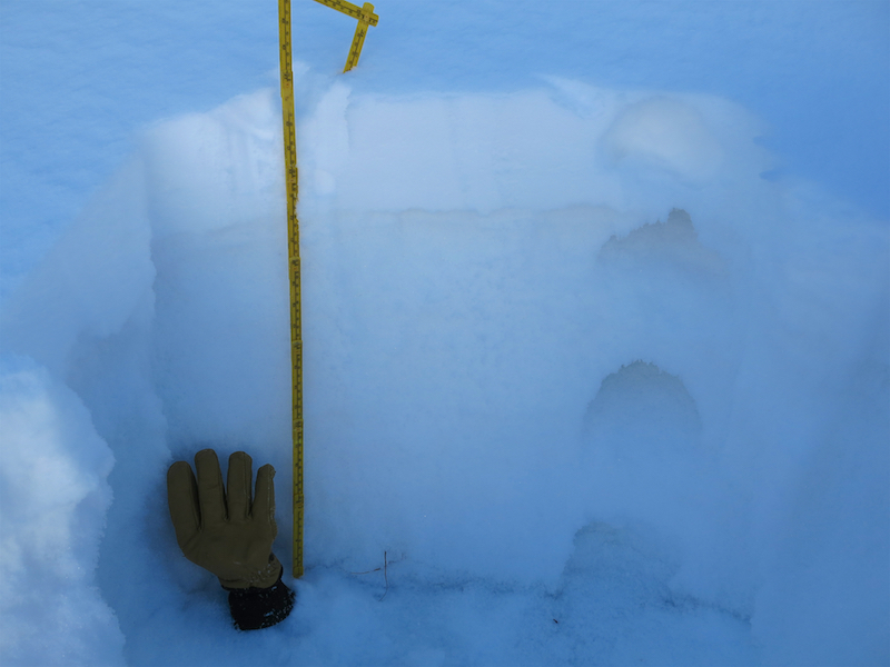
Snowpack: Was only on sub 30 degree low angle terrain in the valley bottom. About 6″ of new snow accumulation since Thursday. Hand pits showed the top couple inches of new snow moving onto of Thursdays snow and not on the old snow/faceted interface.. Though these obs were from so low in the valley and there really wasn’t any slab yet for notable results. HS about 40cm.

Photos:

More sand in the Sandbox

CB Avalanche Center2017-18 Observations

Location: Paradise Divide Area
Date of Observation: 12/22/2017
Name: Evan Ross

Subject: More sand in the Sandbox
Aspect: North, North East, East, South
Elevation: 9,700-12,300

Weather: Gusting moderate winds from the northwest were blowing snow around above treeline. A few swirling gusts at lower elevations otherwise mostly calm winds. Few clouds.
Snowpack: Couldn’t buy an avalanche, even with one of those BitCoins. Yesterday’s new snow was very soft and lacked any cohesion to form slabs. Very continental snowpack. Maybe that snow fell with such cold temperatures, then the sky cleared overnight and the 6″ HST at 11,000ft just headed down the faceting train and never got a chance to strengthen into a slab. Kind of like sprinkling some powdered sugar on top of the large-grained sugar. It’s still a surgery sandbox. This was the snowpack structure on North and Northeast facing slopes above 10,500ft up to an observed 11,500ft. Below that elevation ban, there is very little snow. The crust that was observed in this observation was only present on easterly facing slopes in this area. Southerly facing slopes in the area were just a little new snow on the ground.

At ridgeline, most of the recent new snow had already been transported. This snow had been loaded onto easterly facing slopes right at ridgeline, and further downslope on cross-loaded terrain features. Drifts up to 2 feet deep could be found, but were very narrow and didn’t extend downslope very far. These drifts were also fist hard and didn’t want to budge on the old snow surface. Probably due to lack of cohesion or just small square footage size. Northeasterly and north facing slopes were blown back to the old snow surface. Cross-loaded terrain features on these north to northeast facing slopes would maybe be more reactive then what I observed?

In the end, went searching for an avalanche problem in some of the most suspect areas and couldn’t find one. Windslabs would have been the only terrain management, but didn’t find any that were reactive. When will more widespread slabs form is the big question.

Photos:

Protected NNE facing slope at 10,800ft. The new snow may look more white, but it was still just sugar on sugar. When ever that new snow forms a slab it will be ugly, but it hasn’t happened yet.

Windslab? They were all so soft on easterly facing terrain and not showing any sings of bugging on the old snow surface. Weak layers below but not nearly enough weight to collapse them. Right near rigeline these drifts were up to 2 feet deep. Most of the new snow in the alpine was already blown around by the winds.

North Aspect at 12,000ft. Mostly blown back to old snow surfaces. Thats a rock track sliding down the slick old snow.


Cross-loaded terrain features on north and northeast facing terrain may have been more suspect. These very soft slabs would have been managed like windslab characteristics.

Most of the new snow had already been transported above treeline.

Example of easterly aspect below 10,200ft. This thin snowpack coverage didn’t change between the Crested Butte Area or the Paradise divide Area. Northeasterly facing slops didn’t have much more coverage.

Looking at the 9,500ft to 11,400ft elevation ban generally facing Northeast, on Schuylkill Ride in the more snow favored Paradise Divide area. Still very thin snow coverage.

Opa Hut Storm Observation

CB Avalanche Center2017-18 Observations

Location: Cement Creek Area
Date of Observation: 12/21/2017
Name: Morgan Boyles

Subject: Opa Hut Storm Observation
Aspect: North East, East
Elevation: 10-11,500

Avalanches:

none

Weather: intermittent bands of S-1 to S2 with overcast to broken skies. winds were calm to light.  10cm new snow.

Snowpack: skied east facing, 30º slopes 1mi north of Opas Hut, HS 30-90cm, mix of supportive, breakable and soft shaded facet skiing. 1 section of isolated cracking on NE facing slope on a slick melt-freeze crust. Good stability.


Pre-storm shakedown

CB Avalanche Center2017-18 Observations

Location: Crested Butte Area
Date of Observation: 12/20/2017
Name: ZDK

Subject: Pre-storm shakedown
Aspect: North, North East, East, North West
Elevation: 9000-11,200

Avalanches:

None observed.

Weather: Overcast with stormy-looking clouds building. 26F at 10:00 to 32F at 13:30, light S-W winds BTL
Snowpack: Toured E-NE-N-NW aspects from 9,000-11,200 around Wolverine Basin. Average snowpack 30-50cm of weak faceted snow below a 1-3 cm faceting crust from warmer temps in late Nov. That crust generally now has 1-4 cm of small faceted crystals above it on most sheltered slopes from recent light accumulations . Although the crust has weakened in recent weeks, it still may be capable of supporting a slab in certain areas especially as you move from North aspects to NE and E aspects.

Photos:

Cinnamon Mountain

CB Avalanche Center2017-18 Observations

Location: Paradise Divide Area
Date of Observation: 12/16/2017
Name: Ian HAVLICK

Subject: Cinnamon Mountain
Aspect: East, South East, South, West
Elevation: 10,100-12,300

Avalanches:

no avalanches observed.

Weather: Overcast all day, chilly but only very light winds made day feel warmer. Minimal solar radiation.
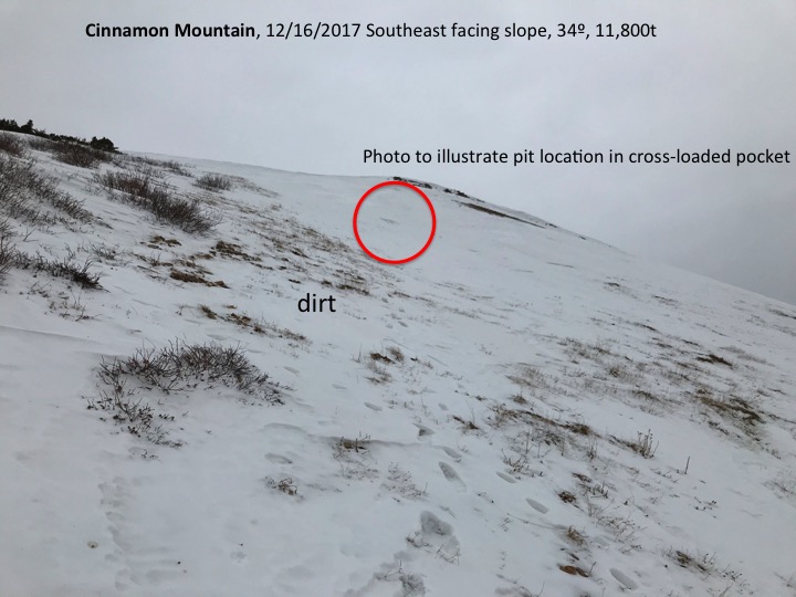
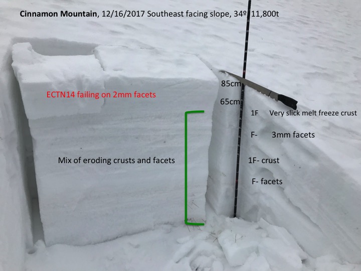
Snowpack: Tale of two different snowpacks at the moment. near and below treeline snowpack is shallow and generally completely rotten and faceted. Big grained depth hoar, total sandbox, with depths ranging from total dirt to 50cm.

Above treeline, the snow surfaces are a war zone. Variable snow surfaces, very dense, slick, wind hammered. Dirt to crossloaded pockets 90cm deep. Snow structure is a beaten dog, 80% facets, with some real firm hardslabs (pencil+ to knife hard). These conditions are not dangerous at the moment, but will be looking at poor instability with any new snow loads. At ridge crest, Wednesday’s 1″ accumulations had drifted to 6-8″ but minimally cracking under boot foot.

Photos:

Washington Gulch

CB Avalanche Center2017-18 Observations

Location: Crested Butte Area
Date of Observation: 12/15/2017
Subject: Photos taken from up Washington Gulch
Aspect: North East
Elevation: 10,843

Weather: Sunny with little wind
Snowpack: Facets to the ground beneath a crust layer with a dusting of snow on top from Wednesday night’s storm. Some areas had no new snow dusting and some areas were deeper, maybe 2 inches of new snow.


Little Italian Mountain/Taylor Pass

CB Avalanche Center2017-18 Observations

Location: Upper Taylor Area
Date of Observation: 12/15/2017
Name: Ben Pritchett

Subject: Little Italian Basin (Italian Joe Pass) / Taylor Pass
Aspect: South, South East
Elevation: 10-12,000ft

Avalanches:

Observed several D1 windslabs near Little Italian Basin and Taylor Pass.

Snowpack: north winds transported snow onto SE facing slopes above treeline. At 11,000ft we saw a 50cm entirely faceted snowpack. Once above treeline, the snowpack is wind and sun ravaged, with pockets of sunbaked hardslab between scoured and crusted facet beds.

Coney’s

CB Avalanche Center2017-18 Observations

Location: Crested Butte Area
Date of Observation: 12/12/2017
Name: Cam Smith

Subject: Coney’s
Aspect: North East
Elevation: 10,700

Avalanches:

None observed


Weather: Warm and sunny. Above freezing in the afternoon. Calm winds.

Snowpack: 15-35cm HS. Generally deeper as you got higher and in loading prone areas. Thin, fragile sun crust on the surface. 1-2mm facets to the ground, everywhere. No signs of instability.

Photos:

Poverty Gulch to Richmond Mountain

CB Avalanche Center2017-18 Observations

Location: Paradise Divide Area
Date of Observation: 12/13/2017
Name: Eric Murrow

Subject: Poverty Gulch to Richmond Mountain
Aspect: North, North East, East, West, North West
Elevation: 9,250 – 12,500

Avalanches:

Weather: Morning started with few clouds/nearly clear and at 10am clouds rolled in and was overcast the rest of the day. Winds were well behaved with speeds of only about 5mph, infrequent questing up to about 10mph. At summit of Richmond winds were still very light out of the west. Overall pleasant day for a walk.

Snowpack: Most surfaces were either facets, faceting windboard, or a few crusts. Travel was generally quite supportive, making travel easy.

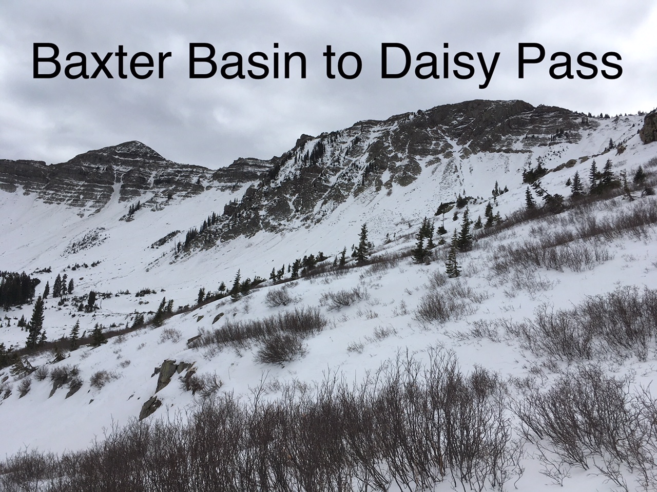
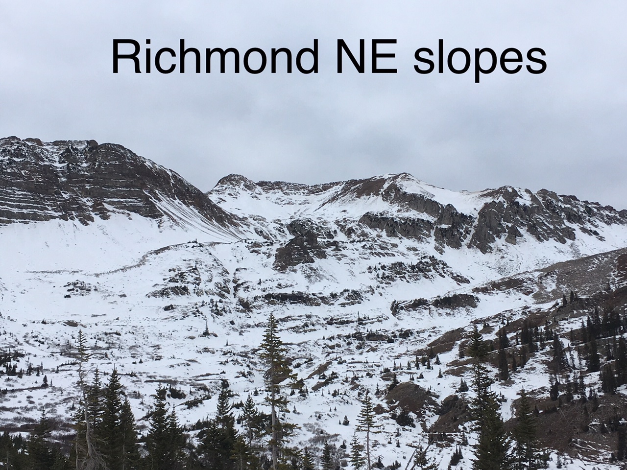
On the way up, we crossed many wind loaded pockets (still only around 70cm deep, N -E aspects) near and above treeline and had no collapsing or shooting cracks. Dug numerous quick hand pits in these deeper pockets; rarely found slab/weaklayer structure. Many of these deeper wind deposits were just supportive windboard over very weak F hardness facets. Had a hard time finding hazardous structure. Slab structure was very small in surface area and was discontinuous from rest of slope, even in areas with same surface conditions.

Ski conditions were mostly crap, but at least supportive. Here are a few photos showing snowcover over some of this terrain.

Photos:

Paradise divide tour

CB Avalanche Center2017-18 Observations

Location: Paradise Divide Area
Date of Observation: 12/11/2017
Name: Eric Murrow

Subject: Paradise divide tour
Aspect: North, North East, East, South East, South West, West, North West
Elevation: 9,600 – 11,750 Weather: Bluebird all day. Winds were blowing steady but light around 5 – 15, gusting to 20mph. Winds were out of the north. Air temps were pleasant with reading of 34f @ 11,100, 11:30am.
Snowpack: On the first part of our ascent went up westerly facing slopes 9,600 – 11,000. Snow surfaces were facets, and faceting crusts. Snow was shallow generally less than 35cm. Skiing was supportive.

Easterly slopes off of Cinnamon 11,000 – 11,750, were a again a mix of facets and crusts. Wind erosion has stripped much of this terrain, leaving many sculpted eroded features. Snow was supportive. Terrain features facing SE, out of the wind, softened just a cm or two which made for a few nice supportive, smeary turns around 1:30pm. Similar SE aspects the had more wind stayed cool and didn’t soften.

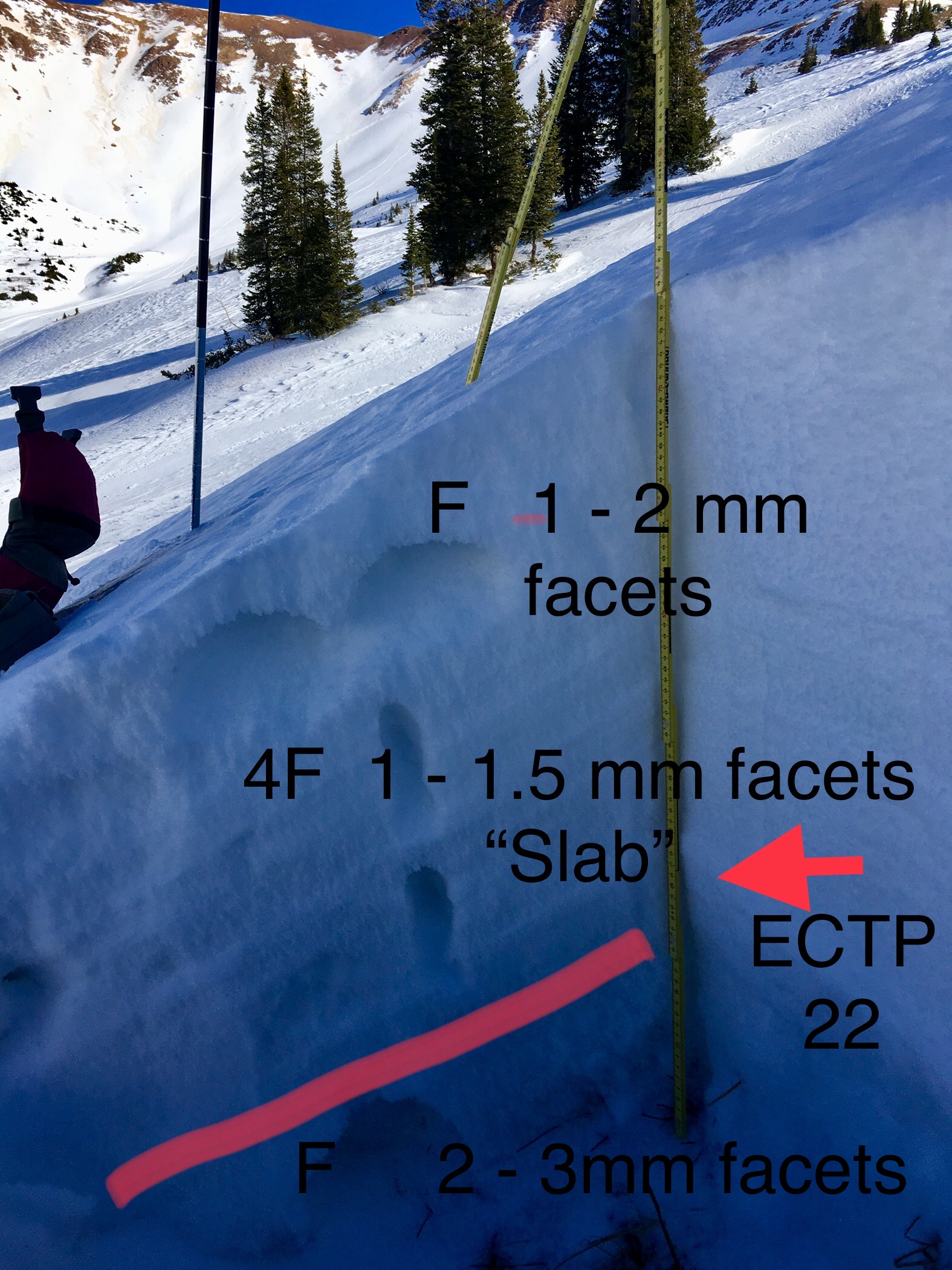
Dug one quick profile on an due North slope at 11,250 which had seen previous loading(HS 78cm), and found a cohesive slab resting over the Oct/early Nov snow. This site produced a hard propagating test result in an ECT (ECTP 21). This site had deeper snowpack than the immediate adjacent terrain, but shows the potential for isolated areas with deeper accumulations from loading to have a slab/weak layer present. See photo.

Photos: