Location: Crested Butte Area Date of Observation: 02/16/2018 Name: Ben Pritchett
Subject: a few D2’s around Crested Butte Aspect: North East, East Elevation:
Avalanches:
4 x D2’s on Axtell and Whetsone.
Weather: Snowpack:
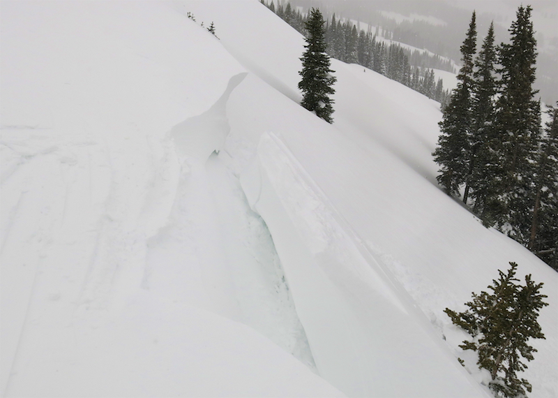
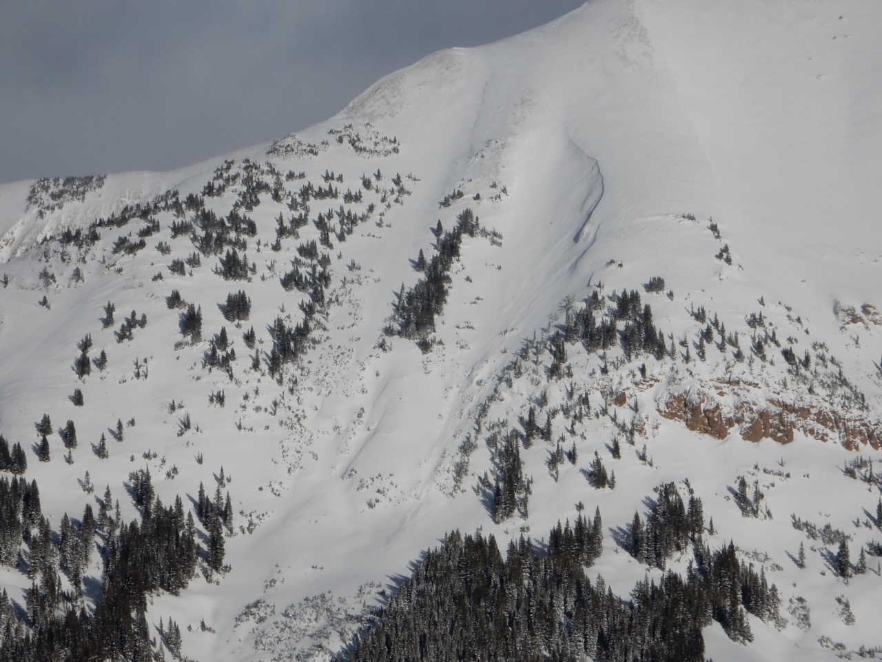
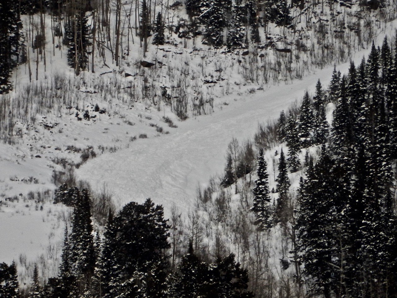
Photos:
Main line on Whetstone, off the summit.
This path is a repeat performer this season.
Classic wind-loaded un-supported slope. This is the largest slide we’ve seen immediately around Crested Butte so far this season. Wouldn’t be surprised to see bigger slides closer to Paradise Divide from this same cycle.
Great example of a small Wind Slab stepping down to become a large Persistent Slab.
Avalanches: Weather: Cloudy with variable wind and snow so a 24 hour total of 5" new snow and 0.39" water. Snow at winters deepest of 40". Snow total for the past week of 25". Now clear and much cooler with the current and low -7F while calm (and hooray for the calm part). billy Snowpack:
Location: Kebler Pass Area Date of Observation: 02/15/2018 Name: Eleven Guides
Subject: Eleven Guides PM Report (Cat tenure) Aspect: East, South East, South, South West, West Elevation: 10-12,000ft
Avalanches:
Generally stable aside from one SS-AE-R2D1.5-O failing on 2/12 Crust/facet combo in Sonic (NTL, East facing). Heavy afternoon snowfall was creating shallow, dry loose sluffing on slopes steeper than 35º (Two chutes, assassins).
Weather: Scattered light snow showers and strong winds in the morning, then transitioned to lighter winds and heavy snowfall during and after lunch. 8″ (.9″SWE) storm but snow measurement challenging with strong winds. High precip rates in the 1-2″/hr range all afternoon. Temps remained in lower 20s at SP and 14 at Ridge. Snowpack: Snowpack in tenure remained quite stable, SWE continues to build. Isolated windslabs and potentially a building storm slab but based on terrain travelled today, good right-side up snowpack and bonding to underlying snowpack, even late afternoon with heavy snowfall. Higher up the Upper Westwall, snow grows more stiff and slabby.
Location: Crested Butte Area Date of Observation: 02/15/2018 Name: Evan Ross
Subject: Coney’s Aspect: North East Elevation: 9,500-11,000
Avalanches: Weather: Overcast. Light snow before noon, then picking up with some heavy bursts in the afternoon. 6″ during the day would be a ruff estimate. Ridgeline winds were generally moderate and transporting snow at times. Snowpack: Lots of wind-transport snow over night since yesterday. Not much for cornices yesterday, with some good ones developed by this morning. Start zones are looking well filled in. Avoided the most suspect areas. Otherwise quiet with no signs to instability.
Location: Crested Butte Area Date of Observation: 02/15/2018 Name: Ben Pritchett
Subject: Pittsburg Aspect: North, North East Elevation: 9,000-10,700′
Avalanches:
Saw 4 D2’s on Schuylkill that ran sometime between Tuesday afternoon and Wednesday mid-day. SS – N – R1/D2 – O
Weather: Snowed pretty much all afternoon, steady. Didn’t accumulate to that much, only an addition 3″ in the PM hours, but certainly made the surfaces soft. HN24 7-10″, measured .7″ SWE. No significant wind transport observed in the sheltered terrain where we were, but west winds really don’t hit Pittsburg. Probably quite windy elsewhere. Snowpack: Didn’t get any cracking or collapsing in the new snow, but by mid-afternoon sloughs were running in steep terrain over 40 degrees.
Dug in two places.
1) 10,400′ NE – in a path that avalanched January 12th below the holiday slab (12/23 interface). total HS was ~135cm. ECTP moderate, popping into our pit with a lot of umpf. Scary structure and represents a similar structure to the avalanches observed below, and the recent mention of skier triggered activity in the last 10 days.
2) 10,600′ NE – in a path that had not avalanched this season. Total HS was 170cm. ECTN. Just too deep and slab too stiff for ECT results. PST End 40/135 repeated in a couple tests, with identical results. Also tested both the 12/23 interface (below holiday slab), and the 1/6 interface just above it. Both produced 40/135 results twice, but the block collapsed and slid on the 12/23 interface. These weak layers are pretty deep and not reacting right now, but worrisome if we get a really big load at once. This slow steady snowfall over the past week hasn’t triggered any slides on these weak layers locally.
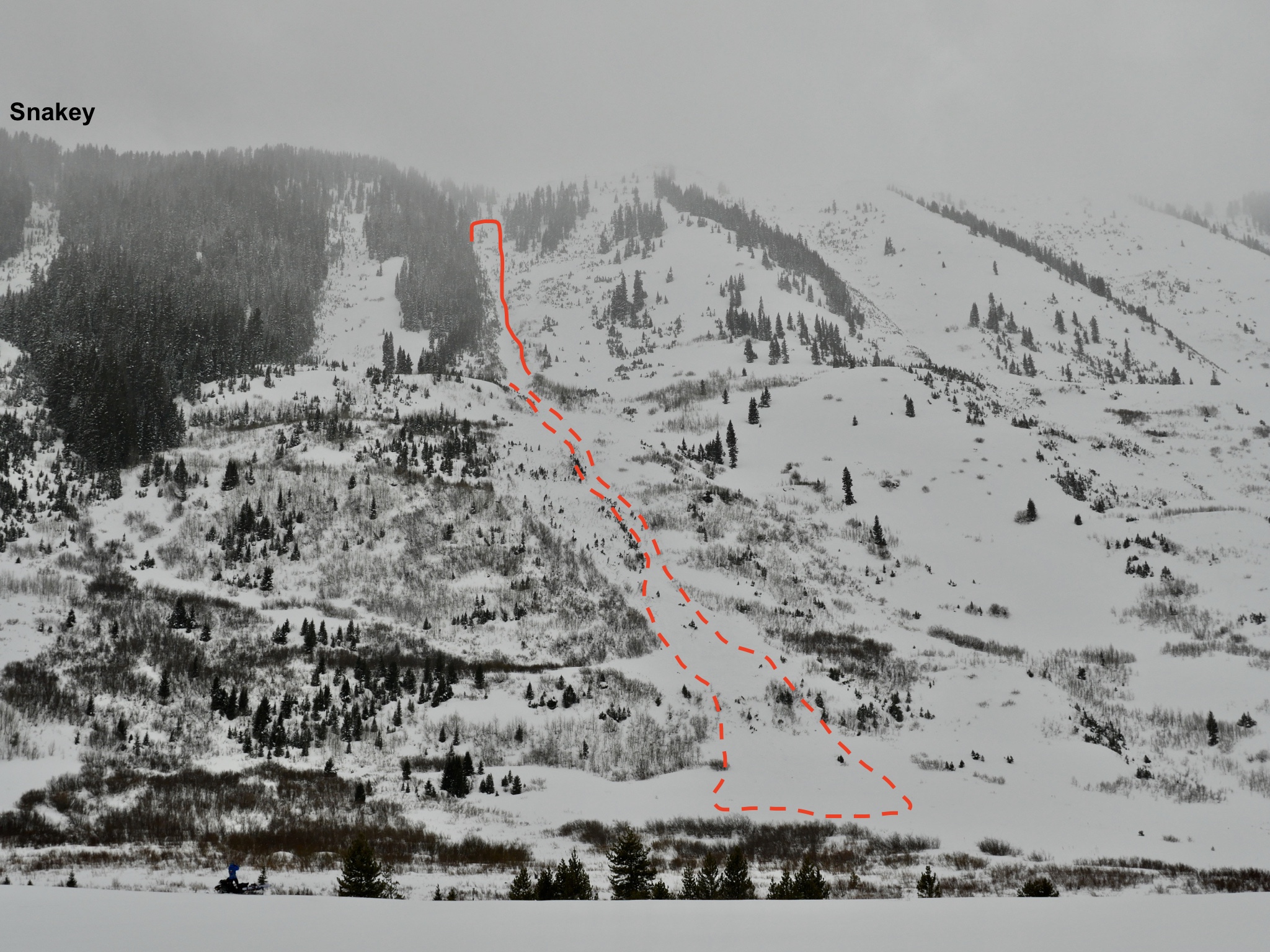
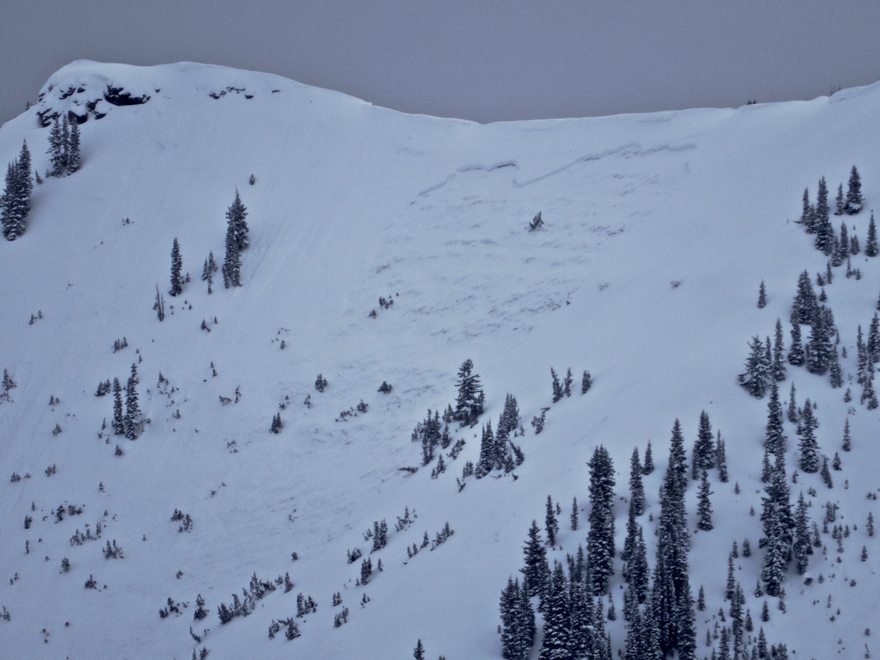
Photos:
D2 at the end of the trees on Schuykill Ridge. This slide ran between Tuesday PM and Wed mid-day (based on reviewing photos from each of those times). The next path up valley (looker’s right) ran Monday.
Three more D2’s just down valley of the first. All ran as repeat offenders on bed surfaces that re-faceted after the Jan 10-12 avalanche cycle.
Location: Cement Creek Area Date of Observation: 02/14/2018 Name: Ben Pritchett
Subject: Trenchtown in Cement Creek Aspect: North, Southwest, West, North West Elevation: 9,000-12,000′
Avalanches: One recent Persistent Slab avalanche off Hunters Hill that gouged down into the depth hoar. East southeast aspect, 12,200′. Given the recent drifting and how sharp the crown appeared through binoculars, I’d guess the slide ran during Monday night’s wind event.
Weather: Warm, breezy day, with looming low dark clouds. PM winds picked up and began to transport snow efficiently near and above treeline. Snow showers rolled in around 2pm, though no significant accumulation.
Snowpack: Very weak, largely unsupportive. Sledding out the valley floor was total Trenchtown. With Al Smith’s grooming (thank you Al!!!) travel was very easy to Hunter Creek, but we didn’t dare leave the road for fear of pegging rocks. Beyond Hunter Creek the snowpack was 60-80cm deep and marginally supportive, requiring good balance and light careful throttle. It would be easy to dig a deep hole for yourself out there given how weak it is. Huge differences in snowpack strength with aspect and drifting patterns. We measured .75″ of SWE from this week’s storms, compared to 1.75″ of SWE measured yesterday in Pittsburg.
Sunny south to west slopes – Thin crusts mid-pack kept ski pen from going to ground. Several moderate collapses above 11,500′ as we got into wind effect, with consistent cracking under skis. HS ranged from 30 to 70cm, avg. 60cm. Little concern for problems in the short term on these aspects with the forecast for strong southwest to west winds.
Shady west to north slopes – Deeper, with HS 60 to 120cm, avg. 90cm. Very weak. Without wind effect, ski pen was over half the snowpack, trenching on sled or skis. In drifted spots ski pen would rise up to 10cm (ahhh, the trailbreaking was so much easier). Got into some steep north facing terrain and pushed on some wind drifts. Had one slope fail, with cracks extending about 200′ downslope and the snowpack displacing an inch or two downslope but stopping. It was literally on the verge of avalanching, but not quite enough load. As we skied below the drifted portion of the slope, the slab quickly tapered and inconsistent trap doors opened and closed from local drifting patterns, making for deep but highly inconsistent pow skiing. As we got below treeline and out of wind effect the homogenous facet beds topped with storm snow made for more consistent turns.
Overall, this snowpack is super weak and teetering on the brink of avalanching where recent winds have formed slabs. Outside of the drifted areas, it’s simply weak and slab-less.
Location: Crested Butte Area Date of Observation: 02/14/2018 Name: Evan Ross
Subject: Connies Aspect: North East Elevation: 9,500-11,000
Avalanches: Weather: Overcast. Warm temps. Winds were calm in the valleys, some moderate westerly gusts at ridgeline. Not much for drifting snow. Higher peaks like Mt Baldy had snow plums much of the day. Snowpack: Start zones are looking nicely filled in. Boot pen is still to the ground. HS in the 120 range on average. Avoided the most suspect areas. Otherwise quiet with no signs to instability.
Location: Kebler Pass Area Date of Observation: 02/13/2018 Name: Ian Havlick Aspect: North East
Avalanches:
Saw three D2 avalanches in Peeler Basin off the opposite side of Scarps Ridge from the Irwin Cat tenure. Too little visibility for good photos, but all looked to have run on the early season depth hoar.
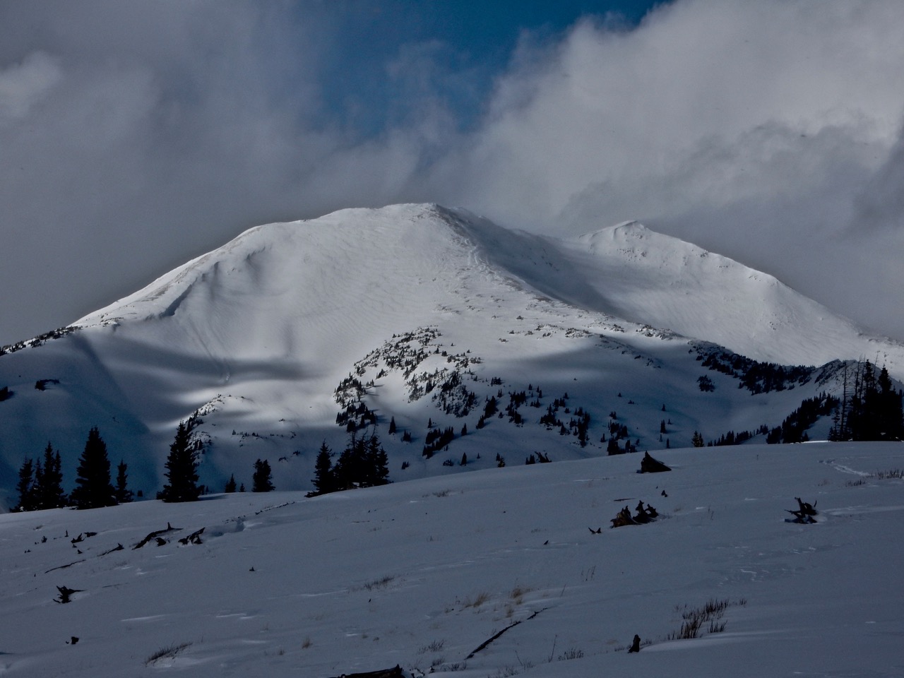
Location: Paradise Divide Area Date of Observation: 02/13/2018 Name: Ben Pritchett
Subject: Elkton Knob look about Aspect: South East, South, South West, West, North West Elevation: 9,400-11,300′
Avalanches:
Generally poor visibility, but avalanche problems seemed spot on. Observed at least two D2 Persistent Slab avalanches that ran naturally, and numerous small Wind Slabs. One off Schuykill Ridge, one out of the Banana (patrol will provide more detail today).
Weather: Continuous snow showers all afternoon. Breaks in the clouds warmed the snow surface quickly, but the breaks were rare. HST 16″ w/ 1.7″ SWE. Steady light SW winds, picked up to Moderate around 4pm. Snowpack: Surprisingly no cracking. Several deep grumbly rumbles in open meadows with the new load sitting on a crust on West aspects above 10,500′. On west and northwest aspects I went looking to see if the character and strength of the crust made an impact on propagation potential. Only ECTX results observed. Still lacking a good stiff slab below 10,500′, then the snowpack becomes more noisy above.
Lots of evidence of wind transport from the night of the 12th.
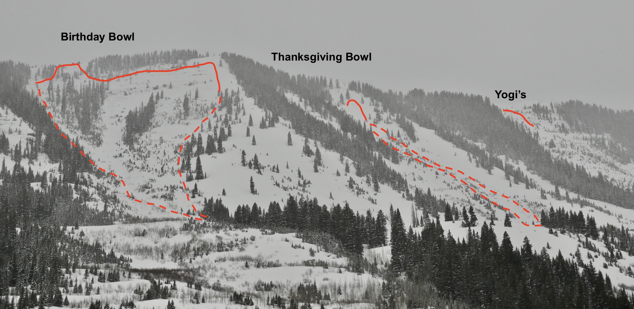
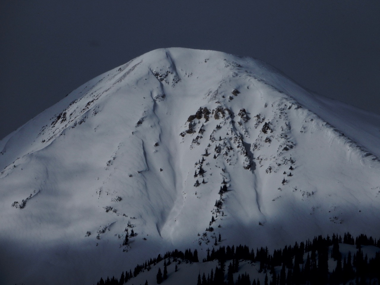
Photos:
efficient loading on Treasury’s SW face, and that’s the windward side.
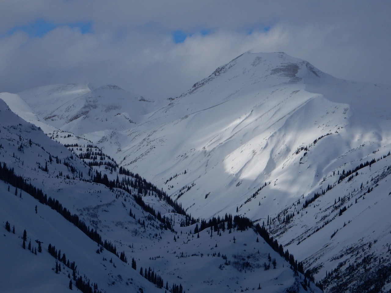
Efficient wind transport, Cinnamon Mtn. South Aspect
Efficient wind transport, Cinnamon Mtn. South Aspect
Efficient wind transport, Cinnamon Mtn. South Aspect
Generally poor visibility, but avalanche problems seemed spot on. Observed at least two D2 Persistent Slab avalanches that ran naturally, and numerous small Wind Slabs.
Generally poor visibility, but avalanche problems seemed spot on. Observed at least two D2 Persistent Slab avalanches that ran naturally, and numerous small Wind Slabs.
Generally poor visibility, but avalanche problems seemed spot on. Observed at least two D2 Persistent Slab avalanches that ran naturally, and numerous small Wind Slabs.
Location: Crested Butte Area Date of Observation: 02/12/2018 Name: Evan Ross
Subject: Gothic Area Aspect: North East Elevation: 9,600-11,100
Avalanches:
In steep terrain sluffs were running smaller then a week ago and not gauging down into the faceted snowpack as easily.
Weather: Calm wind. Overcast. Mostly light snow showers during the day. Picked up in the afternoon. About 4″ HST at 10,500ft by 3pm. Snowpack: 3rd day in a row in the same area. Lots of weakness out there but not enough load or slab yet for things to start acting up. No signs to instability, pushed out on a number of more suspect area. HS mostly in the 60cm to 120cm range in the elevation ban traveled. 1/9 interface down about 20cm. Lots of variability in the snowpack. From slopes that have avalanched previously or not, changes in HS, old wind boards or sun crusts, wind stripped areas. ugly. Though the new snow is making the skiing great and the weak snowpack makes it feel extra deep.