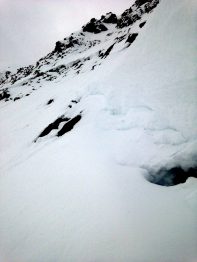
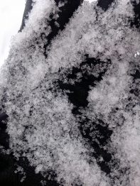
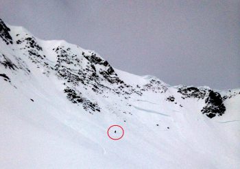
Dense snow at Irwin

CB Avalanche Center2016-17 Observations

Location: Kebler Pass Area
Date of Observation: 12/23/2016
Name: Zach Guy
Subject: Dense snow at Irwin
Aspect: South, South West, West
Elevation: 10,000 to 12,000 ft

Avalanches: Skier triggered a handful of small storm slabs, up to 8″ deep and 150 feet wide in the morning, D1 in size. 3 natural soft slabs in the Ruby Range, easterly aspects ATL, all small in size, probably failed on graupel layer. SS-N-R1-D1-S. Good views from Scarp Ridge of the Southern Ruby Range and Peeler Basin, and no other avalanche activity from this storm observed.
Weather: Calm winds, few to broken skies, mild temps…greenhouse at times.
Snowpack: 12″ of dense storm snow (1.25″ SWE), some reactive graupel layers mid storm. Skier triggered wet roller balls on steep southerlies and a thin crust formed.

IMG_0337

Connies

CB Avalanche Center2016-17 Observations

Location: Crested Butte Area
Date of Observation: 12/23/2016
Name:
Subject: Connies
Aspect: North East
Elevation: Btl

Avalanches:
Weather: Nice
Snowpack: Mid shin ski pen goodness, signs of wind but no affect on skiing. No signs of instability except in final steep roll, cracked on first deep turn but didn’t move. Some activity in main gully on gothic r1d1.5

Basal facets continue to heal in deep snowpack

CB Avalanche Center2016-17 Observations

Location: Paradise Divide Area
Date of Observation: 12/23/2016
Name: Evan Ross
Subject: Basel facets contenue to heal in deep snowpack
Aspect: North East
Elevation: 9,000-11,400

Avalanches: Few loose snow avalanches in steep terrain near Afley and on Augusta and Mineral point.
Weather: Overcast sky in the morning cleared up to partly cloudy in the afternoon. Calm winds.
Snowpack: Basal facets contenue to heal. No other layers of concern observed. Didn’t observe any windslabs below ridgelines but didn’t take direct obs on what would have been the most suspect areas. Snow surface was wind textured on windward side of ridge, hinting at previous snow transport.

At 9,500 Ft HS was about 130cm. Basal facets 1.5mm rounding and necking.

At 11,200ft (below any previous wind loading) HS was about 165cm. Basal facets 1.5mm rounding and necking. CTM break on 12/22 interface. DTN on 12/6 previous NSF interface and basal facets.

IMG_2443

Teocalli/W. Brush Creek

CB Avalanche Center2016-17 Observations, Snow Profiles

Location: Brush Creek Area
Date of Observation: 12/23/2016
Name: ian havlick
Subject: Teocalli/W. Brush Creek
Aspect: South East, South, South West
Elevation: 9000-11500

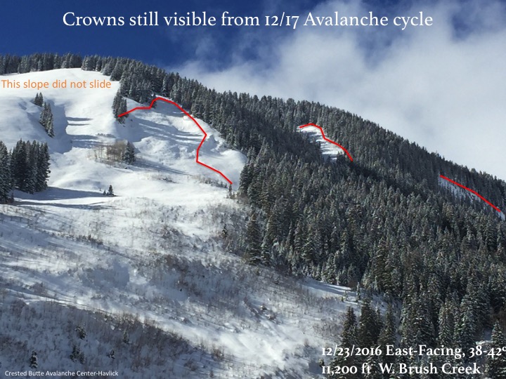
Avalanches: No signs of instability but did see widespread evidence of 12/17 storm and large avalanche cycle on all N-E facing terrain at all elevations.

Only moving snow today was D1 wet loose sluffing in extreme terrain, and D1 windslabs which looked fresh from this morning’s winds right at ridgeline.
Weather: Partly cloudy, very warm air temperatures and intense solar radiation. Moderate winds at ridgetop in the morning, then calming throughout day.
Snowpack: Generally stable, felt like moderate in terrain travelled today. HS averages ~90-110cm throughout terrain travelled. Top 10cm of surface snow became very moist with greenhousing type scuddy clouds scraping ridgetops, calm winds, strong solar radiation, and near freezing ambient air temperatures. Very small facets already forming under this crust, and the other crust buried 12/22 by last nights snow., down 30cm from surface.  In every pit dug, 2-3mm facets near the ground were found, but no ECTs produced propagation near and below treeline.

Slide13
Slide12
Slide11
Slide10

Gothic Townsite Snow Obs

CB Avalanche Center2016-17 Observations

Location: Crested Butte Area
Date of Observation: 12/23/2016
Name: billy barr
Subject: Gothic Townsite Snow Obs
Aspect:
Elevation: 9300

Avalanches:
Weather: Steady moderate snow starting just around sunset and going all night with light wind around 3 a.m. Very warm again with the overnight temperature range of 26 to 27F so once again a very dense snow. Currently snowing moderately with 10½” new and water of 0.88″ (though I have not measured that manually yet and the instrumentation may have that hour delay in posting that data). There is winters deepest of 45½” of snowpack. Once again above at least 8% water content and possibly more. I will update with measured numbers at 7 a.m. or so. billy
Snowpack:

CBAC Snodgrass Study Plot Snowpit

CB Avalanche Center2016-17 Observations, Snow Profiles

Location: Crested Butte Area
Date of Observation: 12/22/2016
Name: Arden Feldman
Subject: CBAC Snodgrass Study Plot Snowpit
Aspect: North East
Elevation: 9760

Avalanches: none
Weather: see profile
Snowpack: see profile

December-22-Snodgrass-Pit

Mt. Owen Crown

CB Avalanche Center2016-17 Observations

Location: Kebler Pass Area
Date of Observation: 12/21/2016
Name: Zach Guy
Subject: Mt. Owen Crown
Aspect: North East, East
Elevation: 11,000 – 12,500 ft

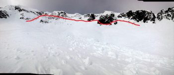
Avalanches: Quick look at avalanche activity in Mt. Owen’s NE bowl from the last cycle 12/16 to 12/17. A number of D2 slabs ran out of the northerly couloirs and faces. The main avalanche was a HS-N-R3-D3-O. Crown was up to 200 cm thick, 1F to P hard, and looked like it averaged around 100 cm, although winds had filled a lot of it in. The failure layer was 1mm, 4F+ facets where I dug below a ~100 cm slab.
Weather:
Snowpack: On E/NE aspects, snow depths on representative slopes were 140 cm near treeline and 160 cm above treeline. No signs of instability

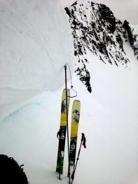
Crown was up to 200 cm thick, pencil hard

Hard slab debris

Looking towards the thinnest part of the slab.

Small grained facets below the slab.

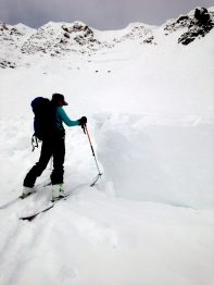
Skier for scale.

Cement Creek

CB Avalanche Center2016-17 Observations

Location: Cement Creek Area
Date of Observation: 12/21/2016
Name:
Subject:
Aspect: East, North West
Elevation: 9-10000

Avalanches: Observed one D2 natural that occurred over the weekend storm cycle. Ran on E facing BTL slope. Couldn’t see crown but estimated to be around the 10k mark in elevation. Probably ran to ground, but it was late and getting dark so I couldn’t see much up there. Slide path stretched across Walrod Rd. and across the creek easily carrying a dead aspen tree 10-15′ long with it. Located just past the Walrod Cutoff trail intersection above the shooting range. No other slide activity between there and Warm Springs intersection.

Heavily edited pictures included. The pictures are the slope that slid
Weather:
Snowpack: Measured snowpack in the upper portion of Walrod on NW BTL slope at 70cm.

20161221_161931
20161221_161836
20161221_161841

washington gulch

CB Avalanche Center2016-17 Observations

Location: Crested Butte Area
Date of Observation: 12/20/2016
Name: J Banks
Subject: washington gulch
Aspect: North East, East
Elevation: 9,800-11,000′

Avalanches:
Weather: Winds L, variable in glades with MOD on ridgetop. no transport.
Snowpack: no signs of instability
2-5mm surface hoar

Wash Gulch

CB Avalanche Center2016-17 Observations

Location: Crested Butte Area
Date of Observation: 12/20/2016
Name: SB
Subject: Wash Gulch
Aspect: North East
Elevation: 9400 – 10800

Avalanches: No new avalanches observed or signs of instability during tour.
Weather: Clear, Calm
2F @ TH @ ~1100, w/ noticeable inversion
Snowpack: Ski Pen: 15 – 20cm throughout tour

Test Pit on 28* Slope on NE facing slope @ 10800′ showed following:
HS 120cm. 40cm of 4F facets @ ground, below 20cm of P hard rounds with preserved surface facets on top from early Dec cold/dry spell. 60 cm of progressively stronger rounds / DFs (1F to F) makes up the top.

ECTP14 down ~40cm within recent storm layer. No weak layers observed at this interface, just slight difference in hardness. Did not observe any other instabilities in this layer during tour.

Of more interest were the deeper weak layer interfaces (early Dec SF and DH). Failures here could be day-wreckers. After removing the top 40cm, we could not get a result after 10 very firm shoulder-level whacks.