Snowpack structure

CB Avalanche Center2015-16 Observations

Location: Paradise Divide Area
Date of Observation: 02/05/2016
Name: Evan Ross
Subject: Snowpack structure
Aspect: North East, South East
Elevation: 9,200-11,400

Weather: Clear skys and light winds. Blowing snow at times on Mt Emmons, Whiterock and several other high peaks. The high peaks in the upper slate river valley looked to have hanging clouds rolling in and out through the day.
Snowpack: No obvious signs to instability while traveling on all sorts of different slope characteristics and slope angles. Ski pen averaged around 20-30cm.

Below Tree Line:
Lots of previous avalanches from the last cycle. A few slopes had an obvious strong over week structure while many others had relatively uniform layering while probing with a general HS around 120cm. A pit at 9,500 on a NE aspect, about 35 degrees, showed a mostly 4f snowpack throughout. With decomposing or rounded grains sitting over 1-1.5 faceted rounds.

Near Tree Line:
Traveled through a few south to southeast slopes near ridgeline at 11,000ft. HS was around 140cm. The Jan 29th interface was down about 60cm and wasn’t looking concerning. That MFcr was about 5-8cm thick with perc columns connecting to the next crust about 20cm below. The 60cm slab didn’t want to budge during informal hand tests on the Jan 29th interface.

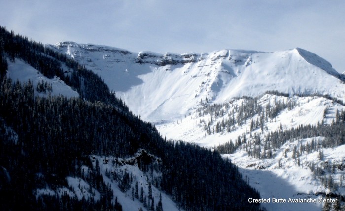
The most concerning snowpack structure of the day was on a northeast aspect at 11,350 in the start zone of an avalanche path that ran during the Christmas natural cycle. 40ish degree slope. HS was 135cm below the old Christmas crown. A 90cm F-1F slab was rusting above 4F 1.5-2mm faceted particles on the Jan 14th interface. CT 18 sudden but not planner fracture in the thick weak layer. PST 30/100 end with block sliding off weak layer. Didn’t properly measure boot pen, but it was tough to not punch through the slab and into the weak layer while walking. Ski pen was in the 20-30cm range.

Avalanches: No recent avalanche observations from today.

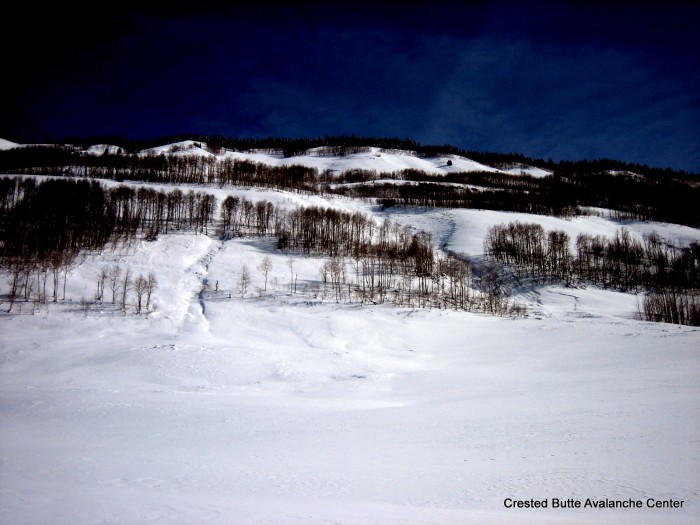
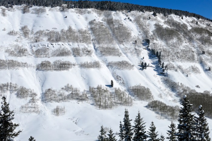
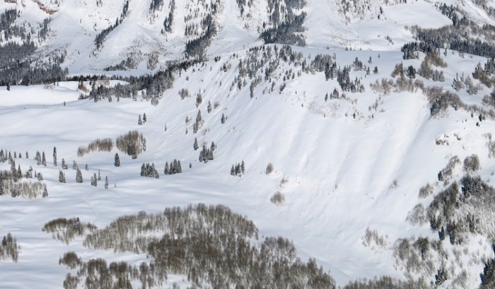
3x SS-N-R1-D1 and 1 SS-N-R1-D1.5 on the windward side of terrain features facing southwest below treeline.

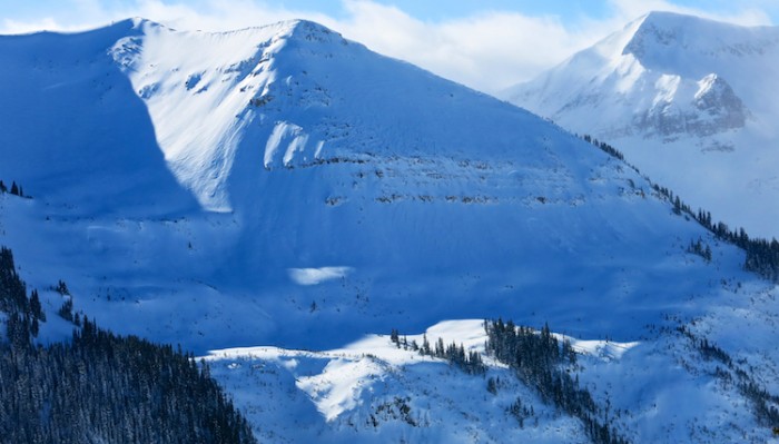
N-R2-D2? Mt Bellevue, south facing, 12,200ft, crown was several hundred feet below the ridgeline.

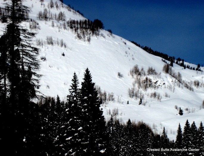
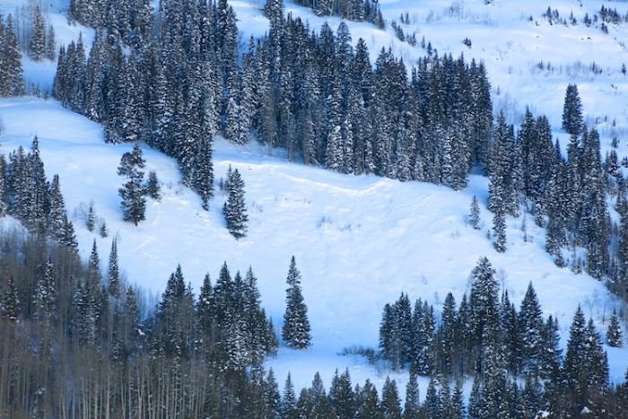
4x N-R1/2-D1.5 on northeasterly facing slopes below tree line.

Additional avalanche observations in the area can be seen in Zach’s ob here.
IMG_1321

3x SS-N-R1-D1 and 1 SS-N-R1-D1.5 on the windward side of terrain features facing southwest below treeline.
IMG_1334

3x SS-N-R1-D1 and 1 SS-N-R1-D1.5 on the windward side of terrain features facing southwest below treeline.
IMG_1337–

IMG_1335

N-R2-D2? Mt Bellevue, south facing, 12,200ft, crown was several hundred feet below the ridgeline.
IMG_1346

4x N-R1/2-D1.5 on northeasterly facing slopes below tree line.

Red Lady Glades

CB Avalanche Center2015-16 Observations

Location: Crested Butte Area
Date of Observation: 02/05/2016
Name: ADB
Subject: Red Lady Glades
Aspect: South East, South, South West
Elevation: BTL/NTL/ATL

Avalanches: BTL: Nothing
NTL and ATL: a few collapses on skin track and ski length cracking at a few location. no propogation.

ATL: Redy Lady Bowl-SS-N-R1-D1; Scarp Ridge (E/SE Aspect): HS-N-R1-D2 (see photo).
Weather: Mostly sunny skies
BTL: calm
NTL: intermittent moderate winds from NE, which transported snow.
ATL-summit ridge: Sustained moderate winds, transporting snow into Red Lady Bowl

BTL: Between Axtell and Whetstone, considerable snow being transported (photograph)
Snowpack: NTL: wind slabs,
ATL: stiffer wind slabs with < 3 inches (7 cm) of new snow.

whetstone_axtell_blowingsnow_02052016
scarp_hs_r1_d2_02052016

Coney’s tour

CB Avalanche Center2015-16 Observations

Location: Crested Butte Area
Date of Observation: 02/05/2016
Name: Jafar Tabaian
Subject: Coney’s tour
Aspect: North East, East, South East
Elevation: 12000

Avalanches: Noted a couple avalanches on Schuykill and Redwell, see photos. Cornice on Schuykill ridge looked a little scary, especially around the nob.
Weather: Bluebird day, but windy on ridge top. Wind was mostly coming out of the North and was very chilly. We could see heavy snow transport from the wind off Mt. Emmons into the bowl.
Snowpack: Skied 2 laps, a bit of a wind crust up high but very nice snow about halfway down the slope. No avalanche activity noted while skiing but we had several collapses on the skin track up. New snow hasn’t formed into any sort of slab. Ski pen was roughly at boot line.

IMG_20160205_120734503
IMG_20160205_121025367

Mountain Weather 2/5/2016

CB Avalanche CenterWeather

Date: 02/05/2016

Last nights small disturbance that brought an inch or two of snow and cloudy sky’s is on its way out this morning. Ridge top winds are currently light to moderate, but we should see some stronger gusts as this disturbance is moving out, before the winds quiet back down later today. Cloud cover will also be decreasing throughout the day. Saturday night, northern Colorado gets clipped by another weak disturbance which will probably just bring some increased winds and clouds for our area and maybe a lucky inch of snow. By Monday a large high pressure ridge will be setting up over the western US, bringing a return to normal temperatures and dry weather heading into the week.

Slate River Valley

CB Avalanche Center2015-16 Observations

Location: Crested Butte Area, Paradise Divide Area
Date of Observation: 02/04/2016
Name: Zach Guy
Subject: Slate River Valley
Aspect: North, North East, East, South East, South West
Elevation: Below Treeline

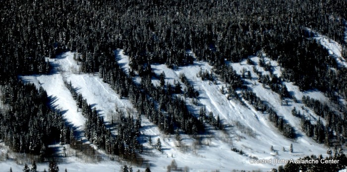
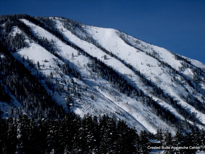
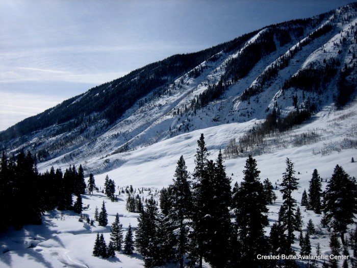
Avalanches: Natural avalanche activity from 2/1 cycle dramatically decreased as we went up valley. Happy Chutes and Climax Chutes (E/NE N/BTL) almost all ran nearly full width, full track, some small trees snapped and debris close to Mike’s Mile. I visited these start zones before the storm and there was about 10″ of settled snow above a very weak Jan14th 1.5mm facet layer. Likely ran on that. SS-N-R3/4-D2/2.5-O. A few crowns visible on Schuykill Ridge (E/ NE BTL), D2s, and two large crowns in Redwell Basin (NE, N ATL). Several D2 Debris piles near Slate River Road from the south side of Anthracite Mesa, couldn’t see start zones (~SW aspects, BTL). One D1.5 crown on a SE aspect BTL near Pittsburg. Signs of early storm sluffing/storm slab action on Schuykill Ridge, and no crowns visible in Ruby Range from our valley vantage points.
Weather: High clouds increased and lowered through the day. Very light snowfall (S-1) by late PM. Cold temps. Light northwest valley winds.
Snowpack: Dug one pit in Upper Slate Area, NE aspect below treeline.  Recent storm has settled into a 65cm slab, increasing from F hardness at surface to 4F at Jan 29 interface.  There is a <1cm thick layer of fist hard 0.5 mm near surface facets with 2-3mm flattened surface hoar needles below the slab.  This layer was not reactive in ECT.  No signs of instability on our tour except a shallow pocket that was skier triggered on a rollover from recent wind drifting.

Happy Chutes, NE BTL

Happy Chutes, NE BTL

Climax Chutes, E/NE aspects

Climax Chutes, E/NE aspects

Some small snapped trees in debris piles below Climax Chutes. Almost reached Mike's Mile.

Some small snapped trees in debris piles below Climax Chutes. Almost reached Mike’s Mile.

IMG_5736-001

Redwell Basin. NE aspect shown. Can barely see the edge of another crown on the north facing part of the bowl

Debris piles below Anthracite Mesa above Slate River Road

Debris piles below Anthracite Mesa above Slate River Road

SE aspect near Pittsburg

SE aspect near Pittsburg

Ruby Range/Irwin Tenure

CB Avalanche Center2015-16 Observations

Location: Kebler Pass Area
Date of Observation: 02/04/2016
Name: Ian Havlick
Subject: Ruby Range/Irwin Tenure
Aspect: North East, East, South East, South, South West, West
Elevation: 10,000-13,000

Avalanches: Observed two size 2 windslabs fresh within last 24hrs this morning on E-SE facing slopes, above treeline on Owen, Purple and Ruby, as well as other similar slides on East Beckwith, and Ohio Peak/Anthracites. Pryed 2 stubborn slabs (50-70ft wide, 10″ deep, 1F hard) off cross loaded westerly aspects today with alb handshots (explosives).
Weather: Clear and cold moving to overcast with ridge obscuration after 1500. Light to moderate west winds transporting snow decreasing in afternoon. Light snow developed in the afternoon but minimal accumulations.
Snowpack: Widespread windslabs across most of terrain travelled today, stubborn to trigger, most localized to ridge tops, and east facing terrain most sensitive. Minimal wind effect NTL/BTL, no solar effect today.

IMG_3204
image1-3

Mountain Weather 2/4/16

CB Avalanche CenterWeather

Date: 02/04/2016

An approaching weak system will bring increasing clouds, moderate alpine winds, and some light snowfall this evening into tomorrow. A high pressure ridge develops over the West Coast. Colorado will initially be under northwest flow on the downslope side of this ridge, bringing unsettled weather but generally light to no snow accumulations into next week. The ridge eventual broadens and moves east, bringing clear weather and a warming trend with it.

Crowns on Whiterock and Cement Mountain

CB Avalanche Center2015-16 Observations

Location: Brush Creek Area, Cement Creek Area
Date of Observation: 02/03/2016
Name: Zach Guy
Subject: Crowns on Whiterock and Cement Mountain
Aspect: South West, West, North West
Elevation: Above treeline

Avalanches: Got views this evening of 6 slab avalanches on NW, W, and SW aspects above treeline on Whiterock and Cement Mountain. D2’s to D2.5’s. Presumably failed 2/1. Two of them had impressively wide propagation, estimated 1,500 feet wide. These windward paths are infrequent flyers of this size.
Weather:
Snowpack: Lots of action on typically windward slopes above treeline. These slopes probably had a very shallow and weak structure, some with thin crusts, prior to this storm. The lack of windscouring accompanying this significant snowfall event looks to have built dangerous persistent slab structures on these aspects now.

Red Lady Glades

CB Avalanche Center2015-16 Observations

Location: Crested Butte Area
Date of Observation: 02/02/2016
Name: Alex Banas
Subject: Red Lady Glades
Aspect: South East, South West
Elevation: 9,400-11,800

Avalanches:
Weather: OVC skies all day. Calm wind and no snow. Sun broke out a few times.
Snowpack: Storm totals at 10,380′ SE were 45cm. Ski pen around 30cm. I noticed 6-8″ settlement cones during the first half of the skin up to ridge and the ski quality reflected that as well. 2-3cm wind formed zipper crust was apparent near treeline. The storm snow is starting to slab up trending from f-4f in the upper 50cm of the pack, making for tricky skiing down low angle terrain. Lower down in the glades I noticed 2-4 feet shooting cracks in front of my skis as well as large, isolated collapses.

Mountain Weather 2/3/16

CB Avalanche CenterWeather

Date: 02/03/2016

Its a chilly one out there, with most mountain and valley temperatures below zero this morning and forecasted to climb into the upper single digits today. We are between systems right now, with cold northwest flow shifting to west flow tomorrow. A weak shortwave today will spur continued snowfall, with the favored orographic locations squeezing out a few more inches of snow and less near town. A weak trough makes its way across Colorado on Thursday night. Look for winds to increase ahead of this system, and half a foot or less to fall by Friday night.