
Avalanches above/onto East River Trail

CB Avalanche Center2015-16 Observations

Location: Brush Creek Area
Date of Observation: 02/07/2016
Subject: Avalanches above/onto East River Trail
Aspect: South East, South
Elevation: 9,000 – 9,600

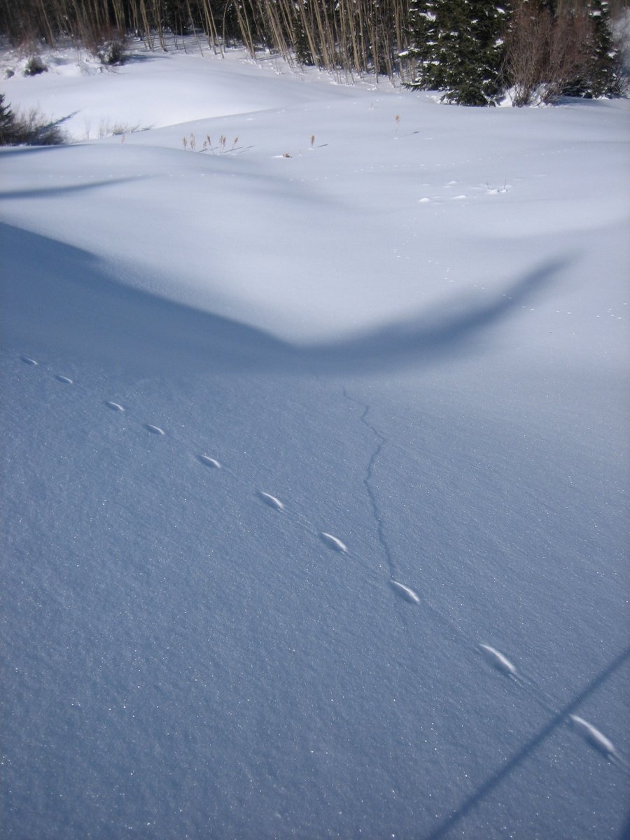
Avalanches: On a tour up Strand Hill noted multiple SS avalanches on the S facing hillside above the East River Trail. Several appear to have reached or crossed the trail. Every steep (>40 degrees?) section of that hillside had slid above the 1st mile or two of the trail. Looked to have occurred in the past 48 hours or so? Several pocket slabs below the trail had occurred as well.
Weather: Bluebird becoming breezy in the p.m.
Snowpack:

IMG_0060-1

Cracking/collapsing on Whetstone

CB Avalanche Center2015-16 Observations, Snow Profiles

Location: Crested Butte Area
Date of Observation: 02/07/2016
Name: Zach Guy
Subject: Cracking/collapsing on Whetstone
Aspect: North East
Elevation: 10,000-11,000 ft

Avalanches: Most obvious paths ran naturally in this terrain on 2/1. D1.5 to D2’s in size. Took a quick look at one crown; ~2 ft thick over F+ 2-3mm facets. These paths also ran in December. Unfortunately, the bedsurfaces are crusty and there is 3-6″ inches of faceting snow above them already, ripe for 3x repeat offender if we get another big storm.
Weather: Light winds below treeline. Continued snow transport observed over Anthracite Range and West Elk Range, but minimal transport looking towards Pearl Pass, Brush, Cement, etc. Few clouds.
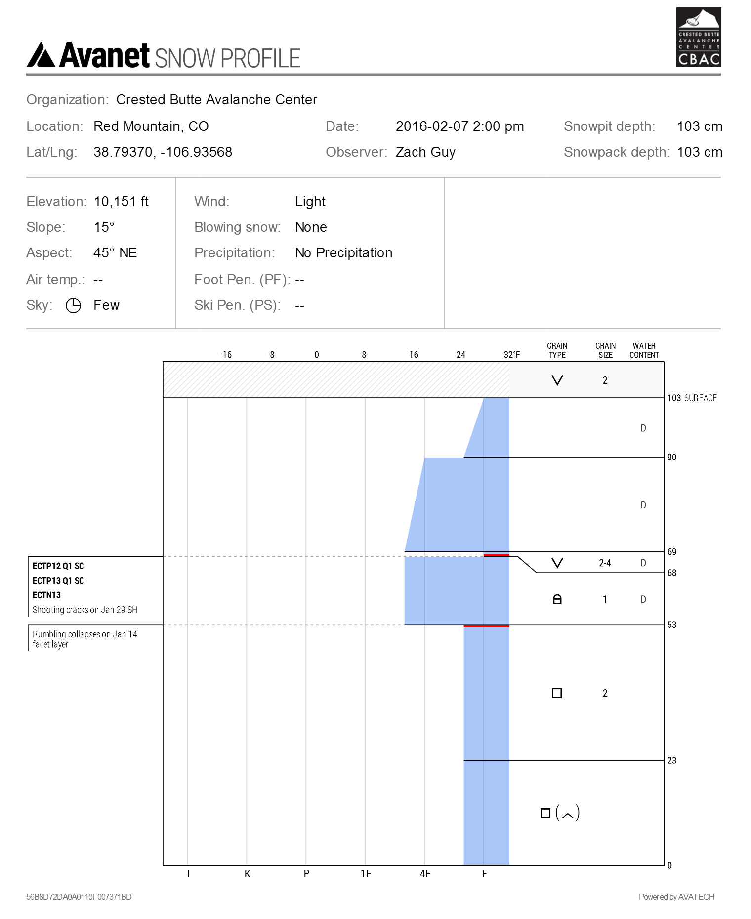
Snowpack: See video. On shaded low angle terrain below treeline, the snowpack was 50cm of slab (F to 4F+) over 50 cm of facets (Jan 14 interface, F+, 1-2mm). We crossed about 10 open meadows, and got 2 rumbling collapses. One as we regrouped and were stepping out of skis, the other by jumping on the snowpack on skis. The Jan 29th surface hoar layer (2-4mm, F) is also preserved about 30-35 cm deep, and propagated in 2 out of 3 of our extended column tests. (ECTPM, SC, Q1). We got several shooting cracks up to 20 feet long on this layer on small rollovers.

IMG_5748-002
IMG_5746-002
Profile NE aspect BTL

Profile NE aspect BTL

Brush Creek

CB Avalanche Center2015-16 Observations

Location: Brush Creek Area
Date of Observation: 02/07/2016
Name: Ian Havlick/Level 1 Avy Course
Subject: Brush Creek
Aspect: East, South East, South, South West, West, North West
Elevation: 9000-10500

Avalanches: Got small glipmse of Double Top natural avalanche as well as numerous D1 wet loose slides confined to new storm snow out of steep, rocky terrain on SE-S-SW facing slopes.
Weather: clear to slightly overcast skies midday, increasing moderate NW-N winds. Strong radiation, above freezing temperatures.
Snowpack: Moderate NW-N winds transporting small amounts of loose snow from surface, not forming signifcant windslabs. Numerous booming collapses, and secondary collapses from others farther back in skin track. Some subtle cracks were observed from these large whoomphs as well. DUg one pit on a SW facing slope, NTL, 10,400ft, ECTP20, ECTN17, CT15 all sudden planar, associated with crusts and small 1mm near crust facets above several different crusts. In general, slabs were 50-70cm thcikness.

IMG_3221

Snodgrass TH

CB Avalanche Center2015-16 Observations

Location: Crested Butte Area
Date of Observation: 02/06/2016
Name: Krista Chris Ian
Subject: Snodgrass TH
Aspect: East, South East, South
Elevation: 10,000 ft

Avalanches:
Weather: WEATHER: Finally a day that felt warm! Thermometer said 15 but felt like 30. Blue skies and calm winds at TH but wind banners off Gothic, Emmons, and a few others in the north end of the valley.
Snowpack: SNOWPACK/AVALANCHE OBS: We were not in any Avy terrain today and stayed close to TH due to time and our big group. We travelled easily on the snow with our skis/split boards but boot pen was 50+ cm in lots of places. HS averaged 95- 130 cm.

Mountain Weather 2/7/2016

CB Avalanche CenterWeather

Date: 02/07/2016

We are on the east end of a strong high pressure ridge parked over the West Coast. We will continue to see moderate winds at higher elevations until this feature broadens and shifts east later in the week. Strong temperature inversions will continue to develop, with a gradual warming trend through the week in the mountains. Dry and mostly clear skies will persist through all of next week.

Mt Emmons

CB Avalanche Center2015-16 Observations

Location: Crested Butte Area
Date of Observation: 02/06/2016
Name: Evan Ross
Subject: Mt Emmons
Aspect: South
Elevation: 9,500-11,600 BTL

Avalanches:
Weather: Lots of blue and not much for white skys. Calm winds with a few light gusts where we traveled, blowing or swirling snow at times on Mt Emmons summit.
Snowpack: Didn’t get into much for avalanche terrain. 1/29th interface was down about 40cm and HS was in the 100-130 on most slopes traveled. A few hand pits couldn’t get any snow to move on the 29th interface. Snow surface was moist near trees and where it was protected from any air movement. Ski pen about 20cm and boot pen was down to the 29th interface.

Large natural today on Double Top

CB Avalanche Center2015-16 Observations

Location: Cement Creek Area
Date of Observation: 02/06/2016
Name: Zach Guy
Subject: Large natural today on Double Top
Aspect: South West
Elevation: Above treeline

Avalanches: Got a second hand observation today of a D3 slab avalanche off of the SW bowl of Double Top above treeline. They believe it ran today; it is a path easily viewed from the highway and they hadn’t noticed it before.

Edit 2/7/16.  Viewed the slide with spotting scope from a good vantage on Whetstone.  Not as large as originally estimated, but looked very fresh. SS-U-R2-D2-O
Weather:
Snowpack:

“Leonard” Washington Gulch

CB Avalanche Center2015-16 Observations

Location: Crested Butte Area
Date of Observation: 02/06/2016
Subject: “Leonard” Washington Gulch
Aspect: North, North East, East
Elevation: 10,900

Avalanches: Several recent small windslab releases above tree line on W face of Gothic. A few noticeable older slides on Schuylkill .
Weather: Mostly sunny. West wind gusting to 20mph.
Snowpack: 7 inch settlement cones on flatter terrain. Wind was moving small amounts of snow over the ridge throughout the day. Windslabs were beginning to form, but as of 3pm, were not very stiff. Stomped around on and skied several slopes with no signs of instability. The skiing was inconsistent in some spots due to minor wind affected snow.

REd Lady Glades/Base of Carbon

CB Avalanche Center2015-16 Observations

Location: Crested Butte Area
Date of Observation: 02/06/2016
Name: ADB
Subject: REd Lady Glades/Base of Carbon
Aspect:
Elevation: BTL/NTL/ATL

Avalanches: No instabilities to report.
Weather: Clear and warmer.
ATL-sustained moderate winds along Scarp Ridge from the north. Winds swired snow on the ridge top. We observed blowing snow on Red Lady upon return back from base of Carbon Peak.
Snowpack: Surface hoar less than 0.5 cm forming in Splain Gulch (BTL).
Glades were a little heavier compared to 24 hours ago, but still loose unconsolidated BTL.

Mountain Weather 2/6/2016

CB Avalanche CenterWeather

Date: 02/06/2016

A strong ridge is continuing to build over the western US and will bring us dry weather and a warming trend starting next week. Before we can make the transition to this dry weather pattern we’ll see one more blip in the flow roll in tonight. We will be on the southern edge of a very weak shortwave trough tonight that could bring some increasing clouds and gusty winds. Northern Colorado will see strong winds in the 50’s, but we should be just outside of these stronger winds. Still our mountains will see some stronger gusts and wind speeds in the 15-25mph range at 11,000ft.