Mountain Weather 2/27/16

CB Avalanche CenterWeather

Date: 02/27/2016

The high pressure ridge that has been steering our warm, dry weather flattens today, kicking off a more progressive pattern that will bring a series of shortwave disturbances through next week. The first wave is weak and steers too far north for any snowfall, but we will see winds increase and cloud cover build this afternoon into tonight on the southern edge of this fast moving system. Any lingering clouds should quickly clear out on Sunday morning in its dry and cool wake. Monday’s wave pushes better moisture further south, but lacks the oomph from frontal and dynamic lift. We could see 3-6″ of orographic snowfall in the typical favored locations, and light accumulations elsewhere by Tuesday.

Mountain Weather 2/26/16

CB Avalanche CenterWeather

Date: 2/26/16

High pressure strengthens over Colorado today, bringing our warmest day yet this week. Mountain temperatures will climb from the low 20’s this morning into the mid-30’s under sunny skies. A more progressive pattern develops this weekend into next week. The first shortwave system passes to our north late Saturday, bringing nothing more than increased winds and cloud cover. A stronger wave approaches on Monday, bringing a better chance for snowfall to the Elk Mountains.

Virginia Basin

CB Avalanche Center2015-16 Observations

Location: Paradise Divide Area
Date of Observation: 02/25/2016
Name: Zach Guy
Subject: Virginia Basin
Aspect: South, West
Elevation: 9,600-12,600 ft

Avalanches: Good views of a lot of the forecast zone today with no new avalanches observed.
Weather: Clear skies. Moderate NW wind in the morning eased to light by PM.
Snowpack: On South aspects N/ATL: The combination of thick upper crusts (~6″ thick) and faceting slab below made it difficult to find any kind of concerning PS structure. Crusts began to soften but remained supportable around 12:30 to 1:00, and were refreezing by 3:00.
On West aspects ATL: Probing around found some discontinuous pockets of lingering PS structure between faceted out slabs. Thin but supportive crusts on the surface (~1″ or so)
Start zones on NW aspects above treeline look mostly blown out down to dirt or bushes. Gulley features still holding enough snow to potentially have PS structure, but didn’t go onto any of those slopes.
No signs of instability observed.

Mountain Weather 2/25/16

CB Avalanche CenterWeather

Date: 02/25/2016

Northwest flow downstream of the stubborn high pressure ridge over the West Coast will bring mostly clear skies and a cool alpine breeze today. The ridge moves east on Friday, which should warm temperatures and ease winds a little. The ridge sags enough to allow a fast-moving shortwave system to bring increasing winds on Saturday and the chance for a few flurries on Saturday night. We look to be too far south for any good snowfall accumulation.

Another cornice fall/persistent slab off of Scarp Ridge

CB Avalanche Center2015-16 Observations

Location: Crested Butte Area, Paradise Divide Area
Date of Observation: 02/24/2016
Name: Zach Guy
Subject: Another cornice fall/persistent slab off of Scarp Ridge
Aspect: North East, East, South East, South
Elevation: 9,500-12,400 ft

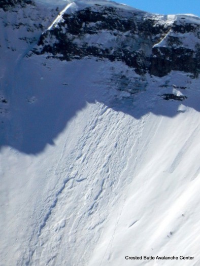
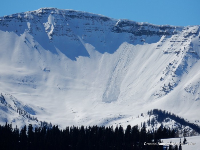
Avalanches: Fresh looking cornice fall on Scarp Ridge into Redwell Basin (NE aspect ATL). I haven’t looked at that path in about a week, but my guess is it fell in the past 3 days. It looks like the cornice initially gouged to the ground through weak and incohesive snow, but encountered more structure further downslope and pulled out a relatively narrow pocket of persistent slab, estimated 30 feet wide and a few feet deep. (SS-NC-R1-D2-O).  See photo.
Weather: Clear skies, cool temps, light to moderate NW winds at ridgetop. Small plumes on peaks this morning and no transport the rest of the day.
Snowpack: 1″ of new snow over variable surface of stout crusts to thin crusts to chalky wind drifts to near surface facets. On a windloaded SSE aspect above treeline, HS was 135 cm and there was 15-20 cm of frozen, pencil hard crusts at the surface (MFpc), over a faceting slab, with percolation columns reaching 30 cm deep. No signs of instability on various aspects/elevations except for some minor cracking and pizza box sized wind slabs in a windloaded gulley, 2-3″ deep on the dusty crust layer.

Very shallow pockets of windslab in a gulley.

Very shallow pockets of windslab in a gulley.

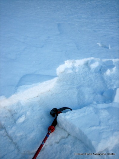
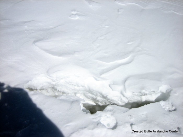
Crack from a cornice pulling away from ridgeline.

Crack from a very large cornice pulling away from ridgeline.

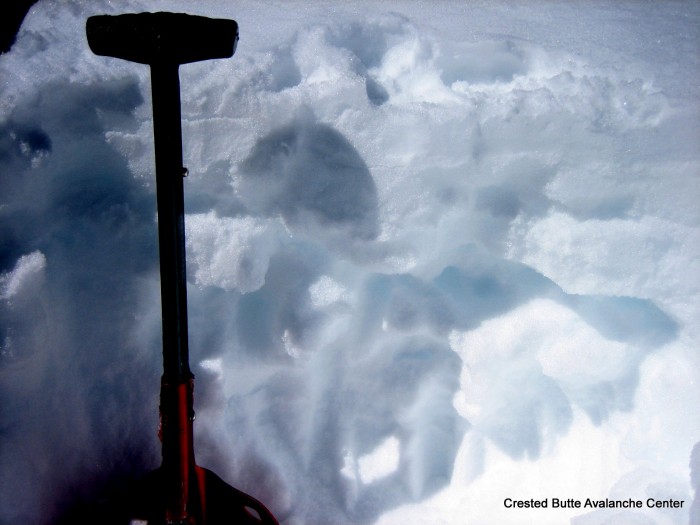
Thick crusts and percolation columns on a SSE aspect above treeline.

Thick crusts and percolation columns on a SSE aspect above treeline.

2/24. Recent cornice fall/ persistent slab off of Scarp Ridge

2/24. Recent cornice fall/ persistent slab off of Scarp Ridge

2/24. Recent cornice fall/ persistent slab off of Scarp Ridge

2/24. Recent cornice fall/ persistent slab off of Scarp Ridge

Mountain Weather 2/24/16

CB Avalanche CenterWeather

Date: 02/24/2016

Our persistent slab problem has found a worthy persistent opponent in the high pressure ridge stuck over the West Coast. Clear skies and a gradual warming trend is in store for this week as the high pressure slowly advances into the Great Basin through the rest of the work week. The ridge breaks down enough to allow a weak disturbance to push through on Saturday, but we are too far south to see any snow accumulate from this one.

Small sluffs

CB Avalanche Center2015-16 Observations

Location: Kebler Pass Area
Date of Observation: 02/23/2016
Name: Irwin Guides
Subject: Small sluffs
Aspect: East, South
Elevation: Above treeline

Avalanches: Lots of D1 or smaller dry loose sluffs off steep cliffs in Rubys on S, E facing slopes, no wind transport
Weather:
Snowpack: 3″ on crust.

Mountain Weather

CB Avalanche CenterWeather

Date: 02/23/2016

Well, we got skunked. Despite modern forecasting, sophisticated weather models and interpretation…sometimes there are still surprises. The 120 knot jet stayed to our west, bringing north to northeast flow aloft, not ideal orographics for snow production. Monarch however, is reporting 15” new this morning, an example of an area that does well with easterly winds. Look for clearing skies today and an increase of wind this afternoon as the tail end of the jet streak slides overhead. Looking ahead, Sunny skies from now until forever…or at least until March.

Snodgrass

CB Avalanche Center2015-16 Observations

Location: Crested Butte Area
Date of Observation: 02/22/2016
Name: Dave Bumgardner
Subject: Snodgrass
Aspect: North, East, South, West
Elevation: 9-10,000ft

Avalanches:
Weather: Morning Started off overcast and snowing. Had a few periods of snow (S1) but no really accumulation. It got sunny mid day. noon day temp was – 4c. Light winds.
Snowpack: HS ranged from 80cm – 120 cm where I probed. Saw no signs of instability. Had a variety of snow conditions but did find some fresh pow.