Location: Kebler Pass Area
Date of Observation: 12/04/2016
Name: Zach Guy and Evan Ross
Subject: Remote avalanche in Oh-Be-Joyful
Aspect: North East, East, South East, North West
Elevation: 10,800 to 12,600 ft
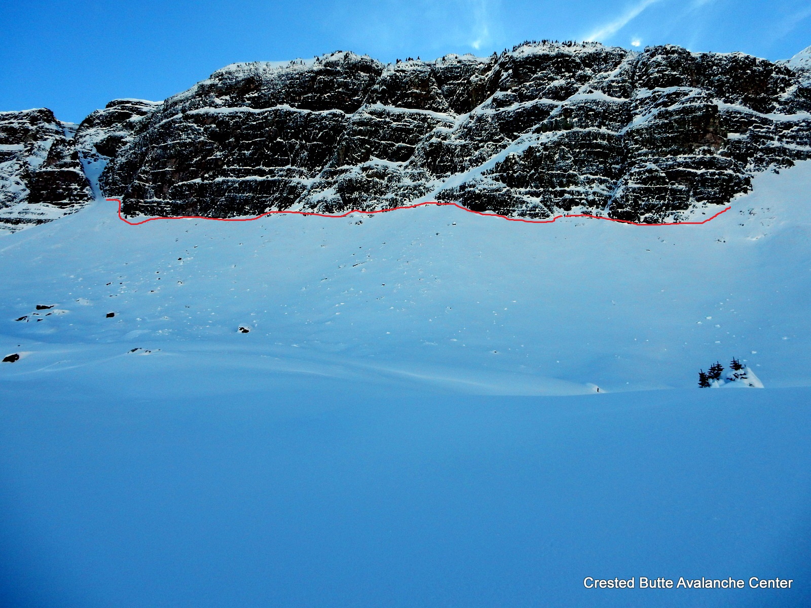
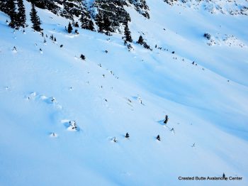
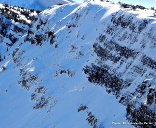
Avalanches: See photos. Evidence of widespread natural avalanche cycle in Peeler and Oh-Be-Joyful Basin from 11/27-11/28 storm, on northerly aspects N/ATL, small to large in size.. Faint crownlines and debris on Scarp Ridge, Purple Peak, and a lot of north facing terrain that we got views of. ~15 x SS-N-R1/2-D1/2-O/G
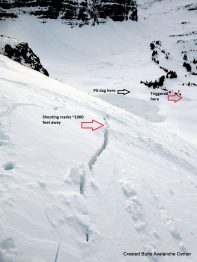
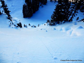
On a NW aspect ATL, we remotely triggered a persistent slab that failed at the ground on 3mm depth hoar. The crown was 2-3 ft deep, up to 1F hard, ~300 ft wide. Triggered from ~800 feet away on low angle, NE facing terrain. SS-ASr-R1-D2-O/G
We also skier triggered one small windslab on a crossloaded NW aspect ATL, less than a foot thick. SS-AS-R1-D1-U.
Multiple small sluffs observed on various aspects from the recent snowfall, all harmless.
Weather: Clear skies increased to scattered clouds. Light to moderate westerly winds with occasional light snow transport. from ridgetops.
Snowpack: On E and SE aspects ATL: One test pit and numerous hand pits showed a ~60-80 cm slab (typically 4F) over .5-1 mm rounding facets, typically 4F- or F+. Two ECT’S showed non propagating results (ECTN H Brk and ECTN M PC). We traveled on several slopes up to 45 degrees with no signs of instability. There is a new meltfreeze , ~1cm thick, forming on the surface of S to SE aspects, with small faceting below.
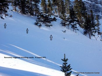
On NW to N aspects N/ATL: We experienced 4 booming collapses, with shooting cracks radiating up to 1,000 feet away. Quite alarming! Structure consisted of 50 cm to 80 cm 4F to 1F slabs over 4F small grained facets over 3mm fist hard depth hoar. It appears that more than half of avalanche terrain had flushed naturally during 11/27-11/28 storm, so the snowpack structure will be quite variable from slope to slope now. Snow surfaces consist of DF grains, windpacked grains, and small facets (less than .5mm)
Some minor, shallow cracking on all aspects ATL isolated to ridgeline windloaded locations.
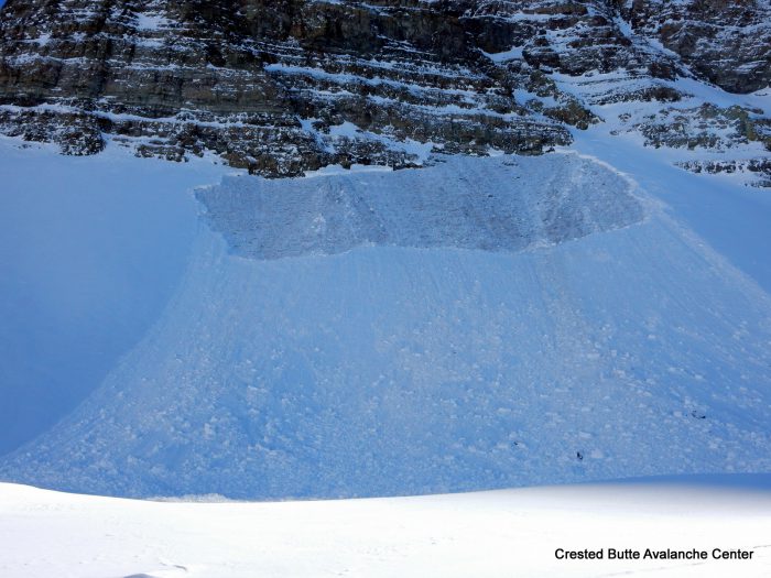
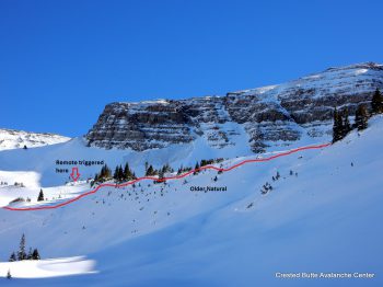
Remote triggered slide today. NW aspect ATL
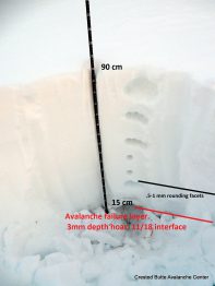
Profile dug near the avalanche trigger location.
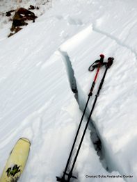
Shooting cracks up to 1000 feet away from trigger location.
NW aspect ATL
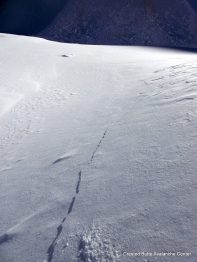
Shooting cracks from trigger location.
NW aspect NTL

Old crown. N aspect ATL
Old crown. N aspect NTL
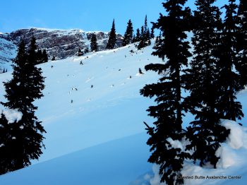
Old crown. NW aspect NTL
Old crown. N aspect NTL
Old crown. NW aspect NTL
NW aspect NTL
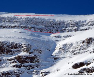
Old crown. ENE aspect Scarp Ridge
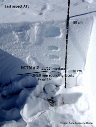
E aspect ATL
Old crown. NE aspect, Scarp Ridge