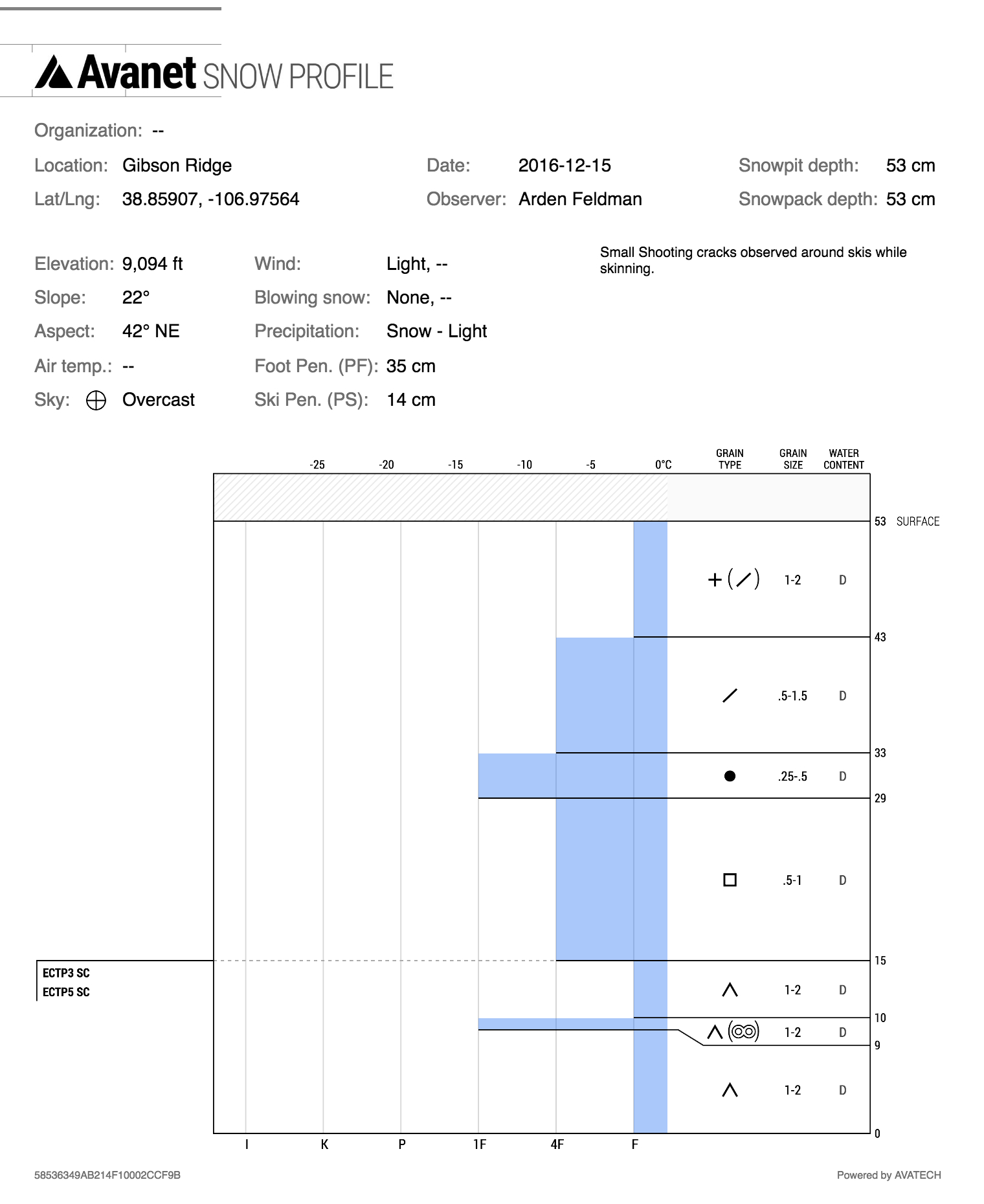
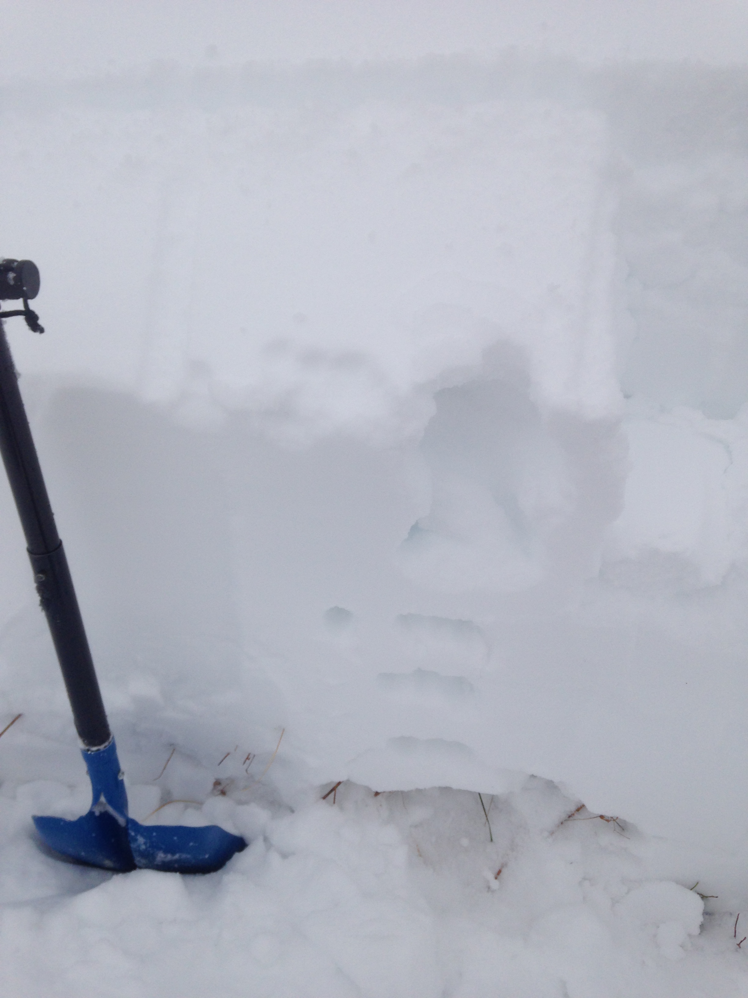
Date of Observation: 12/15/2016
Name: Arden Feldman
Aspect: North East
Elevation: 9100
Avalanches: None
Weather: Overcast, S-1 increasing to S1 by nightfall, Calm winds increasing to Light, minimal snow transport.
Snowpack: See Profile
Avalanches: None
Weather: Overcast, S-1 increasing to S1 by nightfall, Calm winds increasing to Light, minimal snow transport.
Snowpack: See Profile
Avalanches: 5 harmless wet loose avalanches ran naturally on a SW aspect BTL. I could see a fresh D1.5 debris pile on a S aspect NTL, looked like it might have been a slab release but too far to see clearly.
Weather: Broken skies. Warm, greenhousing.
Snowpack: No signs of instability across various rollovers and steep roadcuts BTL. Mid-pack facet layers produced non-propagating results. The structure on southeast aspects appeared to be the most fragile for incoming loads. Northeast aspects could handle a larger load but will produce larger slides. See photos and captions
Avalanches: None.
Weather: Cloudy, calm, warm (25?).
Snowpack: Shallow with a spongy/wet layer between the old and new snow. 4″ powder on top of the spongy stuff. No slough, but didn’t ski over 35 degree pitch.
Date: 12/15/2016
We will see a short gasp of dry air this morning before unseasonably warm, southwesterly flow ushers in the main event. Temperatures at 5am are already in the upper 20s, and look to approach the upper 30s today. Heavy snowfall will start very warm, even potentially as R A I N below 10,000ft (we’re talking Crested Butte), before a sharp cold front acts as gas on the moist atmospheric fire and cranks the snow tomorrow before clearing out Saturday morning. Precipitation models are getting excited about this recipe, and while they may be going a bit heavy on the pinks and purples, 1-2 feet of snow look likely, with the potential for some impressive totals in the usual places (Schofield and Kebler Passes) by midday Saturday.
High Temperature: 38
Wind Speed: 10-25
Wind Direction: SW
Sky Cover: Mostly Cloudy
Snow: 0-1″
Low Temperature: 26
Wind Speed: 15-30 G 50
Wind Direction: SW, W
Sky Cover: Mostly Cloudy
Snow: 4-8″
High Temperature: 33
Wind Speed: 15-25
Wind Direction: W
Sky Cover: Mostly Cloudy
Snow: 12-15″
Thanks to everyone who attended and supported Avalanche Awareness Night! Â Presentations are now online here. Thanks to Chris Miller for filming. Â Photos albums from Avy Night and Beacon Brushup are linked here as well.
Avalanches: none observed
Weather: Overcast and warm. Windy conditions even below treeline
Snowpack: 58 cm right below treeline. Layered snowpack although relatively consolidated. I saw no signs of instability but there was snow being blown around even in the Aspen trees so I imagine there was a lot of transport up high. Thicker denser snow on the surface from temp and sun but low angle slopes helped to not allow the sunburst to develop.