Mountain Weather

CB Avalanche CenterWeather

Date: 12/28/2016

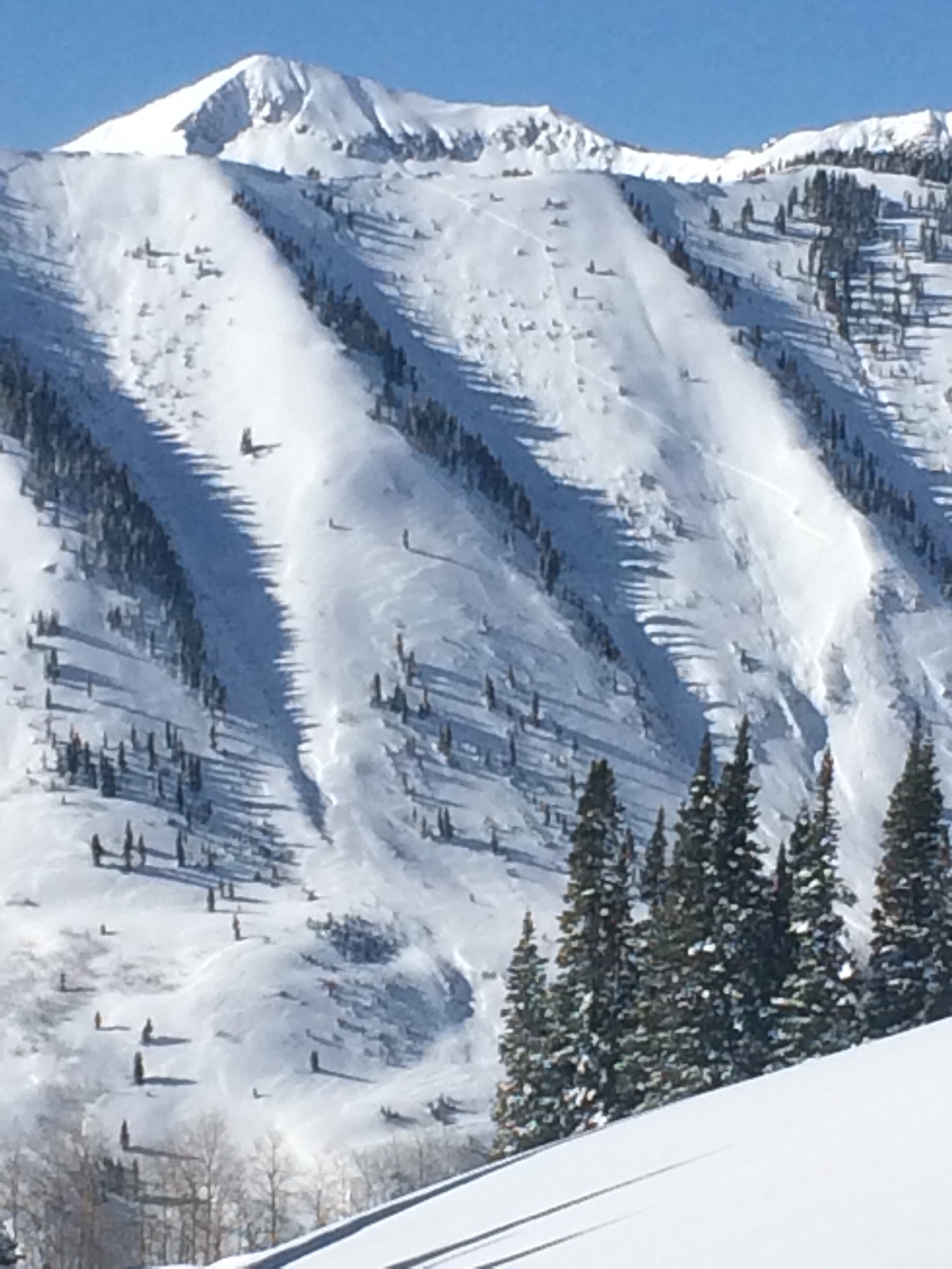
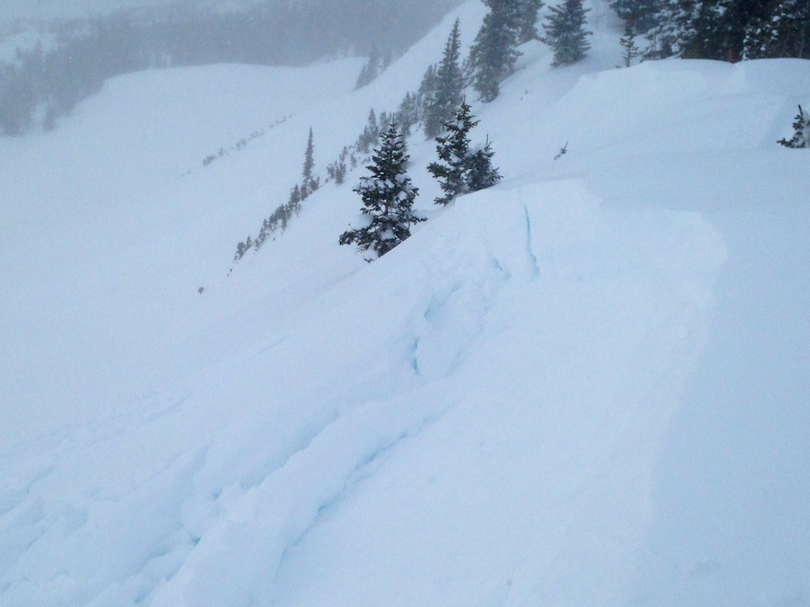
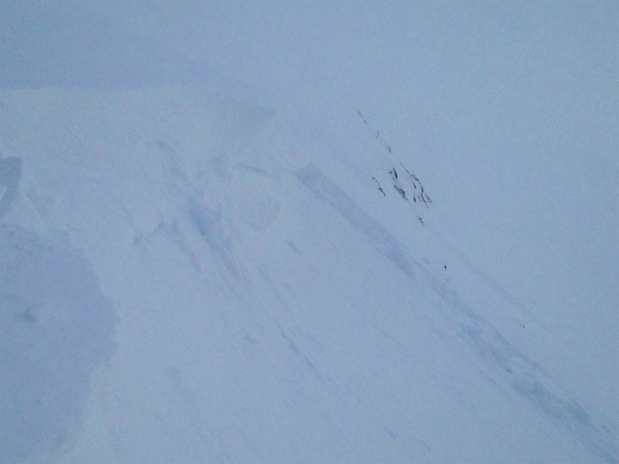
The Elk Mountains are under strong zonal flow today, with the jet stream just to our north. This morning, alpine winds are blowing steadily in the mid-20 mph range, gusting into the 60’s. We will see a few orographic snow flurries today and continued winds, before a high pressure ridge develops tomorrow into Friday. This brings a warming trend and a reprieve from the wind. The next system arrives Friday night and we should see multiple days of snowfall into next week.

Avalanche and wind

CB Avalanche Center2016-17 Observations

Location: Paradise Divide Area
Date of Observation: 12/27/2016
Name: Than
Subject: Avalanche and wind
Aspect: North East
Elevation:

Avalanches: See photo of slab avalanche on Schuylkill Ridge.
Weather: See photo of wind transport
Snowpack:

IMG_0368-1
IMG_0367

Irwin Cat Terrain obs

CB Avalanche Center2016-17 Observations

Location: Kebler Pass Area
Date of Observation: 12/27/2016
Name: Irwin Guides
Subject: Irwin Cat Terrain obs
Aspect:
Elevation: 10,000 -12,000 ft.

Avalanches: Explosive triggered D1.5’s out of Lone Wolf & Ski Heroes 20-50cm crowns. A few small D1s in Field of Screams. UUWW slides explosive triggered with 9# airblasts.
Natural D2 on South Ruby face
Weather: Partly Cloudy with winds picking up throughout the day SW 30’s/G-50’s. Intense wind transport. High Temps: 31F@10K and 19F@12K.
Snowpack: Persistent Slab Un-reactive in UUWW. Top 20-50cms reactive to Air Blasts in UUWW, pryed out borderline hard slab, wind drifted lenses. UUWW very variable with 10-20cm’s of facets to 130cm 1-Finger hard slab on the same slope. Slab formations mostly discontinuous with a lot of wind pasted whales in between runs by tree fences.

Same same with more snow and wind.

CB Avalanche Center2016-17 Observations

Location: Paradise Divide Area
Date of Observation: 12/27/2016
Name: Evan Ross
Subject:
Aspect: North East
Elevation: 9,000-11,400

Avalanches: A number of wind and/or storm slabs that released naturally during the Christmas cycle. The largest was a wind loaded storm slab. Definitely broke as a windslab and propagated further down slope into a storm slab, good stuff. ooo gets better, the debris triggered multiple small windslabs near the valley bottom. Windloaded storm slab that triggered multiple smaller windslabs or as coding would say, SS-N-R3-D2-S.
Weather: Clear sky with clouds starting to stream in, in the later afternoon. Calm winds in the valley with some moderate westerly gusts at ridegline.
Snowpack: Same same as this previous obs, just more snow and some wind effect. No obvious or observed sings to instability on supported slopes up to 38 degrees. Defiantly wind loading below ridgelines from our previous storm. Easy to just simply avoid so no more details.

The great wide open on Schuylkill. Small windslabs down low, bigger slabs in the start zone that are difficult to see in this picture.

It back. The glide cracks near the head of the Slate River Drainage.

White Christmas in the Anthracites

CB Avalanche Center2016-17 Observations

Location: Kebler Pass Area
Date of Observation: 12/25/2016 – 12/26/2016
Name: Zach Guy
Subject: White Christmas in the Anthracites
Aspect: North, North East, East, South East, West, North West
Elevation: 10,000-12,400 ft

Avalanches: Skier triggered a couple of harmless soft slabs each day, ~6-8″ deep on slightly wind affected below treeline slopes, various aspects. SS-AS-R1-D1-S. Lots of natural and skier triggered, shallow sluffing on various aspects.  L-AS/N-R1-D1-S
One natural D2.5 persistent slab ran during the storm, on a NNW aspect ATL. Crown looked about 3 to 5 feet deep and ran on or near the ground. HS-N-R3-D2.5-O/G
Weather: 12/25. S2 most of the day. Moderate NW winds with extreme gusts and intense snow transport. Overcast. -12C in the a.m.
12/26. Overcast decreased to clear. S-1 in the a.m. Very cold temps. Calm to light winds, minimal transport.
Snowpack: Christmas storm total was about 12″-14″, right-side-up. Snow depth in a wind sheltered flat slope was 145 cm. Ski pen was knee deep below treeline and ankle deep or less above treeline, where snow surfaces were stiffened by the wind. Stayed below treeline on 12/25 and saw no signs of instability except the avalanches described above. On 12/26, stomped on a number of suspect windloaded ridges N/ATL and couldn’t get anything to budge. No signs of instability observed other than the avalanches described above and some minor cracking in spots.

IMG_0366

Mountain Weather 12/27/2016

CB Avalanche CenterWeather

Date: 12/27/2016

Some of the season’s coldest temperatures will greet you as you step out the door this morning after a clear and calm night is pushing double digit below zero readings in the valleys (-26º in Taylor Park), while up on Scarp Ridge (12,000ft) we’re seeing a balmy 16ºF above zero. Strong solar will bounce temperatures into the mid teens today.  Looking ahead, winds increase tomorrow, along with a chance of flurries on Wednesday as the northern jetstream dips south. We’ll see quiet weather until the weekend, when it looks like another active pattern sets up to kick in 2017.

Washington Gulch

CB Avalanche Center2016-17 Observations

Location: Crested Butte Area
Date of Observation: 12/26/2016
Name: Donny Roth
Subject: Washington Gulch
Aspect: North East, East
Elevation: 9800-10,900

Avalanches:
Weather: Overcast in AM to clear skies in PM, no new precip; light to moderate down valley wind in morning, calm in PM; cold, high recorded temp of -11ºC @ 10,000’ @ 13:00.
Snowpack: Ski pen of 10cm to 20cm for most of the day; upper 20cm to 40cm of the snowpack was a 4F wind slab. Compression tests and hand shears produced easy results, but an ECT didn’t propagate across the column. The upper part of the pack felt great under foot while touring, but you could feel the inconsistencies on the descent. We got one, short, shooting crack on a 32º slope, but otherwise so no obvious signs of instabilities. The interface between the new wind slab and the buried near surface facets was clear. With the cold temps, the surface of the snow appeared to be faceting in the late afternoon. I think this will heal this week, but it needs a couple days. (IMO).

Irwin

CB Avalanche Center2016-17 Observations

Location: Kebler Pass Area
Date of Observation: 12/25/2016
Name: Irwin Guides
Subject: Irwin
Aspect: East, South, West
Elevation: NTL/ATL

Avalanches: D1’s with ski cuts on everything steeper than 35 degrees failing 10-20cm’s deep on a storm instability, a couple small remote triggers. Paperboy route produced numerous size 1 storm slabs.
Weather: Obscured skies, Snowing S1, strong winds w/ extreme gusts from the WSW, High Gust 74mph. High temp 11F in the study plot 3F at Ridge Top. HST 12″ with 1.2″ SWE at 4pm. H2D’s at 20″ total at 4pm.
Snowpack: Cracking everywhere on the storm instability. I think the instability is when the storm increased in intensity early this morning but seemed to go away in the pm as ski cuts were not producing any cracks.

Mountain Weather 12/26/16

CB Avalanche CenterWeather

Date: 12/26/2016

Yesterday’s arrival of a cold front and westerly orographics really kicked off high snow accumulations in favored areas like the Ruby Range. While Crested Butte still did well, this was the first storm this season that delivered a large difference in snow accumulation like this as many of the previous storms have been on the southern track. This morning we remain in westerly flow with enough moisture upstream and a weak disturbance to our north, to continue seeing some light snow showers and clouds mostly in the mountains west of Crested Butte. Clouds should start decreasing by mid-day as we head into clear and dry weather for Tuesday. Winds will also ease today. The next storm will just brush northern Colorado starting Tuesday night. We’ll see increased winds and clouds and now snow accumulations this far south.

Fresh Windslabs

CB Avalanche Center2016-17 Observations

Location: Crested Butte Area, Mt Emmons
Date of Observation: 12/25/2016
Name: Evan Ross
Subject: Fresh Windslabs
Aspect: South East, South
Elevation: 9,200-11,800. BTL/NTL

Avalanches: Skier triggered a few small windslabs from ridgeline at NTL elevation. These slabs were about 8″ to 12″ thick at 3pm and continuing to build.
Weather: Oooo blustery. Strong down valley winds in the Kebler Pass corridor and strong to extreme westerly winds at higher elevations. Snowing, but couldn’t make a call on hourly rates with all the wind.
Snowpack: Late afternoon tour. Cross loaded slopes BTL, and would have managed them for potential windslabs up to 12″ thick. At NTL elevations recent wind loading was obvious with observed slabs also in the 12″ range on the few easterly slopes I traveled above. Quick observations didn’t reveal any persistent weak layers and avalanche obs didn’t show much for propagation in this area.

Small skier triggered windslab at NTL elevation on easterly aspect.

Small skier triggered windslab at NTL elevation on easterly aspect.

Wind loading at 9,500ft