Slate River natural avalanche

CB Avalanche Center2016-17 Observations

Location: Paradise Divide Area
Date of Observation: 02/14/2017
Name: Ryan Hoynacki
Subject: Slate River natural avalanche
Aspect: North East
Elevation: 11000

Avalanches:
Weather: Blue bird and calm.
Snowpack:

IMG_0538

pow, shmoo, and some loose wet

CB Avalanche Center2016-17 Observations

Location: Crested Butte Area
Date of Observation: 02/14/2017
Name: Evan Ross
Subject: pow, shmoo, and some loose wet
Aspect: North East, South East
Elevation: 9,200-12,300

Avalanches: R2 D2 above treeline in the northeast facing Green Lake Bowl. Looked to have run in the last couple days.

Some loose wet activity on east to south to west aspects. Nothing to impressive or surprising that I could see.
Weather: Big ball of fire with a blue background. Light northeast winds above treeline
Snowpack: Southeast
1/10 interface was down about 25cm’s at 11,350 and down about 60cm’s just below ridegline at 12,390, both on southeast slopes. No CT result at that interface at the lower elevation, and informal hand column didn’t produce a sheer on the interface at the higher elevation. At the 11,350 pit, CTH RP on some rounding faceted particles above a melt freeze crust down 65cm. Light winds kept the snow surface mostly cool above treeline. Snow was warmed and shmoo like at near treeline elevations. By the time we were below treeline on an easterly facing slope the snow surface had already started to cool at 3pm.

Northeast
Steep northeasterly slopes near 11,500 (NTL elevation) had very low density new snow over the old snow interface in some places and wind texture in others. In areas without wind texture sluffing was the main observed concern.

Small loose snow avalanches on an easterly NTL aspect.

IMG_2747

R2 D2 above treeline in the northeast facing Green Lake Bowl. Looked to have run in the last couple days.

IMG_2745-1

Red Lady Glades

CB Avalanche Center2016-17 Observations

Location: Crested Butte Area
Date of Observation: 02/14/2017
Name: Jake
Subject: Red Lady Glades
Aspect: South
Elevation:

Avalanches: No signs of instability on the Mother, but Axtell had a new slide below the cornice past Wang Chung. My guess is that out ran on the buried SH 1-2ft below the surface. I did see tracks down 1st bowl on the way out without any activity.
Weather: Clear skies and mostly Calm winds, Light North Winds on Ridge and Summit.
Snowpack:

Big wet one

CB Avalanche Center2016-17 Observations

Location: Crested Butte Area
Date of Observation: 02/14/2017
Name: Steve Banks
Subject: Big wet one
Aspect: South West, West
Elevation: ATL

Avalanches: See photo.
Weather:
Snowpack:

unnamed1

Wet snow obs below treeline

CB Avalanche Center2016-17 Observations

Location: Crested Butte Area
Date of Observation: 02/14/2017
Name: Zach Guy
Subject: Wet snow obs below treeline
Aspect: North East
Elevation: 9,000 – 9,600 ft.

Avalanches: See photos. A number of shallow loose snow avalanches (both dry and wet), skier and natural triggered on southerly aspects, initiated by solar warming. D1 in size, involving just the recent storm snow. One D2 slab avalanche on NE aspect above treeline of Mt. Axtell, probably ran towards the end of the last storm.
Weather: Clear, calm, mild temps.
Snowpack: On NE aspects BTL, we found a drying, refreezing, stabilizing snowpack. See photo.
At 9,000 ft. Water front had advanced 30 cm and had percolated to, pooled, and now refrozen on an interface 55 cm deep (1/19 interface?). The upper 20 cm is now refrozen clusters or dry storm snow, leaving about 10 cm of very wet grains insulated 20-30 cm deep and capped by a refreeze that won’t break down on this shadier aspect.
At 9,600 ft, there were no wet grains remaining in the snowpack; a series of soft melt-freeze crusts in the upper snowpack.
The biggest concern at both of these locations is the thin layer of low density stellar dendrites above the soft melt-freeze crusts at the surface. This layer will quickly facet into our next weak layer over the next few days on shadier aspects where it doesn’t get cooked.

D2.  NE aspect ATL of Mt. Axtell
NE aspect at 9000 ft.  Wet grains refreezing.
Skier triggered D1 wet loose, S/SE near treeline.
Loose snow avalanches off of Mt. Belleview.  S aspect ATL

Mountain Weather 2/14/2017

CB Avalanche CenterWeather

Date: 02/14/2017

It froze! #itreallybelowfreezing! That may be the first hashtag in CBAC’s weather forecast but I’m really excited about his. Crested Butte is in the single digits this morning while 11,000ft temperatures are in the teens. This will be the theme the week as a high pressure ridge builds. We’ll likely see valley inversions each morning and dry weather through Thursday. Today, wrap around flow from a low pressure moving southeast of Colorado is helping drag in some colder air from the north. Helping shield us from what could be a rapped warm up. Winds look to remain light out of the northeast with mostly clear sky today.

Leve 2 Class

CB Avalanche Center2016-17 Observations

Location: Crested Butte Area
Date of Observation: 02/12/2017
Name: Evan Ross
Subject: Leve 2 Class
Aspect: North East, East
Elevation: 9,500-10,200

Avalanches:
Weather: Sky: obscured in morning, overcast through the midday and obscured again in the afternoon.
Precip: S-1 to S1 in the morning, no precep in during the midday and S1 again in the afternoon.
Temp: 9,500ft 10:30am Tair 3c Sur 0, T20 -1, 2:30pm Tair 1c, Tsur -.5 T20 -.5
Snowpack: See form

snod

I saw a mosquito

CB Avalanche Center2016-17 Observations

Location: Crested Butte Area
Date of Observation: 02/13/2017
Name: Evan Ross
Subject: I saw a mosquito
Aspect: North East
Elevation: 9,400-11,200

Avalanches: Big roller balls on a few steep ENE slopes. Think these mostly fell out of trees rolling to larger size as the moved down the hill. These didn’t entrain any more snow. New snow to thick?

Debris piles below the east face of Gothic. Couldn’t see any slabs or crowns on the face, though light could have been better.
Weather: Sun poking through the clouds in the early morning, then overcast sky for the rest of the day. S1 snowfall began at about 4pm. Calm winds
Snowpack: Very little signs to instability, traveling across several steep slopes to 40 degrees. Snowpack was pasted in above 10,500ft with an inch or two of fluff form last night. Minimal sluffing in 40 degrees terrain. Above this elevation the 2/10 interface was down 25cm and dry with some graupel in the mix. No CT results on this layer or results while skiing. In the same area on a 35 degree slope, 1/19 SH was down 90cm. CT27 SP on the SH. SH is still 2-3mm tall but looks to be filled with rounded grains between the feathers.

Below 10,500ft the snowpack became very thick. Very northwest feeling shmooo. Bet it was still 0c through the new snow as observed in previous days down below the 1/10 interface that is moist, going on borderline wet for about 5cm. Hand pits produced more non-planner breaks. Ski tests showed no signs to instability.

Viewd a number of glide cracks across the valley at low elevations and on small terrain. This one stuck out a litle more. East aspect 9,500ft.

IMG_2742

Moist borderline wet 1/10 interface at 10,000ft on ENE aspect.

IMG_2741

Dry 1/10 interface on NE aspect at 10,500ft. 1/19 SH down 90cm.

IMG_2734

January 27th – February 2nd: High pressure and lurking instabilities

CBAC2016 - 17 Weekly Snowpack Summaries, Weekly Snowpack Summaries

By Arden Feldman            CBAC Intern

The Elk Mountains remained under a high pressure ridge with dry, mostly clear skies and warming temperatures for the duration of the week. Cool northwesterly flow started the week off cold with strong valley inversions and clear skies. On the morning of January 27th, the temperature was down to -32F in town and -10F up at the Elkton weather station at 11,000 ft. On the 27th, winds at Elkton averaged 12 mph and gusted to 32 mph out of the northwest, transporting last week’s snow into wind slabs on leeward aspects above tree line. Similar winds continued out of the northwest until January 31st, but temperatures increased over that time. On the 31st, Elkton recorded a high of 33F and a low of 23F, while down in town there was a high of 40F and a low of -8F. These warm temperatures formed stout melt-freeze crusts on southerly aspects over the week. Flow changed to the southwest later in the week, and winds continued but were running low on snow available for transport.
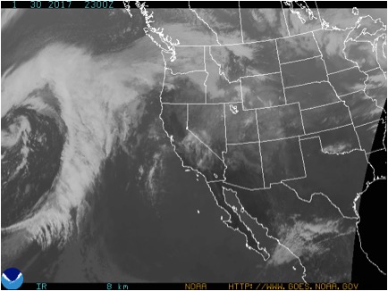
1/30/17 – Satellite image showing relatively clear skies over Colorado.


Avalanche instabilities slowly stabilized over the week. Wind slabs and persistent slabs were the primary concerns. Wind slabs formed on leeward aspects during the northwest winds in the beginning of the week. Observers reported a handful of natural wind slabs running on steep, windloaded terrain at higher elevations. On the 1st, an experienced backcountry skier was caught, carried, and sustained multiple injuries after being washed over several cliffs and trees by a relatively small wind slab in consequential, westerly facing terrain above Copper Creek near Gothic

1/27/17 – Natural D1 wind slab that was possibly cornice triggered.


1/31/17 – Natural D1 wind slab.


1/30/17 – Remotely triggered D1 wind slab.


The 1/19 surface hoar continued to plague our area, with reactive persistent slabs up to several feet thick. They became harder to trigger as the week progressed, but they still lurked and avalanches on this layer were triggered almost every day of the week in either our zone or the neighboring Aspen zone. Northerly and easterly aspects near and below tree line were the most suspect slopes to contain the dangerous surface hoar layer.

1/27/17 – Explosive triggered D2 persistent slab.


1/28/17 – Snowmobile triggered D1 avalanche that ran across Kebler Pass Road.


1/31/17 – Natural D2 persistent slab avalanche that likely ran at the end of the last storm cycle.


1/30/17 – Avalanche rose showing persistent slab avalanche activity since January 19th.


1/28/17 – CBAC Snodgrass Snow Study Plot profile showing the problematic surface hoar layer.

