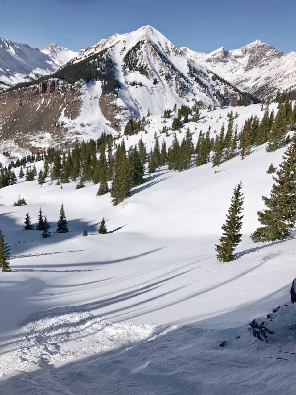
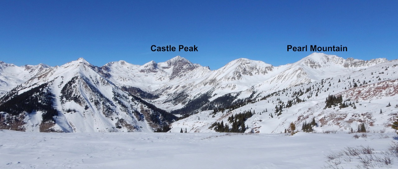
Location: Kebler Pass Area
Date of Observation: 01/27/2018
Name: Cam
Subject: Southerlies
Aspect: South East, South, South West
Elevation: 11,000-12,400 ft
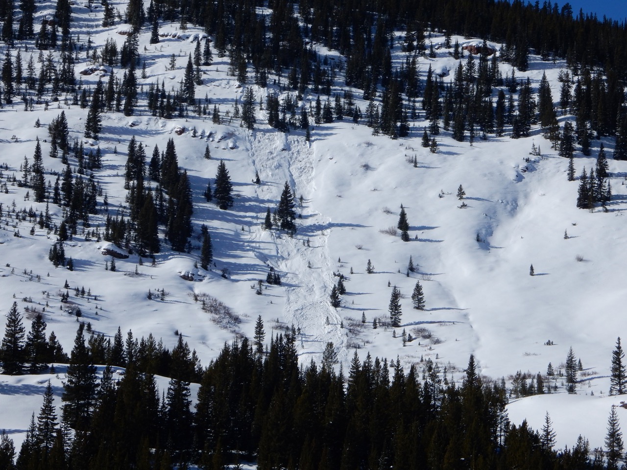
Avalanches:
Observed one avalanche on an East face in Elk Basin beneath the old mining road. 50 ft wide ran about 150 ft. Too far away to tell anything else, but it appeared fairly fresh. Several recent point releases were visible on steep East facing terrain.
Weather: -14F leaving the car 9,000 ft at 0800 hrs.
Warmed up as we climbed and the day went on. Around 25 degrees F by the afternoon.
20-30 mph winds from the W above treeline throughout the morning. Not a cloud in the sky.
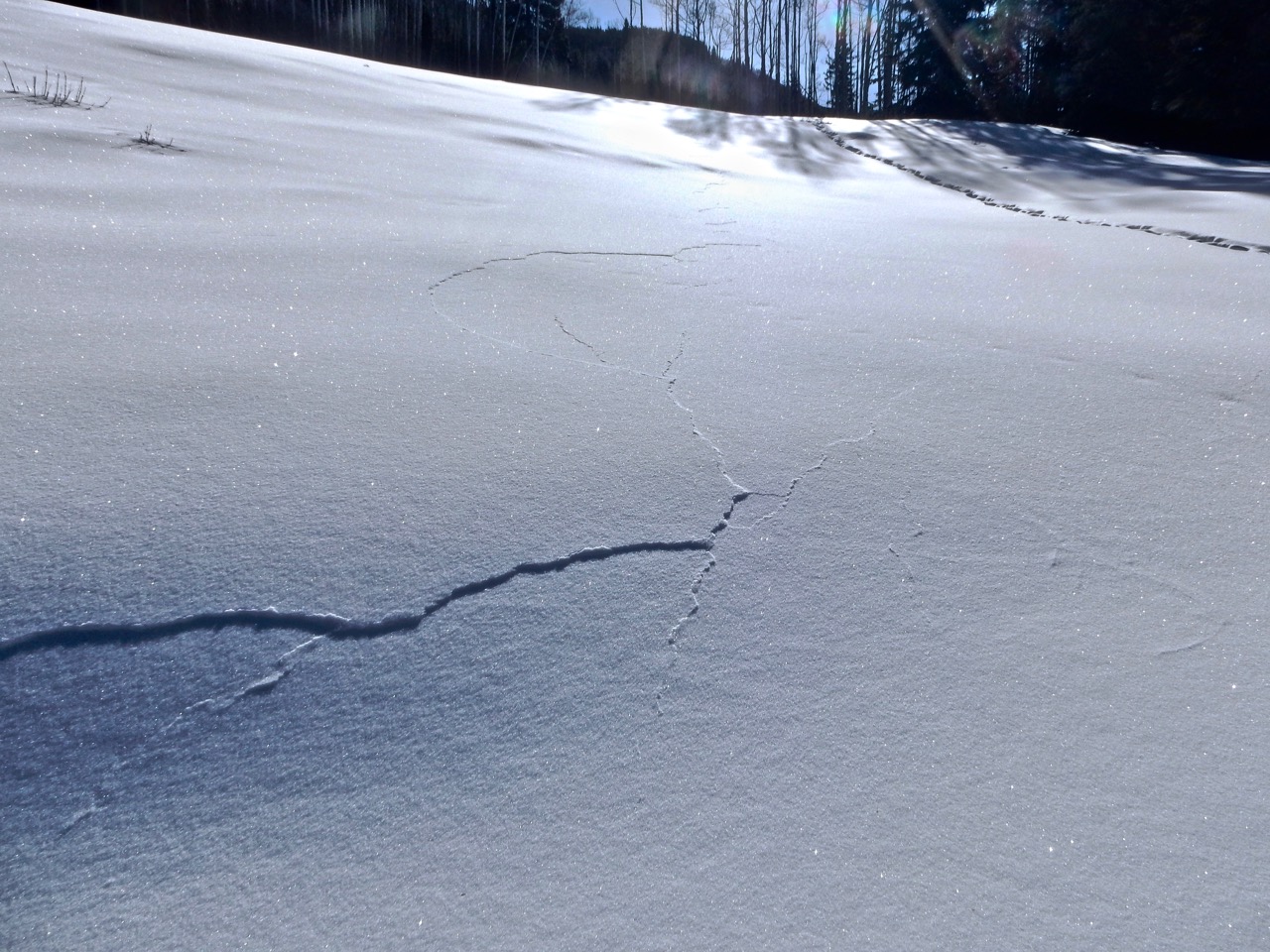
Snowpack: HS generally between 40 and 70 cm below ridgetops. Facets at the ground, a solid crust 20-30cms from the ground, and unconsolidated soft snow on top.
Shallow windslabs in cross-loaded terrain acted like they wanted to move, but there wasn’t enough energy there. The 2-3 inches from Friday was sitting happily in areas below treeline and in basins. On the ridges and up high it was scoured off.
Skied southerlies up to 35 degrees without any signs of instability. Direct south faces were thin but supportive.
Ski pen- 10 cm Boot pen- deep
Photos: