Cracking and collapsing below tree line

CB Avalanche Center2018-19 Observations

Location: Paradise Divide Area
Date of Observation: 11/24/2018
Name: Alex Tiberio

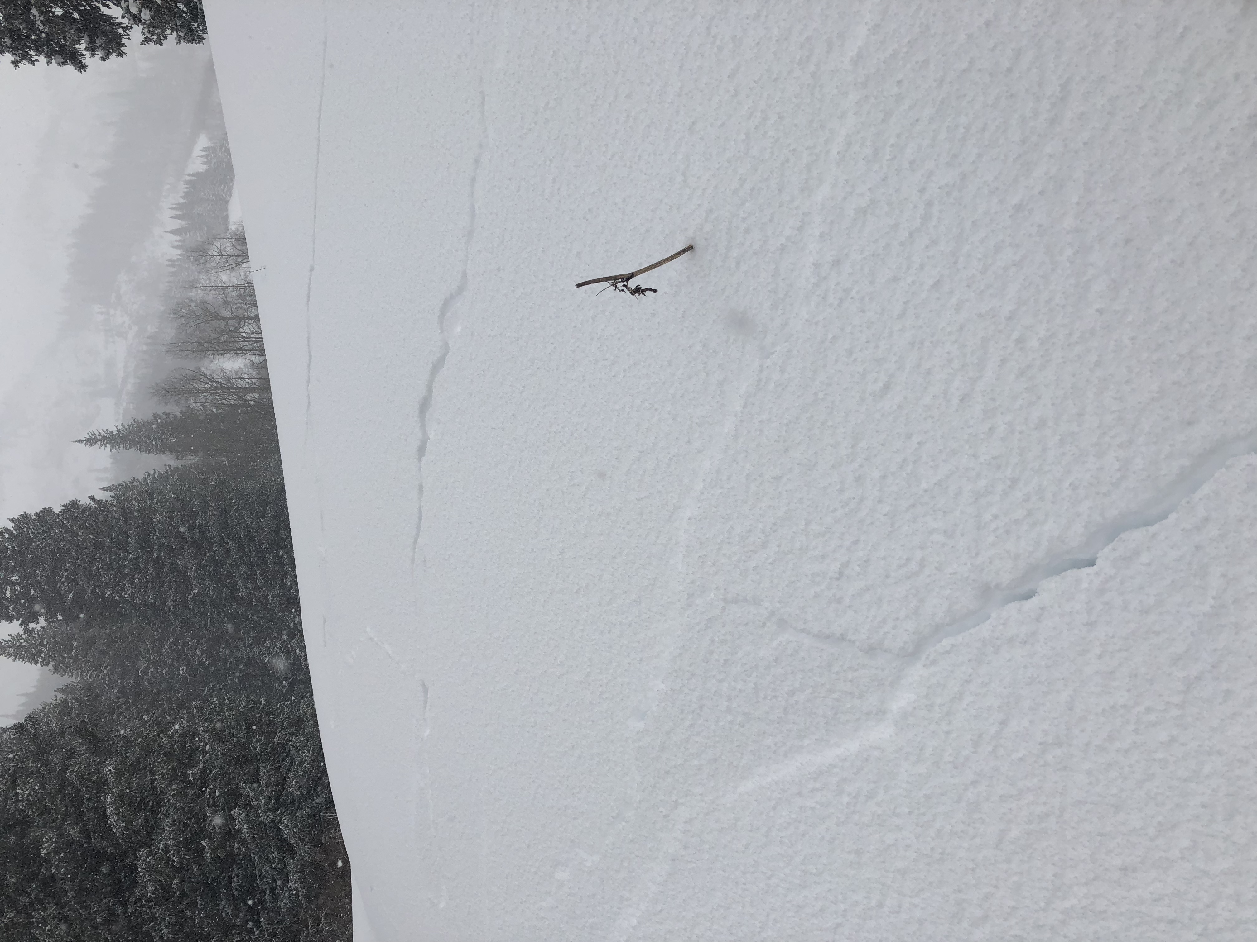
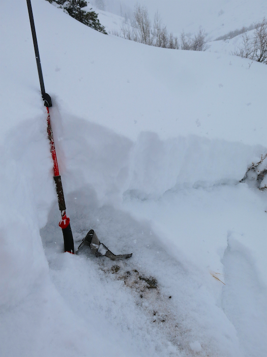
Subject: Cracking and collapsing below tree line
Aspect: North East, East
Elevation: 9,500-10,000

Avalanches:
Weather: Snowing with limited visibility
Snowpack: Widespread collapsing cracking and whomping all failing on facets near the ground. Didn’t travel in terrain over about 30 degrees.

Photos:

Gothic 7am Weather Update

CB Avalanche Center2018-19 Observations

Location: Paradise Divide Area
Date of Observation: 11/24/2018
Name: billy barr

Subject: Gothic 7am Weather Update
Aspect:
Elevation:

Avalanches:
Weather: Yesterday’s snow was very light but with steady, strong wind. The wind died around sunset but snow stayed light until a few hours ago and has been moderate and steady now. The 24 hour totals are 8½” new snow with a moderately dense 0.71″ of water. Snowpack is at the winter’s deepest of 17″. Currently light to no wind with moderate snow, obscured cloud cover and temperature has stayed steady overnight between 21 and 22F. billy
Snowpack:

Photos:

Mountain Weather for 11,000ft

CB Avalanche CenterWeather

Date: 11/24/2018

The second round of snow has arrived in the Crested Butte area. Heavy snowfall began to ramp up at around midnight and will continue through Saturday and into Saturday night. This system is pushing down out of the northwest with ample moisture and energy. Strong winds will be associated with this storm. Expect west and northwest winds to blow around 20 to 30mph during the peak of the storm with gusts reaching as high as 50mph.

  • Today

    High Temperature: 23 to 28
    Winds/Direction: 15 to 25 G60 W
    Sky Cover: Overcast
    Irwin Snow: 8 to 12″
    Elkton Snow: 8 to 12″
    Friend’s Hut Snow: 7 to 10″

  • Tonight

    Low Temperature: 0 to 5
    Winds/Direction: 7 to 17 NW
    Sky Cover: Mostly Cloudy
    Irwin Snow: 0 to 2″
    Elkton Snow: 0 to 2″
    Friend’s Hut Snow: 0 to 2″

  • Tomorrow

    High Temperature: 15 to 20
    Winds/Direction: 5 to 15 NW
    Sky Cover: Mostly Clear
    Irwin Snow: 0
    Elkton Snow: 0
    Friend’s Hut Snow: 0

Lots of activity

CB Avalanche Center2018-19 Observations

Location: Paradise Divide Area
Date of Observation: 11/23/2018
Name: Steve Banks

Subject: Lots of activity
Aspect: North East, East
Elevation: 9,400-10,400

Avalanches:

We saw a lot of activity in this location. Lots of cracking and slumping and numerous avalanches triggered remotely. None were very hazardous (R1-D1) and the biggest one ran about 100′. What surprised me the most was the remote triggering. We triggered several slides from 200′ or more away. Slopes in the mid 30 degree range would crck and move slightly. It seemed the slope needed to be 40 degrees or steeper today to get the momentum to move.

Weather: Lovely winter day. Temps in the mid to high 20’s with calm to light winds. Overcast and snowing all day. Mostly S2 with periods of S1.
Snowpack: Generally 9-12″ of new snow overnight. Bottom half of the new snow was slightly more dense (4f) than the surface snow (F). Very weak facets below (F-). On steeper slopes with more Easterly tilt there was a soft, decomposing crust within the old snow, but this was intermittent. In some areas the facets at the ground were moist, some places frozen back together, and some places totally dry. In general there is little cohesion or slab in the snow, though apparently there is enough to form avalanches!
A quick Shovel Test showed Easy (7) results failing below the new snow on the facets with Resistant Planer shear.

Photos:


Touchy storm slabs in the Paradise Divide zone

CB Avalanche Center2018-19 Observations

Location: Paradise Divide Area
Date of Observation: 11/23/2018
Name: Alex Banas

Subject: Touchy storm slabs in the Paradise Divide zone
Aspect: North East, East
Elevation: 10,000′ – 11,000′

Avalanches:

SS-ASc-R2-D1.5-I This soft slab avalanche propagated from 30* terrain through a gully feature and onto the adjacent slope.

Weather: Overcast. Snowing S1 . Moderate winds from the West.
Snowpack: Today we observed widespread cracking and collapsing on E-NE terrain around 10,500′. Shooting cracks out 20+m. HS varied from 40-95cm. It was a weak over very week set up with the snowpack failing on facets at the interface of the new and old snow, mostly on an old faceted out crust. Storm Slabs varied from 20-45cm thick.

Photos:

Storm observations from Upper Slater River Valley

CB Avalanche Center2018-19 Observations

Location: Paradise Divide Area
Date of Observation: 11/23/2018
Name: Eric Murrow & Evan Ross

Subject: Storm observations from Upper Slater River Valley
Aspect: North East, East, South East
Elevation: 9600′ – 11100′

Avalanches:

We skier triggered 4 Storm Snow avalanches, one of which was remotely triggered and was likely a D2 in size. Poor visibility and trees prevented viewing the debris.
A group riding earlier the morning in same terrain triggered a D1.5 as well.
We also saw two natural avalanches, D1.
All observed avalanches failed at the new/old interface and where easterly to northeasterly facing.

Spoke with a group of skiers, that ascended a ridge just adjacent to our up track, that said Purple Palace terrain had avalanched in multiple places. I did not view this terrain, but based on the slope size in this area these avalanches were likely close to D2 in size.

Weather:

Skies were overcast with light snow from 10am to 3pm, generally S1 snow with brief periods of S2. On our below tree line tour, winds were light with occasional moderate gusts. Visibility was poor but did see small amounts of snow transport.
Snowpack:

On the way out Slate River Valley, we stopped at Pittsburg, 9400′, at 1050am to measure the new storm snow and found 10″ of new snow with .8″SWE. On the way out we stopped back at Pittsburg at 315pm and measured 11.5″ storm total with .95″SWE. Much of the new snow was rimed particles with some graupel present.

On our tour we found new snow totals ranging from 10″ to 15″. The new snow was resting on very weak old snow on any aspects with even the slightest bit of north to it. The new snow was very reactive to the weight of a person. We triggered 4 slides, saw one other human triggered slide, and two natural slides. Mostly D1.5 in size, given the generally small terrain features we were on. I imagine that on larger slopes avalanches would have reached D2 in size (large enough to bury a person). Several of the avalanches were triggered remotely from 75′ to 100′ away; impressive for storm snow that was fist dense(very soft). We descended east facing terrain back to snowmo’s and saw cracking within the new snow on descent that wasn’t present while ascending. The storm snow was sitting on melt/freeze crusts  and large facets on this east aspect.

At the end of the day, we rode machines part way up Paradise Divide road until we were shut down by soft, large drifts up to 4′ thick on the road surface. On our tour we saw minimal evidence of loading below tree line, but riding up the road through the open the impact of the wind was obvious.

Photos:

Gothic 7am Weather Update

CB Avalanche Center2018-19 Observations

Location: Kebler Pass Area
Date of Observation: 11/23/2018
Name: billy barr

Subject: Gothic 7am Weather Update
Aspect:
Elevation:

Avalanches:
Weather: Light snow in the afternoon picking up for an hour or so late afternoon, then light off and on snow overnight with steady wind. Currently obscured with steady moderate wind and light snow. New snow of 4″ with water 0.26″ and snowpack at 8″. Decent snowfall is very unusual with steady wind here and that has been the case overnight. billy
Snowpack:

Photos:

Schofield Pass tour

CB Avalanche Center2018-19 Observations

Location: Paradise Divide Area
Date of Observation: 11/22/2018
Name: Eric Murrow

Subject: Schofield Pass tour
Aspect: North, North East
Elevation: 10300′ – 11,7500′

Avalanches:

Triggered a small Persistent Slab near treeline on a north aspect at 11,750′. It was only about 20′ wide but ran about 600′ vertical. I was able to easily ski off slab as it released.

Weather: First snowflakes dropped at about 11am with consistent accumulating snow at about 2pm. Winds remained light even neat treeline through 3pm.

Snowpack: Same ol’….weak snow surfaces (facets and surface hoar) and really just plain weak in most places. One drifted near treeline pocket clearly contained a small old slab.  Snow depth ranged from 30cm to 60cm across most terrain.

Photos:

Mountain Weather for 11,000ft

CB Avalanche CenterWeather

Date: 11/23/2018

Wahoo…winters has arrived. A southwest to west system moved through our area yesterday and last night and deposited 5″ to 8″ of snow. Winds began from the southwest and rotated towards the northwest. Today you can expect to see continued light snowfall with limited accumulations. Tonight a second, more powerful, system will move into the forecast area from the northwest. This system will bring significant snowfall tonight and into tomorrow with strong winds at all elevation. Be prepared for our first major storm of the season beginning tonight. Snowfall will taper off tomorrow afternoon and end for the weekend.

  • Today

    High Temperature: 25
    Winds/Direction: 10 to 20 G30, West
    Sky Cover: Mostly Cloudy
    Irwin Snow: 1 to 3
    Elkton Snow: 1 to 3
    Friend’s Hut Snow: 1 to 3

  • Tonight

    Low Temperature: 18
    Winds/Direction: 10 to 20 G 40 West
    Sky Cover: Overcast
    Irwin Snow: 8 to 12
    Elkton Snow: 8 to 12
    Friend’s Hut Snow: 6 to 10

  • Tomorrow

    High Temperature: 25
    Winds/Direction: 20 to 30 G60 West
    Sky Cover: Overcast
    Irwin Snow: 8 to 12
    Elkton Snow: 8 to 12
    Friend’s Hut Snow: 6 to 10

Weather Forecast for 11,000′

CB Avalanche CenterWeather

Date: 11/22/2018

Just in time for the holidays….here comes ol’ man winter! Thanksgiving day will bring a long-awaited change to our warm and dry fall in the Elk Mountains. Our first storm will be arriving today with the bulk of the moisture hitting tonight and into early Friday morning. The stream of the atmospheric energy will be to the south which will help to keep winds on the lighter side, especially in the valleys, while offering a favorable southwest flow to begin this stormy weekend. The second and stronger storm will arrive Friday night and will come more from the northwest but with more moisture. The accompanying cold front dropping out of the north will bring strong winds and cold temperatures and up to a foot of snow by Saturday morning. Things will settle down Saturday afternoon and into Sunday, but temperatures will remain cold into next week as it looks like winter is here to stay for a while.

  • Today

    High Temperature: 25
    Winds/Direction: W-SW 10-20 mph
    Sky Cover: Increasing clouds
    Irwin Snow: 1-3″
    Elkton Snow: 1-3″
    Friend’s Hut Snow: 1-3″

  • Tonight

    Low Temperature: 15
    Winds/Direction: W-SW 15-25 mph
    Sky Cover: Overcast
    Irwin Snow: 4-6″
    Elkton Snow: 4-6″
    Friend’s Hut Snow: 3-5″

  • Tomorrow

    High Temperature: 20
    Winds/Direction: West 15-25
    Sky Cover: Mostly Cloudy
    Irwin Snow: 1-3″
    Elkton Snow: 1-3″
    Friend’s Hut Snow: 1-3″