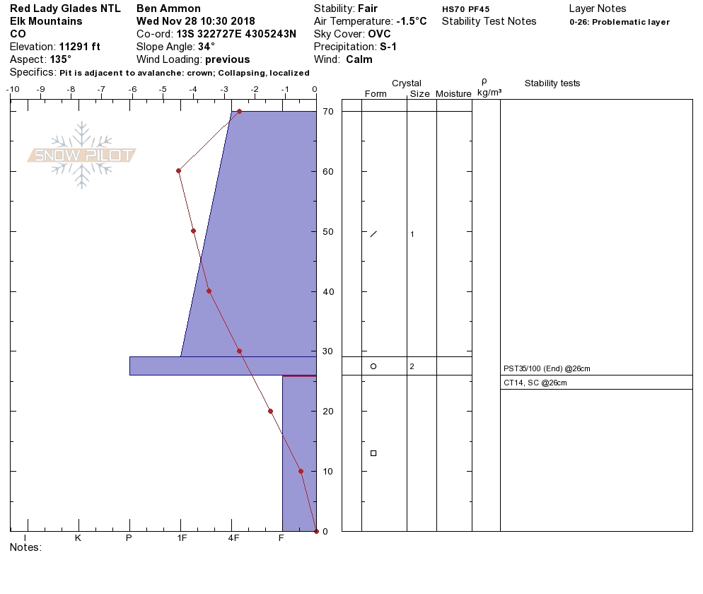
Location: Kebler Pass Area
Date of Observation: 11/30/2018
Name: Eric Murrow
Subject: Afternoon Anthracite Ski
Aspect: North, North East, East
Elevation: 10,000′ – 11,250′
Avalanches:
Not sure if we triggered or well-timed naturals, SS-R1D1-I x 3
Weather: Heading out Kebler Pass at 145pm snow was generally S1, S-1 and continued at that level until about 430pm during the ride home when it ticked closer to S2. Winds were well behaved during this time with only light gusts.
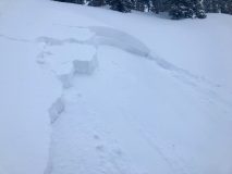
Snowpack: At 240pm poked a hole on a NE slope at 10,800′ found an HS of 115cm, top 37cm was new snow since Wednesday afternoon (latest round of snowfall); it contained 1.2″SWE. Below this was 45cm of 1finger- snow from Thanksgiving storm cycle (weaker NSF were sandwiched between storm snow and Thanksgiving snow), and below this was 2-3mm facets for early Nov/Oct. Only toed into the edge of slope fully expecting it to collapse, but it didn’t (I believe this slope saw very little skier traffic this season, certainly no evidence in my hole).
Ascending to the ridge top, we were able to check out a south facing slope at 11,200. Here we generally found facets – crust-storm snow; some drifted areas had a second facet/crust combo on the ground from snow prior to Thanksgiving storm. As we skinned out the ridge and looked back there were three small Storm Slab avalanches that clearly had just ran immediately below where we just were (these ran on top of suncrust capping Thanksgiving storms. Not sure if we triggered these but seems like a strong possibility. I looped back around to inspect and while crossing same southerly slope we just probed, I got a good size collapse- wasn’t able to find any cracks but felt/sounded impressive for terrain size.
Photos:
-
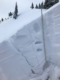
- Profile from NE at 10,800′. HS 115

-
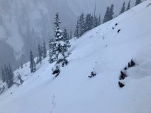
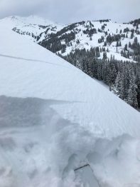
- Fresh slide south side of Anthracites, Storm Slab
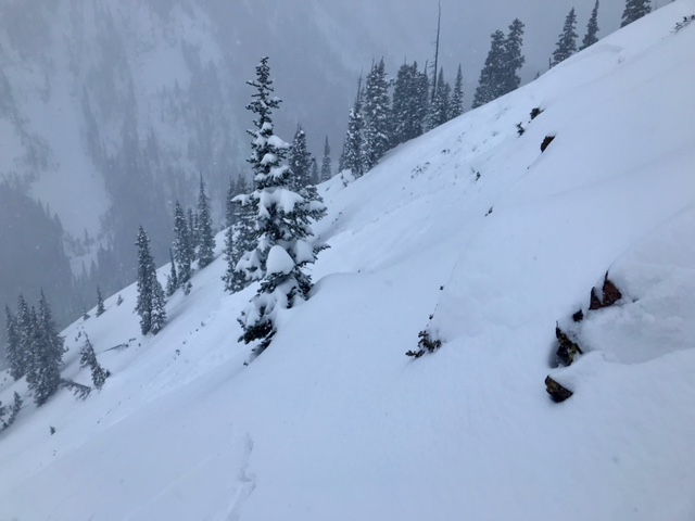
-
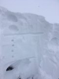
- 11/30 Crown on south aspect in Anthracited

-
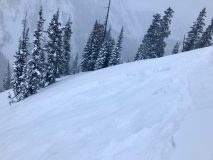
- Propagation into fairly shallow storm snow, approx. 6″ to 8″. Fri 11/30