Location: Crested Butte Area
Date of Observation: 01/07/2019
Name: CBPSP
Subject: CBMR avalanche activity
Aspect: North, North East, North West
Elevation: 10,800′-11,500′
Avalanches:
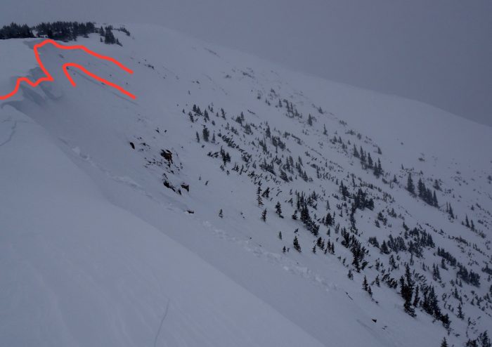
Teocalli Bowl
NE aspect NTL several AE-SS-R1-D1-I avalanches where the storm slab was initiated by explosives and storm slabs on adjacent paths ran sympathetic.
N aspect NTL AS-SS-R4-D1.5-I
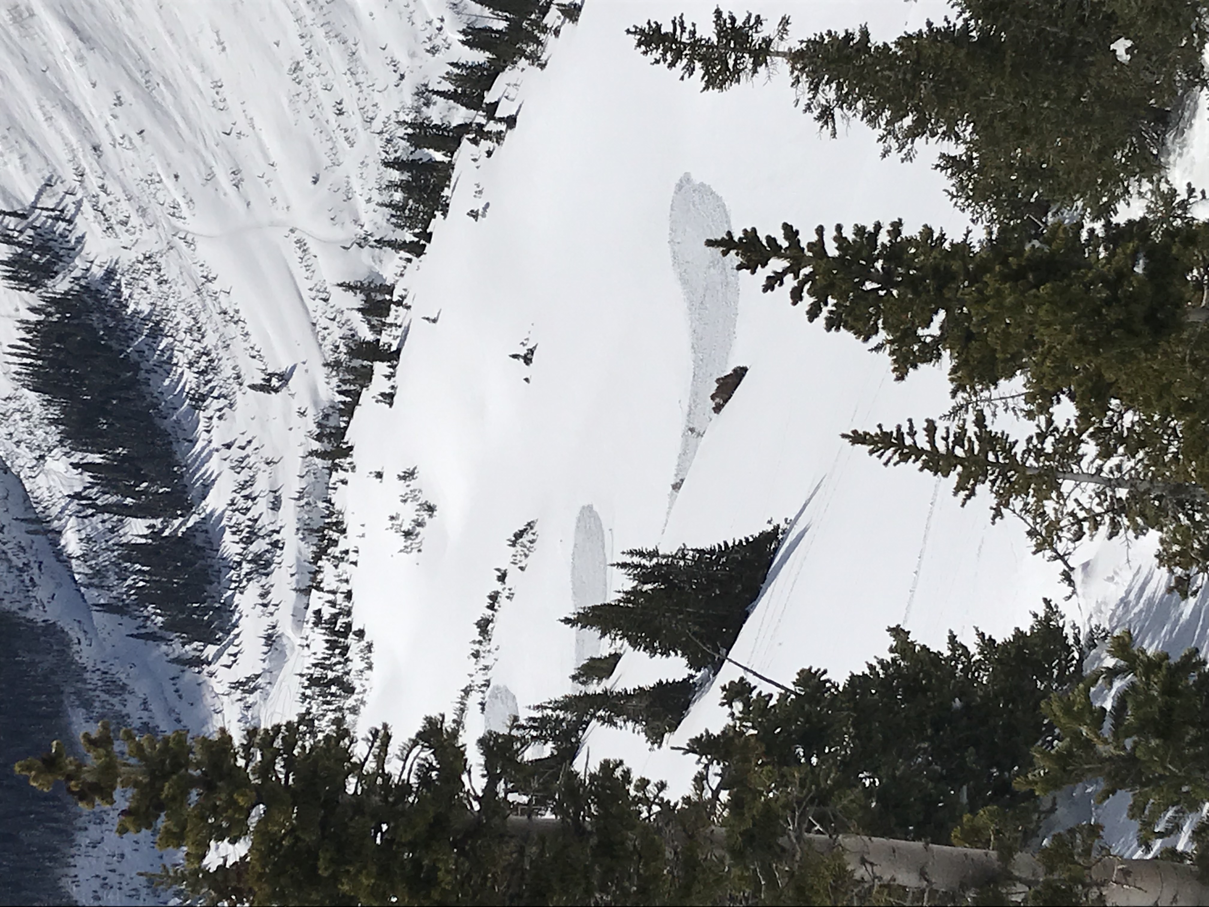
Big Hole
ASr-SS-R3-D2-O/G Triggered from 10′ away while approaching the slope.
Weather: Temperatures in the teens with moderate gusty winds from the west. Storm total 9″ at 7 % and still snowing S2.
Snowpack: The avalanche observations are from two different zones Teocalli bowl which has seen previous avalanche mitigation work and, and boot packing throughout the season so far. On N facing terrain in Teo NTL before the storm the HS was on avg. 60 cm’s of weak faceted snow as the aspect tilted East the HS was around 40 cm’s with a 10cm surface crust on top of weak faceted snow. The 2nd observation is from Big Hole BTL NW aspect which is an area that has been unaffected by any patrol traffic all season. This entire pitch did run natural 1 month prior on facets at the ground and has since filled in with 60 cm’s of weak snow that has also become weak and faceted since then.
Photos: