Mountain Weather for 11,000ft

CB Avalanche CenterWeather

Date: 01/11/2019

Those cold valley inversions got pushed out last night with temps around 20 at both valley elevations and 11,000ft. We got a dusting of snow overnight with CBMR getting 50% more snow then the typically favored Irwin. Unfortunately, we are only talking 2” vs 1”. This is the setting for this storm, as more snow will accumulate further east, primarily in the Sawatch and out to the Front Range. We’ll continue to see overcast sky in our forecast area and could pick up another inch or couple today. Winds look to tick up slightly this afternoon as well. Looking at the weekend, we’ll continue to see clouds hanging out in the area and a couple more inches of snow toward the end of the weekend. Looking at the start of next week, moisture appears to undercut the high-pressure ridge we were talking about yesterday. More on that later, but for now it doesn’t look like clear weather to start the weak.

  • Today

    High Temperature: 20 to 25
    Winds/Direction: 5 to 15 N
    Sky Cover: Overcast
    Irwin Snow: 1 to 2
    Elkton Snow: 1 to 2
    Friend’s Hut Snow: 2 to 3

  • Tonight

    Low Temperature: 10 to 15
    Winds/Direction: 0 to 10 E
    Sky Cover: Mostly Clear
    Irwin Snow: 0 to 1
    Elkton Snow: 0 to 1
    Friend’s Hut Snow: 0 to 1

  • Tomorrow

    High Temperature: 25 to 30
    Winds/Direction: 0 to 10 W
    Sky Cover: Overcast
    Irwin Snow: 0
    Elkton Snow: 0
    Friend’s Hut Snow: 0
Fredo’s Apron

CB Avalanche Center2018-19 Observations

Location: Crested Butte Area
Date of Observation: 01/10/2019
Name: CBPSP

Subject: Fredo’s Apron
Aspect: North
Elevation: 11,150′

Avalanches:

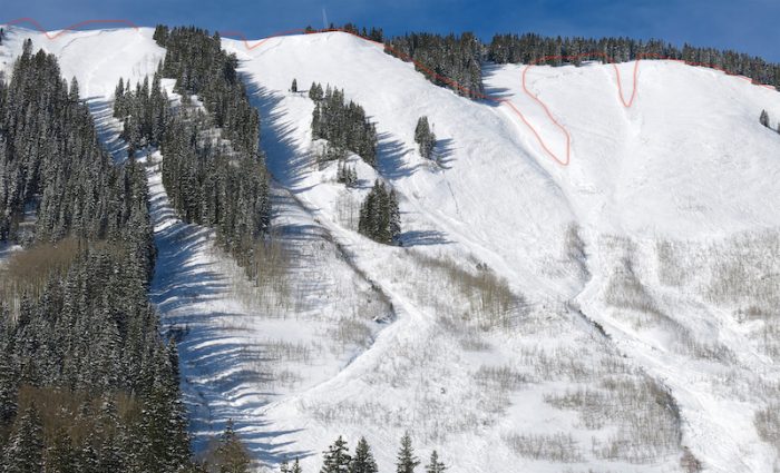
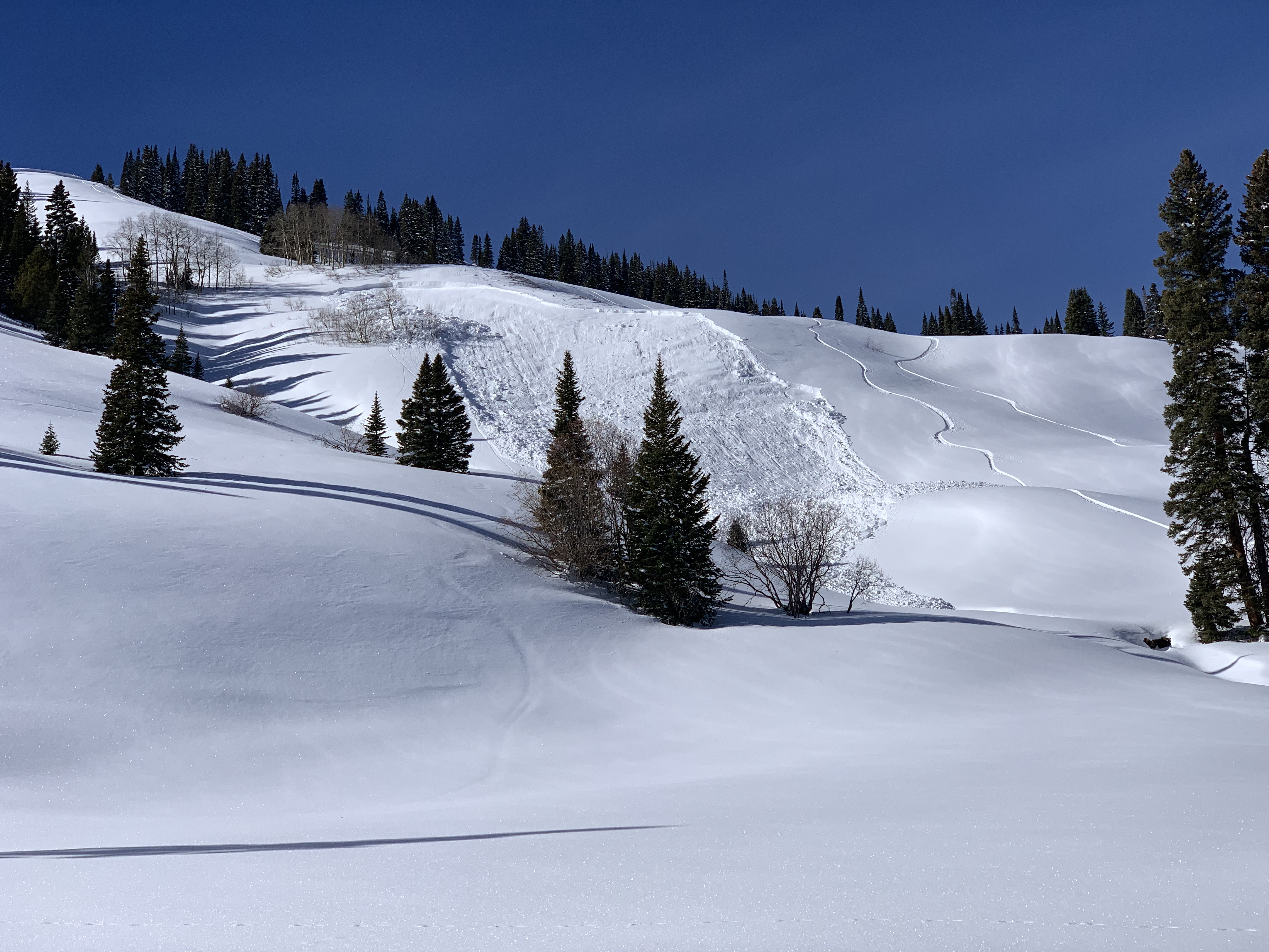
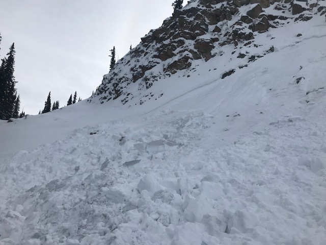
CBMR 11,150′ N aspect cross loaded feature from SE winds below large cliff band. AE-SS-R1-D2-O. Propagated 175′

Weather: Increasing high clouds throughout the day high temp of 34 with calm winds.

Snowpack: HS 43 with approx. two inches of settlement today. In sheltered areas snow weak and faceted with specific ares of wind stiffened snow. Previously unaffected area from skier traffic or explosives.

Photos:

No hate from the Slate

CB Avalanche Center2018-19 Observations

Location: Paradise Divide Area
Date of Observation: 01/10/2019
Name: Roscoe

Subject: No hate from the Slate
Aspect: North East
Elevation: 11,400

Avalanches:

There were signs of Avalanche activity on the lower slopes and rollovers , similar to what what was posted in an OB yesterday . Not much on the upper slopes .

Weather: Grey Bird Day calm and warm

Snowpack: In the zone we were in the slopes were not terribly affected by wind. Snow was dense and supportive. I did not seem this area received as much snow on the last cycle as the Kebler Pass Corridor.

Photos:

Check in on Coney’s skier triggered avalanche

CB Avalanche Center2018-19 Observations

Location: Crested Butte Area
Date of Observation: 01/10/2019
Name: Evan Ross And Eric Murrow

Subject: Check in on Coney’s skier triggered avalanche
Aspect: North East, East
Elevation: 9,800 to 10,800ft

Avalanches:

SS-ASr-R1-D2-O. 1/9

Weather: Calm winds. Partly cloudy sky and warm feeling temps

Snowpack: HS in the 100-120 range on average. Ski pen around 20cm and SH on much of the snow surface. A few large collapses in the terrain but no shooting cracks.

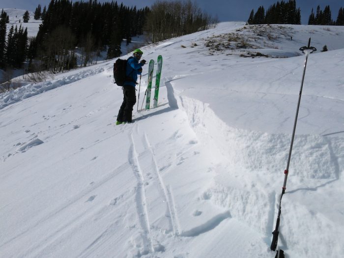
The 1/9 remote triggered avalanche failed just below the holiday slab on 1.5mm NSF. This layer of NSF was about 5cm thick. Crown hight Varied between 1 to 4 feet thick. The thicker part of the slab was on a wind-loaded terrain feature. Slope angles on the bed surface were in the 34 to 36 range. East facing aspect at 10,360ft.

Photos:


Quick Gothic Townsite Tour

CB Avalanche Center2018-19 Observations

Location: Paradise Divide Area
Date of Observation: 01/09/2019
Name: Zach Kinler

Subject: Quick Gothic Townsite Tour
Aspect: East, South East
Elevation: 9,600

Avalanches:

No Gully Washers but many D1-D2+ avalanches Below, Near and Above Tree line on Gothic’s East side including 1 that ran during the tour. See pictures.

Weather: Sunscreen re-application day, calm winds, temps warming above freezing.

Snowpack: Generally ~ 30cm new snow, surface remaining dry in the shade and becoming wet in the sun.
Photos:

Mountain Weather for 11,000ft

CB Avalanche CenterWeather

Date: 01/10/2019

Another clear and inverted morning as valley temps are near 10F in Crested Butte and 25F at 11,000ft. Temperatures will again rebound nicely today. Clouds will begin increasing today ahead of a small storm for Thursday Night into Friday. Looks like we are kinda getting left out on this one. Hopefully we’ll pull off a couple inches in the Kebler and Paradise Divide areas, otherwise, the better snow will develop further east then Crested Butte. We’ll see another ridge developing later this weekend and bringing dry weather for that period and to start the week.

  • Today

    High Temperature: 30 to 35
    Winds/Direction: 0 to 10 W
    Sky Cover: Partly Cloudy
    Irwin Snow: 0
    Elkton Snow: 0
    Friend’s Hut Snow: 0

  • Tonight

    Low Temperature: 15 to 20
    Winds/Direction: 0 to 10 NW
    Sky Cover: Overcast
    Irwin Snow: 0 to 3
    Elkton Snow: 0 to 3
    Friend’s Hut Snow: 0 to 2

  • Tomorrow

    High Temperature: 25 to 30
    Winds/Direction: 5 to 15 NNW
    Sky Cover: Overcast
    Irwin Snow: 1 to 2
    Elkton Snow: 1 to 2
    Friend’s Hut Snow: 2 to 4

Numerous Remote Triggered Avalanches

CB Avalanche Center2018-19 Observations

Location: Brush Creek Area
Date of Observation: 01/09/2019
Name: Evan Ross

Subject: Fun With Avalanches
Aspect: North, North East, East
Elevation: 9,500-10,800

Avalanches:

Ooo boy. This is going to be long.

The highlights: One bounce, producing a collapse, that remote triggered 1 x D2, 1 x D1.5, and slumped the snow off a another rock outcrop. Two other separate collapse each remote triggered a D2 and separate D1 at the same time. The furthest point from a human triggered collapse to the furthest point of a crown, measured on google earth, was about 2,200ft. Yea baby.

2 x SS-ASr-R1-D2-O, NE, BTL
1 x SS-ASr-R1-D2-O, E, BTL
4 x SS-ASr-R1-D1.5-O, NE, BTL

1 x SS-N-R1-D1.5-I, South, ATL. Fresh Natural today. Steep rocky terrain.

There were many more natural avalanches to D2.5 in size from the 1/6 cycle. Mainly on N to E facing aspects at BTL elevations. Other aspects and elevations had a few old Persistent Slabs, but most avalanches looked to have failed within the storm snow and were often confined to gully features or wind-loaded terrain. 

Weather: High clouds hung around for much of the day. Calm wind. Warm temps.

Snowpack: The holiday slab is the slab… while the January 6th storm just added the load to tip the balance. The 1/6 storm snow was about 10 to 12″ in sheltered terrain at the elevations traveled. The 1/6 snow was very soft on NE and becoming moist on E, and other sunny slopes. The very weak NSF below the holiday slab was the layer of concern. This layer was failing in collapses and triggered avalanches, and those avalanches were either running at the interface or gouging to the ground. Boot pen to hip and ski pen about 25cm. HS in the 100-120cm range.

Collapses that produced human triggered avalanches were very very quiet and subtle. No shooting cracks where ever observed from the same area I got a collapses that remote triggered and avalanche. After a collapses, it was a long 10sec before remote triggered avalanches started running.

Photos:

Remote on north end of Coney’s

CB Avalanche Center2018-19 Observations

Location: Paradise Divide Area
Date of Observation: 01/09/2019
Name: Kyote

Subject: Remote on north end of Coney’s
Aspect: East
Elevation: 11,500

Avalanches:

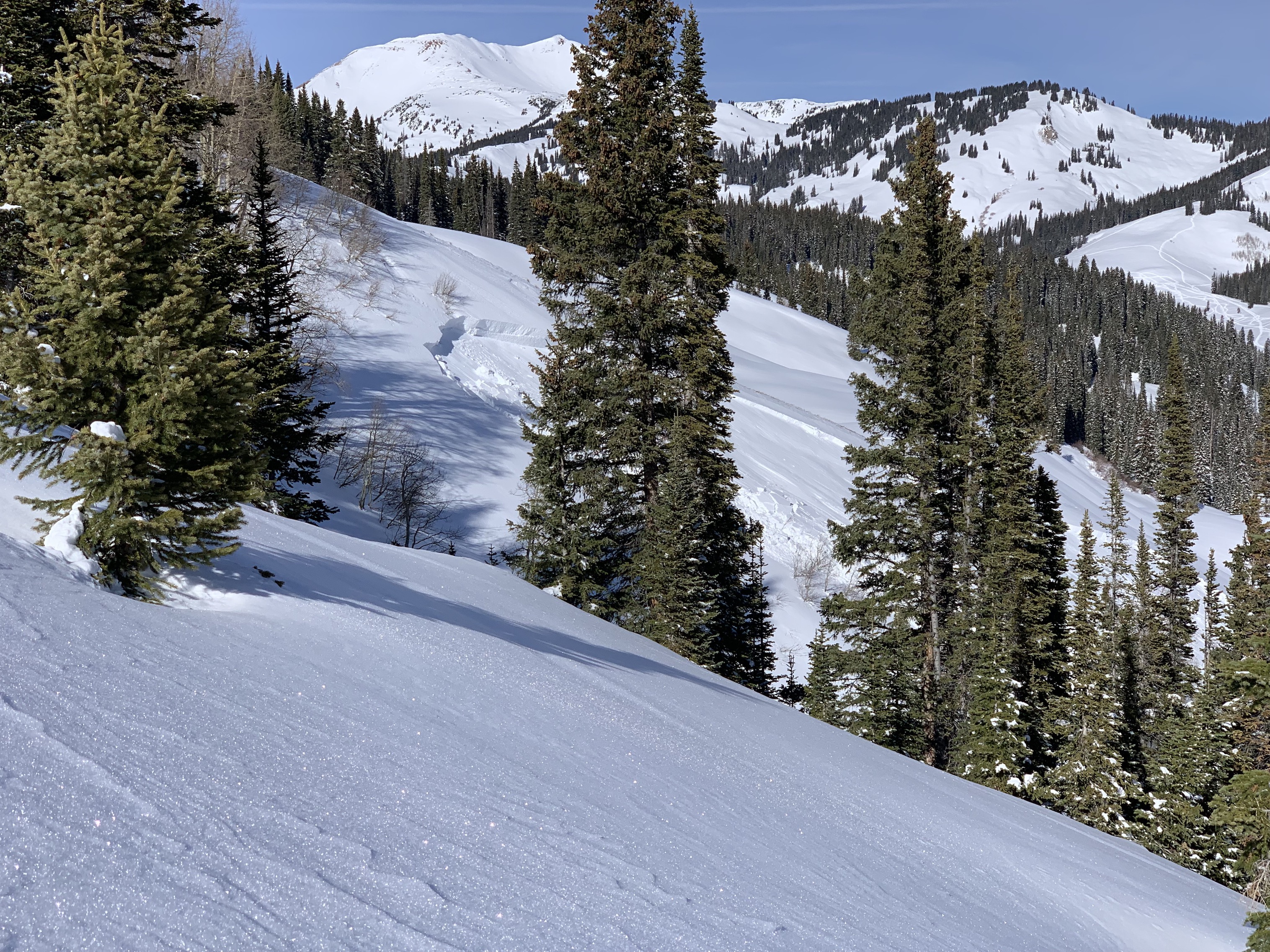
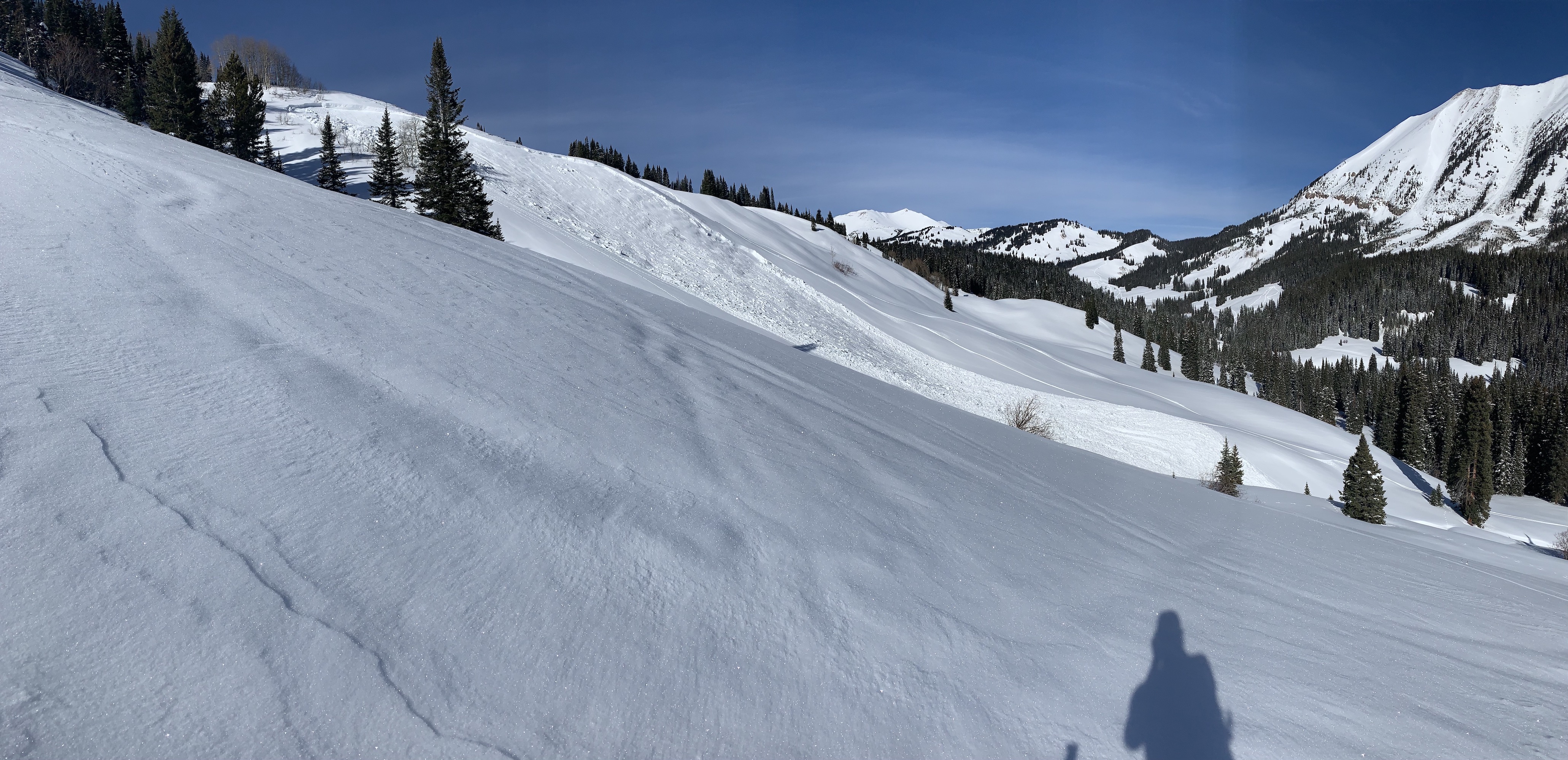
Remote trigger on a southeast steep slope on the north end of Coney’s. Crown was up to 3-4 ft in wind loaded area. Occurred on the new snow from this week. There weren’t any signs of instability prior to seeing this avalanche.

No cracking, romping, etc

Weather: Clear and really nice.

Snowpack: Fresh 1 foot of snow
Photos:

Snodgrass-GFP after the storm

CB Avalanche Center2018-19 Observations

Location: Crested Butte Area
Date of Observation: 01/09/2019
Name: ADB

Subject: Snodgrass-GFP after the storm
Aspect: East, South West, West
Elevation: BTL

Avalanches:

Weather: Calm, few clouds, and warming temperatures above freezing. Warm in the sun.

Snowpack: 1 cm surface hoar widespread in open areas with no shading.

Disclaimer again: Very qualitative tests with hands and poles.
Off main skin track and filled in skin track, no collapsing and one shooting crack.

SW Aspect- hand test CT 13 Q3 on crust 12 inches below snow surface
W Aspect uphill of the weather station CT 4 Q3 on crust 12 inches below snow surface.
Photos:

Mountain Weather for 11,000ft

CB Avalanche CenterWeather

Date: 01/09/2019

Colorado is sitting under a high-pressure ridge as we look ahead to another day of dry and mild weather. High clouds are streaming across the area this morning and we’ll continue to see some more high clouds throughout the day. Our next change in weather comes around Thursday night as a shortwave trough moves through Colorado. Currently, we’re looking at a few inches of snow before returning to dry weather for the weekend.

  • Today

    High Temperature: 30 to 35
    Winds/Direction: 5 to 15 SW
    Sky Cover: Partly Cloudy
    Irwin Snow: 0
    Elkton Snow: 0
    Friend’s Hut Snow: 0

  • Tonight

    Low Temperature: 18 to 22
    Winds/Direction: 0 to 10 W
    Sky Cover: Mostly Clear
    Irwin Snow: 0
    Elkton Snow: 0
    Friend’s Hut Snow: 0

  • Tomorrow

    High Temperature: 30 to 35
    Winds/Direction: 0 to 10 W
    Sky Cover: Partly Cloudy
    Irwin Snow: 0
    Elkton Snow: 0
    Friend’s Hut Snow: 0