


Location: Kebler Pass Area
Date of Observation: 11/18/2019
Name: Eric Murrow
Subject: Snow coverage from October storms
Aspect: North, North East, East, South East, South, South West, West, North West
Snowpack: Snowfall from October has been melted to dirt, or at best, patchy coverage for slopes on the southern half of the compass, while the northern half of the compass has held on to a thin, continuous layer. Snow that has persisted on sunny slopes has developed into a patchwork of crusts. The snowpack on northerly facing slopes has been faceting, weakening, and will provide a poor foundation for the incoming storms. I would anticipate some avalanche activity on shaded slopes if the forecasted storms produce over the next week. Below are photos from around the range; take a gander and find the photos of terrain you play in and make note of what the incoming storms will be falling on. Gallery generally shows terrain from west to east across the forecast area.
Photos:
-
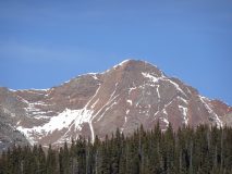
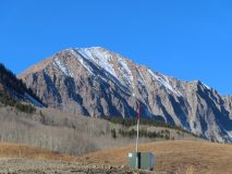
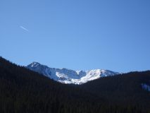
- Mount Owen – Southeasterly, 11/18

-

- Ruby Peak – Southeasterly, 11/18

-

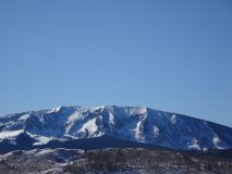
- Anthracites – Northerly, 11/18

-
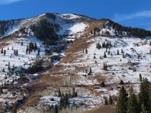
- Axtel – Northeasterly, 11/17

-

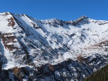
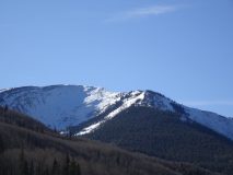
- Whetstone Mtn – Northeasterly, 11/18

-

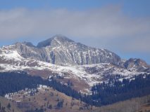
- Mt. Emmons/Red Lady Bowl – Southeasterly, 11/18

-

- Mt. Emmons/Coon Basin – Easterly, 11/18

-

- Mt. Emmons/Redwell Basin- Northerly, 11/17

-

- Mt Emmons/Climax – Northerly, 11/17

-

- Schuylkill Ridge – Northeasterly, 11/17

-

- Schuylkill Ridge – Northeasterly, 11/17

-
- Schuylkill Ridge – Northeasterly, 11/17

-

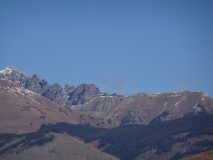
- Schuylkill Peak/Baxter Basin – Northely, 11/17

-

- Purple Ridge/Purple Palace – Northeasterly, 11/17

-
- Purple Peak/Purple Ridge – Northeasterly, 11/17

-

- Slate River Drainage – 11/18

-

- Treasury/Cinnamon/Baldy – 11/18

-

- Gothic Mtn – Southerly, 11/18

-
- Gothic Mtn – Easterly, 11/17

-

- Mount Bellview – South/East, 11/17

-

- Avery Peak – Southeasterly, 11/17

-

- Teocalli Mtn – Southerly, 11/18

-
- Castle Peak/Upper Brush Creek – South/Westerly, 11/18

-

- Pearl Mountains – Westerly, 11/18

-

- Double Top – Westerly, 11/18

-

- Double Top – Westerly, 11/18

-
- Star Peak – Southwesterly, 11/18

-

- Italian Mtn – Westerly, 11/18

-

- Cement Mtn – Westerly, 11/18

-

- Cement Mtn – Northerly, 11/18

-
- Cement Mtn – Northerly 11/18

-
- Tilton/Eyre Basin – Northerly, 11/15

-

- Star Peak – Easterly, 11/15

-

- American Flag & Italian Massif – Easterly, 11/15


