Location: Cement Creek Area
Date of Observation: 01/03/2020
Name: Eric Murrow
Subject: Windy Cement Creek – Hunter Hill
Aspect: East, South East
Elevation: 9000′ – 12000′
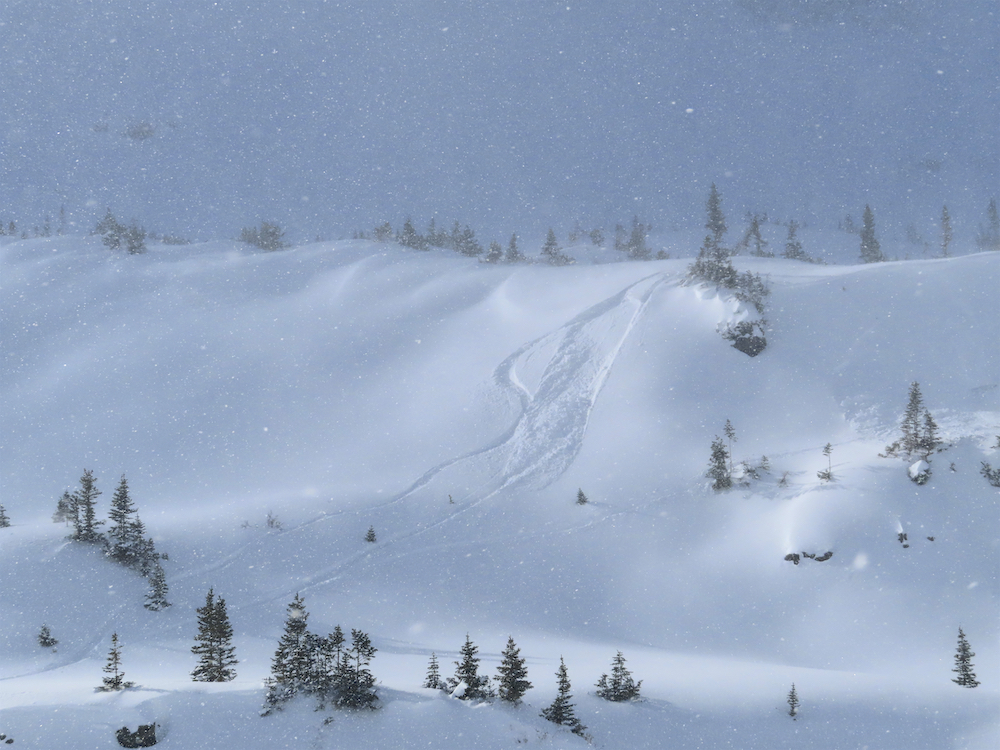
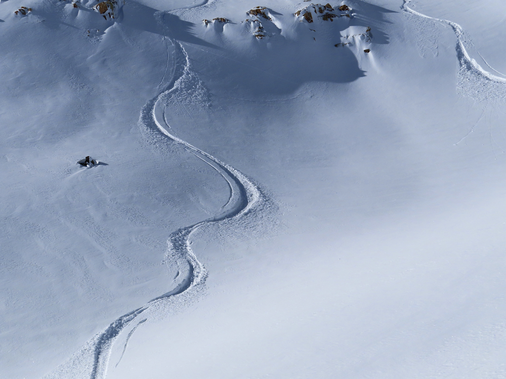
Avalanches: Observed a handful of natural avalanches near and above treeline on east and southeast aspects. Several looked to have a bit of age possibly from the Christmas storm period, but two windslabs were recent from drifting. I was able to poke into one of these fresh windslab avalanches and found slabs 30cm thick and pencil hard.
Weather: Mostly sunny with a few thin, low clouds on highest terrain. The wind was the real story…alpine terrain was absolutely blasted with snow being blown into the atmosphere at upper elevations. Would estimate wind speeds of 40+ miles per hour above tree line out of the NNW.
Snowpack: HS was around 70cm in this area. SE slopes were largely a mix of facets and crusts capped with recent snowfall. An easterly facing slope at 11,900′, with previous drifting, produced an ECTP 13 result, 30cm down on thin facet layer. Much of the alpine terrain in this area was worked by the wind leaving behind some hardslabs on select leeward alpine features; terrain closer to treeline held a more concerning snowpack with some drifting but not the blasting alpine terrain received.
Photos:
-

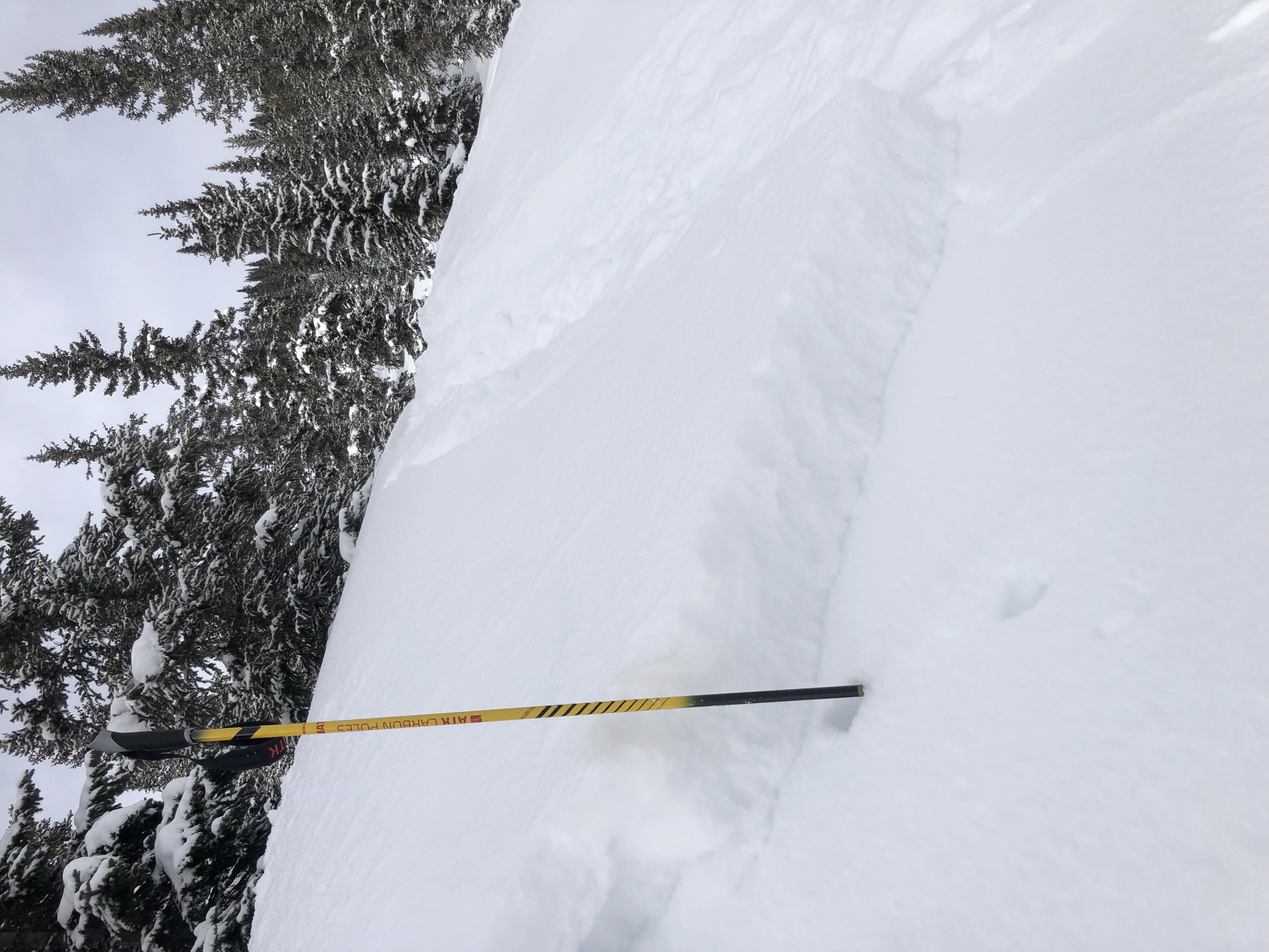
- Very small fresh windslab in drifted feature

-

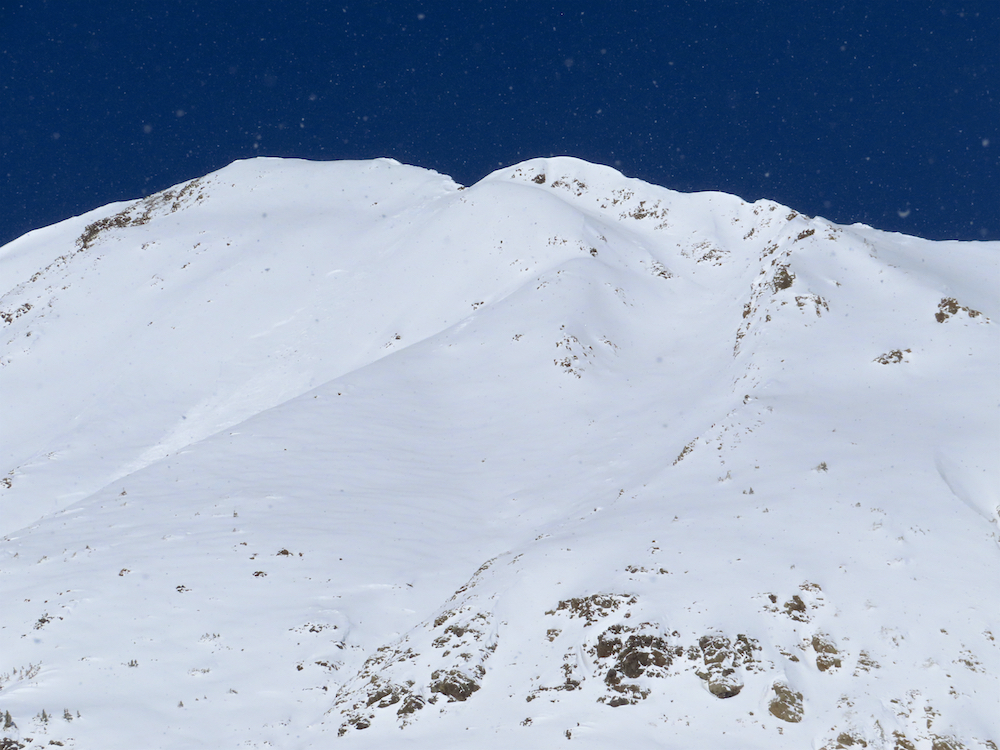
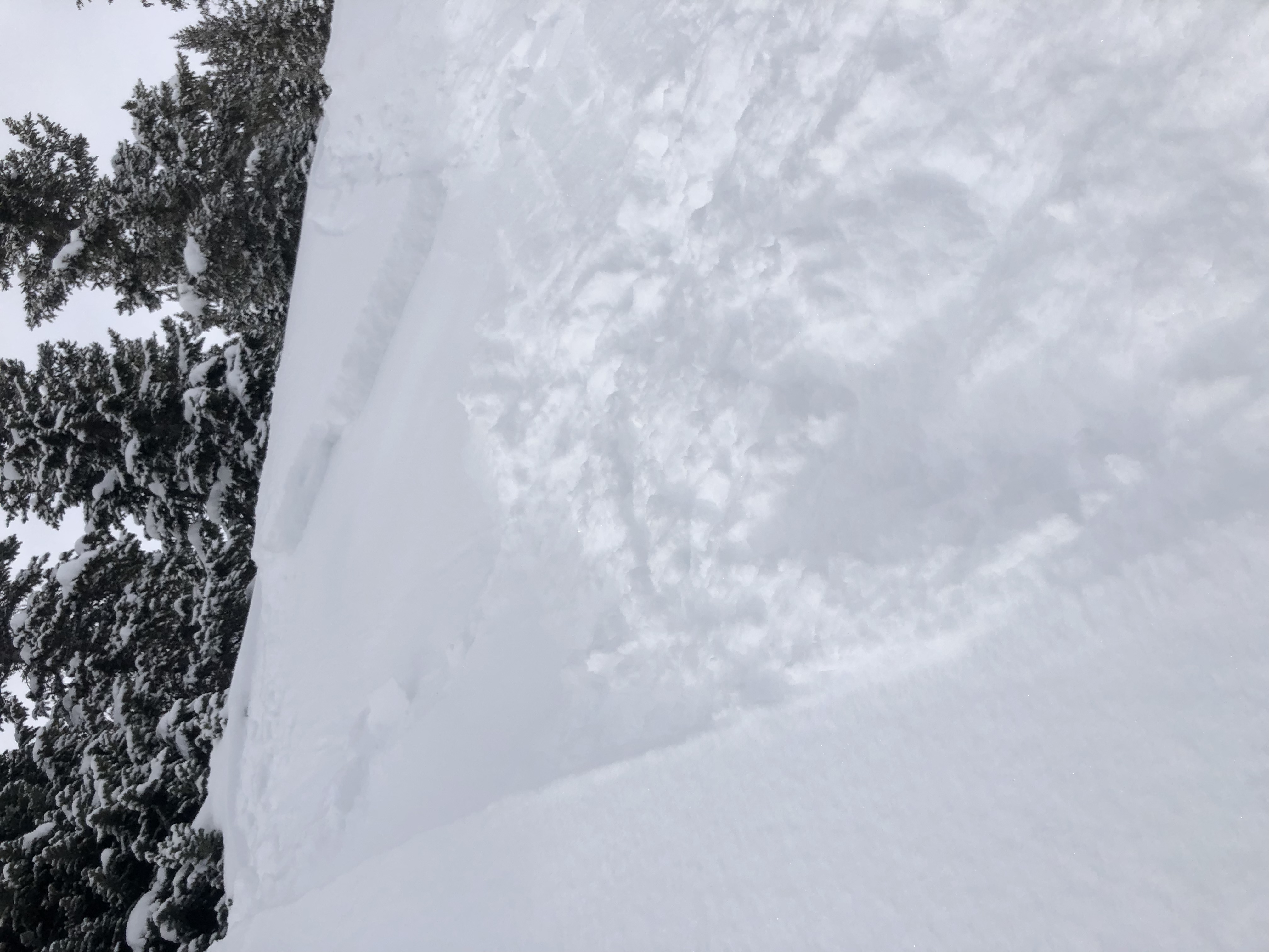
- Hammered easterly alpine terrain

-

- Extremely strong winds blasting snow

-

- Very small fresh windslab, SE, 12k

-

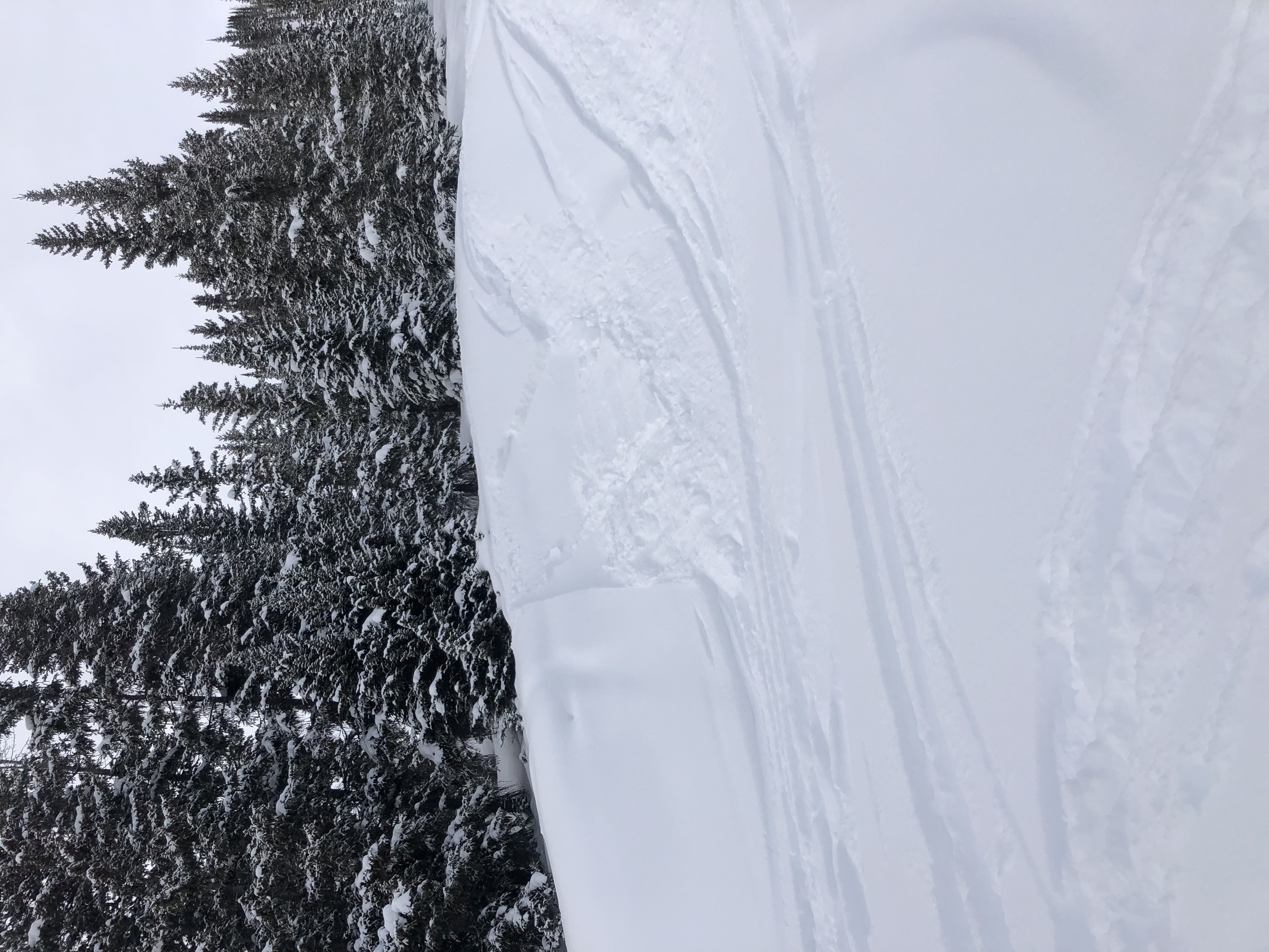
- Cracking up to 20′ in drifted alpine SE feature immediately adjacent natural avalanche