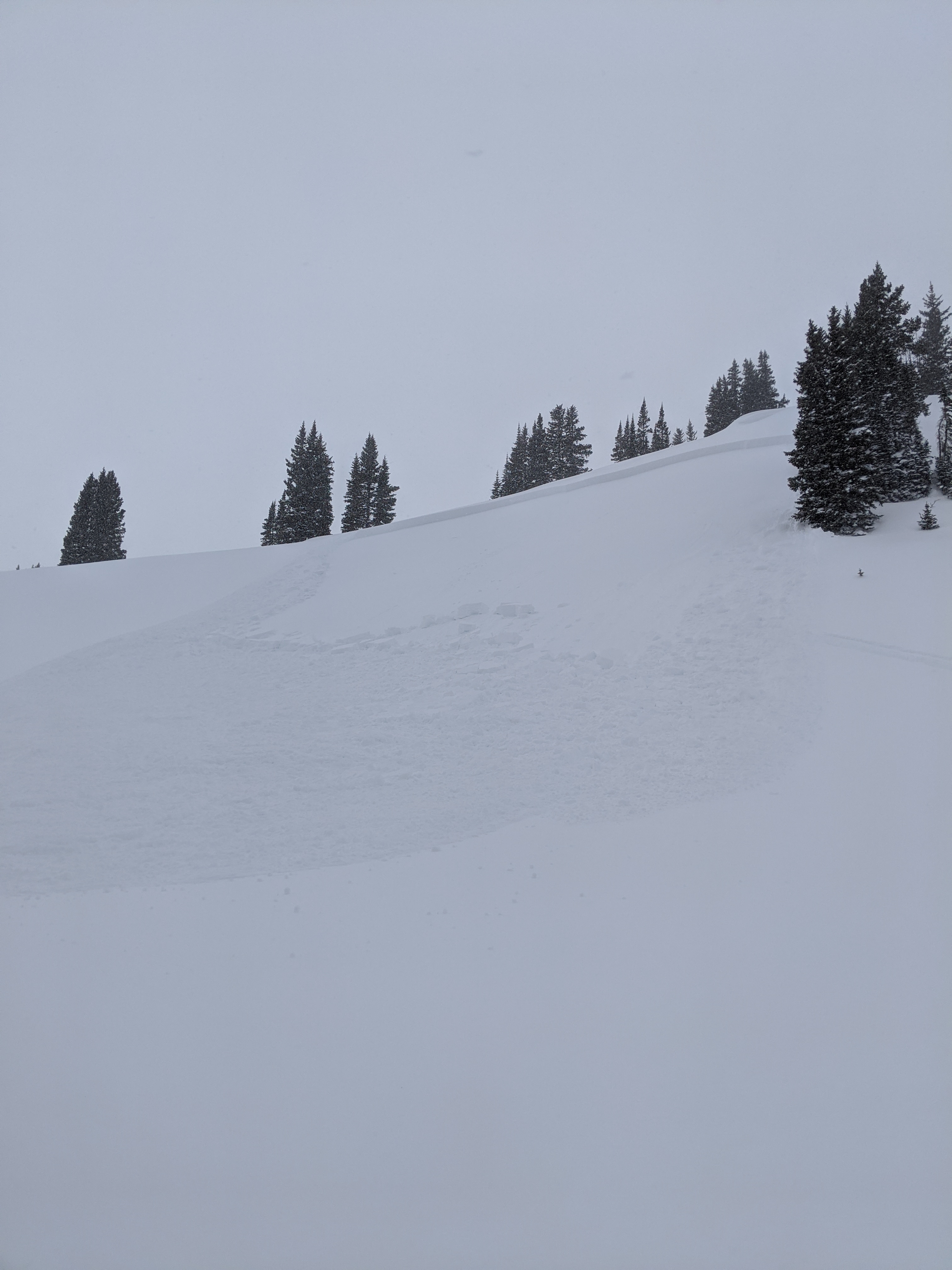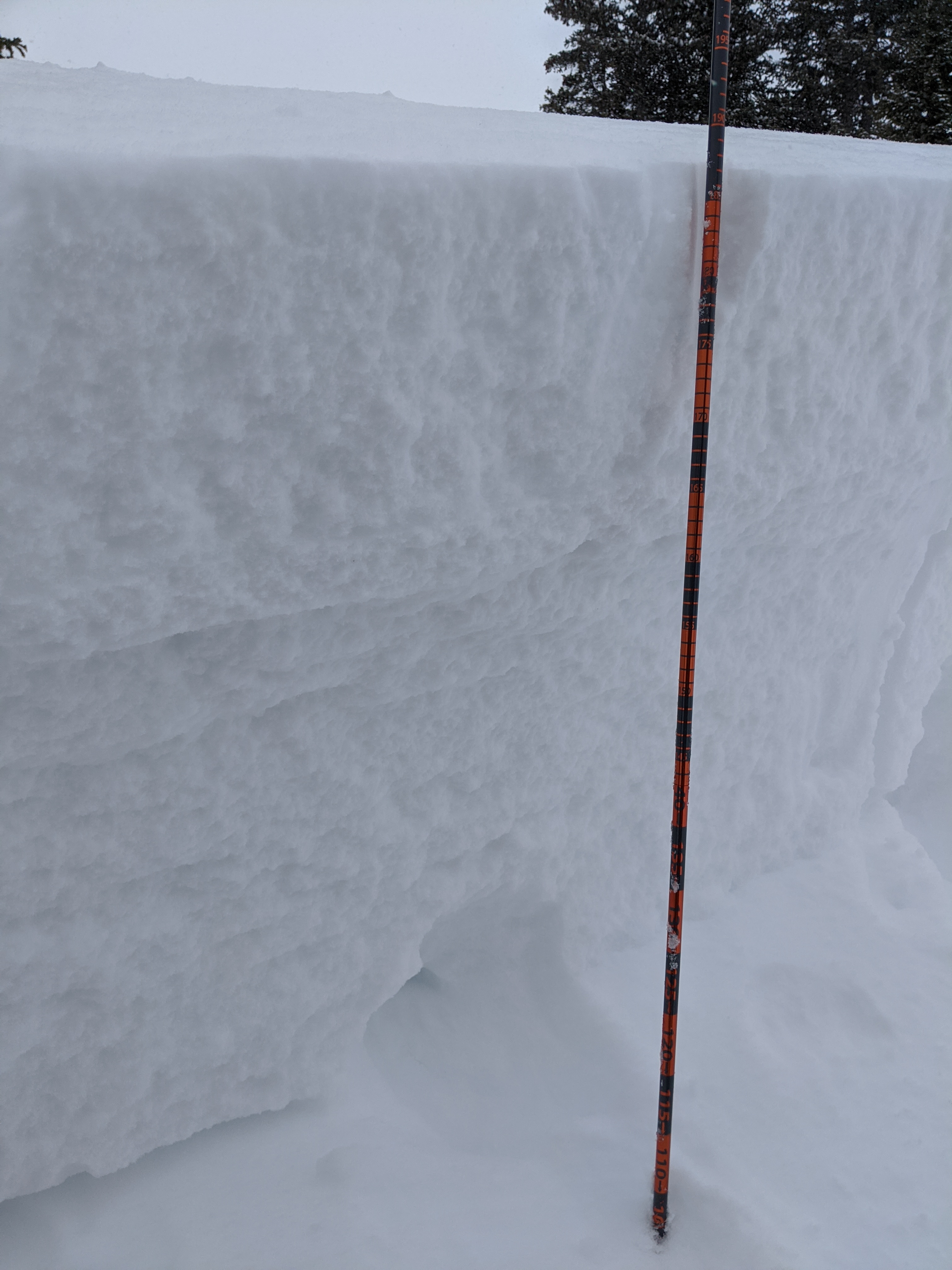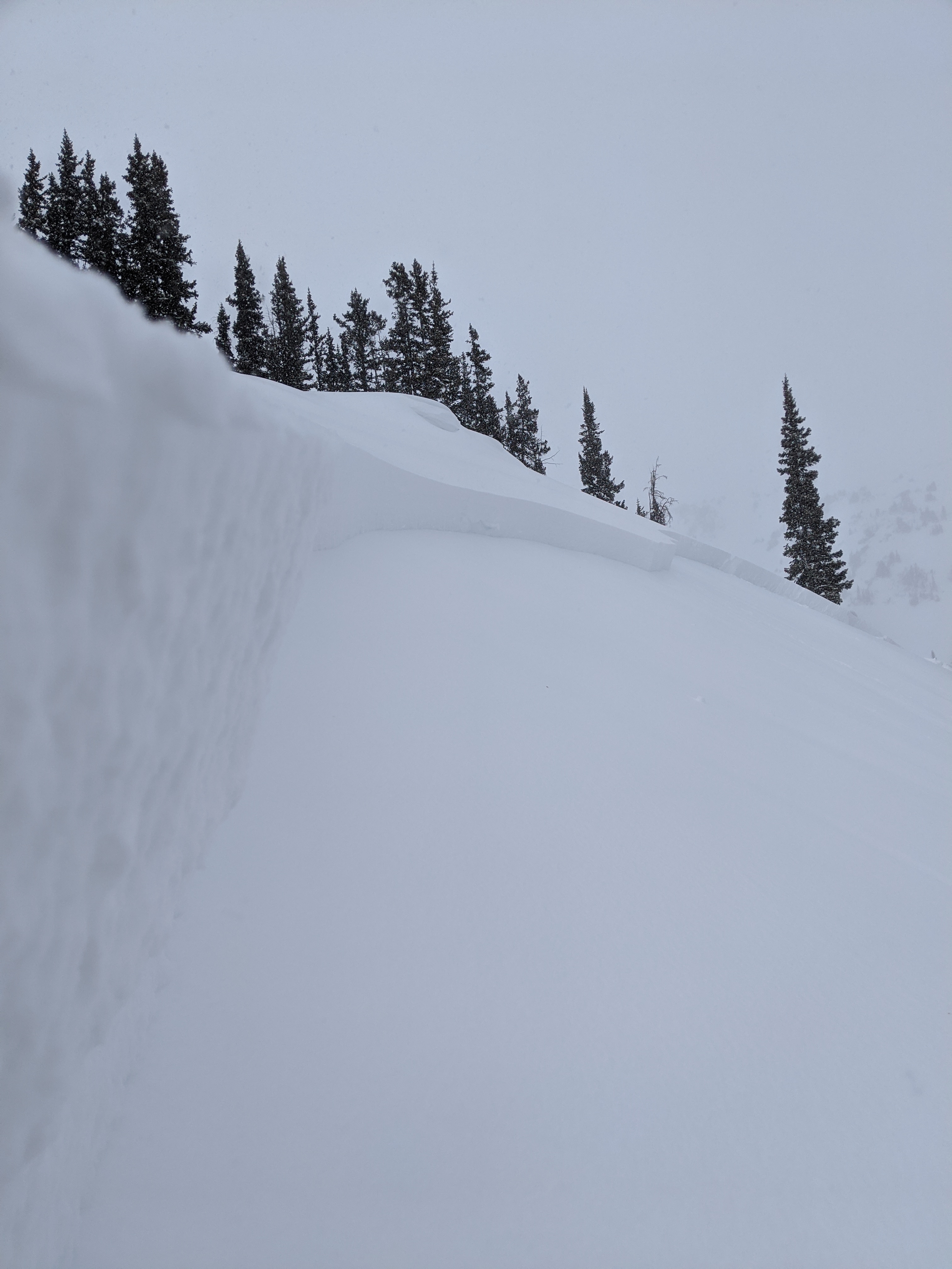
Mt Emmons (Red Lady Bowl) Skier Triggered Avalanche

CB Avalanche Center2019-20 Observations

Location: Crested Butte Area
Date of Observation: 01/19/2020
Subject: Mt Emmons (Red Lady Bowl) Skier Triggered Avalanche
Aspect: South East
Elevation: 12,200ft
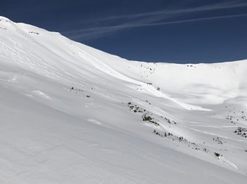
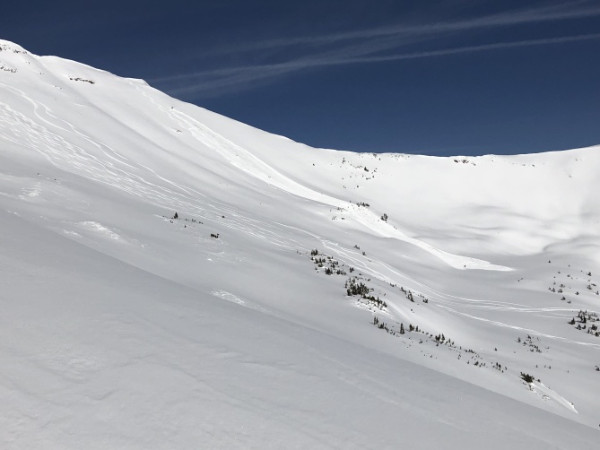
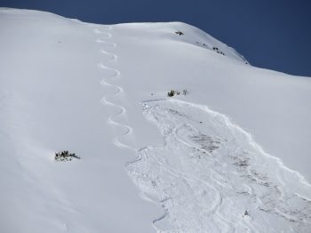
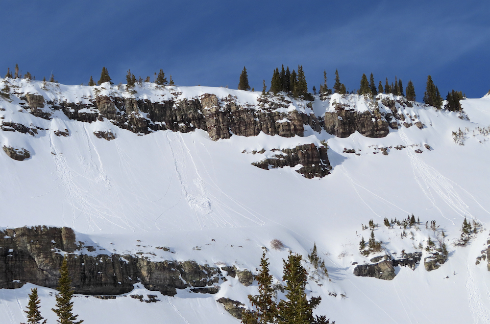
Avalanches: A skier triggered and was caught in a large avalanche on an alpine southeast-facing slope. They deployed their airbag, took a ride on the surface of the debris, lost a ski, and self-evacuated, uninjured.

(Update) CBAC and CAIC forecast staff visited the area on January 20th.

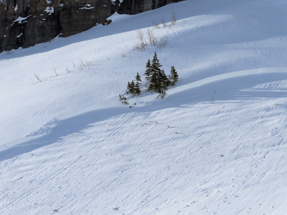
There was too much hang-fire to visit the crown, but additional information was gathered from lower on the slope. Avalanche debris piles averaged around 1 meter deep and were near or exceeding 3 meters in the deepest pile. The ski tracks did a good job managing the visible previously wind-loaded portions of the slope. In the end, the skier found the right trigger point and released the avalanche from low on the slope.

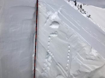
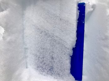
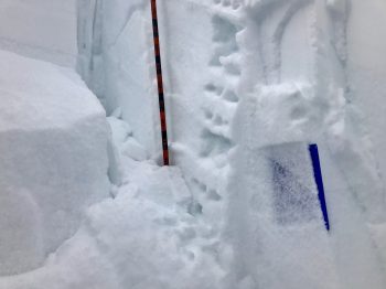
A profile was dug about 600ft below the highest portion of the crown. The avalanche debris impacted this slope and produced cracks through the snowpit. Tests were performed just above those cracks. Test results and those shooting cracks suggested the avalanche failed below a thin and soft crust capping a weaker layer of facets. That curst generally represents a boundary between weak snow that formed during late 2019, and most of the snow that has fallen in 2020. That interface is estimated to be the same interface producing a string of recent human triggered avalanches. A strong NW wind event in early January likely helped produce a slab over the interface that failed, at this location. While the rest of the snow in January added incremental loading that wasn’t enough for a natural avalanche, but did add stress on the weak layer until the skier found the right trigger point. After initiation, the avalanche further stepped down into the weak snow near the base of the snowpack. Old ski tracks could also be seen on the bed surface.


Mountain Weather For 11,000FT Friday, 1/20

CB Avalanche CenterWeather

Date: 01/20/2020

A strong inversion remains in place for another morning in the Gunnison Valley. Temperature spreads between valley bottoms and upper elevations are greater than 30 degrees. Skies are currently mostly clear but expect this to change over the course of the day. A trough to the west of Crested Butte is pushing clouds eastward and is expected to create mostly cloudy conditions by the end of the day. Precipitation from this trough will start dropping snow late tonight or very early Tuesday morning. Snowfall will last from early Tuesday through Wednesday night. Models are currently showing a 4 to 10-inch storm total across the forecast. Winds are anticipated to increase with this system but are not expected to reach the extreme levels of our previous snow-maker.

  • Today

    High Temperature: 28 to 32
    Winds/Direction: 3 to 13, SW
    Sky Cover: Partly Cloudy
    Irwin Snow: 0
    Elkton Snow: 0
    Friend’s Hut Snow: 0

  • Tonight

    Low Temperature: 8 to 12
    Winds/Direction: 3 to 13, SSW
    Sky Cover: Mostly Cloudy
    Irwin Snow: 0 to 1
    Elkton Snow: 0 to 1
    Friend’s Hut Snow: 0 to 1

  • Tomorrow

    High Temperature: 24 to 28
    Winds/Direction: 5 to 15, WSW
    Sky Cover: Overcast
    Irwin Snow: 3 to 5
    Elkton Snow: 3 to 5
    Friend’s Hut Snow: 2 to 4

Far Western Anthracites

CB Avalanche Center2019-20 Observations

Location: Kebler Pass Area
Date of Observation: 01/19/2020
Name: Ian Havlick
Subject: Far Western Anthracites
Aspect: North, North East, East, South East, South
Elevation: 9800-11500

Avalanches: Small windslab avalanche failing <10″ deep in ENE facing previously wind-loaded feature. Otherwise, had great eyes on Beckwith, and surrounding terrain with no recent avalanches observed.


Weather: Beauty day. -5 to start the day, noticeably warmer mid-elevations, even by 0930. Minimal winds, strong solar radiation even though temperatures stayed chilly. 6-8″ settled new snow from previous storm in western Anthracites

Snowpack: Snowpack generally seems shallower than expected with average snowpack depths 100-130cm deep in terrain traveled (N/BTL). Distinct and easily identifiable grey stripe of surface hoar ~45-60cm deep, widespread in terrain traveled today. Performed ECT tests and revealed ECTP12 x 2, as well as failures/cracking in sledcuts on slopes between 25-30 in steepness. Stab stiffest above surface hoar in previously windloaded locations adjacent to cornices and ridgelines.

Avalanche Obs 1/19

CB Avalanche Center2019-20 Observations

Location: Crested Butte Area
Date of Observation: 01/19/2020
Name: Zach Kinler

Aspect: North East, East, South East, South

Avalanches: A few more avalanches observed from the last cycle. Wind loaded terrain from NE-E-S has been most active. Also included the Red Lady skier triggered avalanche that has been reported.

Weather: Bluebird, cold start but warming nicely.

Snowpack: 5-7 mm surface hoar needles observed on the surface.
Photos:

Small wind slabs, NE Axtel

Cross-loaded south-facing gully near Perry Creek.

Large persistent slab avalanche East face of Peeler Pk. This path has run previously this winter.

Surface hoar observed on 1/19, north aspect BTL

Reported skier-triggered avalanche in Red Lady Bowl

Snodgrass Observation Tour

CB Avalanche Center2019-20 Observations

Location: Crested Butte Area
Date of Observation: 01/19/2020
Name: Colorado Backcountry AIARE 1
Subject: Snodgrass Observation Tour
Aspect: East
Elevation: 9600′ – 10400′

Avalanches: none observed

Weather: sunny and warm, about upper 20s, calm winds.

Snowpack: Snow depth 80 to 100cm. Supportive to skis, but boots went to ground. Tests, from east and northeast facing locations, showed easy result underneath new snow but new snow was still fist hard and 6 inches down. Poor structure continues to exist but midpack remains fairly weak. Moderate results in Compression Test on basal weak layer. No propagation results in ECT. Buried Surface hoar found at two sites about 40cm down. Surface hoar present on east and northeast aspects at the surface.

Snodgrass slide

CB Avalanche Center2019-20 Observations

Location: Crested Butte Area
Date of Observation: 01/19/2020
Name: ADB

Subject: Snodgrass slide

Aspect: North East

Elevation: BTL

Avalanches:

Observed a slide likely triggered on 1/18/29 at 10,300 feet on a NE aspect at 10,300 feet. Photo from below doesn’t capture this small convex slope with a slope angle greater than 35 degrees on an isolated feature skiers left of the main slide path with saplings, where the majority of yesterdays tracks are and our tracks are. Looks like a SS-R2-D1. Didn’t get close enough to gage the crown height, but did observe the debris pile in the runout zone, which would have partially buried you.


Weather: clear skies and calm.

Snowpack: surface hoar less than 1 inch across all slopes except forested areas (see pictures). snow skied like we were skiing facets on the open slopes.

Photos:

Ruby Range

CB Avalanche Center2019-20 Observations

Location: Kebler Pass Area
Date of Observation: 01/19/2020
Name: Evan Ross
Subject: Ruby Range
Aspect: North East, East, South East, South
Elevation: 10,600-12,600ft

Avalanches: Looking down the spine of the Ruby Range, there were no signifiant recent avalanche results. Some things were probably smoothed over quickly during the extreme wind event on Friday. Otherwise simple storm slabs and shallow wind-slabs here and there, with nothing obviously deep.

Estimated Snow Bike triggered avalanche from low on the slope. ESE aspect, 11,100ft elevation. Estimated 80-100cm crown. Interesting that the crown wasn’t higher on the slope or that it didn’t propagate wider. Maybe SH pocket as this is somewhat low in Robinson Basin and protected from some wind.

Weather: Lovely day out there. Calm to light winds in the alpine, moving a little snow on the highest peaks. Clear sky in the morning, high clouds for the middle of the day and back to clear in the late afternoon.

Snowpack: Worked the terrain to avoided obvious wind-loaded features. Otherwise traveled fairly aggressively. Lots of folks and different user groups stepping out more and more aggressive tracks.
We mostly traveled near and above treeline. The snowpack was dense with boot pen around 30 cm. The snow surfaces were riding really well thanks to the last 8-10″ of snow that fall on Friday night into Saturday as the winds were deceasing.

Steep southeast and south slopes had some roller balls and a couple loose snow avalanches given the warm temps and good solar.

Pictures Of Recent Avalanches

CB Avalanche Center2019-20 Observations

Date of Observation: 01/18/2020
Name: Zach Kinler And Evan Ross
Subject: Gothic Avalanches
Aspect: North East, East, South East, South
Elevation: 10,000-12,000′

Avalanches: Gothic Mountain, Double Top, Coon Basin.
5x SS-N-D1-I
3x SS-N-D1.5-I
1x SS-NL-D1.5-O
1x SS-N-D1.5-O
1x SS-N-D2-O
1x SS-N-D2-I
HS-N-D2-O, SS-N-D1-I

Mountain Weather for 11,000ft. Sunday January 19th

CB Avalanche CenterWeather

Date: 01/19/2020

Valley inversions are set up this morning with low temperatures in CB and Gunnison below zero while mountain low temperatures are in the low teens. A high-pressure ridge continues to build over the area. High clouds are currently moving over Utah and will move through our area today. Otherwise, we have dry air aloft and should otherwise see a mostly clear sky day. Winds look to be light, with high temperatures in the mountains near or just above yesterdays.

Moisture moves back in on Monday afternoon with increasing clouds. By Tuesday that moisture looks thick and will start producing snowflakes. There isn’t much of a storm associated with this moisture, so we’ll largely rely on orographics for snowfall. A low-pressure trough moves in for the midweek and will bring a better chance of accumulating snowfall.

  • Today

    High Temperature: 26 to 30
    Winds/Direction: 5 to 15, WNW
    Sky Cover: Mostly Clear
    Irwin Snow: 0
    Elkton Snow: 0
    Friend’s Hut Snow: 0

  • Tonight

    Low Temperature: 6 to 10
    Winds/Direction: 3 to 13, NW
    Sky Cover: Mostly Clear
    Irwin Snow: 0
    Elkton Snow: 0
    Friend’s Hut Snow: 0

  • Tomorrow

    High Temperature: 26 to 30
    Winds/Direction: 3 to 13, WSW
    Sky Cover: Increasing clouds
    Irwin Snow: 0
    Elkton Snow: 0
    Friend’s Hut Snow: 0

Avalance near Washington Gulch

CB Avalanche Center2019-20 Observations

Location: Paradise Divide Area
Date of Observation: 01/18/2020
Subject: Avalance near Washington Gulch
Aspect: East
Elevation: 11,100

Avalanches: Snowmobile triggered avalanche on an easterly, heavily wind loaded slope. Crown was appx 80-90cm deep and ran on what seemed to be an old surface hoar layer from before Jan 13th storm. Crown was appx 80-90m across and propagated near the top of slope. Slide ran appx 400ft. Slab was consistently dense (wind affected snow) aside from the top 6″ of fresh storm snow. No riders were caught.